this just in from wwltv.com
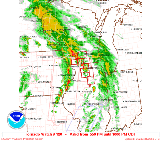
Tornado Watch
urgent - immediate broadcast requested
Tornado Watch number 120
NWS Storm Prediction Center Norman OK
205 am CST Fri Apr 1 2005
The NWS Storm Prediction Center has issued a
Tornado Watch for portions of
Southern Alabama
the western Florida Panhandle
southeast Louisiana
coastal waters
Effective this Friday morning from 205 am until 700 am CST.
Tornadoes... hail to 1 inch in diameter... thunderstorm wind gusts
to 70 mph... and dangerous lightning are possible in these areas.
The Tornado Watch area is approximately along and 55 statute miles
north and south of a line from 70 miles west of Gulfport
Mississippi to 35 miles east northeast of Crestview Florida. For
a complete depiction of the watch see the associated watch outline
update (wous64 kwns wou0).
Remember... a Tornado Watch means conditions are favorable for
tornadoes and severe thunderstorms in and close to the watch area.
Persons in these areas should be on the lookout for threatening
weather conditions and listen for later statements and possible
warnings.
Other watch information... continue... ww 118... ww 119...
Discussion... warm front/outflow bndry oriented WNW/ESE along the
cntrl Gulf CST appears to be lifting slowly nwd this morning... in
response to pressure fall axis extending from srn MS into cntrl al.
Most of the storms in the ww region will likely be slightly
elevated. But given strong veering profiles invof bndry... and rich
moisture inflow apparent near New Orleans... potential will exist for
isolated tornadoes in addition to locally damaging wind and possibly
severe hail.
Aviation... tornadoes and a few severe thunderstorms with hail
surface and aloft to 1 inch. Extreme turbulence and surface wind
gusts to 60 knots. A few cumulonimbi with maximum tops to 450.
Mean storm motion vector 26030.
... Corfidi
;311,0901 314,0855 301,0855 293,0901;
Tornado Watch - AL, FL, SE LA
Moderator: S2k Moderators
Forum rules
The posts in this forum are NOT official forecast and should not be used as such. They are just the opinion of the poster and may or may not be backed by sound meteorological data. They are NOT endorsed by any professional institution or STORM2K.
Tornado Watch - AL, FL, SE LA
0 likes
Return to “USA & Caribbean Weather”
Who is online
Users browsing this forum: No registered users and 33 guests


