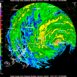
If this would be better in another forum please move it. I just purchased National Geographic Topo software for Alabama, Florida, and Georgia. It links up with GPS units and is just way way cool. My question is...1) is anyone familiar with this and if so 2) have you used it to track storms, ie, enter coordinates etc..thanks
docjoe
topo software
Moderator: S2k Moderators
Forum rules
The posts in this forum are NOT official forecasts and should not be used as such. They are just the opinion of the poster and may or may not be backed by sound meteorological data. They are NOT endorsed by any professional institution or STORM2K. For official information, please refer to products from the National Hurricane Center and National Weather Service.
- docjoe
- S2K Supporter

- Posts: 262
- Joined: Thu Sep 09, 2004 10:42 pm
- Location: SE Alabama..formerly the land of ivan and dennis
topo software
0 likes
Who is online
Users browsing this forum: No registered users and 52 guests

