TX Winter Wx Threat # 9--- Another Arctic Outbreak?
Moderator: S2k Moderators
Forum rules
 The posts in this forum are NOT official forecast and should not be used as such. They are just the opinion of the poster and may or may not be backed by sound meteorological data. They are NOT endorsed by any professional institution or STORM2K.

The posts in this forum are NOT official forecast and should not be used as such. They are just the opinion of the poster and may or may not be backed by sound meteorological data. They are NOT endorsed by any professional institution or STORM2K.

-
HarlequinBoy

- Category 5

- Posts: 1400
- Age: 35
- Joined: Wed Nov 29, 2006 1:57 am
- Location: Memphis
There is a new Winter Storm Watch in effect for North Texas, including Forth Worth and Dallas.
---
COLLIN-HUNT-HOPKINS-TARRANT-DALLAS-ROCKWALL-KAUFMAN-VAN ZANDT-
RAINS-JOHNSON-ELLIS-HILL-
INCLUDING THE CITIES OF...PLANO...GREENVILLE...COMMERCE...
SULPHUR SPRINGS...FORT WORTH...ARLINGTON...DALLAS...ROCKWALL...
TERRELL...KAUFMAN...FORNEY...WILLS POINT...CANTON...
GRAND SALINE...VAN...EDGEWOOD...EMORY...POINT...EAST TAWAKONI...
CLEBURNE...BURLESON...WAXAHACHIE...ENNIS...MIDLOTHIAN...
GLENN HEIGHTS...HILLSBORO
312 PM CST WED JAN 17 2007
...WINTER WEATHER ADVISORY REMAINS IN EFFECT UNTIL 6 PM CST THIS
AFTERNOON...
...WINTER STORM WATCH IN EFFECT FROM THURSDAY EVENING THROUGH
LATE FRIDAY NIGHT...
THE NATIONAL WEATHER SERVICE IN FORT WORTH HAS ISSUED A WINTER
STORM WATCH...WHICH IS IN EFFECT FROM THURSDAY EVENING THROUGH
LATE FRIDAY NIGHT. A WINTER WEATHER ADVISORY REMAINS IN EFFECT
UNTIL 6 PM CST THIS AFTERNOON.
PATCHY...LIGHT FREEZING RAIN OR DRIZZLE...PERIODICALLY MIXED WITH
LIGHT SLEET SHOULD CONTINUE ENDING ACROSS THE REGION THROUGH 6 PM
THIS EVENING. EVEN SO...PATCHY ICE ON ROADS AND HIGHWAYS...PARTICULARLY
BRIDGES AND OVERPASSES WILL CONTINUE TO BE A PROBLEM AS TEMPERATURES
REMAIN BELOW FREEZING.
BEGINNING THURSDAY NIGHT AND LINGERING INTO EARLY SATURDAY...SHALLOW
COLD AIR WILL REMAIN ENTRENCHED OVER THE NORTHWEST HALF OF NORTH
TEXAS. FREEZING RAIN...POSSIBLY MIXED WITH SLEET WILL BEGIN TO
DEVELOP LATE THURSDAY NIGHT...AND SPREAD SOUTHEAST ON FRIDAY AND
FRIDAY NIGHT. AT THIS TIME...ICE ACCUMULATIONS UP TO...OR IN
EXCESS OF 1/4 OF AN INCH WILL BE POSSIBLE.
A WINTER STORM WATCH MEANS THERE IS A POTENTIAL FOR SIGNIFICANT
SNOW...SLEET...OR ICE ACCUMULATIONS THAT MAY IMPACT TRAVEL.
0 likes
-
JonathanBelles
- Professional-Met

- Posts: 11430
- Age: 35
- Joined: Sat Dec 24, 2005 9:00 pm
- Location: School: Florida State University (Tallahassee, FL) Home: St. Petersburg, Florida
- Contact:
-
gboudx

- S2K Supporter

- Posts: 4090
- Joined: Thu Sep 04, 2003 1:39 pm
- Location: Rockwall, Tx but from Harvey, La
Johnny wrote:and maybe 8-12 inches across the Red River of Texas and into southern Oklahoma.
Alright wxman, that might be doable. I can hit Dallas in about 2 1/2 hours from my house. How much farther north do you think I should go to get into at least 6+ inches of snow?
Sounds like around Ardmore.
0 likes
-
wxman57

- Moderator-Pro Met

- Posts: 23170
- Age: 68
- Joined: Sat Jun 21, 2003 8:06 pm
- Location: Houston, TX (southwest)
gboudx wrote:Johnny wrote:and maybe 8-12 inches across the Red River of Texas and into southern Oklahoma.
Alright wxman, that might be doable. I can hit Dallas in about 2 1/2 hours from my house. How much farther north do you think I should go to get into at least 6+ inches of snow?
Sounds like around Ardmore.
The core may go through Ardmore, but if you drive west through Abilene to just west of there you may see a good bit more snow.
0 likes
-
AggieSpirit
- Tropical Storm

- Posts: 223
- Joined: Sat Nov 29, 2003 5:18 am
- Location: Midlothian, TX
micah_R wrote:There is a new Winter Storm Watch in effect for North Texas, including Forth Worth and Dallas.
---
COLLIN-HUNT-HOPKINS-TARRANT-DALLAS-ROCKWALL-KAUFMAN-VAN ZANDT-
RAINS-JOHNSON-ELLIS-HILL-
INCLUDING THE CITIES OF...PLANO...GREENVILLE...COMMERCE...
SULPHUR SPRINGS...FORT WORTH...ARLINGTON...DALLAS...ROCKWALL...
TERRELL...KAUFMAN...FORNEY...WILLS POINT...CANTON...
GRAND SALINE...VAN...EDGEWOOD...EMORY...POINT...EAST TAWAKONI...
CLEBURNE...BURLESON...WAXAHACHIE...ENNIS...MIDLOTHIAN...
GLENN HEIGHTS...HILLSBORO
312 PM CST WED JAN 17 2007
...WINTER WEATHER ADVISORY REMAINS IN EFFECT UNTIL 6 PM CST THIS
AFTERNOON...
...WINTER STORM WATCH IN EFFECT FROM THURSDAY EVENING THROUGH
LATE FRIDAY NIGHT...
THE NATIONAL WEATHER SERVICE IN FORT WORTH HAS ISSUED A WINTER
STORM WATCH...WHICH IS IN EFFECT FROM THURSDAY EVENING THROUGH
LATE FRIDAY NIGHT. A WINTER WEATHER ADVISORY REMAINS IN EFFECT
UNTIL 6 PM CST THIS AFTERNOON.
PATCHY...LIGHT FREEZING RAIN OR DRIZZLE...PERIODICALLY MIXED WITH
LIGHT SLEET SHOULD CONTINUE ENDING ACROSS THE REGION THROUGH 6 PM
THIS EVENING. EVEN SO...PATCHY ICE ON ROADS AND HIGHWAYS...PARTICULARLY
BRIDGES AND OVERPASSES WILL CONTINUE TO BE A PROBLEM AS TEMPERATURES
REMAIN BELOW FREEZING.
BEGINNING THURSDAY NIGHT AND LINGERING INTO EARLY SATURDAY...SHALLOW
COLD AIR WILL REMAIN ENTRENCHED OVER THE NORTHWEST HALF OF NORTH
TEXAS. FREEZING RAIN...POSSIBLY MIXED WITH SLEET WILL BEGIN TO
DEVELOP LATE THURSDAY NIGHT...AND SPREAD SOUTHEAST ON FRIDAY AND
FRIDAY NIGHT. AT THIS TIME...ICE ACCUMULATIONS UP TO...OR IN
EXCESS OF 1/4 OF AN INCH WILL BE POSSIBLE.
A WINTER STORM WATCH MEANS THERE IS A POTENTIAL FOR SIGNIFICANT
SNOW...SLEET...OR ICE ACCUMULATIONS THAT MAY IMPACT TRAVEL.
A little snow is great every once in a while. But this is getting ridiculous.
0 likes
-
TexasStooge

- Category 5
- Posts: 38127
- Joined: Tue Mar 25, 2003 1:22 pm
- Location: Irving (Dallas County), TX
- Contact:
At least it'll be done and over with...until the weekend, which is gonna be a rerun from last week from the forecasts.
NWS Forecasts:
DALLAS/FORT WORTH
Friday: 37°F | 33°F
Saturday: 37°F | 33°F
Sunday: 44°F | 32°F
-------------------------------------------------------------------------------------
WICHITA FALLS
Friday: 30°F | 24°F
Saturday: 30°F | 27°F
Sunday: 33°F | 23°F
-------------------------------------------------------------------------------------
ABILENE
Friday: 32°F | 29°F
Saturday: 31°F | 27°F
Sunday: 36°F | 27°F
-------------------------------------------------------------------------------------
LUBBOCK
Friday: 31°F | 23°F
Saturday: 31°F | 23°F
Sunday: 34°F | 21°F
-------------------------------------------------------------------------------------
AMARILLO
Friday: 32°F | 21°F
Saturday: 30°F | 23°F
Sunday: 35°F | 21°F
-------------------------------------------------------------------------------------
EL PASO
Friday: 38°F | 27°F
Saturday: 35°F | 26°F
Sunday: 45°F | 28°F
NWS Forecasts:
DALLAS/FORT WORTH
Friday:
37°F | 33°F
Saturday:
37°F | 33°F
Sunday:
44°F | 32°F
-------------------------------------------------------------------------------------
WICHITA FALLS
Friday:
30°F | 24°F
Saturday:
30°F | 27°F
Sunday:
33°F | 23°F
-------------------------------------------------------------------------------------
ABILENE
Friday:
32°F | 29°F
Saturday:
31°F | 27°F
Sunday:
36°F | 27°F
-------------------------------------------------------------------------------------
LUBBOCK
Friday:
31°F | 23°F
Saturday:
31°F | 23°F
Sunday:
34°F | 21°F
-------------------------------------------------------------------------------------
AMARILLO
Friday:
32°F | 21°F
Saturday:
30°F | 23°F
Sunday:
35°F | 21°F
-------------------------------------------------------------------------------------
EL PASO
Friday:
38°F | 27°F
Saturday:
35°F | 26°F
Sunday:
45°F | 28°F
0 likes
-
Stormsfury

- Category 5
- Posts: 10549
- Age: 53
- Joined: Wed Feb 05, 2003 6:27 pm
- Location: Summerville, SC

-
TexasStooge
- Category 5
- Posts: 38127
- Joined: Tue Mar 25, 2003 1:22 pm
- Location: Irving (Dallas County), TX
- Contact:
-
aggiecutter
- Category 5
- Posts: 1755
- Joined: Thu Oct 14, 2004 9:22 pm
- Location: Texarkana
This next system is going to cause some forecasting headaches in NE Texas and SW Arkansas this weekend. The 18z run of the GFS has the freezing line at the surface sitting right on top of Texarkana onto Dallas. If the model underestimates the strength of the air mass because of the snow and ice on the ground in this part of the country, then there will be some weather offices left with egg on their faces, not to mention the problems that evaporational cooling can cause.
18z GFS:
http://www.nco.ncep.noaa.gov/pmb/nwprod ... _078.shtml
18z GFS:
http://www.nco.ncep.noaa.gov/pmb/nwprod ... _078.shtml
0 likes


Wow what a diverse weather forecast for next week. I have seen everything from the upper 50's for Monday to a low (high) of 32 on channel 11.
I think the folks on storm2k do a better job of sticking their necks out earlier than the other tv or even the nws forecasters do.
This seems to be a pattern now that it has stuck around more than just a few days. It has been a long time since we have gone almost a week without topping the 40's and with lots of chances to see frozen stuff from the sky. Looks like a typical El NIno for Texas.
So think this pattern will be here to stay? Will I finally get to wear gloves, hat and coat for more than a few days in a row?
I wonder if this is what it is like up north in the winter? Nice change from the flaming heat and dry weather we have to deal with most of the rest of the year.
So More Cold and Frozen stuff to look forward to in the next few weeks?
0 likes

ETXHAMXYL wrote:Wow what a diverse weather forecast for next week. I have seen everything from the upper 50's for Monday to a low (high) of 32 on channel 11.
I think the folks on storm2k do a better job of sticking their necks out earlier than the other tv or even the nws forecasters do.
This seems to be a pattern now that it has stuck around more than just a few days. It has been a long time since we have gone almost a week without topping the 40's and with lots of chances to see frozen stuff from the sky. Looks like a typical El NIno for Texas.
So think this pattern will be here to stay? Will I finally get to wear gloves, hat and coat for more than a few days in a row?
I wonder if this is what it is like up north in the winter? Nice change from the flaming heat and dry weather we have to deal with most of the rest of the year.
So More Cold and Frozen stuff to look forward to in the next few weeks?
I heard on the radio there might be freezing rain again.
0 likes
-
Extremeweatherguy

- Category 5
- Posts: 11095
- Joined: Mon Oct 10, 2005 8:13 pm
- Location: Florida
Nothing to be worried with yet, but it is interesting to note that the 18z GFS shows quite a wintry mess across TX again (reaching even Houston) by late this month:
http://www.nco.ncep.noaa.gov/pmb/nwprod ... _312.shtml
^^afternoon of Jan. 30th^^
http://www.nco.ncep.noaa.gov/pmb/nwprod ... _324.shtml
^^morning of Jan. 31st^^
http://www.nco.ncep.noaa.gov/pmb/nwprod ... _336.shtml
^^afternoon of Jan. 31st^^
http://www.nco.ncep.noaa.gov/pmb/nwprod ... _348.shtml
^^morning of Feb. 1st^^
This seems to be in line with JBs thoughts and some other thoughts I have heard about a possible major winter blast by the week of the 30th (JB calling for possible citrus freeze to south TX and FL). This has also been represented in other model runs and ensemble runs. Either way...regardless of another statewide winter event...it looks like the cold air will continue with a possible brutal shot of arctic air toward late month or early February. I won't get too thrilled with the chances though until it is within 7 days though..
0 likes
Looks like it will be the case for Texas, La... etc.... Lots of cold air ready to pump on in through at least mid - Feb... for those folks...
It does not look like this will be the case for Florida however.... Continued unseasonably warm especially for South Fla.... Our lows have been 10 to 15 degrees above normal consistently for the last month and a half....Daytime highs 8 to 10 degrees above normal... Actually I am really enjoying this..... I have lived here quite a few years, but also in Minnesota, the Northeast, and Canada.....Trust me I like this warmth a lot better....I get my snow and cold on my annual snow boarding trip to the Rockies every year!!
I do remember back in the day though it getting quite cold by Florida standards...... Seems like those days have been few and far between for a few years now, but hey that is why we live in Florida...
It has been strange this year though.... We are actually having to cut the grass once a week just like during the summer.... Usually you can go up to 3 weeks without cutting it in the winter... The pool is actually warm enough to jump in (without a heater).... That never happened before in January.... You can also hear summertime crickets chirping in the night like mid - July.....
0 likes
-
aggiecutter
- Category 5
- Posts: 1755
- Joined: Thu Oct 14, 2004 9:22 pm
- Location: Texarkana
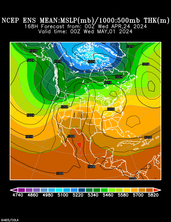
The Ensembles bring down a significant arctic blast the middle of next week. During this same time frame, the EURO has a low sitting in the GOM and an upper level feature in west Texas.
Ensembles @ 168hrs:
http://www.cdc.noaa.gov/map/images/ens/ ... 8_usbg.gif
Ensembles @ 168hrs:
http://www.cdc.noaa.gov/map/images/ens/ ... 8_usbg.gif
0 likes
-
cctxhurricanewatcher

- Category 5
- Posts: 1206
- Joined: Sun Sep 12, 2004 8:53 pm
- Location: Corpus Christi, Texas
Extremeweatherguy wrote:Nothing to be worried with yet, but it is interesting to note that the 18z GFS shows quite a wintry mess across TX again (reaching even Houston) by late this month:
http://www.nco.ncep.noaa.gov/pmb/nwprod ... _312.shtml
^^afternoon of Jan. 30th^^
http://www.nco.ncep.noaa.gov/pmb/nwprod ... _324.shtml
^^morning of Jan. 31st^^
http://www.nco.ncep.noaa.gov/pmb/nwprod ... _336.shtml
^^afternoon of Jan. 31st^^
http://www.nco.ncep.noaa.gov/pmb/nwprod ... _348.shtml
^^morning of Feb. 1st^^
This seems to be in line with JBs thoughts and some other thoughts I have heard about a possible major winter blast by the week of the 30th (JB calling for possible citrus freeze to south TX and FL). This has also been represented in other model runs and ensemble runs. Either way...regardless of another statewide winter event...it looks like the cold air will continue with a possible brutal shot of arctic air toward late month or early February. I won't get too thrilled with the chances though until it is within 7 days though..
EWG
Am I reading this right? Cold from coast to coast and almost everywhere in between?
0 likes
-
Extremeweatherguy
- Category 5
- Posts: 11095
- Joined: Mon Oct 10, 2005 8:13 pm
- Location: Florida
Looks pretty interesting. This one also bears watching for Texas as it may bring some really frigid air down.aggiecutter wrote:The Ensembles bring down a significant arctic blast the middle of next week. During this same time frame, the EURO has a low sitting in the GOM and an upper level feature in west Texas.
Ensembles @ 168hrs:
http://www.cdc.noaa.gov/map/images/ens/ ... 8_usbg.gif
The question will be where the possible winter precip. falls from this one next week. Looks likely that up in north Texas you guys will get some...but it is questionable here in SE Texas due to the typical uncertainties.
Either way...What a cold next 2-4 weeks this will be! Looks like jacket weather may be possible most every day.
Biggest blast of arctic chill may hold off until late Jan/early Feb. though (as I posted above). I bet we see a pretty interesting system in that timeframe for all of us. I am just hoping I get some SNOW here in SE Texas before this winter ends (instead of just ice).
0 likes
Who is online
Users browsing this forum: Google Adsense [Bot], South Texas Storms and 36 guests