I don't think anyone posted on this:
The Intertropical Convergence Zone is like a necklace with big stones strung across the Atlantic today. Interesting that the previous SAL/ridge pattern appears to be back in place keeping the ITCZ convection on a flat line with a clear dry air divide above. I've seen situations like this before where one of those convection areas starts spinning.
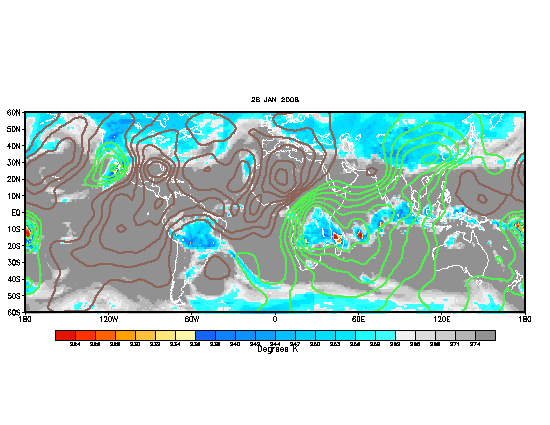
ITCZ Ripe
Moderator: S2k Moderators
Forum rules

The posts in this forum are NOT official forecasts and should not be used as such. They are just the opinion of the poster and may or may not be backed by sound meteorological data. They are NOT endorsed by any professional institution or STORM2K. For official information, please refer to products from the National Hurricane Center and National Weather Service.

-
SouthFloridawx

- S2K Supporter

- Posts: 8346
- Age: 47
- Joined: Tue Jul 26, 2005 1:16 am
- Location: Sarasota, FL
- Contact:
-
wxfollower
Re: ITCZ Ripe
Its ripe, but the High, I believe is suppressing a lot. Here in tampa, it is friggin hot and odd. Maybe things will change this weekend, or at least that is what the weather people say...
0 likes
-
gatorcane

- S2K Supporter
- Posts: 23703
- Age: 47
- Joined: Sun Mar 13, 2005 3:54 pm
- Location: Boca Raton, FL
Re: ITCZ Ripe
wxfollower wrote:Its ripe, but the High, I believe is suppressing a lot. Here in tampa, it is friggin hot and odd. Maybe things will change this weekend, or at least that is what the weather people say...
what happen to the days of afternoon/evening storms that roll in around 5:00pm....not anymore...
the weather patterns are far different than they were 20-30 years ago.
0 likes
-
wxfollower
Re: ITCZ Ripe
gatorcane wrote:wxfollower wrote:Its ripe, but the High, I believe is suppressing a lot. Here in tampa, it is friggin hot and odd. Maybe things will change this weekend, or at least that is what the weather people say...
what happen to the days of afternoon/evening storms that roll in around 5:00pm....not anymore...
the weather patterns are far different than they were 20-30 years ago.
Gator, your right, it has been different. I was just telling my wife, I missed the afternoon storms that roll in. It just feels far different.....
0 likes
-
gatorcane
- S2K Supporter
- Posts: 23703
- Age: 47
- Joined: Sun Mar 13, 2005 3:54 pm
- Location: Boca Raton, FL
Re: ITCZ Ripe
wxfollower wrote:gatorcane wrote:wxfollower wrote:Its ripe, but the High, I believe is suppressing a lot. Here in tampa, it is friggin hot and odd. Maybe things will change this weekend, or at least that is what the weather people say...
what happen to the days of afternoon/evening storms that roll in around 5:00pm....not anymore...
the weather patterns are far different than they were 20-30 years ago.
Gator, your right, it has been different. I was just telling my wife, I missed the afternoon storms that roll in. It just feels far different.....
I used to live in the Tampa Bay area. They used to roll in from the east or southeast and move in between 5:00pm and 9:00pm (the coastal areas usually got them later than the city)....
those days are gone.
The typical pattern now is W to WSW winds that blow the storms inland or they just don't develop as much. The easterly wind pattern regime doesn't seem to last as long as it used to back in the 1960s-1980s
0 likes
-
wxfollower
Re: ITCZ Ripe
The typical pattern now is W to WSW winds that blow the storms inland or they just don't develop as much. The easterly wind pattern regime doesn't seem to last as long as it used to back in the 1960s-1980s[/quote]
Well, I don't know abot those days, but your right. The easterlies doesn't seem to be that strong to push the storms westward, but rather, it seems more east. There have been a couple of days where the storms got pushed to the east, but it has been far and in between. A couple of weeks ago it was the same pattern east to west, but no west to east...Oddly enough they occurred late at night...
Well, I don't know abot those days, but your right. The easterlies doesn't seem to be that strong to push the storms westward, but rather, it seems more east. There have been a couple of days where the storms got pushed to the east, but it has been far and in between. A couple of weeks ago it was the same pattern east to west, but no west to east...Oddly enough they occurred late at night...
0 likes


Re: ITCZ Ripe
I agree its been a summer without the deep easterlies. But, alas, wait one more day. After this tropical wave passes, we will have the easterly pattern set in for at least a week.
0 likes
-
wxfollower
Re: ITCZ Ripe
ronjon wrote:I agree its been a summer without the deep easterlies. But, alas, wait one more day. After this tropical wave passes, we will have the easterly pattern set in for at least a week.
cakes-n-pies, cakes-n-pies...
0 likes
-
seaswing

- S2K Supporter
- Posts: 561
- Joined: Sun Aug 31, 2003 11:56 am
- Location: High Springs, FL/just NW of Gainesville
Re: ITCZ Ripe
gatorcane wrote:wxfollower wrote:Its ripe, but the High, I believe is suppressing a lot. Here in tampa, it is friggin hot and odd. Maybe things will change this weekend, or at least that is what the weather people say...
what happen to the days of afternoon/evening storms that roll in around 5:00pm....not anymore...
the weather patterns are far different than they were 20-30 years ago.
Yep...they are! In Gainesvilee it used to be around 4 pm, storms would roll in from the west (Gulf) and it was everyday. Steamy afterwards but it was cooler. It was the same thing day after day until end of September. Not ANYMORE!
0 likes
Re: ITCZ Ripe
Just a ridge pattern keeping high pressure over Florida. It will snap back. It's not a permanent change of climate.
0 likes
-
Stormcenter
- S2K Supporter
- Posts: 6687
- Joined: Wed Sep 03, 2003 11:27 am
- Location: Houston, TX
Re: ITCZ Ripe
It should be ripe considering it's August 22nd but there is really nothing
out there of any immediate concern. The tropics overall even with Dean have
been pretty non-eventful for the most of the 2007 season.....so far.
out there of any immediate concern. The tropics overall even with Dean have
been pretty non-eventful for the most of the 2007 season.....so far.
0 likes
Re: ITCZ Ripe
Yeah, come to think of it we should let this thread drop because it is unlikely any of those areas will form.
I think Dean beat the ITCZ because he had a good start with low pressure. If a disturbance doesn't arrive in this environment with its own 'juice' it won't make it.
I think Dean beat the ITCZ because he had a good start with low pressure. If a disturbance doesn't arrive in this environment with its own 'juice' it won't make it.
0 likes
-
'CaneFreak

- Category 5

- Posts: 1487
- Joined: Mon Jun 05, 2006 10:50 am
- Location: New Bern, NC
If I were a betting man, I would say that we might see development in 3 to 4 days in the East Atlantic...why...there are a few reasons why...and i am not going to go in a roundabout manner like some of you do to prove your point....I am going to dig deep for this one...
For one, the precipitable water charts are showing browns and yellows BULGING OFF OF THE AFRICAN COAST...what does that mean? Well, it means that this next wave coming off of the African coast has a lot of water vapor to work with. This is the same type of moist "bulge" that Dean had to help it fight off the SAL and shear...remember? When all of you were shouting, "OMG, look theres SAL AND SHEAR!!!! THIS THING IS GOING TO GO POOF!!!" Why didnt it? Well, it had a nice warm moist bubble in the low to mid levels to keep the low to mid level circulation intact all the way through its life to help it until it was able to survive the harsh elements on its own. Its like a life jacket if you will.... Anyways, this current wave has this same moist envelope and heres the freaking PW map in motion if you dont believe me...its pulsating all around the African Coast. You didnt see this in June and July because the weak easterly Jet in Africa wasnt quite going yet. It wasnt the "right time of year". Also, you will notice a shear map that I will post at the bottom as well that shows this easterly jet in the upper levels is causing about 20 knots of shear over this wave currently...thus, there are no current convective "bursts" at the present moment...however that can and will change as this thing gets to about 35 to 40 west. The easterly jet is a little too strong at the current moment but I do believe that that will change in the coming weeks and months to come. I believe it will be just like Dean as far as the moisture availability, the low shear, etc. Its just an area at the current moment that I PERSONALLY am watching...more so than the dead 92L that everyone still thinks has a chance, which it probably doesnt. Nothing is working for it. Anyways, here are the maps to back up all this B.S. Oh and one last thing, on the last link I have so graciously provided, notice at the bottom the circulation trying to work its way down to the surface. Its the little engine that could..."I think I can, I think I can...." Its just now emerging off the coast of Africa and believe it or not...there is a tiny burst of convection just now appearing off the coast of Senegal around 12.5 N and 15 W. Just something to keep your eyes open for. Thanks for your attention. Have a great evening.
20 + knots of Easterly Shear
http://cimss.ssec.wisc.edu/tropic/real- ... m7shr.html
Precipitable Water Contents
http://cimss.ssec.wisc.edu/tropic/real- ... t48hrs.gif
East Atlantic 850 mb (10000 feet) Vorticity Chart
http://cimss.ssec.wisc.edu/tropic/real- ... m7vor.html
East Atlantic Infrared Satellite Image (convective burst occurred at 00:15 UTC image update)
http://www.ssd.noaa.gov/PS/TROP/DATA/RT/EATL/IR4/20.jpg
0 likes


http://www.ssd.noaa.gov/PS/TROP/DATA/RT/EATL/IR4/20.jpg
Hey guys looks like theres only two blobs. could those be the ITCZ twins!
so since these blobs have been around the longest do you think the have a chance to develop?
Hey guys looks like theres only two blobs. could those be the ITCZ twins!
so since these blobs have been around the longest do you think the have a chance to develop?
0 likes
Re: ITCZ Ripe
No matter how much moisture, or how much vorticity, that dry zap the ITCZ just took rules the day.
0 likes

Re: ITCZ Ripe
gatorcane wrote:wxfollower wrote:Its ripe, but the High, I believe is suppressing a lot. Here in tampa, it is friggin hot and odd. Maybe things will change this weekend, or at least that is what the weather people say...
what happen to the days of afternoon/evening storms that roll in around 5:00pm....not anymore...
the weather patterns are far different than they were 20-30 years ago.
Sorry for the late response, I did not see this thread until now.
For South Florida; which I think Chris is referring to; the summer pattern yields Night/Morning rain for the East coast and Afternoon/Evening for Inland and West Coast. The 5:00 PM storms that roll in for the East Coast are when the upper level winds are from the West or Southwest ususally having to do with troughs which are more typically early summer (June/July).
Now, one thing that has changed from 20-30 years ago is where Inland starts.
The Everglades provides "juice" for the storms to develop along with the sea breezes.
So as there has been much more building and expansion westward, it has taken away some of the Everglades and therefore the mechanism for storms to develop a lot closer to the East Coast.
What was close to the Everglades before is not nearly as close as it was before.
And the loss of a lot of Everglades also contributes to the decrease in build up of the afternoon storms.
So now we see less rainfall than 20-30 years ago due to the above factors.
But the East Coast never really fell under the "every afternoon it rains at 4 or 5" routine as much as you think it did. That was much more the case for the Southwest Coast and Inland.
NWS-Miami as part of AFD states the "normal" pattern:
"South Florida should get back to the typical Summer
time weather pattern which is the isolated to scattered late
night and morning activity East Coast...and the scattered afternoon
and evening activity interior and West Coast. "
Last edited by fci on Thu Aug 23, 2007 2:07 pm, edited 1 time in total.
0 likes
Who is online
Users browsing this forum: No registered users and 119 guests