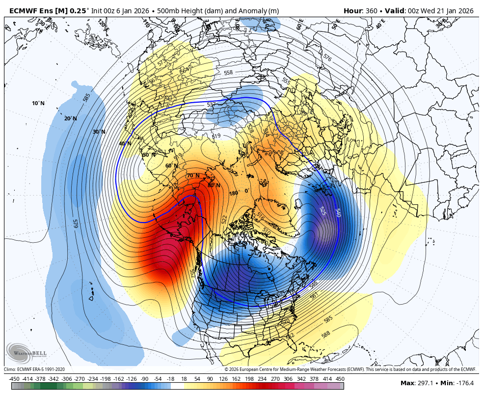
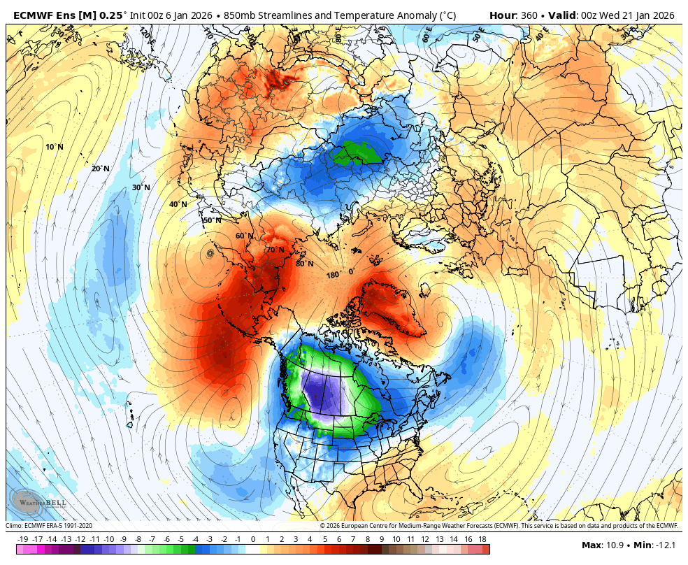
Stratton23 wrote:Obviously operational models wont see the cold or magnitude of it this far out, but after observing the 12z Euro with a massive - EPO ridge linking up with ridging in the arctic, id say the potential is their for this to be a pretty significant cold air dump into the plains
Major Arctic Outbreak potential increasing for the lower 48 end of week 2, all indices aligning on the Ensembles. ENS upper level pattern looks textbook! GEFS now trending towards the EURO ENS
To give all a better idea of the potential, these are the week 1 anomalies over Alaska (coldest climo of the year as well)...the upper level forecast is moving this down into the plains week 2

 The posts in this forum are NOT official forecast and should not be used as such. They are just the opinion of the poster and may or may not be backed by sound meteorological data. They are NOT endorsed by any professional institution or


