Texas winter wx thread (2009-2010)

Winter Weather Discussion

Moderator: S2k Moderators

Forum rules

The posts in this forum are NOT official forecast and should not be used as such. They are just the opinion of the poster and may or may not be backed by sound meteorological data. They are NOT endorsed by any professional institution or STORM2K.

Help Support Storm2K
Message
Author
User avatar
wxgirl69
Tropical Storm
Tropical Storm
Posts: 120
Age: 55
Joined: Wed Nov 18, 2009 9:32 pm
Location: Deer Park, Texas

Re: Texas winter wx thread (2009-2010)

#1001 Postby wxgirl69 » Thu Dec 10, 2009 10:40 am

HockeyTx82 wrote:Why do I have a feeling that we are going to miss out next week? :(


Hate to say it, I have to agree with you.. I have been reading it may go to the east of us. We shall see..
When will the next model run come out?
0 likes   

HockeyTx82
S2K Supporter
S2K Supporter
Posts: 2540
Joined: Tue Oct 27, 2009 11:17 am
Location: Ponder, TX

Re: Texas winter wx thread (2009-2010)

#1002 Postby HockeyTx82 » Thu Dec 10, 2009 11:02 am

wxgirl69 wrote:
HockeyTx82 wrote:Why do I have a feeling that we are going to miss out next week? :(


Hate to say it, I have to agree with you.. I have been reading it may go to the east of us. We shall see..
When will the next model run come out?


I have no idea, like you I am fairly new to this stuff. The lack of posting has me concerned in terms of anything happening. This board was lit up like a Christmas Tree when that last snow storm blew through for NTX and South Texas and now nothing. I have only been posting and reading this winter so I am not sure how last winter went in terms of it no one is posting that means nothing big is going to happen. I guess if I want snow and cold weather I need to move out of the south and up north. Of course my co-worker from Indiana was asking me why I would be so stupid as to do that, which is why he moved down here with his wife. I hear that a lot from people who moved down south, that they don't miss the cold winters. Oh well, technically Winter has not even started yet so we are just getting started I guess.
0 likes   
Don't hold me accountable for anything I post on this forum. Leave the real forecasting up to the professionals.

Location: Ponder, TX (all observation posts are this location unless otherwise noted)

User avatar
srainhoutx
S2K Supporter
S2K Supporter
Posts: 6919
Age: 67
Joined: Sun Jan 14, 2007 11:34 am
Location: Haywood County, NC
Contact:

Re: Texas winter wx thread (2009-2010)

#1003 Postby srainhoutx » Thu Dec 10, 2009 11:08 am

HockeyTx82 wrote:
wxgirl69 wrote:
HockeyTx82 wrote:Why do I have a feeling that we are going to miss out next week? :(


Hate to say it, I have to agree with you.. I have been reading it may go to the east of us. We shall see..
When will the next model run come out?


I have no idea, like you I am fairly new to this stuff. The lack of posting has me concerned in terms of anything happening. This board was lit up like a Christmas Tree when that last snow storm blew through for NTX and South Texas and now nothing. I have only been posting and reading this winter so I am not sure how last winter went in terms of it no one is posting that means nothing big is going to happen. I guess if I want snow and cold weather I need to move out of the south and up north. Of course my co-worker from Indiana was asking me why I would be so stupid as to do that, which is why he moved down here with his wife. I hear that a lot from people who moved down south, that they don't miss the cold winters. Oh well, technically Winter has not even started yet so we are just getting started I guess.


Patience folks. Patience... :lol:
0 likes   
Carla/Alicia/Jerry(In The Eye)/Michelle/Charley/Ivan/Dennis/Katrina/Rita/Wilma/Ike/Harvey

Member: National Weather Association
Wx Infinity Forums
http://wxinfinity.com/index.php

Facebook.com/WeatherInfinity
Twitter @WeatherInfinity

User avatar
iorange55
Category 5
Category 5
Posts: 2388
Joined: Thu Nov 13, 2008 9:47 pm
Location: Big D

Re: Texas winter wx thread (2009-2010)

#1004 Postby iorange55 » Thu Dec 10, 2009 11:09 am

That's usually how it goes there is always going to be more posts when something is actually happening rather than just speculating on the models, and trends. Things will heat up again maybe as soon as next week. Maybe not towards Christmas. We'll see.
0 likes   

msstateguy83

Re: Texas winter wx thread (2009-2010)

#1005 Postby msstateguy83 » Thu Dec 10, 2009 11:18 am

12z gfs is running now coming in as i speak, i will look over it shortly... the brunt of the arctic air *could* the way it
has looked pass just to the east of our region but that said i see temps VERY cold in about 8-10 days by christmas
time with highs possibly as far south as houston near the 32 degree mark for highs. so its a situation that is changing
rapidly cant say either way yet that its gonna miss us or not, you cant go by 1 run or 2 runs its a work in process
and keep in mind the models will change ALOT up until the event unfolds. its a VERY,VERY ruff forecast to say the
least for next wk... stay tuned though folks i will post more thoughts in just a few after i look over the 12z
0 likes   

msstateguy83

Re: Texas winter wx thread (2009-2010)

#1006 Postby msstateguy83 » Thu Dec 10, 2009 11:30 am

12z still hangin it up WAY up north.. that air is very much arctic and when you have that cold of air, the setup
its just hard to believe its not going to come down, where are gonna need alot more runs to get a handle on this
i would say mid way thru the wkend we should have a better handle on this situation, what exactly is gonna play
out. BUT i would by NO means write this off. winter wx is the most dificult wx to forecast for example a north tx
setup for you that are in denton i believe it was march 08 that big snow storm that hit out of the blue, we knew
there was gonna be snow but the models under estimated the precip BIG TIME, parts of the denton area got
like close to 9 inches! just an example, its NOTHING like forecasting severe wx in the spring, its much more complex,
can change so rapidly, i mean svr wx can to but you have so many factors and the main thing is ALOT of times the
computer models in winter under estimate the cold air, the gfs is VERY much notorious doing that..

so bottom line dont give up yet, i know its not the most perfect picture the models are painting,
but the models are not always to be trusted either lol
0 likes   

User avatar
CaptinCrunch
S2K Supporter
S2K Supporter
Posts: 8728
Age: 57
Joined: Mon Nov 03, 2003 4:33 pm
Location: Kennedale, TX (Tarrant Co.)

Re: Texas winter wx thread (2009-2010)

#1007 Postby CaptinCrunch » Thu Dec 10, 2009 11:30 am

msstateguy83 wrote:12z gfs is running now coming in as i speak, i will look over it shortly... the brunt of the arctic air *could* the way it
has looked pass just to the east of our region but that said i see temps VERY cold in about 8-10 days by christmas
time with highs possibly as far south as houston near the 32 degree mark for highs. so its a situation that is changing
rapidly cant say either way yet that its gonna miss us or not, you cant go by 1 run or 2 runs its a work in process
and keep in mind the models will change ALOT up until the event unfolds. its a VERY,VERY ruff forecast to say the
least for next wk... stay tuned though folks i will post more thoughts in just a few after i look over the 12z


Don't expect much cold air next week due to zonel flow, look for a brupt change after next weekend when we can see cross polar flow and some extreme cold air move down into the southern plains and TX. This wiil be the start of some of the coldest weather we have seen in a while, I expect it to last the remainder of the month.
We will also see a active southern jet to feed a few upper lows in to the polar air mass. Between Christmas and New Years I think a large part of the south from TX to GA will see some sort of winter storm whether it be snow or ice.
0 likes   

msstateguy83

Re: Texas winter wx thread (2009-2010)

#1008 Postby msstateguy83 » Thu Dec 10, 2009 11:35 am

agree with the zonal flow comment, that is to be taken into acct.. I TOTALLY agree w/after next wkend though
the signs have been there for days starting about 8 days from now well thru christmas possibly into new years,
major pattern shift, likely setting the stage for several rounds of ice,snow across the srn plains region... that
setup iam MUCH,MUCH,MUCH more confident in... lets just put it this way i think for those of you wanting to know
winter is and when its gonna be around to stay awhile next wkend is the best bet...


its VERY,VERY hard to say this far out on a white christmas i wouldnt even go there but the signs, trends are
there for portions of the southern plains region of tx/ok to get snow on or around christmas eve, christmas day...
0 likes   

User avatar
cctxhurricanewatcher
Category 5
Category 5
Posts: 1206
Joined: Sun Sep 12, 2004 8:53 pm
Location: Corpus Christi, Texas

Re: Texas winter wx thread (2009-2010)

#1009 Postby cctxhurricanewatcher » Thu Dec 10, 2009 11:44 am

Another Corpus Christmas snow miracle according to the 12z.... :froze: :roll:

http://www.nco.ncep.noaa.gov/pmb/nwprod ... 48_l.shtml
0 likes   

User avatar
srainhoutx
S2K Supporter
S2K Supporter
Posts: 6919
Age: 67
Joined: Sun Jan 14, 2007 11:34 am
Location: Haywood County, NC
Contact:

Re: Texas winter wx thread (2009-2010)

#1010 Postby srainhoutx » Thu Dec 10, 2009 11:53 am

Just some food for thought folks. We are seeing a very strong Polar Vortex in Central Canada. The position of the PV is very important to how things will unfold. This feature extends very high in the Upper Atmosphere and spits out shortwaves or Uppper Air disturbances around it breaking off pieces of Very Cold Air that is at the surface. As cold air move around the core of the PV, storms (Upper Level Energy and Surface Cold Fronts) will drop south. Cold domes of High pressure follow the fronts. Keep in mind that some of the colder air will be rather shallow, or not as high in the Atmosphere. Sometimes in Denver for example, it is warmer than TX due to the shallow nature of the airmass. The Sub Tropical Jet (Southern Stream ) is very active and throws off data sets in guidance sometimes. The Guidance will depict warmer temps and faster recovery after the fronts pass. Guidance will struggle with the Polar Vortex as long as it is present. There is much more cold air across the US and North America that we have not seen in many years. Add to that the snow cover that is now present from Canada into the US (West Coast through the Mid West) and this leads to less airmass modification, meaning colder temps than guidance suggests. This is one reason we see WFO's trending temps down behind every front because the all the guidance is suggesting it is warmer than what actually is happening.This is very simply put, but winter weather is a bit different than tracking a tropical system via guidance. Hopefully it helps. :wink:

I am a visual type person and will offer up a Big Picture View. Sometimes we need to "see" what is happening to understand just a bit better...

http://wxweb.meteostar.com/models/noaap ... UMBLOOP=10
Last edited by srainhoutx on Thu Dec 10, 2009 12:47 pm, edited 1 time in total.
0 likes   
Carla/Alicia/Jerry(In The Eye)/Michelle/Charley/Ivan/Dennis/Katrina/Rita/Wilma/Ike/Harvey

Member: National Weather Association
Wx Infinity Forums
http://wxinfinity.com/index.php

Facebook.com/WeatherInfinity
Twitter @WeatherInfinity

User avatar
srainhoutx
S2K Supporter
S2K Supporter
Posts: 6919
Age: 67
Joined: Sun Jan 14, 2007 11:34 am
Location: Haywood County, NC
Contact:

Re: Texas winter wx thread (2009-2010)

#1011 Postby srainhoutx » Thu Dec 10, 2009 12:34 pm

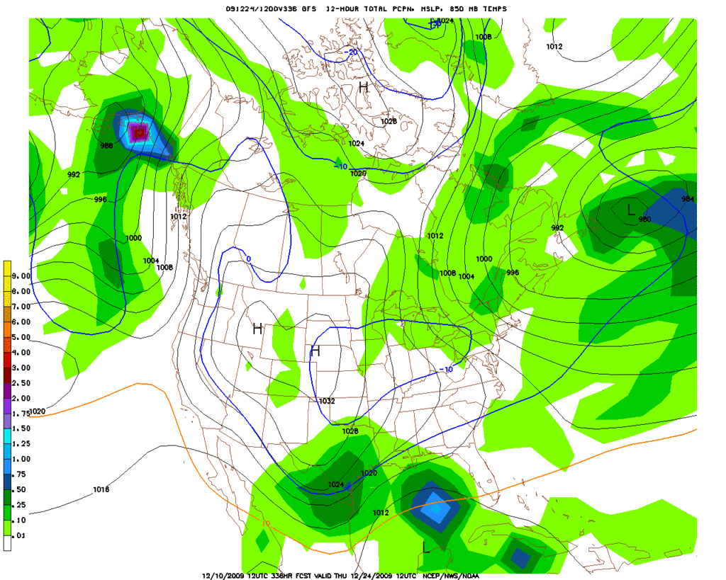
cctxhurricanewatcher wrote:Another Corpus Christmas snow miracle according to the 12z.... :froze: :roll:

http://www.nco.ncep.noaa.gov/pmb/nwprod ... 48_l.shtml


At least we are sharing this time... :cheesy:

Image
0 likes   
Carla/Alicia/Jerry(In The Eye)/Michelle/Charley/Ivan/Dennis/Katrina/Rita/Wilma/Ike/Harvey

Member: National Weather Association
Wx Infinity Forums
http://wxinfinity.com/index.php

Facebook.com/WeatherInfinity
Twitter @WeatherInfinity

User avatar
jasons2k
Storm2k Executive
Storm2k Executive
Posts: 8245
Age: 51
Joined: Wed Jul 06, 2005 12:32 pm
Location: The Woodlands, TX

#1012 Postby jasons2k » Thu Dec 10, 2009 1:17 pm

For my taste...

Active southern jet & talk of some winter precip --> yeah! :-)
Talk of record cold & polar vortex dropping south --> Oh dear God, please no, no, no, NO! My plants are already fried the worst since we moved here - they can't take much more, Jim.

Just my $.02, as usual :D
0 likes   

TornadoAlleyMom
Tropical Wave
Tropical Wave
Posts: 5
Joined: Thu Dec 10, 2009 1:07 pm

Re: Texas winter wx thread (2009-2010)

#1013 Postby TornadoAlleyMom » Thu Dec 10, 2009 1:50 pm

Hi, everyone! I was just searching online for any upcoming forecasts of wintry weather for North Texas and happened upon this forum. I was intrigued and joined to hopefully learn from the wealth of knowledge you all obviously have! I love to watch the weather, but I am an amateur when it comes to deciphering models, etc.

I will humbly ask a lot of questions, if that's okay? :oops:

I hope to incorporate this into my homeschool lessons, and I REALLY HOPE all the models that are pointing to winter precip within the next few weeks are accurate! That would be so fun! I love cold weather, but it seems so in vain when there's no snow or ice to go with it!

So, in terms of what might happen in the weeks ahead, are there winter patterns that repeat themselves over the years? I remember, as a child, the winter of 1988 and the huge winter storm that passed through North Texas! We had another mentionable storm a few years ago, too, but really haven't seen anything since.

Are these forecasts predicting significant winter weather events? Also, could Texas ever see a winter mix that lasts more than just a day? My family and I would be very excited about that!!!! :cold:
0 likes   

User avatar
jasons2k
Storm2k Executive
Storm2k Executive
Posts: 8245
Age: 51
Joined: Wed Jul 06, 2005 12:32 pm
Location: The Woodlands, TX

Re: Texas winter wx thread (2009-2010)

#1014 Postby jasons2k » Thu Dec 10, 2009 2:06 pm

TornadoAlleyMom wrote:
I will humbly ask a lot of questions, if that's okay? :oops:


Please do! That's what this forum is for :-) And welcome to S2K!!

I remember the winters of 88-89 and 89-90 quite well in the DFW area. School was closed due to a gas curtailment, of all things, with the extreme cold. 6" of snow at our house in Plano in March...TV footage on Channel 8 of gigantic icicles falling from the buildings downtown...I'll never forget those times.
0 likes   

rhoby13
Tropical Low
Tropical Low
Posts: 31
Joined: Thu Dec 03, 2009 4:02 pm
Location: Austin, TX

Re: Texas winter wx thread (2009-2010)

#1015 Postby rhoby13 » Thu Dec 10, 2009 2:30 pm

srainhoutx:

I like that satellite imagery you posted. However, I could use a little help interpreting what all is going on....What is the pink over the North Pole? Lighter colors = colder cloud tops?
0 likes   

User avatar
Ntxw
Storm2k Moderator
Storm2k Moderator
Posts: 22786
Joined: Wed Oct 21, 2009 6:34 pm
Location: DFW, Texas

Re: Texas winter wx thread (2009-2010)

#1016 Postby Ntxw » Thu Dec 10, 2009 2:31 pm

TornadoAlleyMom wrote:Hi, everyone! I was just searching online for any upcoming forecasts of wintry weather for North Texas and happened upon this forum. I was intrigued and joined to hopefully learn from the wealth of knowledge you all obviously have! I love to watch the weather, but I am an amateur when it comes to deciphering models, etc.... Are these forecasts predicting significant winter weather events? Also, could Texas ever see a winter mix that lasts more than just a day? My family and I would be very excited about that!!!! :cold:


No winters are the same. Generally though there are similarities when patterns setup. The atmosphere is very complex but there are patterns and a number of things play a factor. So far this winter (though it doesn't officially start until Dec. 21st) has proven to have a good start for those who like snow and cold. The 'trends' look promising
0 likes   
The above post and any post by Ntxw is NOT an official forecast and should not be used as such. It is just the opinion of the poster and may or may not be backed by sound meteorological data. It is NOT endorsed by any professional institution including Storm2k. For official information, please refer to NWS products.

  Help support Storm2K!
Help Support Storm2K

User avatar
srainhoutx
S2K Supporter
S2K Supporter
Posts: 6919
Age: 67
Joined: Sun Jan 14, 2007 11:34 am
Location: Haywood County, NC
Contact:

Re: Texas winter wx thread (2009-2010)

#1017 Postby srainhoutx » Thu Dec 10, 2009 2:41 pm

rhoby13 wrote:srainhoutx:

I like that satellite imagery you posted. However, I could use a little help interpreting what all is going on....What is the pink over the North Pole? Lighter colors = colder cloud tops?


This satellite doesn't "see" well over the North Pole. The imagery is a composite of all global satellites put together though.

For example here is a great VIS shot of the snowcover across N America...time sensative...

http://wxweb.meteostar.com/models/noaap ... /SPN/COMP/

Edit to add the HPC Final Extended Disco since there is some interest in what next week will bring for TX...

EXTENDED FORECAST DISCUSSION
NWS HYDROMETEOROLOGICAL PREDICTION CENTER CAMP SPRINGS MD
230 PM EST THU DEC 10 2009

VALID 12Z SUN DEC 13 2009 - 12Z THU DEC 17 2009

THE COMBINATION OF NEGATIVE HGT ANOMALIES NEAR 40N/150W...ALONG
WITH A VERY STRONG CORE OF BLOCKING POSITIVE HEIGHT ANOMALIES
DRIFTING SW ACROSS GREENLAND...IS EXPECTED TO YIELD A WRN
RIDGE/ERN TROF MEAN PATTERN LATE THE MEDIUM RANGE...ACCORDING TO
TELECONNECTIONS ON THE GREENLAND BLOCK. GFS/GEFS ENSEMBLE MEAN
SOLNS HAVE BEEN SOMEWHAT MORE AMPLIFIED WITH THIS LATE PERIOD
LONGWAVE PATTERN THAN THE DETERMINISTIC ECMWF/AND THE LATEST
12Z/00Z ECMWF ENSEMBLE MEANS BY THE MIDDLE OF NEXT WEEK
.

AGAIN TODAY THE MOST SIGNIFICANT FORECAST PROBLEM APPEARS TO BE
HOW MUCH COLD AIR IS ABLE TO SINK S FROM CANADA INTO THE LOWER 48
STATES THE FIRST PART OF NEXT WEEK.
IN GENERAL... THE GFS FAMILY
OF SOLUTIONS HAS BEEN PORTENDING MORE COOLING WORKING S INTO THE
CONUS THAN THE CORRESPONDING ECMWF FAMILY. THIS WAS ESPECIALLY
EVIDENT IN THE ENSEMBLE SPAGHETTI PLOTS FOR NEXT TUE-THU DAYS 5-7.
THE 00Z/10 ECMWF ENSEMBLE FAMILY OF SOLUTIONS WAS FAIRLY FLAT
ACROSS THE LOWER 48 STATES TUE-THU...PENDING THE POSSIBLE INCREASE
IN AMPLITUDE TO A WRN RIDGE/ERN TROF PATTERN NEAR THE END OF THE
MEDIUM RANGE PERIOD.

FINAL HPC PROGS STAYED WITH THE UPDATE PRELIM CONTINUITY THRU TUE
DAY 5. FOR DAYS 6-7...WE BLENDED IN HALF OF THE 12Z/10 GFS...WHICH
HAD LITTLE IMPACT OVER THE LOWER 48 BUT WILL HOPEFULLY HELP US GET
BETTER TIMING OF SHORTWAVES OVER THE OCEAN AREAS. WE CHOSE TO
WEIGHT WED/THU DAYS 6-7 TOWARDS THE GFS...GIVEN ITS GOOD RUN TO
RUN CONSISTENCY OVER THE LOWER 48. SIGNIFICANTLY..THERE IS BETTER
CLUSTERING OF 12Z/10 MODELS...INCLUDING THE ECMWF...IN ALLOWING
THE VORTEX OVER SW CENTRAL CANADA SAT TO MOVE EWD INTO ERN CANADA
BY THU.
THIS WILL ALLOW MORE ARCTIC AIR TO COME S INTO THE CONUS
AS PER THE GFS FAMILY OF SOLUTIONS.
IN FACT THE NEW 12Z ECMWF HAS
ALSO TRENDED TOWARDS MORE TROF CROSSING THE NE QUARTER OF THE
NATION ON TUE-WED DAYS 5-6...TRENDING TOWARDS THE COLD ERN TROF
SOLUTION FAVORED BY THE GFS AND TELECONNECTIONS.

THE SRN STREAM SYS WILL BRING MODERATE QPF TO PORTIONS OF THE SWRN
STATES SUN/MON. WAVINESS ACROSS THE GULF COAST REGION AND THE S
ATLANTIC STATES THOSE DAYS WILL ALSO SQUEEZE OUT ANOTHER ROUND OF
HEAVY PF. A NEW ROUND OF HEAVY LAKE EFFECT SNOW IS LIKELY AROUND
THE MIDDLE OF NEXT WEEK.

FLOOD
Last edited by srainhoutx on Thu Dec 10, 2009 2:53 pm, edited 1 time in total.
0 likes   
Carla/Alicia/Jerry(In The Eye)/Michelle/Charley/Ivan/Dennis/Katrina/Rita/Wilma/Ike/Harvey

Member: National Weather Association
Wx Infinity Forums
http://wxinfinity.com/index.php

Facebook.com/WeatherInfinity
Twitter @WeatherInfinity

rhoby13
Tropical Low
Tropical Low
Posts: 31
Joined: Thu Dec 03, 2009 4:02 pm
Location: Austin, TX

Re: Texas winter wx thread (2009-2010)

#1018 Postby rhoby13 » Thu Dec 10, 2009 2:53 pm

That's really impressive. Hopefully that snow cover will last long enough until the PV jolts South!
0 likes   

User avatar
srainhoutx
S2K Supporter
S2K Supporter
Posts: 6919
Age: 67
Joined: Sun Jan 14, 2007 11:34 am
Location: Haywood County, NC
Contact:

Re: Texas winter wx thread (2009-2010)

#1019 Postby srainhoutx » Thu Dec 10, 2009 3:11 pm

I will add that TX WFO's are beefing up the chances for some mighty cold air making it all the way to Brownsville. Read the afternoon AFD's as the are issued and you will get an idea what the TX forecasters are thinking. :wink:

Exmaple: Brownsville...

PRESSURE FALLS WILL DEVELOP IN THE PLAINS SUNDAY AND MONDAY AS AN
AIR MASS FROM CANADA MOVES SOUTHEAST OUT OF ALBERTA. THIS COLD
FRONT WILL AFFECT MAINLY THE LOWER MISSISSIPPI VALLEY...BUT AN
EXTENSION WILL TRAIL ACROSS SOUTH TEXAS ON TUESDAY
...WITH
HIGHER RAIN CHANCES. THOUGH THE COLD FRONT WILL PUSH OFFSHORE...
ISOLATED SHOWERS MAY LINGER NEAR THE COAST NEXT WEDNESDAY. NORTH
WINDS WILL STICK AROUND AS ANOTHER HIGH PRESSURE AIR MASS FROM THE
GREAT BASIN SHOWS UP ON THURSDAY TO REINFORCE THE ONGOING COOL AIR
PATTERN OVER DEEP SOUTH TEXAS. SOUTHEAST WINDS MAY RETURN BRIEFLY
NEXT FRIDAY...ONLY TO GIVE WAY TO ANOTHER COLD FRONT NEXT
SATURDAY.


Midland/Odessa...


SPLIT FLOW ALOFT WILL DEVELOP BY SATURDAY OVER THE CONUS. BY EARLY
NEXT WEEK AN UPPER TROUGH WILL MAKE ITS WAY THOUGH THE AREA. THE GFS
AND ECMWF HAVE PRETTY GOOD AGREEMENT WITH THE TIMING OF THIS
TROUGH...BUT THE ECMWF SHOWS IT BEING A BIT STRONGER. THE
ATMOSPHERE APPEARS TOO DRY FOR ANY PRECIPITATION REGARDLESS OF WHICH
COMES TRUE. BOTH OF THESE MODELS SHOW 700MB WINDS OF ABOUT 40 KNOTS
WITH THIS FEATURE...BUT LIFT AHEAD OF THE WAVE...A NOT TOO TIGHT
HEIGHT GRADIENT AND TIMING DIFFERENCES WITH THE WAVE MAY KEEP THE
BETTER WINDS FROM MIXING DOWN IN THE GUADALUPE MOUNTAINS.
THEREFORE...WILL INCREASE WINDS A LITTLE IN FORECAST AND FOREGO ANY
MENTION IN THE HWO. BOTH MODELS DO INDICATE A PACIFIC COLD FRONT
WILL PASS THROUGH THE AREA LATE MONDAY...AND HINT AT SOME MODIFIED
ARCTIC AIR PUSHING SOUTH INTO THE REGION.
CONSIDERING THE SNOW
COVER OVER THE NORTHERN AND CENTRAL U.S. PLAINS...AND THE COLD AIR
INTRUSIONS WE HAVE SEEN IN THE LAST COUPLE OF WEEKS...HAVE TENDED
TEMPERATURES AT OR BELOW MOS GUIDANCE. LATER SHIFTS WILL HAVE TO
MONITOR TO SEE WHETHER WE GET MORE OF THE COLDER AIR
.
0 likes   
Carla/Alicia/Jerry(In The Eye)/Michelle/Charley/Ivan/Dennis/Katrina/Rita/Wilma/Ike/Harvey

Member: National Weather Association
Wx Infinity Forums
http://wxinfinity.com/index.php

Facebook.com/WeatherInfinity
Twitter @WeatherInfinity

User avatar
cctxhurricanewatcher
Category 5
Category 5
Posts: 1206
Joined: Sun Sep 12, 2004 8:53 pm
Location: Corpus Christi, Texas

Re: Texas winter wx thread (2009-2010)

#1020 Postby cctxhurricanewatcher » Thu Dec 10, 2009 3:19 pm

srainhoutx wrote:I will add that TX WFO's are beefing up the chances for some mighty cold air making it all the way to Brownsville. Read the afternoon AFD's as the are issued and you will get an idea what the TX forecasters are thinking. :wink:

Exmaple: Brownsville...

PRESSURE FALLS WILL DEVELOP IN THE PLAINS SUNDAY AND MONDAY AS AN
AIR MASS FROM CANADA MOVES SOUTHEAST OUT OF ALBERTA. THIS COLD
FRONT WILL AFFECT MAINLY THE LOWER MISSISSIPPI VALLEY...BUT AN
EXTENSION WILL TRAIL ACROSS SOUTH TEXAS ON TUESDAY
...WITH
HIGHER RAIN CHANCES. THOUGH THE COLD FRONT WILL PUSH OFFSHORE...
ISOLATED SHOWERS MAY LINGER NEAR THE COAST NEXT WEDNESDAY. NORTH
WINDS WILL STICK AROUND AS ANOTHER HIGH PRESSURE AIR MASS FROM THE
GREAT BASIN SHOWS UP ON THURSDAY TO REINFORCE THE ONGOING COOL AIR
PATTERN OVER DEEP SOUTH TEXAS. SOUTHEAST WINDS MAY RETURN BRIEFLY
NEXT FRIDAY...ONLY TO GIVE WAY TO ANOTHER COLD FRONT NEXT
SATURDAY.


Midland/Odessa...


SPLIT FLOW ALOFT WILL DEVELOP BY SATURDAY OVER THE CONUS. BY EARLY
NEXT WEEK AN UPPER TROUGH WILL MAKE ITS WAY THOUGH THE AREA. THE GFS
AND ECMWF HAVE PRETTY GOOD AGREEMENT WITH THE TIMING OF THIS
TROUGH...BUT THE ECMWF SHOWS IT BEING A BIT STRONGER. THE
ATMOSPHERE APPEARS TOO DRY FOR ANY PRECIPITATION REGARDLESS OF WHICH
COMES TRUE. BOTH OF THESE MODELS SHOW 700MB WINDS OF ABOUT 40 KNOTS
WITH THIS FEATURE...BUT LIFT AHEAD OF THE WAVE...A NOT TOO TIGHT
HEIGHT GRADIENT AND TIMING DIFFERENCES WITH THE WAVE MAY KEEP THE
BETTER WINDS FROM MIXING DOWN IN THE GUADALUPE MOUNTAINS.
THEREFORE...WILL INCREASE WINDS A LITTLE IN FORECAST AND FOREGO ANY
MENTION IN THE HWO. BOTH MODELS DO INDICATE A PACIFIC COLD FRONT
WILL PASS THROUGH THE AREA LATE MONDAY...AND HINT AT SOME MODIFIED
ARCTIC AIR PUSHING SOUTH INTO THE REGION.
CONSIDERING THE SNOW
COVER OVER THE NORTHERN AND CENTRAL U.S. PLAINS...AND THE COLD AIR
INTRUSIONS WE HAVE SEEN IN THE LAST COUPLE OF WEEKS...HAVE TENDED
TEMPERATURES AT OR BELOW MOS GUIDANCE. LATER SHIFTS WILL HAVE TO
MONITOR TO SEE WHETHER WE GET MORE OF THE COLDER AIR
.


Dare I ask if one of the old timers came into to sub at NWS Brownsville?
0 likes   


Return to “Winter Weather”

Who is online

Users browsing this forum: No registered users and 12 guests