Wednesday definitely has me intrigued. In case any of you weren't aware Wednesday will be the 3 year anniversary of the Rockwall tornado. Other than that these two storm systems aren't very similar. The 2015 system was a positively tilted trough that was pretty strong and created some pretty impressive windshear over North and Central Texas. However, imo, what made that storm system was the well above normal temperatures of the Gulf of Mexico. Originally SPC was only expecting CAPE to be around 500-1500 J, supporting QLCS tornadoes, however, CAPE ended up being above 3K J. Temps were in the low 70s that day and dewpoints were near or at 70 as well. The Skew-T was pretty evident for the risk of severe weather as it was a signature loaded gun.
This Wednesday is interesting though. Windshear may not be as impressive, but the system is looking like it could be negatively tilted. The LLJ at the 850 level looks like it could be potent. There's some decent turning in the lower atmosphere as well. The GFS has also been slowing trending upwards with temperatures and dewpoints. One thing to look at it is that the northern Gulf of Mexico is fairly below normal right now, however, the southern Gulf is a little bit above normal. A negatively tilted system will likely be able to tap into more of that moisture. It will definitely be interesting to see how high temps and dewpoints trend. I would definitely not sleep on this system.
Texas Winter 2018-2019
Moderator: S2k Moderators
Forum rules
 The posts in this forum are NOT official forecast and should not be used as such. They are just the opinion of the poster and may or may not be backed by sound meteorological data. They are NOT endorsed by any professional institution or STORM2K.

The posts in this forum are NOT official forecast and should not be used as such. They are just the opinion of the poster and may or may not be backed by sound meteorological data. They are NOT endorsed by any professional institution or STORM2K.
-
TheProfessor

- Professional-Met

- Posts: 3506
- Age: 29
- Joined: Tue Dec 03, 2013 10:56 am
- Location: Wichita, Kansas
Re: Texas Winter 2018-2019
3 likes
An alumnus of The Ohio State University.
Your local National Weather Service office is your best source for weather information.
Your local National Weather Service office is your best source for weather information.
-
South Texas Storms

- Professional-Met
- Posts: 4255
- Joined: Thu Jun 24, 2010 12:28 am
- Location: Houston, TX
Re: Texas Winter 2018-2019
Cpv17 wrote:Man, the models are really pounding the southeast with a ton of rain. I’m jealous.
The models are trending towards heavier rainfall across TX next week. I think much of the eastern half of the state will see around 1-3 inches of rain from the potent storm system that will push through Wednesday into Thursday.
0 likes

Re: Texas Winter 2018-2019
At the end of the FV3/Euro runs, you can see the North Atlantic block teeing up. Starting to latch on to the Ensembles.
1 likes
The above post and any post by Ntxw is NOT an official forecast and should not be used as such. It is just the opinion of the poster and may or may not be backed by sound meteorological data. It is NOT endorsed by any professional institution including Storm2k. For official information, please refer to NWS products.
Help support Storm2K!
Re: Texas Winter 2018-2019
bubba hotep wrote:orangeblood wrote:Ntxw wrote:EPS and GEFS rolling forward are now beginning to show the big -NAO/-AO over the polar regions and NATL. Also possible is the reflection of SSW, while I don't think we see severe cold with this SSW it will likely dislodge more cold air into the -NAO pattern. The Aleutian low also retrogrades from Alaska to form the snowier/colder weak-mod Nino look that we had a taste of late November and early December. Dec 28-31 will give a glimpse of colder air as the Pacific buckles some and less zonal, but the real fun likely happens the second week of January.
If you want to see a repeat of '78 then having the Hudson->Greenland west based NAO go crazy helps
https://images2.imgbox.com/8f/b7/Qh4Vl8io_o.jpg
Yep, and don't underestimate this SSW...there appears to now be consensus with all Models that this will become a Major SSW with a PV split around the 30th +/-. And it appears the weakened main portion of the Vortex might be coming to our side of the world, if that kind of block gets locked in and the PV is underneath, look out below - Jan 2019 is becoming really really interesting!!!
Dr. Amy Butler reminds us via Twitter today that not all SSW events work out good for us. She highlighted the Dec 2001 event that had a similar setup to now but ended up not delivering the cold.
https://pbs.twimg.com/media/Du9YtQIUwAELD7o.jpg
However, typically SSW events do deliver the cold.
https://pbs.twimg.com/media/Du9ZergUYAA6oI_.jpg
Dr. Butler is very informative and tweets a lot of her research at @DrAHButler
Winter 2001-2002 was a good winter snow wise for DFW. Feb and March equaled nearly 4" of snow! Fueled by a monthly -AO that likely was aided by that very SSW!
1 likes
The above post and any post by Ntxw is NOT an official forecast and should not be used as such. It is just the opinion of the poster and may or may not be backed by sound meteorological data. It is NOT endorsed by any professional institution including Storm2k. For official information, please refer to NWS products.
Help support Storm2K!
Help support Storm2K!
-
Portastorm

- Storm2k Moderator

- Posts: 9954
- Age: 63
- Joined: Fri Jul 11, 2003 9:16 am
- Location: Round Rock, TX
- Contact:
Re: Texas Winter 2018-2019
Not trying to start any rumors or anything but this photo was posted this morning on the Internet ... photo was taken as this truck was reportedly headed towards southwest Austin.

7 likes
Any forecasts under my name are to be taken with a grain of salt. Get your best forecasts from the National Weather Service and National Hurricane Center.
-
ztshanklin
- Tropical Low

- Posts: 29
- Joined: Thu Dec 13, 2018 1:33 pm
Re: Texas Winter 2018-2019
South Texas Storms wrote:ztshanklin wrote:End of year could really be interesting.
Yes, it's certainly looking interesting right now. Still plenty of time to watch, but I'm liking the trends!
By the way, welcome to Storm2K!
Thank you. Been lurking a few years, finally decided to sign up.
2 likes


-
gboudx

- S2K Supporter

- Posts: 4090
- Joined: Thu Sep 04, 2003 1:39 pm
- Location: Rockwall, Tx but from Harvey, La
Re: Texas Winter 2018-2019
TheProfessor wrote:Wednesday definitely has me intrigued. In case any of you weren't aware Wednesday will be the 3 year anniversary of the Rockwall tornado.
It was actually Rowlett. No part of the City of Rockwall was impacted, but some of the parts of Rowlett that were impacted are in Rockwall County. My estimation is the circulation center probably passed about 300 yards west of my house, as it went NE over the lake. My kids pediatrician's office was completely destroyed, except for the room where the patient files were stored. Isn't that interesting?
2 likes

Re: Texas Winter 2018-2019
Hello, I'm new to this forum and have been following you guys for a couple of years. I don't know a lot about weather but it is a huge interest of mine and I've learned so much just from yall.
4 likes
Re: Texas Winter 2018-2019
carrye d wrote:Hello, I'm new to this forum and have been following you guys for a couple of years. I don't know a lot about weather but it is a huge interest of mine and I've learned so much just from yall.
Welcome! Happy to see you decided to jump in with us and discuss!
0 likes
The above post and any post by Ntxw is NOT an official forecast and should not be used as such. It is just the opinion of the poster and may or may not be backed by sound meteorological data. It is NOT endorsed by any professional institution including Storm2k. For official information, please refer to NWS products.
Help support Storm2K!
Help support Storm2K!
Re: Texas Winter 2018-2019
carrye d wrote:Hello, I'm new to this forum and have been following you guys for a couple of years. I don't know a lot about weather but it is a huge interest of mine and I've learned so much just from yall.
Welcome! Thanks for signing up. The more the merrier.
1 likes
-
WinterMax
- Tropical Storm

- Posts: 164
- Age: 63
- Joined: Thu Jan 25, 2018 3:50 pm
- Location: Ville Platte, La
Re: Texas Winter 2018-2019
GFS is all over the place for end of month, early January, as many here predicted, well done. That's why I read this forum.
0 likes
-
DFW Stormwatcher
- Tropical Storm
- Posts: 243
- Age: 55
- Joined: Sun Dec 27, 2009 10:35 pm
- Location: Keller, Tx
Re: Texas Winter 2018-2019
40% chance of mixed frozen precip on the always accurate weatherbug forecast on day 10. Even though it’s weatherbug I’ll take it, rare to see that even in a bad forecast in Frisco. Pete Delkus just tweeted that he doesn’t see any winter precip in the next ten days, so considering my respect for wfaa weather my gut is saying blizzard on New Year’s Eve for DFW.
4 likes
Disclaimer: This is not an official weather forecast. I am only an amateur weather enthusiast therefore any weather forecasts or opinions should be taken with a grain of salt. Hook em Horns!


-
TheProfessor
- Professional-Met
- Posts: 3506
- Age: 29
- Joined: Tue Dec 03, 2013 10:56 am
- Location: Wichita, Kansas
Re: Texas Winter 2018-2019
Would be a nasty ice storm on the FV3 out west.
0 likes
An alumnus of The Ohio State University.
Your local National Weather Service office is your best source for weather information.
Your local National Weather Service office is your best source for weather information.
-
Brent
- S2K Supporter
- Posts: 38715
- Age: 37
- Joined: Sun May 16, 2004 10:30 pm
- Location: Tulsa Oklahoma
- Contact:
Re: Texas Winter 2018-2019
very cold rain on the 0z Euro mostly
The cold is definitely coming next weekend
The cold is definitely coming next weekend
1 likes
#neversummer
-
bubba hotep

- S2K Supporter
- Posts: 6012
- Joined: Wed Dec 28, 2016 1:00 am
- Location: Collin County Texas
Re: Texas Winter 2018-2019
00z EPS showing a bit of spread for early January with some members showing highs in the 70s and others showing lows in the teens for DFW lol
About half the members show some form of frozen precipitation with the mean pushing 1".
About half the members show some form of frozen precipitation with the mean pushing 1".
1 likes
Winter time post are almost exclusively focused on the DFW area.
-
bubba hotep
- S2K Supporter
- Posts: 6012
- Joined: Wed Dec 28, 2016 1:00 am
- Location: Collin County Texas
Re: Texas Winter 2018-2019
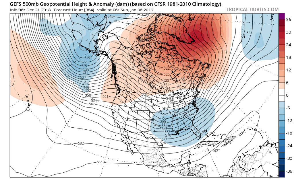
I'll gladly take my chances with what the 06z GEFS is showing, just need to get the timing right with one system.


3 likes
Winter time post are almost exclusively focused on the DFW area.
Re: Texas Winter 2018-2019
A couple of notes this morning, I've been following the HP for next weekend and it is a product of high pressure crossing over from Siberia. The risk here is that the air mass may be colder than currently modeled (these kinds of things usually do).
Secondly the 500mb pattern (SE ridge) has a tendency to trend towards cold coming more clearly down the plains (there is an escape path to eastern Canada however) so we'll have to watch this.

Third, analogous historical patterns of such set up with a big trough in the southwest and shallow, dense cold air has shown to provide opportunities for icing. Assuming air mass is sufficiently cold.
Next weekend's cold wave is a result of the East Pacific Oscillation buckling. By far, will be the strongest HP to date this season.
Secondly the 500mb pattern (SE ridge) has a tendency to trend towards cold coming more clearly down the plains (there is an escape path to eastern Canada however) so we'll have to watch this.
Third, analogous historical patterns of such set up with a big trough in the southwest and shallow, dense cold air has shown to provide opportunities for icing. Assuming air mass is sufficiently cold.
Next weekend's cold wave is a result of the East Pacific Oscillation buckling. By far, will be the strongest HP to date this season.
2 likes
The above post and any post by Ntxw is NOT an official forecast and should not be used as such. It is just the opinion of the poster and may or may not be backed by sound meteorological data. It is NOT endorsed by any professional institution including Storm2k. For official information, please refer to NWS products.
Help support Storm2K!
Help support Storm2K!
-
wxman57

- Moderator-Pro Met

- Posts: 23170
- Age: 68
- Joined: Sat Jun 21, 2003 8:06 pm
- Location: Houston, TX (southwest)
Re: Texas Winter 2018-2019
Looks like all the models keep backing away from (and delaying) any very cold/ice across Texas after New Year's. There are SO many run-to-run differences. Don't believe any solution you see beyond 2-3 days.
3 likes
Who is online
Users browsing this forum: No registered users and 131 guests