Texas Winter 2020-2021
Moderator: S2k Moderators
Forum rules
 The posts in this forum are NOT official forecast and should not be used as such. They are just the opinion of the poster and may or may not be backed by sound meteorological data. They are NOT endorsed by any professional institution or STORM2K.

The posts in this forum are NOT official forecast and should not be used as such. They are just the opinion of the poster and may or may not be backed by sound meteorological data. They are NOT endorsed by any professional institution or STORM2K.
Re: Texas Winter 2020-2021
Finally got a break at work and good to see not much has changed. I'm thinking of a 4am alarm. I wonder if that is early enough.
0 likes

Re: Texas Winter 2020-2021
cheezyWXguy wrote:12k nam is pretty great for dfw, with no changeover back to rain
Agree!
0 likes
-
orangeblood
- S2K Supporter

- Posts: 3895
- Joined: Tue Dec 15, 2009 6:14 pm
- Location: Fort Worth, TX
Re: Texas Winter 2020-2021
Cerlin wrote:rwfromkansas wrote:Captmorg70 wrote:
It looks like the surface temps are ~ 37-38 degrees when it switches back to rain.
I thought temps were going to be 32-34 for DFW. That would really limit accumulations if it goes above 35.
With how strong the rates are, there’s no way there’s not thermal cooling. HRRR keeps the temperatures the same despite higher snowfall rates and I really don’t see how temperatures would persist, let alone raise given that.
Yep, it’s also the perfect time of year for snow accumulations/low sun angle.
Hi Res Models continue to increase totals/heavy convective showers showing up...DFW looks to now be in the over 1/2 inch QPF mark, approaching 3/4.. If that were to verify, warnings need to go up for Tarrant Dallas and Ellis Counties. Probabilities appear to be increasing each model run for a 4+ inch event in the immediate metroplex
Latest SREF probabilities
3 inch plus

6 inch plus

Last edited by orangeblood on Sat Jan 09, 2021 3:33 pm, edited 1 time in total.
7 likes
-
Captmorg70
- Tropical Storm

- Posts: 206
- Age: 38
- Joined: Mon Dec 18, 2017 12:07 am
- Location: Highland Village Tx
Re: Texas Winter 2020-2021
gpsnowman wrote:Finally got a break at work and good to see not much has changed. I'm thinking of a 4am alarm. I wonder if that is early enough.
The earliest the models have precipitation coming in is 8-9am. Looking closer to 10 or 11 am before anyone in Metro would see snow.
2 likes
Location - Highland Village
-
txtwister78

- Category 5

- Posts: 2136
- Joined: Wed Jan 30, 2019 12:56 pm
- Location: San Antonio
Re: Texas Winter 2020-2021
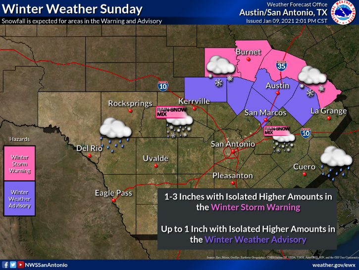
I wouldn't be shocked to see them add another row to this south overnight in terms of the advisory
Last edited by txtwister78 on Sat Jan 09, 2021 3:38 pm, edited 1 time in total.
4 likes
-
Coffey1275
- Tropical Wave

- Posts: 3
- Joined: Fri Dec 02, 2016 7:13 pm
- Location: Celina, TX
Re: Texas Winter 2020-2021
ooff...was hyped for the WWA then realized Collin County wasn't listed. May have to head over to Highland Village to partake in the higher accumulation.
2 likes
Re: Texas Winter 2020-2021
Captmorg70 wrote:gpsnowman wrote:Finally got a break at work and good to see not much has changed. I'm thinking of a 4am alarm. I wonder if that is early enough.
The earliest the models have precipitation coming in is 8-9am. Looking closer to 10 or 11 am before anyone in Metro would see snow.
Oh good I can sleep longer. Thanks.
0 likes
-
Captmorg70
- Tropical Storm
- Posts: 206
- Age: 38
- Joined: Mon Dec 18, 2017 12:07 am
- Location: Highland Village Tx
Re: Texas Winter 2020-2021
gpsnowman wrote:Captmorg70 wrote:gpsnowman wrote:Finally got a break at work and good to see not much has changed. I'm thinking of a 4am alarm. I wonder if that is early enough.
The earliest the models have precipitation coming in is 8-9am. Looking closer to 10 or 11 am before anyone in Metro would see snow.
Oh good I can sleep longer. Thanks.
Let’s be honest, we will all be up by 7 likes it’s Christmas morning
3 likes
Location - Highland Village
-
cheezyWXguy

- Category 5
- Posts: 6280
- Joined: Mon Feb 13, 2006 12:29 am
- Location: Dallas, TX
Re: Texas Winter 2020-2021
Coffey1275 wrote:ooff...was hyped for the WWA then realized Collin County wasn't listed. May have to head over to Highland Village to partake in the higher accumulation.
May not need to pack it in just yet. The setup is still the same in that totals will be higher the further south and west you go, but the hi res models have been getting more generous or holding steady. If these trends keep up I think Collin will be included in the WWA in time.
4 likes
-
WacoWx
- Category 2

- Posts: 692
- Joined: Mon Dec 28, 2009 4:14 pm
- Location: NOT Waco, TX ----> Dallas, TX
Re: Texas Winter 2020-2021
Captmorg70 wrote:gpsnowman wrote:Captmorg70 wrote:
The earliest the models have precipitation coming in is 8-9am. Looking closer to 10 or 11 am before anyone in Metro would see snow.
Oh good I can sleep longer. Thanks.
Let’s be honest, we will all be up by 7 likes it’s Christmas morning
I was up at 5 today due to tomorrow’s anticipation. No sleep again tonight.
5 likes
-
Texas Snow

- S2K Supporter
- Posts: 817
- Joined: Mon Oct 19, 2015 12:06 pm
- Location: N. Dallas & Cedar Creek Lake
Re: Texas Winter 2020-2021
Coffey1275 wrote:ooff...was hyped for the WWA then realized Collin County wasn't listed. May have to head over to Highland Village to partake in the higher accumulation.
Yep, I am in Collin just on border of Dallas County. I’m pretty sure we are packing up in the morning and heading to the lake which is in Henderson county just SE of Dallas County (not quite all the way to Athens). Still showing as watch but even their graphic says likely to be upgraded this afternoon.
I’m just playing the odds of best chance for multi inch snow. Hope I’m right.
2 likes
"Don't let wishcastin get in the way of your forecastin"

Re: Texas Winter 2020-2021
Captmorg70 wrote:gpsnowman wrote:Captmorg70 wrote:
The earliest the models have precipitation coming in is 8-9am. Looking closer to 10 or 11 am before anyone in Metro would see snow.
Oh good I can sleep longer. Thanks.
Let’s be honest, we will all be up by 7 likes it’s Christmas morning
Lol... Must be a bunch of youngsters, I'm up by 5:00 am every day drinking coffee.

Last edited by EnnisTx on Sat Jan 09, 2021 3:51 pm, edited 1 time in total.
5 likes
-
Captmorg70
- Tropical Storm
- Posts: 206
- Age: 38
- Joined: Mon Dec 18, 2017 12:07 am
- Location: Highland Village Tx
Re: Texas Winter 2020-2021
For those that want to get a good snow measurement tomorrow, NWS has you covered!!
https://twitter.com/NWSFortWorth/status/1347967043505680384
https://twitter.com/NWSFortWorth/status/1347967043505680384
4 likes
Location - Highland Village
-
Brent
- S2K Supporter
- Posts: 38716
- Age: 37
- Joined: Sun May 16, 2004 10:30 pm
- Location: Tulsa Oklahoma
- Contact:
Re: Texas Winter 2020-2021
Texas Snow wrote:Coffey1275 wrote:ooff...was hyped for the WWA then realized Collin County wasn't listed. May have to head over to Highland Village to partake in the higher accumulation.
Yep, I am in Collin just on border of Dallas County. I’m pretty sure we are packing up in the morning and heading to the lake which is in Henderson county just SE of Dallas County (not quite all the way to Athens). Still showing as watch but even their graphic says likely to be upgraded this afternoon.
I’m just playing the odds of best chance for multi inch snow. Hope I’m right.
I've been thinking of driving that way myself somewhere between Tyler Athens and Palestine but I'm wait and see we might get lucky closer I could definitely see the WWA getting expanded later
Last edited by Brent on Sat Jan 09, 2021 3:52 pm, edited 1 time in total.
4 likes
#neversummer

Re: Texas Winter 2020-2021
Any time there’s a threat of snow I’m always up at like 4 am, just because I’m worried that the snow will magically start hours in advance if I’m not awake 
5 likes
Graduate Meteorology Student at the University of Oklahoma!
All opinions independent of employers and the university.
All opinions independent of employers and the university.
-
Captmorg70
- Tropical Storm
- Posts: 206
- Age: 38
- Joined: Mon Dec 18, 2017 12:07 am
- Location: Highland Village Tx
Re: Texas Winter 2020-2021
Also this is the current timing associated with the storm per the NWS.
https://twitter.com/NWSFortWorth/status/1347942964325212161
https://twitter.com/NWSFortWorth/status/1347942964325212161
0 likes
Location - Highland Village


Re: Texas Winter 2020-2021
For those of you in Collin (all the northern counties really) worried your benefit will be the trowal feature snow. These things can be underestimated by guidance until nearly real time and they can drop a lot of steady snow over a long period of time. It may not be the fast dumping but it's some of the best in a system.
4 likes
The above post and any post by Ntxw is NOT an official forecast and should not be used as such. It is just the opinion of the poster and may or may not be backed by sound meteorological data. It is NOT endorsed by any professional institution including Storm2k. For official information, please refer to NWS products.
Help support Storm2K!
-
Captmorg70
- Tropical Storm
- Posts: 206
- Age: 38
- Joined: Mon Dec 18, 2017 12:07 am
- Location: Highland Village Tx
Re: Texas Winter 2020-2021
Area Forecast Discussion
National Weather Service Fort Worth TX
246 PM CST Sat Jan 9 2021
...New Short Term, Aviation...
.SHORT TERM... /NEW/
/This afternoon through Monday Morning/
"
But wait...there`s more. A secondary band of precipitation could
develop due to the release of weak conditional symmetric
instability along the backside of the upper low during the pre-
dawn hours on Monday morning. Regions north of I-20 and near/west
of I-35 would be the recipient of the upper lows last gasp to
produce winter precipitation. Some modest mid-level frontogenesis
thanks to a diffuse TROWAL may be sufficient to generate some
precipitation. Negative saturated equivalent potential vorticity
values suggest some weak CSI. The latest HRRR, TTU WRF and NAM
nest do indicate this potential and I`ve nudged PoPs into the
20-30 percent range across North Texas and the northern part of
the Big Country. While winter weather products are currently set
to all expire at 6am Monday, it`s possible some extension may be
necessary here.
Bain
&&
"
This is something for everyone in the metro to watch for tomorrow as the storm unfolds.
1 likes
Location - Highland Village
Re: Texas Winter 2020-2021
Captmorg70 wrote:Area Forecast Discussion
National Weather Service Fort Worth TX
246 PM CST Sat Jan 9 2021
...New Short Term, Aviation...
.SHORT TERM... /NEW/
/This afternoon through Monday Morning/
"
But wait...there`s more. A secondary band of precipitation could
develop due to the release of weak conditional symmetric
instability along the backside of the upper low during the pre-
dawn hours on Monday morning. Regions north of I-20 and near/west
of I-35 would be the recipient of the upper lows last gasp to
produce winter precipitation. Some modest mid-level frontogenesis
thanks to a diffuse TROWAL may be sufficient to generate some
precipitation. Negative saturated equivalent potential vorticity
values suggest some weak CSI. The latest HRRR, TTU WRF and NAM
nest do indicate this potential and I`ve nudged PoPs into the
20-30 percent range across North Texas and the northern part of
the Big Country. While winter weather products are currently set
to all expire at 6am Monday, it`s possible some extension may be
necessary here.
Bain
&&
"
This is something for everyone in the metro to watch for tomorrow as the storm unfolds.
This is what I've been trying to say. The ULL passing overhead has very strong vorticity with a lot of lift.
5 likes
The above post and any post by Ntxw is NOT an official forecast and should not be used as such. It is just the opinion of the poster and may or may not be backed by sound meteorological data. It is NOT endorsed by any professional institution including Storm2k. For official information, please refer to NWS products.
Help support Storm2K!
Help support Storm2K!
-
Captmorg70
- Tropical Storm
- Posts: 206
- Age: 38
- Joined: Mon Dec 18, 2017 12:07 am
- Location: Highland Village Tx
Re: Texas Winter 2020-2021
Ntxw wrote:Captmorg70 wrote:Area Forecast Discussion
National Weather Service Fort Worth TX
246 PM CST Sat Jan 9 2021
...New Short Term, Aviation...
.SHORT TERM... /NEW/
/This afternoon through Monday Morning/
"
But wait...there`s more. A secondary band of precipitation could
develop due to the release of weak conditional symmetric
instability along the backside of the upper low during the pre-
dawn hours on Monday morning. Regions north of I-20 and near/west
of I-35 would be the recipient of the upper lows last gasp to
produce winter precipitation. Some modest mid-level frontogenesis
thanks to a diffuse TROWAL may be sufficient to generate some
precipitation. Negative saturated equivalent potential vorticity
values suggest some weak CSI. The latest HRRR, TTU WRF and NAM
nest do indicate this potential and I`ve nudged PoPs into the
20-30 percent range across North Texas and the northern part of
the Big Country. While winter weather products are currently set
to all expire at 6am Monday, it`s possible some extension may be
necessary here.
Bain
&&
"
This is something for everyone in the metro to watch for tomorrow as the storm unfolds.
This is what I've been trying to say. The ULL passing overhead has very strong vorticity with a lot of lift.
4 likes
Location - Highland Village
Who is online
Users browsing this forum: SnowyOwl31 and 67 guests