Texas Winter 2011-2012...

Winter Weather Discussion

Moderator: S2k Moderators

Forum rules

The posts in this forum are NOT official forecast and should not be used as such. They are just the opinion of the poster and may or may not be backed by sound meteorological data. They are NOT endorsed by any professional institution or STORM2K.

Help Support Storm2K
Message
Author
User avatar
Portastorm
Storm2k Moderator
Storm2k Moderator
Posts: 9914
Age: 63
Joined: Fri Jul 11, 2003 9:16 am
Location: Round Rock, TX
Contact:

Re: Texas Winter 2011-2012...

#1901 Postby Portastorm » Fri Jan 06, 2012 7:47 pm

:uarrow: :uarrow: :uarrow:

Donwrk ... that is a good question. I'll offer an answer but I'm sure others here may have things to add. Generally speaking with the GFS, the key runs are the 0z and the 12z. It is on those runs where new data (upper air soundings, various data measurements from reporting stations, etc) is loaded into the computer run. The 6z is a variant of the 0z while the 18z builds off the grid of the 12z.

Something else to keep in mind ... the system progged to move across Texas early next week is still out over the Pacific Ocean where sampling data is much more sparse. That is why these systems are often more challenging to predict this far out. Once the system is over land and more measurements can be taken, then you can really rely more on the computer models.
0 likes   
Any forecasts under my name are to be taken with a grain of salt. Get your best forecasts from the National Weather Service and National Hurricane Center.

User avatar
wxman57
Moderator-Pro Met
Moderator-Pro Met
Posts: 22980
Age: 67
Joined: Sat Jun 21, 2003 8:06 pm
Location: Houston, TX (southwest)

Re: Texas Winter 2011-2012...

#1902 Postby wxman57 » Fri Jan 06, 2012 8:05 pm

Even though the upper level feature is out over the Pacific, we can see that no new Canadian air is going to move south over Texas next week. So there's not much to work with. The cold air is coming out of the Rockies rather than from Canada, which is going to make it harder to get snow across the Hill Country eastward. Could be some near the upper low center as it moves across NE TX/Red River area.
0 likes   

User avatar
Texas Snowman
Storm2k Moderator
Storm2k Moderator
Posts: 6179
Joined: Fri Jan 25, 2008 11:29 am
Location: Denison, Texas

#1903 Postby Texas Snowman » Fri Jan 06, 2012 9:50 pm

I'm amazed that this thread is now at 96 pages and counting...on January 6th!

Imagine if we had some real winter weather to talk about (besides the Panhandle snows)! 8-)
0 likes   
The above post and any post by Texas Snowman is NOT an official forecast and should not be used as such. It is just the opinion of the poster and may or may not be backed by sound meteorological data. It is NOT endorsed by any professional institution including storm2k.org. For official information, please refer to NWS products.

User avatar
Texas Snowman
Storm2k Moderator
Storm2k Moderator
Posts: 6179
Joined: Fri Jan 25, 2008 11:29 am
Location: Denison, Texas

#1904 Postby Texas Snowman » Fri Jan 06, 2012 9:56 pm

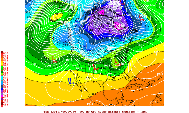
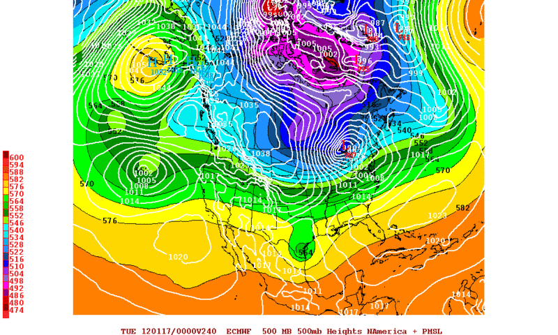
Want to know where winter really is right now? :jacket: :sled:


-----

-----------------------------

Blizzard Hits Valdez; Bitter Cold Grips Nome

Valdez received a total of 19.2 inches of snow Thursday from the Prince William Sound blizzard, making for a total snowfall of 29.2 inches for the first five days of January.

The season total for Valdez stood at 252.8 inches, and the snow depth stood at an even 6 feet.

The Richardson Highway over Thompson Pass has been closed by an avalanche, with no estimate of when it might be reopened.

The snow is expected to continue into the weekend, with forecasters predicting an additional 5 to 10 inches on Saturday.

Other extreme weather is hitting Nome, where, for the first time in 13 years, the temperature hit 40 below zero. The low was recorded just after 10 a.m. Thursday. The last time it was this cold in Nome was Feb. 1, 1999. The last time a minus 40 reading was taken on Jan. 5 was in 1917.

Temperatures in Nome remained "firmly in the 30s below zero" on Friday, according to the weather service, making it the 10th consecutive day with temperatures below minus 30. Temperatures of minus 38 on Jan. 3 and minus 38 on Jan. 4 broke the previous low temperature records for those days.

This is the longest severe cold wave since a record-breaking 16-day stretch from Jan. 15 to 30, 1989. That epic spell saw two days tie Nome's all-time record low, 54 below zero.

Nome has not seen temperatures above zero since Dec. 23.

"There is a good chance that the cold wave will continue two or three more days," said the weather service report

Read more here: http://www.thenewstribune.com/2012/01/0 ... rylink=cpy#storylink=cpy
Last edited by Texas Snowman on Fri Jan 06, 2012 10:01 pm, edited 1 time in total.
0 likes   
The above post and any post by Texas Snowman is NOT an official forecast and should not be used as such. It is just the opinion of the poster and may or may not be backed by sound meteorological data. It is NOT endorsed by any professional institution including storm2k.org. For official information, please refer to NWS products.

User avatar
Texas Snowman
Storm2k Moderator
Storm2k Moderator
Posts: 6179
Joined: Fri Jan 25, 2008 11:29 am
Location: Denison, Texas

#1905 Postby Texas Snowman » Fri Jan 06, 2012 10:00 pm

I've been to Cordova on a salmon fishing trip. They're getting blasted too.

Haven't looked at the maps this evening, but I'm guessing this is the storm system that is going to give us our rain this next week?

-----
"We're calling it 'Snowpocalypse,' " said J.R. Lewis, owner of KLAM and KCDV radio stations in Cordova. "We have a drift that's gotta be 8 or 9 feet high at the station and our transmitter shack is almost completely buried."

The snow wasn't just falling but blowing around creating white-out conditions. The Cordova Police Department asked drivers to stay off the road for a while said dispatcher Nancy Gentry. "The snowplows were not running because visibility was only 10 or 15 feet," she said.

Cordova had it easy compared with Valdez, where a winter storm warning was in effect through this morning. The NOAA forecast called for an accumulation of up to 30 inches and advised that visibility would be severely limited. It advised travelers to "keep an extra flashlight, food and water in your vehicle in case of an emergency."

Read more here: http://www.thenewstribune.com/2012/01/0 ... rylink=cpy
0 likes   
The above post and any post by Texas Snowman is NOT an official forecast and should not be used as such. It is just the opinion of the poster and may or may not be backed by sound meteorological data. It is NOT endorsed by any professional institution including storm2k.org. For official information, please refer to NWS products.

User avatar
iorange55
Category 5
Category 5
Posts: 2388
Joined: Thu Nov 13, 2008 9:47 pm
Location: Big D

Re: Texas Winter 2011-2012...

#1906 Postby iorange55 » Fri Jan 06, 2012 10:06 pm

The 00z NAM is a little more favorable for snow next week for those in west Texas and north west Texas.
0 likes   

User avatar
Texas Snowman
Storm2k Moderator
Storm2k Moderator
Posts: 6179
Joined: Fri Jan 25, 2008 11:29 am
Location: Denison, Texas

Re: Texas Winter 2011-2012...

#1907 Postby Texas Snowman » Fri Jan 06, 2012 10:09 pm

:uarrow: Hmm, notice one of the year's referenced in the Nome cold story above...


"This is the longest severe cold wave since a record-breaking 16-day stretch from Jan. 15 to 30, 1989. That epic spell saw two days tie Nome's all-time record low, 54 below zero."

EDIT: Never mind, my bad, that's January 1989 not December 1989. :roll:
0 likes   
The above post and any post by Texas Snowman is NOT an official forecast and should not be used as such. It is just the opinion of the poster and may or may not be backed by sound meteorological data. It is NOT endorsed by any professional institution including storm2k.org. For official information, please refer to NWS products.

Palmer divide shadow
Tropical Depression
Tropical Depression
Posts: 54
Joined: Thu Dec 29, 2011 11:15 am
Location: Monument Colorado,but from Sugarland tx

Re: Texas Winter 2011-2012...

#1908 Postby Palmer divide shadow » Fri Jan 06, 2012 10:46 pm

Actually feb 89 had a major cold outbreak hmmm
0 likes   

User avatar
Portastorm
Storm2k Moderator
Storm2k Moderator
Posts: 9914
Age: 63
Joined: Fri Jul 11, 2003 9:16 am
Location: Round Rock, TX
Contact:

Re: Texas Winter 2011-2012...

#1909 Postby Portastorm » Fri Jan 06, 2012 11:36 pm

0z GFS rolling in ... looks pretty warm for Texas through next Friday. No signs of Arctic or polar airmasses impacting the state. Will be curious to see what it does later in the run.
0 likes   
Any forecasts under my name are to be taken with a grain of salt. Get your best forecasts from the National Weather Service and National Hurricane Center.

DonWrk
Category 1
Category 1
Posts: 488
Age: 37
Joined: Mon Jan 03, 2011 11:54 pm
Location: Collinsville, TX

#1910 Postby DonWrk » Fri Jan 06, 2012 11:41 pm

So the 0z GFS is still showing snow in the northwest part of the state. Even better than the 18z but I'm still not sure how trustworthy it should be taken.
0 likes   

User avatar
Portastorm
Storm2k Moderator
Storm2k Moderator
Posts: 9914
Age: 63
Joined: Fri Jul 11, 2003 9:16 am
Location: Round Rock, TX
Contact:

Re: Texas Winter 2011-2012...

#1911 Postby Portastorm » Fri Jan 06, 2012 11:45 pm

The 0z GFS is also showing an Arctic/polar airmass around 240 hours but shunts it to the Great Lakes and Northeast and keeps the flow over Texas mostly zonal. Heh, if this verifies there's going to be a lot of unhappy campers around here (except for wxman57!).

Yeah ... the entire run pretty much stinks unless you like mild weather. There is some rain for Texas here and there through 16 days.

I can't believe I stayed up for this! Stoopid GFS. :roll:
0 likes   
Any forecasts under my name are to be taken with a grain of salt. Get your best forecasts from the National Weather Service and National Hurricane Center.

User avatar
Texas Snowman
Storm2k Moderator
Storm2k Moderator
Posts: 6179
Joined: Fri Jan 25, 2008 11:29 am
Location: Denison, Texas

#1912 Postby Texas Snowman » Sat Jan 07, 2012 12:11 am

Depends on how reliable the GFS turns out to be in that time frame.

Bastardi tweeted that the "...operational models will have problems with strong temp gradients euro ensemble uncorks 2cnd beast in the east cold shot 16-20."

So it sounds like he's still on board for his "mild, wild, then vile" pattern change to cold over the next three weeks.

We'll see...
0 likes   
The above post and any post by Texas Snowman is NOT an official forecast and should not be used as such. It is just the opinion of the poster and may or may not be backed by sound meteorological data. It is NOT endorsed by any professional institution including storm2k.org. For official information, please refer to NWS products.

User avatar
Texas Snowman
Storm2k Moderator
Storm2k Moderator
Posts: 6179
Joined: Fri Jan 25, 2008 11:29 am
Location: Denison, Texas

#1913 Postby Texas Snowman » Sat Jan 07, 2012 12:14 am

And earlier today, Larry Cosgrove remained bullish on future potential cold...

"Eventually, an Arctic air mass will come roaring through SE TX. We might be able to squeeze out a somewhat milder day on January 11, before a "Blue Norther" chills you to the bone on Wednesday night. This incoming cold air mass will be followed by two more like regimes the following weekend and the week of January 22.

No, winter still has surprise punches left in its arsenal!"

http://www.examiner.com/weather-in-hous ... ary-6-2012
0 likes   
The above post and any post by Texas Snowman is NOT an official forecast and should not be used as such. It is just the opinion of the poster and may or may not be backed by sound meteorological data. It is NOT endorsed by any professional institution including storm2k.org. For official information, please refer to NWS products.

User avatar
srainhoutx
S2K Supporter
S2K Supporter
Posts: 6919
Age: 67
Joined: Sun Jan 14, 2007 11:34 am
Location: Haywood County, NC
Contact:

#1914 Postby srainhoutx » Sat Jan 07, 2012 12:19 am

Hang in there Portastorm. The Canadian came to the rescue once again...;)
0 likes   
Carla/Alicia/Jerry(In The Eye)/Michelle/Charley/Ivan/Dennis/Katrina/Rita/Wilma/Ike/Harvey

Member: National Weather Association
Wx Infinity Forums
http://wxinfinity.com/index.php

Facebook.com/WeatherInfinity
Twitter @WeatherInfinity

User avatar
iorange55
Category 5
Category 5
Posts: 2388
Joined: Thu Nov 13, 2008 9:47 pm
Location: Big D

Re:

#1915 Postby iorange55 » Sat Jan 07, 2012 1:11 am

srainhoutx wrote:Hang in there Portastorm. The Canadian came to the rescue once again...;)


It does drop down some pretty serious cold, huh? Let's hope the crazy Canadian is right this time.
0 likes   

User avatar
Rgv20
S2K Supporter
S2K Supporter
Posts: 2466
Age: 39
Joined: Wed Jan 05, 2011 5:42 pm
Location: Edinburg/McAllen Tx

#1916 Postby Rgv20 » Sat Jan 07, 2012 3:18 am

At least the GFS and ECMWF have come until some kind of agreement on developing a ridge some where up in Alaska or close to it. Beware tho with this kind of delicate pattern long range models are going to be all over the place.


0zGFS 500mb Heights valid for 01-17-2011. Notice the bright yellow oval until western Alaska. 0zGFS Ensembles are in the same general idea of developing positive 500mb Heights Anomalies up until Alaska.
Image


0zECMWF has the same idea...Its also forecasting a ridge to build close to Alaska.
Image
0 likes   
The following post is NOT an official forecast and should not be used as such. It is just the opinion of the poster and may or may not be backed by sound meteorological data. It is NOT endorsed by any professional institution including storm2k.org For Official Information please refer to the NHC and NWS products.

orangeblood
S2K Supporter
S2K Supporter
Posts: 3714
Joined: Tue Dec 15, 2009 6:14 pm
Location: Fort Worth, TX

Re: Texas Winter 2011-2012...

#1917 Postby orangeblood » Sat Jan 07, 2012 3:25 am

Portastorm wrote:The 0z GFS is also showing an Arctic/polar airmass around 240 hours but shunts it to the Great Lakes and Northeast and keeps the flow over Texas mostly zonal. Heh, if this verifies there's going to be a lot of unhappy campers around here (except for wxman57!).

Yeah ... the entire run pretty much stinks unless you like mild weather. There is some rain for Texas here and there through 16 days.

I can't believe I stayed up for this! Stoopid GFS. :roll:


Don't fret too much Portastorm, the operational models have no clue how to handle dense arctic air-mass's like the ones depicted on tonight's model suites...1050+ highs originating in the Arctic don't just dissipate and become obsolete. They will always make themselves known somewhere!!!!
0 likes   

User avatar
srainhoutx
S2K Supporter
S2K Supporter
Posts: 6919
Age: 67
Joined: Sun Jan 14, 2007 11:34 am
Location: Haywood County, NC
Contact:

Re: Texas Winter 2011-2012...

#1918 Postby srainhoutx » Sat Jan 07, 2012 6:13 am

Once again, as we saw in December, these closed cold core upper lows are a forecasting challenge at best. This morning we see Winter Storm Watches hoisted for New Mexico with Special Weather Statements for winter weather from El Paso, Midland/Odessa, to Amarillo. San Angelo has joined in the question of whether they will see wintry mischief across their area and even Dallas/Ft Worth is mentioning the possibility of a wintry mix to their W as the upper low treks E. Further S, rains and storms look likely beginning late Sunday into Tuesday morning. The SPC is mentioning even a possible tornado or two for S Texas as a Coastal Low develops. It does appear that heavy rains and storms are likely for Central/SE TX Sunday night into Monday night/early Tuesday morning. There still remain some uncertainty on the exact track of the U/L and precip could linger into Tuesday as the closed cold core upper low passes. The focal point for heavy rains will be along a stalled frontal boundary draped across Central/SE TX and wide spread 1-2 inch amounts, with isolated 4+ inch amounts possible where any training of heavy showers/storms develop.

A stronger push of colder air should follow on Thursday as a complex Winter Storm develops near the Great Lakes/Upper Mid West and a Canadian front dives S into the Plains in the wake of our passing storm early next week. Model volatility returns yet again with what happens with yet another upper low to our W on Wednesday/Thursday and just when that feature will eject E. Sound familiar? Various solutions and day to day, run to run solutions are offered by the various guidance and a very changeable forecast lies ahead regarding late next week. What is developing via guidance is heights increasing near/over Alaska and a break down of the Alaska Vortex that has brought record cold and snows to Cordova/Prince William Sound and cold temps are pushed into Western Canada and Arctic high pressure builds in the 1048-1055+ range and extends to the N Pole.

What often happen when a whole sale pattern change occurs are guidance flip flops and various solutions will change like the hands on a clock. It does appear we are entering a period where cold air intrusions are becoming more likely as we head into mid January. There still remain indications the a favorable MJO in phase 7-8, albeit weak will allow tropical forcing to keep the Pacific pattern active for us before relaxing later this month. A -AO/-EPO regime with a waffling +/-PNA is conducive to a cold and active pattern for the Western 1/2 to 2/3 of the North America while the East Coast remains warm with a +NAO or lack of Greenland blocking. The SE ridge tends to hold the cold air intrusions W as storm systems trek NE into the Ohio Valley or W of the Appalachians. All that said, stay tuned! We are entering a very changeable period and cold air intrusions well S into Mexico cannot be ruled out as a cross Polar flow may develop and depending on exactly where the Alaska Vortex is displaced, or takes up shop in Canada. My hunch is we are entering a very interesting period, weather wise so hang on. It could become a very bumpy ride... ;)

The following post is NOT an official forecast and should not be used as such. It is just the opinion of the poster and may or may not be backed by sound meteorological data. It is NOT endorsed by any professional institution including storm2k.org. For official information, please refer to NWS products.

0 likes   
Carla/Alicia/Jerry(In The Eye)/Michelle/Charley/Ivan/Dennis/Katrina/Rita/Wilma/Ike/Harvey

Member: National Weather Association
Wx Infinity Forums
http://wxinfinity.com/index.php

Facebook.com/WeatherInfinity
Twitter @WeatherInfinity

User avatar
cycloneye
Admin
Admin
Posts: 145464
Age: 68
Joined: Thu Oct 10, 2002 10:54 am
Location: San Juan, Puerto Rico

Re: Texas Winter 2011-2012...

#1919 Postby cycloneye » Sat Jan 07, 2012 6:33 am

The daily SOI index is crashing.

7 Jan 2012 1010.53 1009.35 -16.15

http://www.longpaddock.qld.gov.au/seaso ... soivalues/
0 likes   
Visit the Caribbean-Central America Weather Thread where you can find at first post web cams,radars
and observations from Caribbean basin members Click Here

User avatar
wxman57
Moderator-Pro Met
Moderator-Pro Met
Posts: 22980
Age: 67
Joined: Sat Jun 21, 2003 8:06 pm
Location: Houston, TX (southwest)

Re: Texas Winter 2011-2012...

#1920 Postby wxman57 » Sat Jan 07, 2012 8:51 am

Portastorm wrote:The 0z GFS is also showing an Arctic/polar airmass around 240 hours but shunts it to the Great Lakes and Northeast and keeps the flow over Texas mostly zonal. Heh, if this verifies there's going to be a lot of unhappy campers around here (except for wxman57!).

Yeah ... the entire run pretty much stinks unless you like mild weather. There is some rain for Texas here and there through 16 days.

I can't believe I stayed up for this! Stoopid GFS. :roll:


GFS looks good to me, Portastorm! ;-)
0 likes   


Return to “Winter Weather”

Who is online

Users browsing this forum: No registered users and 2 guests