Texas Winter 2011-2012...

Winter Weather Discussion

Moderator: S2k Moderators

Forum rules

The posts in this forum are NOT official forecast and should not be used as such. They are just the opinion of the poster and may or may not be backed by sound meteorological data. They are NOT endorsed by any professional institution or STORM2K.

Help Support Storm2K
Message
Author
aggiecutter
Category 5
Category 5
Posts: 1753
Joined: Thu Oct 14, 2004 9:22 pm
Location: Texarkana

Re: Texas Winter 2011-2012...

#1921 Postby aggiecutter » Sat Jan 07, 2012 9:12 am

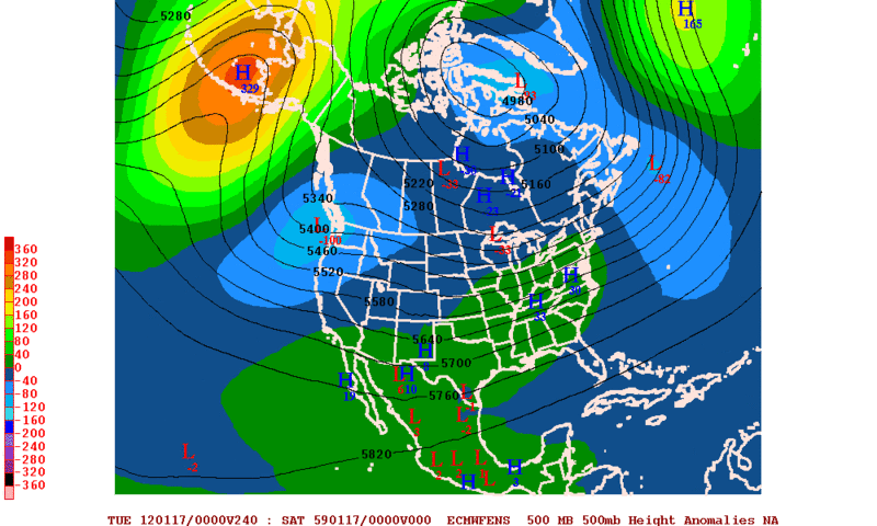
Portastorm wrote:The 0z GFS is also showing an Arctic/polar airmass around 240 hours but shunts it to the Great Lakes and Northeast and keeps the flow over Texas mostly zonal. Heh, if this verifies there's going to be a lot of unhappy campers around here (except for wxman57!).

Yeah ... the entire run pretty much stinks unless you like mild weather. There is some rain for Texas here and there through 16 days.

I can't believe I stayed up for this! Stoopid GFS. :roll:

Remember HM's forecast from earlier this week. He thinks the cold air will remain north of Texas for the most part. Looks like the models are buying into his idea.
0 likes   

User avatar
amawea
S2K Supporter
S2K Supporter
Posts: 385
Age: 73
Joined: Mon Aug 09, 2004 3:36 pm
Location: Horseshoe Bend, Ar. but from Baytown, Tx

Re: Texas Winter 2011-2012...

#1922 Postby amawea » Sat Jan 07, 2012 9:45 am

Yep, even the forecaster out of Springfield Missouri has changed his tune! I have now lost hope of a pattern change mid to late month. This would mean Texas isn't going to go to the cold pattern also.

AREA FORECAST DISCUSSION
NATIONAL WEATHER SERVICE SPRINGFIELD MO
541 AM CST SAT JAN 7 2012

...UPDATE TO AVIATION...

.DISCUSSION...

ANOTHER MILD JANUARY NIGHT WAS OBSERVED OVER EXTREME SOUTHEAST
KANSAS AND THE MISSOURI OZARKS. A 200 MILE WIDE BAND OF MID LEVEL
CLOUDS MITIGATED TEMPERATURES FROM COOLING OUT OF THE UPPER 30S AND
LOWER 40S. MEANWHILE...LIGHT NORTHERLY BREEZES PERSISTED AT 5 TO 10
MPH.

TODAYS WEATHER WILL BE FANTASTIC FOR JANUARY. AFTERNOON
TEMPERATURES WILL WARM INTO THE 50S...UNDER A MIX OF SUN AND
CLOUDS. HIGH PRESSURE WILL CONTINUE TO BUILD INTO THE REGION FROM
THE NORTHWEST...CAUSING NORTHERLY TRAJECTORIES TO BLOW OFF OF THIS
FEATURE. FORTUNATELY AN UNSEASONABLY MILD AIRMASS RESIDES ACROSS
THE NORTHERN PLAINS...AN AREA WITHOUT A SNOW PACK.

AS HIGH PRESSURE CONTINUES TO BUILD INTO SOUTHERN MISSOURI ON
SUNDAY...EVEN COOLER TEMPERATURES ARE EXPECTED...WITH AFTERNOON
HIGHS ONLY REACHING THE 40S. NO PRECIPITATION IS EXPECTED THROUGH
THE ENTIRE WEEKEND.

ADVANCING INTO NEXT WORK WEEK...THE MILD AND DRY WEATHER WILL
PERSIST THROUGH TUESDAY MORNING. HOWEVER...LIGHT RAIN CHANCES
INCREASE TUESDAY AFTERNOON AND NIGHT. A STORM SYSTEM...WHICH CAN BE
VIEWED ON THE WATER VAPOR OVER THE MOUNTAIN WEST...WILL CONTINUE TO
DIG SOUTHWARD WHILE CLOSING OFF SOMEWHERE LEE OF THE ROCKIES.

MODELS HAVE BEEN EXTREMELY CONSISTENT WITH SUGGESTING AN INTERSTATE
20 TRACK WITH THIS CLOSED OFF STORM SYSTEM. THIS WOULD FORCE THE
NORTHERN EDGE OF A SHIELD OF LIGHT RAIN INTO ARKANSAS AND POTENTIALLY
AREAS OF SOUTHERN MISSOURI TUESDAY AFTERNOON THROUGH TUESDAY NIGHT.

THE GFS SHOWS LIGHT RAIN AS FAR NORTH AS INTERSTATE 44...WHILE THE
ECMWF CONFINES THE RAINFALL TO AREAS ALONG AND SOUTH OF THE ARKANSAS
STATE LINE. WE WILL CONTINUE TO FORECAST A BLEND OF THESE TWO
SOLUTIONS...THINKING THAT SOME LIGHT RAIN WILL FALL OVER FAR
SOUTHERN MISSOURI...MAINLY SOUTH OF INTERSTATE 44. PRECIPITATION
AMOUNTS SHOULD REMAIN BELOW ONE HALF OF AN INCH...AND THERE ARE NO
CHANCES FOR SNOW WITH THIS SYSTEM.

FOLLOWING THIS POSSIBLE LIGHT RAIN EVENT...A CANADIAN AIRMASS WILL
DROP INTO THE OZARKS...CAUSING TEMPERATURES TO COOL DOWN FOR THE
REST OF THE WORK WEEK. AFTERNOON READINGS ON THURSDAY AND FRIDAY
WILL ONLY WARM INTO THE 30S...WHILE OVERNIGHT LOWS FALL INTO THE
TEENS AND 20S.

JUST WANTED TO BRIEFLY DISCUSS THE LATEST EXTENDED TRENDS FROM
MEDIUM RANGE SOLUTIONS. ARCTIC AIR HAS BEEN CONFINED TO ALASKA AND
THE NORTHERN CANADIAN PROVINCES THE ENTIRE FALL AND WINTER SEASONS.

THERE ARE SOME INDICATIONS THAT ARCTIC AIR WILL SPREAD INTO THE
NORTHERN PLAINS AND GREAT LAKES REGION WITHIN THE 9 TO 11 DAY TIME
FRAME. AT THIS TIME...THERE ARE NO INDICATIONS THAT OUR ZONAL BELT
OF WESTERLIES WILL BECOME SUFFICIENTLY AMPLIFIED ENOUGH...TO ALLOW A
COLD OUTBREAK FOR THE OZARKS. AS SUGGESTED BY THE LATEST CLIMATE
PREDICTION CENTER...ABOVE AVERAGE TEMPERATURES FOR THE MONTH OF JANUARY
COULD COME TO FRUITION.
CRAMER
0 likes   

User avatar
iorange55
Category 5
Category 5
Posts: 2388
Joined: Thu Nov 13, 2008 9:47 pm
Location: Big D

Re: Texas Winter 2011-2012...

#1923 Postby iorange55 » Sat Jan 07, 2012 10:18 am

I still have plenty of faith. It will come down sometime.

As the cool kids might say, "Ain't no thing but a chicken wing."
0 likes   

User avatar
Portastorm
Storm2k Moderator
Storm2k Moderator
Posts: 9914
Age: 63
Joined: Fri Jul 11, 2003 9:16 am
Location: Round Rock, TX
Contact:

Re: Texas Winter 2011-2012...

#1924 Postby Portastorm » Sat Jan 07, 2012 10:27 am

iorange55 wrote:I still have plenty of faith. It will come down sometime.

As the cool kids might say, "Ain't no thing but a chicken wing."


Oh, I do too iorange55. Our longtime friend srainhoutx has written an outstanding summary of the "players" on the board and I am encouraged this morning!

Time to look over the ensembles and figure out how I'm going to foil wxman57's plot to rule the winter with mild temperatures.
0 likes   
Any forecasts under my name are to be taken with a grain of salt. Get your best forecasts from the National Weather Service and National Hurricane Center.

Palmer divide shadow
Tropical Depression
Tropical Depression
Posts: 54
Joined: Thu Dec 29, 2011 11:15 am
Location: Monument Colorado,but from Sugarland tx

Re: Texas Winter 2011-2012...

#1925 Postby Palmer divide shadow » Sat Jan 07, 2012 10:34 am

Wxman and his warm weather -removed- :D
0 likes   

User avatar
Portastorm
Storm2k Moderator
Storm2k Moderator
Posts: 9914
Age: 63
Joined: Fri Jul 11, 2003 9:16 am
Location: Round Rock, TX
Contact:

Re: Texas Winter 2011-2012...

#1926 Postby Portastorm » Sat Jan 07, 2012 10:43 am

The Canadian and Euro ensembles do look colder for us (Texas) than the GFS ensembles which in the 6-10 day period lock in the cold over the East. I'm speaking generally here. There is nothing "earth shattering" though. Admittedly, I wasn't focused on looking upstream to see what kind of ridging would develop. Srainhoutx did a great job of outlining that earlier this morning.

Well, on to the 12z op runs and let's see what they have in store for us. We have an active system approaching for late in the weekend which promises heavy rain, storms, snow ... heh, gotta love it! And then, frontal passage by midweek which remains up for debate just how strong it is.

Should be a fun weekend around here, folks. Stop in frequently and take a break from watching the NFL playoffs. :wink:

Go Texans! Go Saints!
0 likes   
Any forecasts under my name are to be taken with a grain of salt. Get your best forecasts from the National Weather Service and National Hurricane Center.

User avatar
wxman57
Moderator-Pro Met
Moderator-Pro Met
Posts: 22980
Age: 67
Joined: Sat Jun 21, 2003 8:06 pm
Location: Houston, TX (southwest)

Re: Texas Winter 2011-2012...

#1927 Postby wxman57 » Sat Jan 07, 2012 11:17 am

Palmer divide shadow wrote:Wxman and his warm weather -removed- :D


My "wishes" appear to be coming true. About to head out on the bikes for a 4-5 hour ride in the 70+ deg temps. Will stop by Discovery Green to watch the ice sculpting. They always seem to pick a warm day for the event.

12Z GFS coming in. Not much change for early next week. Will check the new Euro & Canadian when we get home around 3pm. Definitely watching the Saints tonight. Have been a Saints fan since they started in the 60s.
0 likes   

User avatar
gboudx
S2K Supporter
S2K Supporter
Posts: 4080
Joined: Thu Sep 04, 2003 1:39 pm
Location: Rockwall, Tx but from Harvey, La

Re: Texas Winter 2011-2012...

#1928 Postby gboudx » Sat Jan 07, 2012 11:20 am

wxman57 wrote:
My "wishes" appear to be coming true. About to head out on the bikes for a 4-5 hour ride in the 70+ deg temps. Will stop by Discovery Green to watch the ice sculpting. They always seem to pick a warm day for the event.


Enjoy the ride 57! I'll be heading out soon for an hour or so ride on a nature trail. Who Dat!
0 likes   

User avatar
Ntxw
Storm2k Moderator
Storm2k Moderator
Posts: 22787
Joined: Wed Oct 21, 2009 6:34 pm
Location: DFW, Texas

#1929 Postby Ntxw » Sat Jan 07, 2012 11:44 am

I like what the GFS showing. It had this pattern long range and is now appearing in medium range also, that is very promising. Can't really let yourself down because it halts everything once it hits low res :wink:. If what it has is true a cross polar/arctic high is coming. It may not be vodka cold, but it is setting stage for lower heights in North America which means these systems will have colder air to work with come later.

Go Saints!
0 likes   
The above post and any post by Ntxw is NOT an official forecast and should not be used as such. It is just the opinion of the poster and may or may not be backed by sound meteorological data. It is NOT endorsed by any professional institution including Storm2k. For official information, please refer to NWS products.

  Help support Storm2K!
Help Support Storm2K

User avatar
Portastorm
Storm2k Moderator
Storm2k Moderator
Posts: 9914
Age: 63
Joined: Fri Jul 11, 2003 9:16 am
Location: Round Rock, TX
Contact:

Re: Texas Winter 2011-2012...

#1930 Postby Portastorm » Sat Jan 07, 2012 11:46 am

Interesting to note that the 12z GFS for later next week is coming closer to the more "exciting" Canadian solution (colder airmass, upper level energy approaching from the west).
0 likes   
Any forecasts under my name are to be taken with a grain of salt. Get your best forecasts from the National Weather Service and National Hurricane Center.

User avatar
Ntxw
Storm2k Moderator
Storm2k Moderator
Posts: 22787
Joined: Wed Oct 21, 2009 6:34 pm
Location: DFW, Texas

Re: Texas Winter 2011-2012...

#1931 Postby Ntxw » Sat Jan 07, 2012 11:49 am

Portastorm wrote:Interesting to note that the 12z GFS for later next week is coming closer to the more "exciting" Canadian solution (colder airmass, upper level energy approaching from the west).


We're putting PWC on alert! Better deliver this time the people are getting unrest! We need some PWC voodoo magic to make it happen!

Btw GFS is delivering 1060+ Highs into NW Canada.
0 likes   
The above post and any post by Ntxw is NOT an official forecast and should not be used as such. It is just the opinion of the poster and may or may not be backed by sound meteorological data. It is NOT endorsed by any professional institution including Storm2k. For official information, please refer to NWS products.


  Help support Storm2K!

Help Support Storm2K


orangeblood
S2K Supporter
S2K Supporter
Posts: 3714
Joined: Tue Dec 15, 2009 6:14 pm
Location: Fort Worth, TX

Re: Texas Winter 2011-2012...

#1932 Postby orangeblood » Sat Jan 07, 2012 11:58 am

Ntxw wrote:
Portastorm wrote:Interesting to note that the 12z GFS for later next week is coming closer to the more "exciting" Canadian solution (colder airmass, upper level energy approaching from the west).


We're putting PWC on alert! Better deliver this time the people are getting unrest! We need some PWC voodoo magic to make it happen!

Btw GFS is delivering 1060+ Highs into NW Canada.


And then the High just seems to vanish...not buying it!
0 likes   

User avatar
Ntxw
Storm2k Moderator
Storm2k Moderator
Posts: 22787
Joined: Wed Oct 21, 2009 6:34 pm
Location: DFW, Texas

Re: Texas Winter 2011-2012...

#1933 Postby Ntxw » Sat Jan 07, 2012 12:04 pm

orangeblood wrote:And then the High just seems to vanish...not buying it!


I'm not buying it either. I think it's the model's bias to go zonal for pattern changes and longer range from climo. It winter it's almost never zonal, if it does just means pattern change and never lasts long. The temperature gradient along the Canadian border is impressive I believe the dense cold air will win. There's going to be big troughs/ridges somewhere...

Edit: Canadian suggests there could be some wintry action with frontal passage in parts of Texas next week.
Last edited by Ntxw on Sat Jan 07, 2012 1:07 pm, edited 1 time in total.
0 likes   
The above post and any post by Ntxw is NOT an official forecast and should not be used as such. It is just the opinion of the poster and may or may not be backed by sound meteorological data. It is NOT endorsed by any professional institution including Storm2k. For official information, please refer to NWS products.


  Help support Storm2K!

Help Support Storm2K


User avatar
Rgv20
S2K Supporter
S2K Supporter
Posts: 2466
Age: 39
Joined: Wed Jan 05, 2011 5:42 pm
Location: Edinburg/McAllen Tx

Re: Texas Winter 2011-2012...

#1934 Postby Rgv20 » Sat Jan 07, 2012 12:45 pm

Ntxw wrote:
orangeblood wrote:And then the High just seems to vanish...not buying it!


I'm not buying it either. I think it's the model's bias to go zonal for pattern changes and longer range from climo. It winter it's almost never zonal, if it does just means pattern change and never lasts long. The temperature gradient along the Canadian border is impressive I believe the dense cold air will win. There's going to be big troughs/ridges somewhere...


0zECMWF Ensembles by day 10 favor a Ridge up in Alaska and a Trough in the NW....I'm with you guys on not buying a zonal solution in the longer range.

Image
0 likes   
The following post is NOT an official forecast and should not be used as such. It is just the opinion of the poster and may or may not be backed by sound meteorological data. It is NOT endorsed by any professional institution including storm2k.org For Official Information please refer to the NHC and NWS products.

User avatar
srainhoutx
S2K Supporter
S2K Supporter
Posts: 6919
Age: 67
Joined: Sun Jan 14, 2007 11:34 am
Location: Haywood County, NC
Contact:

Re: Texas Winter 2011-2012...

#1935 Postby srainhoutx » Sat Jan 07, 2012 12:47 pm

Folks may want to look at the 12Z GFS Ensembles for later next week and the longer range Canadian. Interesting days ahead, gang... :wink:
0 likes   
Carla/Alicia/Jerry(In The Eye)/Michelle/Charley/Ivan/Dennis/Katrina/Rita/Wilma/Ike/Harvey

Member: National Weather Association
Wx Infinity Forums
http://wxinfinity.com/index.php

Facebook.com/WeatherInfinity
Twitter @WeatherInfinity

User avatar
Ntxw
Storm2k Moderator
Storm2k Moderator
Posts: 22787
Joined: Wed Oct 21, 2009 6:34 pm
Location: DFW, Texas

Re: Texas Winter 2011-2012...

#1936 Postby Ntxw » Sat Jan 07, 2012 1:17 pm

^ And this is only 5-6 days out :cold: :jacket:

Image

Uploaded with ImageShack.us
0 likes   
The above post and any post by Ntxw is NOT an official forecast and should not be used as such. It is just the opinion of the poster and may or may not be backed by sound meteorological data. It is NOT endorsed by any professional institution including Storm2k. For official information, please refer to NWS products.


  Help support Storm2K!

Help Support Storm2K


ndale
Category 1
Category 1
Posts: 429
Joined: Tue Dec 29, 2009 11:12 am
Location: Pflugerville/Austin Tx

#1937 Postby ndale » Sat Jan 07, 2012 1:33 pm

Did Wxman57 see this gfs ensemble when he was saying this morning that everything he saw showed no cold in the near future. There seems to be some contradictions here, can someone clarify?
0 likes   
Any opinions stated are those of an amateur, please take with several grains of salt and for official forecast refer to the National Weather Service.

User avatar
Rgv20
S2K Supporter
S2K Supporter
Posts: 2466
Age: 39
Joined: Wed Jan 05, 2011 5:42 pm
Location: Edinburg/McAllen Tx

#1938 Postby Rgv20 » Sat Jan 07, 2012 4:20 pm

NWS Brownsville Afternoon discussion about the late week system..

THE NEXT AND POTENTIALLY MORE IMPACTFUL SYSTEM WILL BEGIN TO
IMPACT THE AREA THU AS CLOUDS INCREASE AND A SLIGHT CHANCE OF
SHOWERS DEVELOPS THU AFTERNOON. A STRONG COLD FRONT IS ANTICIPATED
TO MOVE THROUGH THE AREA LATE THU NIGHT OR EARLY FRIDAY AS RAIN
CHANCES INCREASE. THE UPPER LEVEL SYSTEM APPEARS TO BE A SLOW
MOVER SO CLEARING WILL BE SLOW TO OCCUR. IN FACT...THE CHANCE FOR
SHOWERS WILL LIKELY LINGER INTO SATURDAY. HAVE ADJUSTED TEMPS DOWN
A BIT FRIDAY AND FRIDAY NIGHT TO BE MORE IN LINE WITH THE GFS 12Z
RUN...BUT EVEN COOLER CONDITIONS ARE POSSIBLE. DUE TO EXPECTED
CLOUD COVER...FREEZING TEMPS NOT ANTICIPATED AT THIS TIME...BUT
OVERNIGHT LOWS FALLING INTO THE MID TO UPPER 30S ACROSS THE BRUSH
COUNTRY AND WESTERN ZONES MAY WELL OCCUR NEVERTHELESS.
0 likes   
The following post is NOT an official forecast and should not be used as such. It is just the opinion of the poster and may or may not be backed by sound meteorological data. It is NOT endorsed by any professional institution including storm2k.org For Official Information please refer to the NHC and NWS products.

User avatar
iorange55
Category 5
Category 5
Posts: 2388
Joined: Thu Nov 13, 2008 9:47 pm
Location: Big D

Re: Texas Winter 2011-2012...

#1939 Postby iorange55 » Sat Jan 07, 2012 4:29 pm

The NAM at the end of its run seems to hint at a pretty strong cold front getting ready to come down into the plains.
0 likes   

User avatar
Rgv20
S2K Supporter
S2K Supporter
Posts: 2466
Age: 39
Joined: Wed Jan 05, 2011 5:42 pm
Location: Edinburg/McAllen Tx

#1940 Postby Rgv20 » Sat Jan 07, 2012 5:28 pm

Winter Watches up for the Lubbock and Midland Area.

Image
0 likes   
The following post is NOT an official forecast and should not be used as such. It is just the opinion of the poster and may or may not be backed by sound meteorological data. It is NOT endorsed by any professional institution including storm2k.org For Official Information please refer to the NHC and NWS products.


Return to “Winter Weather”

Who is online

Users browsing this forum: No registered users and 2 guests