The posts in this forum are NOT official forecast and should not be used as such. They are just the opinion of the poster and may or may not be backed by sound meteorological data. They are NOT endorsed by any professional institution or


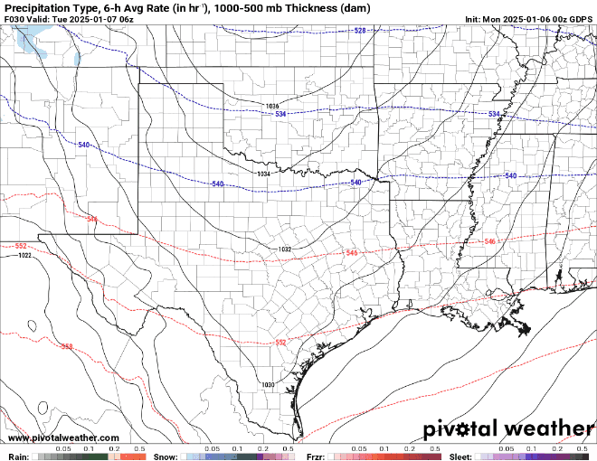
Gotwood wrote:txtwister78 wrote:bubba hotep wrote:The 00z GFS looks good above the surface, but in some areas of DFW, a lot of the snow falls with surface temps right at 32F.
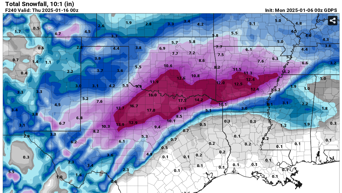
Yeah that's why I laugh a little when Bastardi goes full apocalypse with some of his social media hype predictions. High impact event no question for a day, "but 2-3 day shutdown"? Lol. I would expect surface temps to cool initially but then rise a degree or two and hold steady perhaps during most of that.
You don’t think a foot of snow would shut down DFW for a couple days?
Depends on surface temps obviously. It can snow above 32 degrees and so while a foot is probably a high end prediction, it's what actually sticks to roads and doesn't melt will of course determine impacts to travel. Most models warm above freezing Friday anyway and so yeah seems a little hype driven in my opinion .