Texas Winter 2014-2015

Winter Weather Discussion

Moderator: S2k Moderators

Forum rules

The posts in this forum are NOT official forecast and should not be used as such. They are just the opinion of the poster and may or may not be backed by sound meteorological data. They are NOT endorsed by any professional institution or STORM2K.

Help Support Storm2K
Message
Author
User avatar
Ntxw
Storm2k Moderator
Storm2k Moderator
Posts: 22793
Joined: Wed Oct 21, 2009 6:34 pm
Location: DFW, Texas

Re: Texas Winter 2014-2015

#2981 Postby Ntxw » Sun Jan 11, 2015 12:04 pm

Portastorm wrote:I know that wxman57 and I will enjoy the warmup the next 10 days. However, unfortunately, it looks like both the EPO and NAO will go negative later this month ... meaning a return to colder weather.


The -EPO looks to return pretty quickly. +PNA will kick in before then I think. The question remains how much the AO will help for storms.
0 likes   
The above post and any post by Ntxw is NOT an official forecast and should not be used as such. It is just the opinion of the poster and may or may not be backed by sound meteorological data. It is NOT endorsed by any professional institution including Storm2k. For official information, please refer to NWS products.

  Help support Storm2K!
Help Support Storm2K

GRAYSONCO.WX
Category 1
Category 1
Posts: 450
Joined: Thu Jan 06, 2011 4:29 pm
Location: Denison, Texas

Re: Texas Winter 2014-2015

#2982 Postby GRAYSONCO.WX » Sun Jan 11, 2015 12:04 pm

We still have Tuesday and Wednesday to watch before the advertised warmup!
0 likes   

User avatar
dhweather
S2K Supporter
S2K Supporter
Posts: 6199
Joined: Sat Aug 14, 2004 9:29 pm
Location: Heath, TX
Contact:

#2983 Postby dhweather » Sun Jan 11, 2015 12:27 pm

12Z PGFS looks progressive, no precip this week, but a promising system dropping out of northwest, down to near north Texas then breaking off northeast towards Illinois.

Promising for rain, wintry precip well to the north, Nebraska.

The potential might be there for some significant severe weather, Far East Texas into ark/la/miss , we will get to hurry up and wait, and watch. As always, models > 3-5 days out are usually wrong, but if the trend of a significant system stays, then we may have hope for rain.
0 likes   
The above post and any post by dhweather is NOT an official forecast and should not be used as such. It is just the opinion of the poster and may or may not be backed by sound meteorological data. It is NOT endorsed by any professional institution including storm2k.org. For official information, please refer to NWS products.

User avatar
wxman57
Moderator-Pro Met
Moderator-Pro Met
Posts: 23007
Age: 67
Joined: Sat Jun 21, 2003 8:06 pm
Location: Houston, TX (southwest)

Re: Texas Winter 2014-2015

#2984 Postby wxman57 » Sun Jan 11, 2015 12:47 pm

Portastorm wrote:I know that wxman57 and I will enjoy the warmup the next 10 days. However, unfortunately, it looks like both the EPO and NAO will go negative later this month ... meaning a return to colder weather.


I thought you also hate cold weather (now)?
0 likes   

User avatar
Portastorm
Storm2k Moderator
Storm2k Moderator
Posts: 9914
Age: 63
Joined: Fri Jul 11, 2003 9:16 am
Location: Round Rock, TX
Contact:

Re: Texas Winter 2014-2015

#2985 Postby Portastorm » Sun Jan 11, 2015 2:12 pm

wxman57 wrote:
Portastorm wrote:I know that wxman57 and I will enjoy the warmup the next 10 days. However, unfortunately, it looks like both the EPO and NAO will go negative later this month ... meaning a return to colder weather.


I thought you also hate cold weather (now)?


Of course I do! That's why I used the word "unfortunately" when referring to the possibility of cold weather returning. Give me 95 and sunny!
0 likes   
Any forecasts under my name are to be taken with a grain of salt. Get your best forecasts from the National Weather Service and National Hurricane Center.

aggiecutter
Category 5
Category 5
Posts: 1753
Joined: Thu Oct 14, 2004 9:22 pm
Location: Texarkana

Re: Texas Winter 2014-2015

#2986 Postby aggiecutter » Sun Jan 11, 2015 5:27 pm

These are the types of systems that on occasion can bring wintry surprises to the state. Shreveport AFD:

A MUCH STRONGER UPPER LEVEL TROUGH
WILL EXIT THE FOUR CORNERS REGION AND SLOWLY MOVE ITS WAY INTO THE
TX HILL COUNTRY DURING THE DAY WEDNESDAY AND INTO THE LOWER MISS
VALLEY WEDNESDAY NIGHT. MUCH COLDER AIR ALOFT WILL BE ASSOCIATED
WITH THIS TROUGH...ENOUGH SO SUCH THAT WE COULD BE LOOKING AT A
WINTRY MIX OF PRECIPITATION ACROSS OUR NORTHERN ZONES LATE WED
INTO WED NIGHT.
0 likes   

User avatar
vbhoutex
Storm2k Executive
Storm2k Executive
Posts: 29113
Age: 73
Joined: Wed Oct 09, 2002 11:31 pm
Location: Cypress, TX
Contact:

Re: Texas Winter 2014-2015

#2987 Postby vbhoutex » Sun Jan 11, 2015 7:27 pm

Heck after this last week in Houston I think of our current temp of 45f as warm!!! May have to break out the shorts and tank tops when the January thaw arrives next week. :sun:
0 likes   
Skywarn, C.E.R.T.
Please click below to donate to STORM2K to help with the expenses of keeping the site going:
Image

User avatar
Ntxw
Storm2k Moderator
Storm2k Moderator
Posts: 22793
Joined: Wed Oct 21, 2009 6:34 pm
Location: DFW, Texas

#2988 Postby Ntxw » Sun Jan 11, 2015 7:33 pm

ENS all generally look very similar. It's a high confidence forecast, thaw mild next week after midweek. Then complete 180 from +EPO back to -EPO
0 likes   
The above post and any post by Ntxw is NOT an official forecast and should not be used as such. It is just the opinion of the poster and may or may not be backed by sound meteorological data. It is NOT endorsed by any professional institution including Storm2k. For official information, please refer to NWS products.


  Help support Storm2K!

Help Support Storm2K


User avatar
Ntxw
Storm2k Moderator
Storm2k Moderator
Posts: 22793
Joined: Wed Oct 21, 2009 6:34 pm
Location: DFW, Texas

#2989 Postby Ntxw » Sun Jan 11, 2015 7:58 pm

Something pretty out of the ordinary just happened to start January. Through the 10th, the AO was very positive along with the NAO. The MJO was strongly going through it's warm phases and very strong through the 5th octant which typically signals torch for most of us. Yet it was some 5-10 below normal and a very cold start for much of the eastern half US including Texas. The EPO overwhelmed the other signals being modestly negative. What beast it is.

Image

If you followed the EPO forecasts from November through now, it pretty much tells you the story. Cold, Warm, Cold. This index needs better monitoring tools. It's so difficult to get good sources as few agencies actually have substantial information on it unless you have paid subscription.
0 likes   
The above post and any post by Ntxw is NOT an official forecast and should not be used as such. It is just the opinion of the poster and may or may not be backed by sound meteorological data. It is NOT endorsed by any professional institution including Storm2k. For official information, please refer to NWS products.


  Help support Storm2K!

Help Support Storm2K


User avatar
Texas Snowman
Storm2k Moderator
Storm2k Moderator
Posts: 6180
Joined: Fri Jan 25, 2008 11:29 am
Location: Denison, Texas

#2990 Postby Texas Snowman » Sun Jan 11, 2015 8:41 pm

Sigh. I may need to take a short break from this forum.

Why? Because we've had a fair amount of chilly air since early November (the mild December conditions not withstanding). But there's been nothing to show for it so far in terms of a big winter storm in Texas.

This week, it would appear that our beloved Portastorm has gone back to the dark side (again).

And the Dallas Cowboys lost today in heartbreaking fashion.

Sigh. Again.
0 likes   
The above post and any post by Texas Snowman is NOT an official forecast and should not be used as such. It is just the opinion of the poster and may or may not be backed by sound meteorological data. It is NOT endorsed by any professional institution including storm2k.org. For official information, please refer to NWS products.

orangeblood
S2K Supporter
S2K Supporter
Posts: 3714
Joined: Tue Dec 15, 2009 6:14 pm
Location: Fort Worth, TX

Re: Texas Winter 2014-2015

#2991 Postby orangeblood » Sun Jan 11, 2015 10:40 pm

Ntxw wrote:
Portastorm wrote:I know that wxman57 and I will enjoy the warmup the next 10 days. However, unfortunately, it looks like both the EPO and NAO will go negative later this month ... meaning a return to colder weather.


The -EPO looks to return pretty quickly. +PNA will kick in before then I think. The question remains how much the AO will help for storms.


Need desperately for the AO to tank, these airmasses are wimpy in comparison to some of the analog years we were looking at....it seems the - AO is what's been missing to really get this winter crankin!!! Not going to get too excited until I see the downward trend....
0 likes   

weatherdude1108
Category 5
Category 5
Posts: 4228
Joined: Tue Dec 13, 2011 1:04 pm
Location: Northwest Austin/Cedar Park, TX

#2992 Postby weatherdude1108 » Mon Jan 12, 2015 12:14 am

We received over an inch of rain from this weekend's freezing precip and last night's chilly thunderstorms. It's not snow, but I'll take the liquid gold! :wink:
0 likes   

User avatar
gatorcane
S2K Supporter
S2K Supporter
Posts: 23692
Age: 47
Joined: Sun Mar 13, 2005 3:54 pm
Location: Boca Raton, FL

Re: Texas Winter 2014-2015

#2993 Postby gatorcane » Mon Jan 12, 2015 9:07 am

orangeblood wrote:
Ntxw wrote:
Portastorm wrote:I know that wxman57 and I will enjoy the warmup the next 10 days. However, unfortunately, it looks like both the EPO and NAO will go negative later this month ... meaning a return to colder weather.


The -EPO looks to return pretty quickly. +PNA will kick in before then I think. The question remains how much the AO will help for storms.


Need desperately for the AO to tank, these airmasses are wimpy in comparison to some of the analog years we were looking at....it seems the - AO is what's been missing to really get this winter crankin!!! Not going to get too excited until I see the downward trend....


Long-range GFS sniffing out a possible pattern change that brings another very cold arctic airmass into the lower 48 the last week of this month. Let's see if future GFS model runs continue to show this or not as it is super long-range. The GFS model did pretty well with detecting the last pattern change well in advance that brought the severe cold to much of the lower 48 the first week of January.

Image
Image
0 likes   

User avatar
Portastorm
Storm2k Moderator
Storm2k Moderator
Posts: 9914
Age: 63
Joined: Fri Jul 11, 2003 9:16 am
Location: Round Rock, TX
Contact:

Re: Texas Winter 2014-2015

#2994 Postby Portastorm » Mon Jan 12, 2015 10:02 am

:uarrow:

There was online chatter this weekend from a couple of pro mets who specialize in medium to long range forecasting indicating a significant pattern change late month. In fact, Michael Ventrice from WSI tweeted that the projected MJO indices were unparalleled in terms of an analog. In other words, they haven't seen this type/strength of MJO in 50 years or more. The MJO is progged to be very strong and would usher in very cold air for the eastern two-thirds of the CONUS. We shall see.

I would hate that ... you know me ... I love warm weather. :wink:
0 likes   
Any forecasts under my name are to be taken with a grain of salt. Get your best forecasts from the National Weather Service and National Hurricane Center.

User avatar
Ntxw
Storm2k Moderator
Storm2k Moderator
Posts: 22793
Joined: Wed Oct 21, 2009 6:34 pm
Location: DFW, Texas

#2995 Postby Ntxw » Mon Jan 12, 2015 10:06 am

3 more days of raw, chilly weather then wxman57 takes over. Im noticing models are showing extensive cloud cover to start the thaw. If thats the case lows would be higher and highs would be a little lower. -EPO tank is likely to end the thaw the end of next week. If we avoid any 70s (with clouds, I doubt that happens) the negative departures could make this a top 10 cold January.
0 likes   
The above post and any post by Ntxw is NOT an official forecast and should not be used as such. It is just the opinion of the poster and may or may not be backed by sound meteorological data. It is NOT endorsed by any professional institution including Storm2k. For official information, please refer to NWS products.


  Help support Storm2K!

Help Support Storm2K


BigB0882
S2K Supporter
S2K Supporter
Posts: 2284
Joined: Thu Jul 03, 2003 12:08 am
Location: Baton Rouge, LA
Contact:

Re: Texas Winter 2014-2015

#2996 Postby BigB0882 » Mon Jan 12, 2015 10:32 am

Portastorm wrote::uarrow:

There was online chatter this weekend from a couple of pro mets who specialize in medium to long range forecasting indicating a significant pattern change late month. In fact, Michael Ventrice from WSI tweeted that the projected MJO indices were unparalleled in terms of an analog. In other words, they haven't seen this type/strength of MJO in 50 years or more. The MJO is progged to be very strong and would usher in very cold air for the eastern two-thirds of the CONUS. We shall see.

I would hate that ... you know me ... I love warm weather. :wink:


Well the GFS long range is cold for the WESTERN 2/3 of the country. That darn southeast ridge would have us over here torching. I am so sick of that ridge. GO AWAY!

I hope your post is right and that the cold can funnel all the way down to Florida. so we all get a chance at something. But I suppose if we don't get any snow out of it, I'd rather be warm. I don't really like the cold. I hate it, actually. I just love snow, sleet, freezing rain! Give them all to me. The problem is, you can't have those without the cold.
0 likes   

GRAYSONCO.WX
Category 1
Category 1
Posts: 450
Joined: Thu Jan 06, 2011 4:29 pm
Location: Denison, Texas

Re: Texas Winter 2014-2015

#2997 Postby GRAYSONCO.WX » Mon Jan 12, 2015 10:34 am

The 14Z RAP is showing a narrow band of mixed precipitation developing across western Texas and moving east-northeastward into northern Texas this evening. The HRRR is also showing signs of this band developing at the end of its range.
0 likes   

orangeblood
S2K Supporter
S2K Supporter
Posts: 3714
Joined: Tue Dec 15, 2009 6:14 pm
Location: Fort Worth, TX

Re: Texas Winter 2014-2015

#2998 Postby orangeblood » Mon Jan 12, 2015 11:22 am

Portastorm wrote::uarrow:

There was online chatter this weekend from a couple of pro mets who specialize in medium to long range forecasting indicating a significant pattern change late month. In fact, Michael Ventrice from WSI tweeted that the projected MJO indices were unparalleled in terms of an analog. In other words, they haven't seen this type/strength of MJO in 50 years or more. The MJO is progged to be very strong and would usher in very cold air for the eastern two-thirds of the CONUS. We shall see.

I would hate that ... you know me ... I love warm weather. :wink:


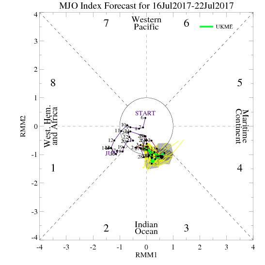
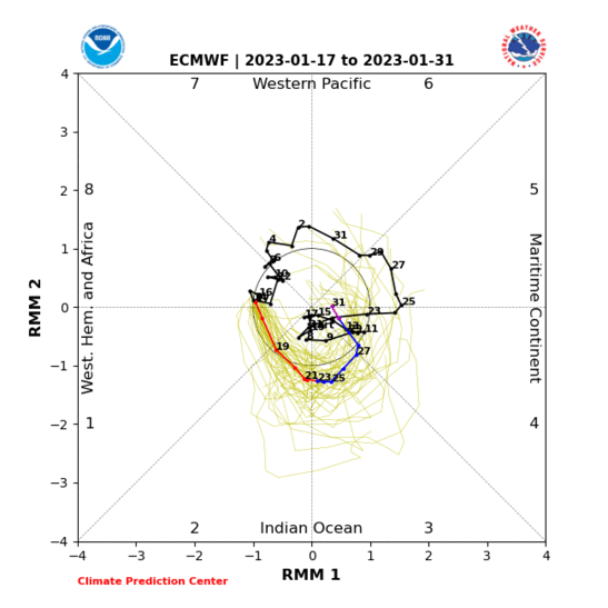
Yes the MJO is really strong (currently in the warm phase for the US) at this time but almost ALL models project it to crater over the next few days....so I'm not sure where WSI is getting their projections ??

Image

Image
0 likes   

User avatar
gatorcane
S2K Supporter
S2K Supporter
Posts: 23692
Age: 47
Joined: Sun Mar 13, 2005 3:54 pm
Location: Boca Raton, FL

#2999 Postby gatorcane » Mon Jan 12, 2015 12:12 pm

12Z GFS out. It's two weeks away, but still advertising an impressive widespread arctic intrusion into the lower 48 and Texas :eek:

Image
0 likes   

GRAYSONCO.WX
Category 1
Category 1
Posts: 450
Joined: Thu Jan 06, 2011 4:29 pm
Location: Denison, Texas

Re: Texas Winter 2014-2015

#3000 Postby GRAYSONCO.WX » Mon Jan 12, 2015 12:55 pm

Can't believe no one is talking about the RAP and HRRR for tonight. I know it's not showing an epic or widespread snowstorm, but there's hope for some light wintry precipitation tonight across northern Texas (especially for western Texas where some banding may occur).
0 likes   


Return to “Winter Weather”

Who is online

Users browsing this forum: No registered users and 20 guests