 The posts in this forum are NOT official forecast and should not be used as such. They are just the opinion of the poster and may or may not be backed by sound meteorological data. They are NOT endorsed by any professional institution or


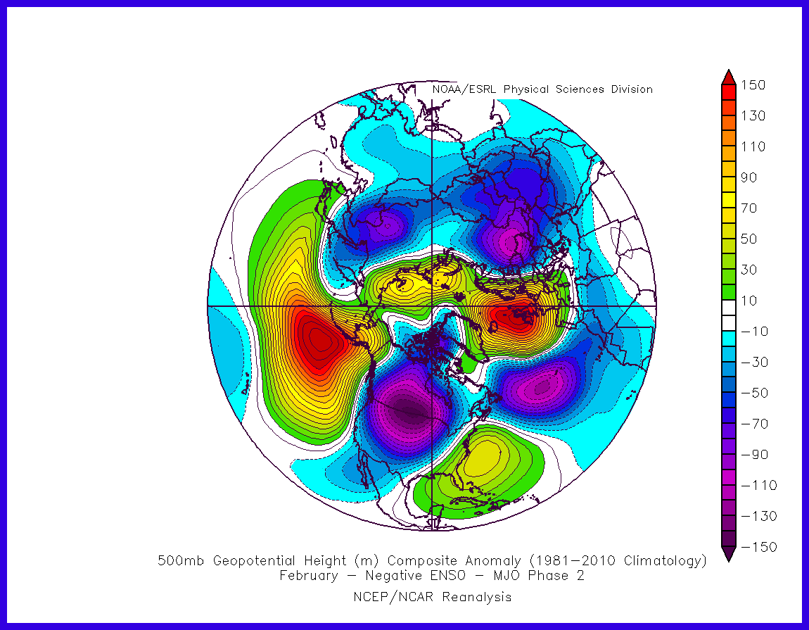
Ntxw wrote:The coming NPO ridge is more potent than the ridge that set up early to mid December. I wish I could find a good hovmoller depiction from the GFS or it's ensembles. It's quite useful for ENSO, I bet it would be for the mid and high latitudes too. But for now Mike Ventrice has a good one for the ECMWF
The ridges are the red blobs. The area of the Pacific is about the middle in the image which is close to 180 degrees longitude/dateline
https://twitter.com/MJVentrice/status/8 ... 5389571073
There's also the Greenland area that will see some ridging too
Bump follow up post. Prediction was very good and produced one of the more memorable cold blasts of recent years. Now the Pacific will flip to +EPO and the exact opposite pattern commence. Courtesy of Dr. Mike Ventrice


