#4147 Postby srainhoutx » Tue Jan 22, 2019 9:17 am
Tuesday morning weather briefing from Jeff:
Active weather pattern will remain in place over much of the nation resulting in a series of cold front across TX.
Moisture return is underway over the area in response to developing low pressure over NM and the retreat of the weekend cold ridge to the east. Cloud deck will thicken and lower today as Gulf moisture increases and expect that by late morning some areas of drizzle may develop. Rain chances ramp up this evening as a cold front moves into the region. Combination of lift along and behind the front and incoming strong short wave will likely result in widespread showers and possibly a few thunderstorms tonight. Rainfall amounts will generally be on the low side with most areas seeing less than .50 of an inch.
Cold air mass will quickly overtake the region early Wednesday as the next chunk of modified arctic air moves southeast over the Ohio Valley. Low temperature son Wednesday morning will drop into the 36-39 degree range over much of the area and light rainfall will linger until about 6-8am. A few models show just enough cooling in the mid levels to get a flake of snow of tow across our northern counties Wednesday morning, but think the dry air will be working into the area prior to the mid levels being cold enough to support anything frozen. Would not rule out a little bit of rain/snow mix north of a line from College Station to Huntsville tomorrow morning. With surface temperatures above freezing, whatever falls will not have any impacts.
Wednesday will be cold with strong cold air advection likely keeping temperatures in the 40’s all day. Clearing skies late in the day will set the stage for near freezing temperatures Thursday morning over much of the area. This should be a light freeze with lows in the 29-32 range.
Fairly quick return of southerly winds by Thursday evening ahead of another front for late Friday and yet another front for Saturday. The Friday front will likely have little impact over the area, but the Saturday front is being monitored for another shot of cold air and potentially some showers late Saturday. ECMWF model has been the strongest with the short wave on Saturday and shows much more rainfall over the area compared to the drier GFS and CMC. Looks like moisture return will be fairly meager, but intensity of the short wave could squeeze out some rainfall late Saturday. Strong cold air advection once again behind the Saturday evening frontal passage with cold temperatures again next Sunday.
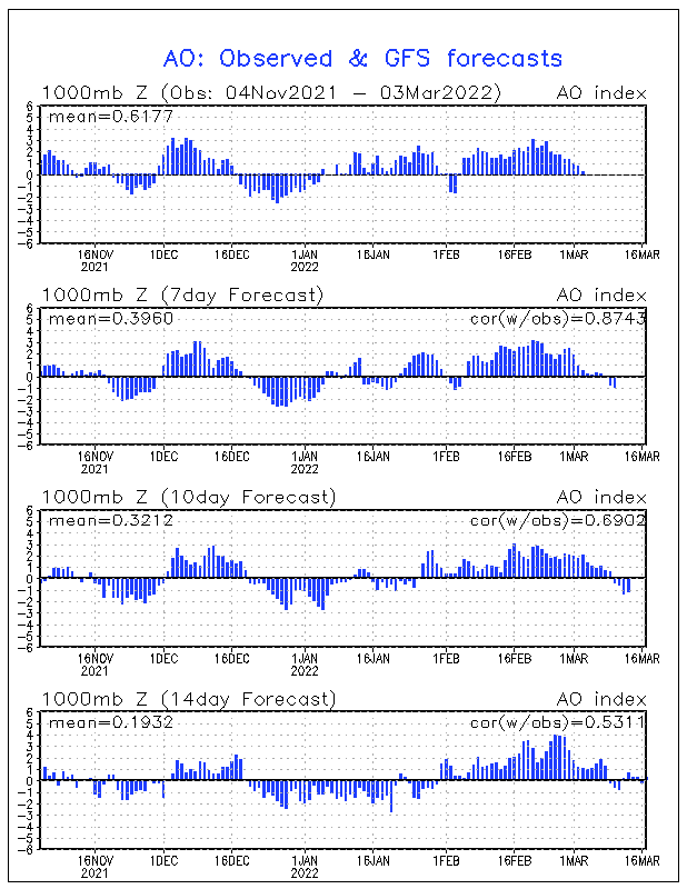
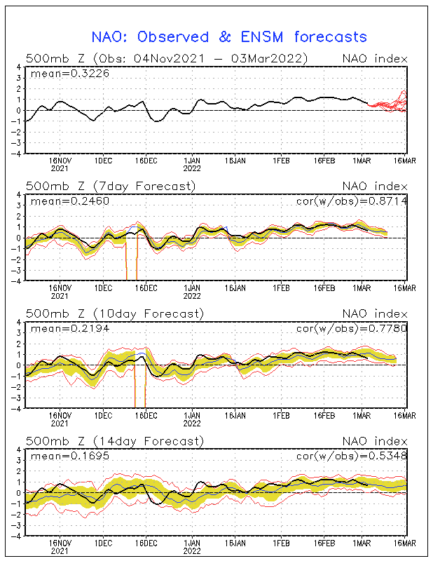
Another front looks to impact the area next Tuesday and this boundary may bring more “true” arctic air toward the area however models have been struggling greatly with the recent cold air intrusions into the US and that trajectory of these air masses. Most of the coldest air has been shunted to the NE/E of our region so that is something to watch heading into next week to see exactly how much cold air we may in fact get.
0 likes
Carla/Alicia/Jerry(In The Eye)/Michelle/Charley/Ivan/Dennis/Katrina/Rita/Wilma/Ike/Harvey
Member: National Weather Association
Wx Infinity Forums
http://wxinfinity.com/index.phpFacebook.com/WeatherInfinity
Twitter @WeatherInfinity
 The posts in this forum are NOT official forecast and should not be used as such. They are just the opinion of the poster and may or may not be backed by sound meteorological data. They are NOT endorsed by any professional institution or


