Texas winter wx thread (2009-2010)
Moderator: S2k Moderators
Forum rules
 The posts in this forum are NOT official forecast and should not be used as such. They are just the opinion of the poster and may or may not be backed by sound meteorological data. They are NOT endorsed by any professional institution or STORM2K.

The posts in this forum are NOT official forecast and should not be used as such. They are just the opinion of the poster and may or may not be backed by sound meteorological data. They are NOT endorsed by any professional institution or STORM2K.
-
msstateguy83
-
wxman57

- Moderator-Pro Met

- Posts: 23172
- Age: 68
- Joined: Sat Jun 21, 2003 8:06 pm
- Location: Houston, TX (southwest)
Re:
msstateguy83 wrote:so wxman57 i guess your thinking that is very less likely at this point or do you still see the chance being there?
Both - less likely a significant ice event but there is still a chance of some issues on roads up along the Red River. I never really thought freezing/frozen precip would be a problem in Dallas, and it was only a few model runs that suggested heavier precip in cold air at Wichita Falls.
0 likes
-
srainhoutx

- S2K Supporter

- Posts: 6919
- Age: 68
- Joined: Sun Jan 14, 2007 11:34 am
- Location: Haywood County, NC
- Contact:
Re: Texas winter wx thread (2009-2010)
Pardon me for picking your brain a bit wxman57.  Some things changed fairly dramatically today via guidance. A couple of things I noticed is the PV is stronger that modeled. Also the NAM began some confusion and now things have shifted to a warmer regime. I know this event is still very dynamic, but do you see any changes ahead should the 00Z run align to a sensible solution, or is this one of those wait a see scenarios?
0 likes
Carla/Alicia/Jerry(In The Eye)/Michelle/Charley/Ivan/Dennis/Katrina/Rita/Wilma/Ike/Harvey
Member: National Weather Association
Wx Infinity Forums
http://wxinfinity.com/index.php
Facebook.com/WeatherInfinity
Twitter @WeatherInfinity
Member: National Weather Association
Wx Infinity Forums
http://wxinfinity.com/index.php
Facebook.com/WeatherInfinity
Twitter @WeatherInfinity
-
wxman57
- Moderator-Pro Met
- Posts: 23172
- Age: 68
- Joined: Sat Jun 21, 2003 8:06 pm
- Location: Houston, TX (southwest)
Re: Texas winter wx thread (2009-2010)
srainhoutx wrote:Pardon me for picking your brain a bit wxman57.
Predicting just how far south cold air will sag ahead of an approaching upper trof is always difficult. We know the models have a lot of problems with VERY cold and shallow Arctic air, so we compensate (sometimes quite a bit). But this is not one of those situations. I think that the models are just getting a better grasp on where the frontal boundary will be tomorrow/tomorrow night as the event gets closer. Don't look for many changes at 00Z.
0 likes

Re: Texas winter wx thread (2009-2010)
DFW appears to be out of the woods. No ice for them. ECMWF doing the same as is the latest GFS.
Latest NAM is keeping DFW > 32F until Friday night. Ice should be NW of FTW on Thu.
Latest NAM is keeping DFW > 32F until Friday night. Ice should be NW of FTW on Thu.
0 likes
“If you thought that science was certain - well, that is just an error on your part.”
-
wall_cloud

- Professional-Met

- Posts: 401
- Age: 49
- Joined: Sun Dec 04, 2005 7:32 am
- Location: Bartlett, TN
- Contact:
Re: Texas winter wx thread (2009-2010)
txagwxman wrote:DFW appears to be out of the woods. No ice for them.
Latest NAM is keeping DFW > 32F until Friday night.
but it is also showing a dewpoint depression of 5F or more. When precip occurs, wet bulbing can have a significant impact on temps. Not saying it will bring winter wx to your area, but you have to take the output with a grain of salt.
0 likes
My comments are my own and do not reflect those of NOAA or the National Weather Service.

Re: Texas winter wx thread (2009-2010)
txagwxman wrote:DFW appears to be out of the woods. No ice for them. ECMWF doing the same as is the latest GFS.
Latest NAM is keeping DFW > 32F until Friday night. Ice should be NW of FTW on Thu.
gives up and moves to OK soon...lol
hopefully we will have some more chances in feb
0 likes
just a guess.......take everything i say with a grain of salt.......check your local NWS for forecast information
-
wxman57
- Moderator-Pro Met
- Posts: 23172
- Age: 68
- Joined: Sat Jun 21, 2003 8:06 pm
- Location: Houston, TX (southwest)
Re: Texas winter wx thread (2009-2010)
wall_cloud wrote:txagwxman wrote:DFW appears to be out of the woods. No ice for them.
Latest NAM is keeping DFW > 32F until Friday night.
but it is also showing a dewpoint depression of 5F or more. When precip occurs, wet bulbing can have a significant impact on temps. Not saying it will bring winter wx to your area, but you have to take the output with a grain of salt.
That's true, but the moisture may move out very quickly after sunrise Friday, leaving nothing but a thin layer of low clouds by noon. Nothing to produce precip and lower the temps.
0 likes
-
orangeblood
- S2K Supporter
- Posts: 3895
- Joined: Tue Dec 15, 2009 6:14 pm
- Location: Fort Worth, TX
Re: Texas winter wx thread (2009-2010)
With this being a very dynamic system, it will be very hard for the models to pick up on all the shortwaves rounding the base of this trough. There are a couple of shortwaves that some of the models are picking up on that will be moving through central and north texas friday morning after the cold air has established itself (look at the NAM and NMM models). Friday morning into early afternoon appears to be the best window for winter precip in the North Texas area. I believe everyone should still monitor this situation closely.
0 likes
Re: Texas winter wx thread (2009-2010)
wall_cloud wrote:txagwxman wrote:DFW appears to be out of the woods. No ice for them.
Latest NAM is keeping DFW > 32F until Friday night.
but it is also showing a dewpoint depression of 5F or more. When precip occurs, wet bulbing can have a significant impact on temps. Not saying it will bring winter wx to your area, but you have to take the output with a grain of salt.
I am talking ice not a snow flurry (which may/may not happen fri evening).
0 likes
“If you thought that science was certain - well, that is just an error on your part.”
-
wall_cloud
- Professional-Met
- Posts: 401
- Age: 49
- Joined: Sun Dec 04, 2005 7:32 am
- Location: Bartlett, TN
- Contact:
Re: Texas winter wx thread (2009-2010)
actually, a dry slot would promote freezing drizzle over snow due to the lack of dendrites in the -12 to -18C layer. Ice would be more likely in that case.
0 likes
My comments are my own and do not reflect those of NOAA or the National Weather Service.


I'm expecting rain and that's that!  unless someone (hope so!) can convince me otherwise!
0 likes
The above post and any post by Ntxw is NOT an official forecast and should not be used as such. It is just the opinion of the poster and may or may not be backed by sound meteorological data. It is NOT endorsed by any professional institution including Storm2k. For official information, please refer to NWS products.
Help support Storm2K!
-
msstateguy83
Re: Texas winter wx thread (2009-2010)
cold air moves into oklahoma i still say it holds the key to alot of this.... time will tell
0 likes
-
srainhoutx
- S2K Supporter
- Posts: 6919
- Age: 68
- Joined: Sun Jan 14, 2007 11:34 am
- Location: Haywood County, NC
- Contact:
Re: Texas winter wx thread (2009-2010)
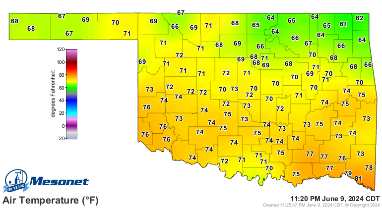
msstateguy83 wrote::wink: we should keep a eye on temps up into northern ok this eve on the mesonet to see how quickly the
cold air moves into oklahoma i still say it holds the key to alot of this.... time will tell
Look further N.
0 likes
Carla/Alicia/Jerry(In The Eye)/Michelle/Charley/Ivan/Dennis/Katrina/Rita/Wilma/Ike/Harvey
Member: National Weather Association
Wx Infinity Forums
http://wxinfinity.com/index.php
Facebook.com/WeatherInfinity
Twitter @WeatherInfinity
Member: National Weather Association
Wx Infinity Forums
http://wxinfinity.com/index.php
Facebook.com/WeatherInfinity
Twitter @WeatherInfinity

Re: Texas winter wx thread (2009-2010)
The temp right now in Dodge City is 35F with a north wind at 16 fyi. Thats not that far away........
0 likes
-
wall_cloud
- Professional-Met
- Posts: 401
- Age: 49
- Joined: Sun Dec 04, 2005 7:32 am
- Location: Bartlett, TN
- Contact:
my biggest concerns right now are starting to become more apparent. latest model guidance for the TX Panhandle show sustained NE winds at 25 kts. This will result in blizzard conditions for many areas. Coupled with ice accumulations, we could see crippling results. Luckily, the strongest winds may not phase up with the heaviest snow.
Last edited by wall_cloud on Wed Jan 27, 2010 7:37 pm, edited 1 time in total.
0 likes
My comments are my own and do not reflect those of NOAA or the National Weather Service.
-
msstateguy83
Re: Texas winter wx thread (2009-2010)
the upper level storm sys needs to be watched also closely this eve to see what it does b/c any further e-ward track
and no turn to the north with be huge. as of last check i still think it is a bit further south then previous forecast
and no turn to the north with be huge. as of last check i still think it is a bit further south then previous forecast
0 likes
-
srainhoutx
- S2K Supporter
- Posts: 6919
- Age: 68
- Joined: Sun Jan 14, 2007 11:34 am
- Location: Haywood County, NC
- Contact:
Re:
wall_cloud wrote:my biggest concerns right now are starting to become more apparent. latest model guidance for the TX Panhandle show sustained NE winds at 25 kts. This will result in blizzard conditions for many areas. Coupled with ice accumulations, we could see crippling results.
I agree. Just for the record look a bit further N. Pattern changes can be very tricky...

0 likes
Carla/Alicia/Jerry(In The Eye)/Michelle/Charley/Ivan/Dennis/Katrina/Rita/Wilma/Ike/Harvey
Member: National Weather Association
Wx Infinity Forums
http://wxinfinity.com/index.php
Facebook.com/WeatherInfinity
Twitter @WeatherInfinity
Member: National Weather Association
Wx Infinity Forums
http://wxinfinity.com/index.php
Facebook.com/WeatherInfinity
Twitter @WeatherInfinity
-
msstateguy83
With this storm aside, JB this morning mentioned that the EC family showed warming trends next week for early Feb which is contrary to what I had believed with the stepping down process. Though the GFS lately seem to agree on the warmth. Any thoughts?
0 likes
The above post and any post by Ntxw is NOT an official forecast and should not be used as such. It is just the opinion of the poster and may or may not be backed by sound meteorological data. It is NOT endorsed by any professional institution including Storm2k. For official information, please refer to NWS products.
Help support Storm2K!
Help support Storm2K!
Who is online
Users browsing this forum: No registered users and 84 guests