#7744 Postby Ntxw » Fri Feb 19, 2010 2:42 pm
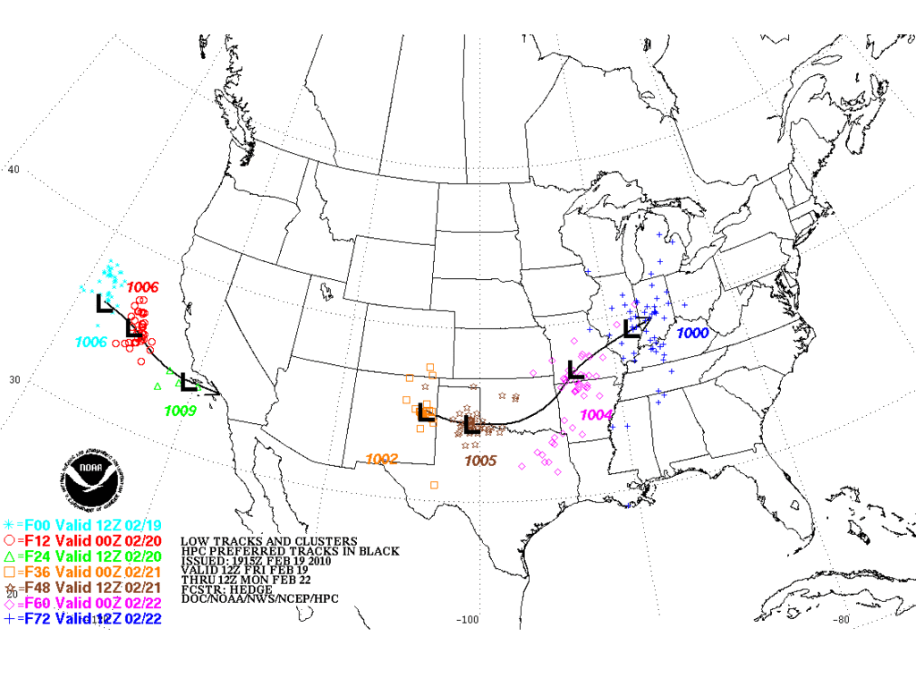
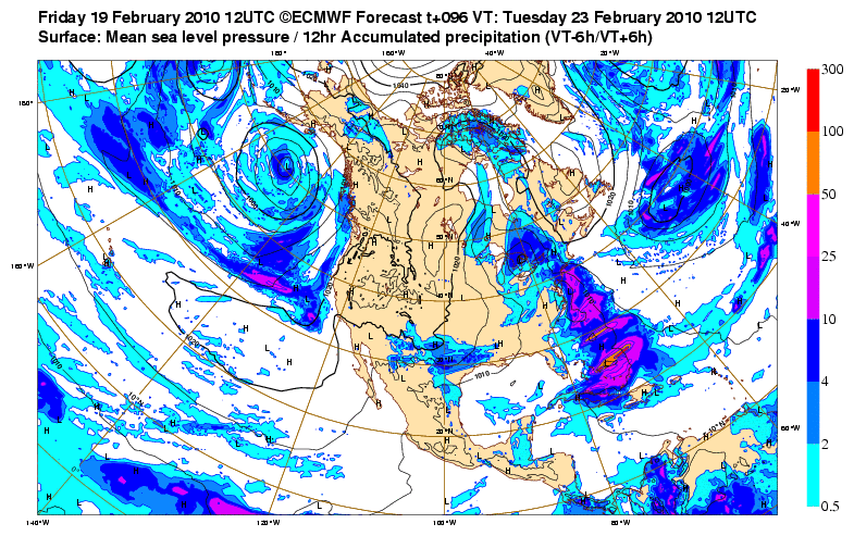
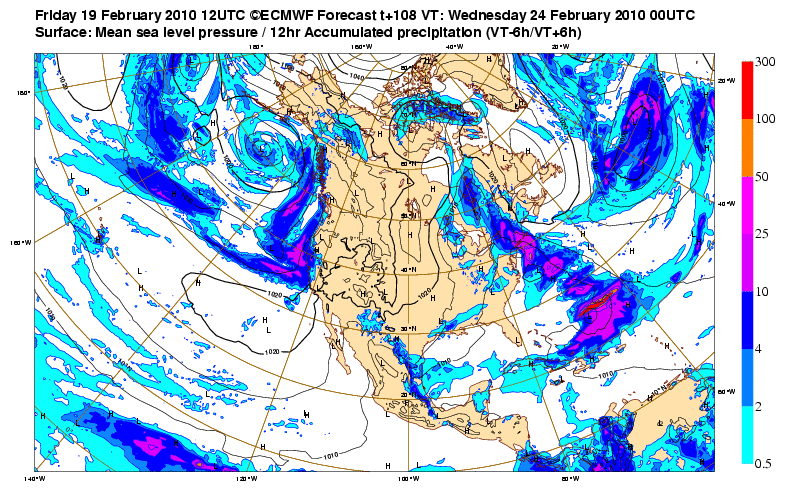
One thing to note, those in NW Tx and southern Oklahoma shouldn't write this off yet, way too early. Remember the last storm kept everything south of I-20 on the models and it turned out a healthy swath of 6+ was right along the Red River counties. I find it hard to believe all the precip in Tx panhandle doesn't make a move there. This storm looks almost a mirror image of it. The difference in this storm is there is a wider area of cold air making for a larger area of snow.
Last edited by
Ntxw on Fri Feb 19, 2010 2:50 pm, edited 1 time in total.
0 likes
The above post and any post by Ntxw is NOT an official forecast and should not be used as such. It is just the opinion of the poster and may or may not be backed by sound meteorological data. It is NOT endorsed by any professional institution including Storm2k. For official information, please refer to NWS products.
Help support Storm2K!

 The posts in this forum are NOT official forecast and should not be used as such. They are just the opinion of the poster and may or may not be backed by sound meteorological data. They are NOT endorsed by any professional institution or


 my Cowboys


