#10492 Postby northjaxpro » Sun Jan 31, 2016 12:30 pm
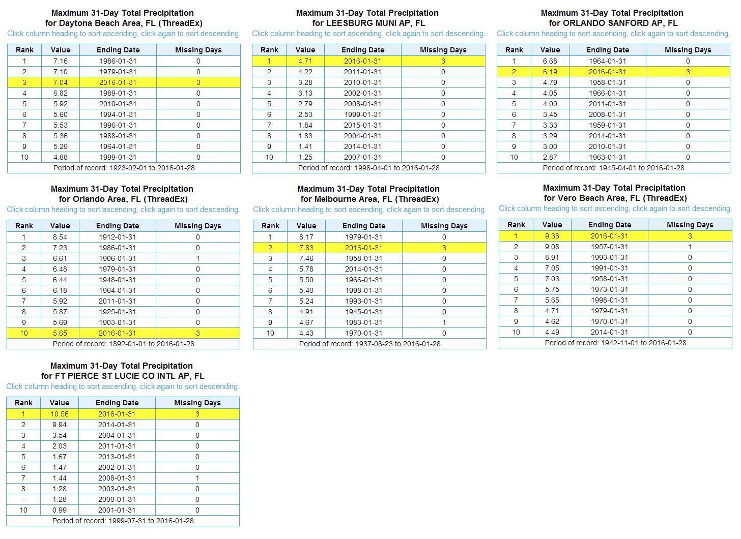
For the month of January, the Fort Myers/Sanibel Island area has received just over 16 inches of rainfall for the month. That is absolutely amazing. Shows just how strong this El Nino has been this winter season. Here at my locale, I have picked up just under 6.5 inches for the month. This amount of rain is well above the normal for this time of year.
Also for this month of January, 6 days of freezing temps were measured at my locale, which included one Hard Freeze(duration of 4 or more hours at or below 28 degrees), with the coldest temperature reading of 26.7 degrees, which occurred last Sunday morning (January 24). The previous day, snow flurries fell at my locale with a max daytime high of 38 degrees.
Last edited by
northjaxpro on Sun Jan 31, 2016 1:13 pm, edited 2 times in total.
0 likes
NEVER, EVER SAY NEVER in the tropics and weather in general, and most importantly, with life itself!!
________________________________________________________________________________________
Fay 2008 Beryl 2012 Debby 2012 Colin 2016 Hermine 2016 Julia 2016 Matthew 2016 Irma 2017 Dorian 2019