Re: Texas Summer 2019
Posted: Sun Jun 09, 2019 10:06 am

Welcome to Storm2k! Your Year Round Weather Community since 2002!
http://www.storm2k.org/phpbb2/

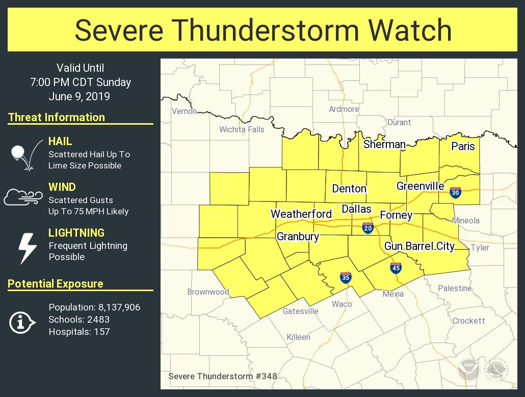

Brent wrote:that line moving into Gainesville and Sherman looks like it's gonna make at least the eastern half of the metro
so will there be another round or will this be it?
bubba hotep wrote:Brent wrote:that line moving into Gainesville and Sherman looks like it's gonna make at least the eastern half of the metro
so will there be another round or will this be it?
Good question, the HiRes models from this morning had storms dying out before even reaching the Red River and then storms firing later along the front. This throws everything out of wack but probably the only storms of the day for DFW given the impressive cold pool behind these batch.

srainhoutx wrote:62 kt wind gust reported at Love Field in Dallas. I also see reports of trucks blown over along 635