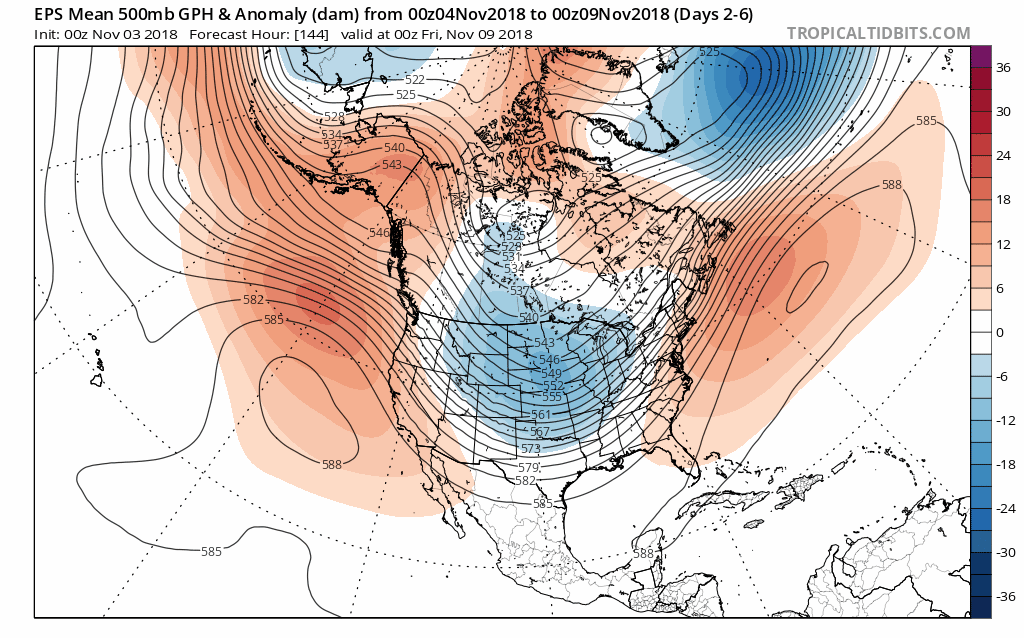
Brent wrote:Ntxw wrote:The forecast is for the PNA to go negative. I would not be surprised if subsequent runs dig a deeper trough towards the southwest.
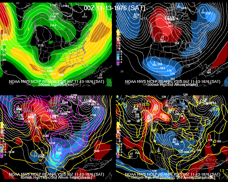
hmmm, wonder what the pattern was when DFW got 4.7 inches of snow in November 1976, a big analog this year
It was from split flow with a strong 500mb into NW and Central Canada. Storm undercut the ridge from the Pacific Aleutian Low into the southwest. It was likely a very marginal event with temps near freezing.


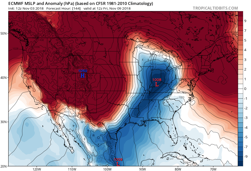
 Would be close to record lows verbatim