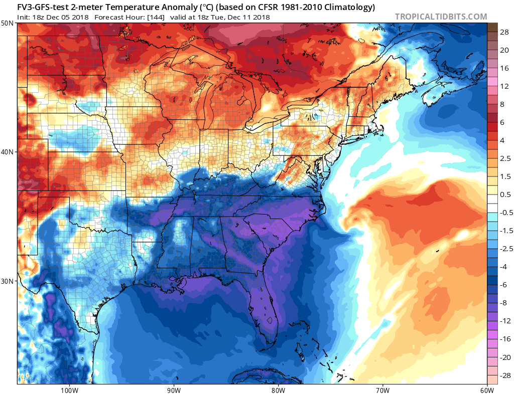
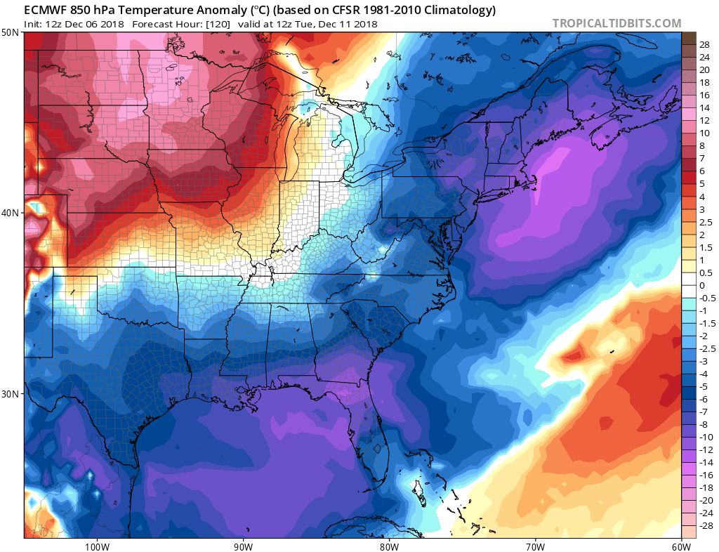
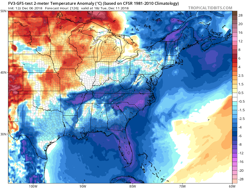
The models imo will continue to trend colder for the peninsula in the short term(next 5-7 days) as we will have quite a drastic drop in 500 mb heights due to a very potent Mid-Upper Low pivoting through the Deep South and Southeast U.S. on Monday -Wednesday. Also, in addition, a fresh snow and ice pack from a powerful winter storm, which will impact primarily North Carolina late this weekend into early next week, will keep the next cold airmass from moderating quickly for our region. I am confident about this.
Monday really looks to be a cold, overcast, breezy day here in Jax as wraparound moisture from the aforementioned feature will likely be in this area.
I think a freeze will be quite probable for my area on Wednesday morning and possibly Thursday morning as well. The potent Upper Low will finally move off away from the Southeast U.S. Atlantic coast by Tuesday afternoon, clearing the skies, but strong cold air advection and brisk, windy conditions for the entire peninsula, especially Tuesday and Wednesday.
I don't see moderation of temperatures in earnest until Thursday of next week peninsula-wide.