
northjaxpro wrote:SFLcane wrote:Nice....Friday forecast for pompano beach
A 50 percent chance of showers, mainly before 5pm. Partly sunny, with a high near 73. Windy, with a west wind 30 to 34 mph, with gusts as high as 45 mph.
Agreed. I'm not really sure how the surface wind profile will differ all that much through most of Florida. As far as I can tell, the gradient appears equally tight nearly statewide. Maybe the other NWS offices are still a bit gun-shy about buying into the EURO surface wind forecasts?? That or, might MIA be over-shooting the pressure gradient? I tend to doubt the latter but who knows.
Based on this, I would expect NWS Miami WFO to issue a inland wind advisory for Thursday night into Friday for their forecast zone region.
Florida Weather
Moderator: S2k Moderators
Forum rules

The posts in this forum are NOT official forecast and should not be used as such. They are just the opinion of the poster and may or may not be backed by sound meteorological data. They are NOT endorsed by any professional institution or STORM2K.
Re: Florida Weather
1 likes
Andy D
(For official information, please refer to the NHC and NWS products.)
(For official information, please refer to the NHC and NWS products.)
-
Bocadude85

- Category 5

- Posts: 2991
- Age: 39
- Joined: Mon Apr 18, 2005 2:20 pm
- Location: Honolulu,Hi
Re: Florida Weather
SFLcane wrote:That’s a rather healthy looking squall line
https://twitter.com/johnmoralesnbc6/status/1075490739285622786?s=21
I would not be surprised to see reports of gusts over 70mph if the squall line is anything like being forecast. I also would not be surprised to see gusts close to 50mph Friday afternoon.
1 likes
-
northjaxpro

- S2K Supporter

- Posts: 8900
- Joined: Mon Sep 27, 2010 11:21 am
- Location: Jacksonville, FL
Re: Florida Weather
I think a lot of those strong winds are going to mix down fairly effectively, especially on Friday, as the cooler, drier air advects into the region as the deep upper level trough pulls away from the peninsula.
Friday will be a very windy day statewide. I am pretty confident the state WFOs will hoist inland wind advisories within the next 12- 24 hours. Looking at the wind profiles and synoptic analysis, I would be quite surprised, saying this mildly, if none of the WFOs does not issue them.
Friday will be a very windy day statewide. I am pretty confident the state WFOs will hoist inland wind advisories within the next 12- 24 hours. Looking at the wind profiles and synoptic analysis, I would be quite surprised, saying this mildly, if none of the WFOs does not issue them.
0 likes
NEVER, EVER SAY NEVER in the tropics and weather in general, and most importantly, with life itself!!
________________________________________________________________________________________
Fay 2008 Beryl 2012 Debby 2012 Colin 2016 Hermine 2016 Julia 2016 Matthew 2016 Irma 2017 Dorian 2019
________________________________________________________________________________________
Fay 2008 Beryl 2012 Debby 2012 Colin 2016 Hermine 2016 Julia 2016 Matthew 2016 Irma 2017 Dorian 2019
-
northjaxpro
- S2K Supporter
- Posts: 8900
- Joined: Mon Sep 27, 2010 11:21 am
- Location: Jacksonville, FL
Re: Florida Weather
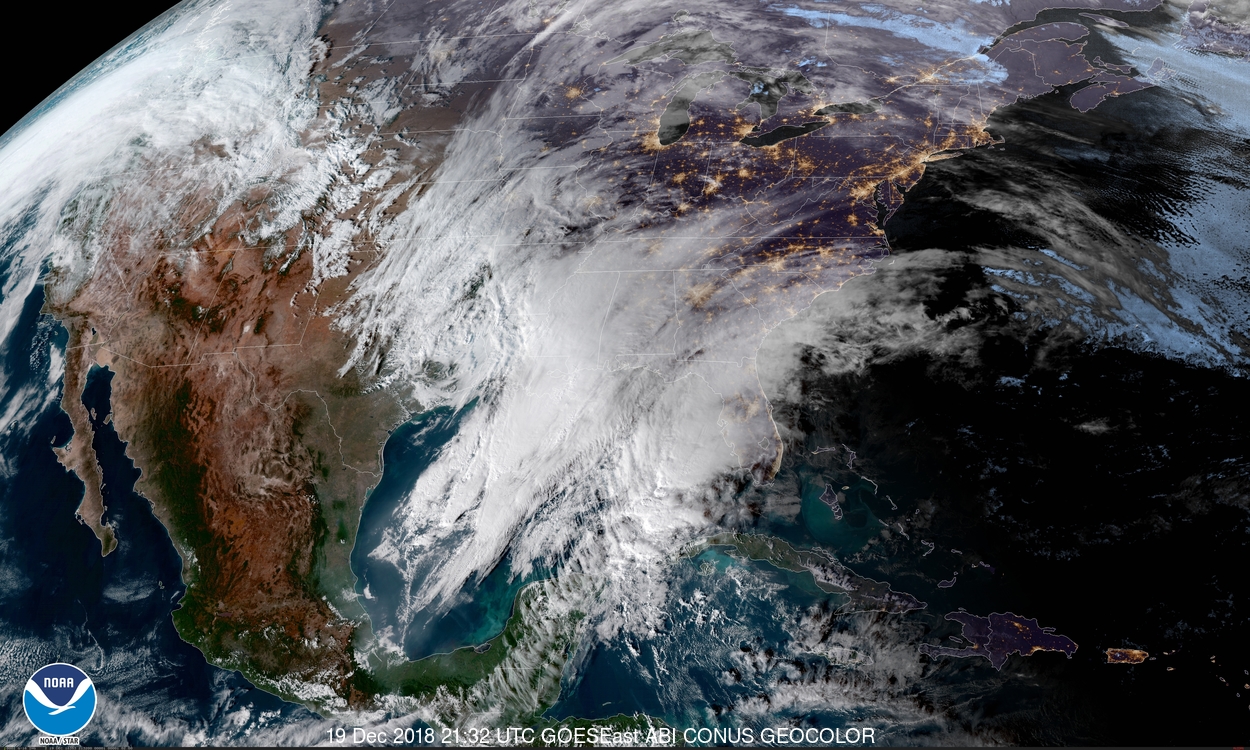
Latest 18Z GFS for 00Z tomorrow evening

0 likes
NEVER, EVER SAY NEVER in the tropics and weather in general, and most importantly, with life itself!!
________________________________________________________________________________________
Fay 2008 Beryl 2012 Debby 2012 Colin 2016 Hermine 2016 Julia 2016 Matthew 2016 Irma 2017 Dorian 2019
________________________________________________________________________________________
Fay 2008 Beryl 2012 Debby 2012 Colin 2016 Hermine 2016 Julia 2016 Matthew 2016 Irma 2017 Dorian 2019
-
SFLcane

- S2K Supporter
- Posts: 10281
- Age: 48
- Joined: Sat Jun 05, 2010 1:44 pm
- Location: Lake Worth Florida
Re: Florida Weather
0 likes
-
northjaxpro
- S2K Supporter
- Posts: 8900
- Joined: Mon Sep 27, 2010 11:21 am
- Location: Jacksonville, FL
Re: Florida Weather
I even looked at the NAM, a great winter synoptics model of course, and a model I generally do not analyze for events like this one. It even showed a squall line potential down into South Florida also.
I still would be inclined to think that there is still a reasonably decent chance that strong storms are possible down in South Florida by late tomorrow afternoon into the early evening. This is a pretty strong front moving through the peninsula late tomorrow into early Friday as this deep upper trough pivots across the region.. I can still see a potential of a impressive squall line moving out ahead of it through much of tomorrow. I would stay alert still down that way.
0 likes
NEVER, EVER SAY NEVER in the tropics and weather in general, and most importantly, with life itself!!
________________________________________________________________________________________
Fay 2008 Beryl 2012 Debby 2012 Colin 2016 Hermine 2016 Julia 2016 Matthew 2016 Irma 2017 Dorian 2019
________________________________________________________________________________________
Fay 2008 Beryl 2012 Debby 2012 Colin 2016 Hermine 2016 Julia 2016 Matthew 2016 Irma 2017 Dorian 2019
-
TheStormExpert
Re: Florida Weather
0 likes
Re: Florida Weather
TheStormExpert wrote::uarrow: That GFS rum would suggest that the “Enhanced” risk is from Tampa NE to Jacksonville/St. Augustine, not E-Central FL.
I would bet heavily with the SPC on their placement of the svr risk. It is really predicated on daytime heating and timing. If it's going to happen it's going to favor east central and southeast florida as they stand the best chance of surface heating/moisture flux before the arrival of the squall line. The rain max (and consequently lower svr potential with lesser surface heating/rain cooled air) will likely reside north and west of the peak svr risk area probably riding in a zone from near or north of tampa bay northeastward toward Jax. I think our WFOs have a good handle on that with flood watch placement and the SPC has a good thesis on the svr risk...I'd definitely favor their expertise over any individual model run...and as a side the GFS may not be out to lunch with it's radar simulations..it's certainly going to rain hard but heavy rain doesn't = severe weather.
2 likes
-
northjaxpro
- S2K Supporter
- Posts: 8900
- Joined: Mon Sep 27, 2010 11:21 am
- Location: Jacksonville, FL
Re: Florida Weather
0 likes
NEVER, EVER SAY NEVER in the tropics and weather in general, and most importantly, with life itself!!
________________________________________________________________________________________
Fay 2008 Beryl 2012 Debby 2012 Colin 2016 Hermine 2016 Julia 2016 Matthew 2016 Irma 2017 Dorian 2019
________________________________________________________________________________________
Fay 2008 Beryl 2012 Debby 2012 Colin 2016 Hermine 2016 Julia 2016 Matthew 2016 Irma 2017 Dorian 2019
Re: Florida Weather
Lightning data shows quite a show in the western gulf...and it extends pretty far south..there's a big hot zone east southeast of Brownsville so things are percolating at some pretty low latitudes as of now.
0 likes


Re: Florida Weather
The 23Z HRRR model shows some pretty impressive strong bands coming to West Central areas.
No telling at this point if they could be severe. Definitely possible given the dynamics of this system.
https://www.tropicaltidbits.com/analysi ... 0421&fh=16
No telling at this point if they could be severe. Definitely possible given the dynamics of this system.
https://www.tropicaltidbits.com/analysi ... 0421&fh=16
0 likes
Re: Florida Weather
I used to really favor the GFS with regard to meso-scale synaptics but I just dont know anymore. Frankly, I'm one to really eyeball both the 3K NAM and the RGEM. Let me tell you, if what the RGEM depicts actually verifies - then watch out folks. Nasty-bad! ( and I mean from the very tip of South Florida all the way up to panhandle)
1 likes
Andy D
(For official information, please refer to the NHC and NWS products.)
(For official information, please refer to the NHC and NWS products.)

Re: Florida Weather
chaser1 wrote:I used to really favor the GFS with regard to meso-scale synaptics but I just dont know anymore. Frankly, I'm one to really eyeball both the 3K NAM and the RGEM. Let me tell you, if what the RGEM depicts actually verifies - then watch out folks. Nasty-bad! ( and I mean from the very tip of South Florida all the way up to panhandle)

Pretty potent looking squall line covering most of the peninsula.
0 likes
-
gatorcane

- S2K Supporter
- Posts: 23708
- Age: 48
- Joined: Sun Mar 13, 2005 3:54 pm
- Location: Boca Raton, FL
Re: Florida Weather
Wow look at the offshore forecast off Pinellas in Clearwater, FL
Friday W wind 27 to 31 kt, with gusts as high as 42 kt. Showers likely. Seas 14 to 15 ft.
https://marine.weather.gov/MapClick.php ... Br_ropOmhA
Friday W wind 27 to 31 kt, with gusts as high as 42 kt. Showers likely. Seas 14 to 15 ft.
https://marine.weather.gov/MapClick.php ... Br_ropOmhA
0 likes
Re: Florida Weather
CDO62 wrote:chaser1 wrote:I used to really favor the GFS with regard to meso-scale synaptics but I just dont know anymore. Frankly, I'm one to really eyeball both the 3K NAM and the RGEM. Let me tell you, if what the RGEM depicts actually verifies - then watch out folks. Nasty-bad! ( and I mean from the very tip of South Florida all the way up to panhandle)
https://i.imgur.com/b0BoFXR.jpg
Pretty potent looking squall line covering most of the peninsula.
Yep, that intense squall line is depicted to reach W. Cuba and nearly Yucatan. If the Miami NWS is correct about their Friday (over-land) wind forcast, then I have to believe that nearly all Florida counties will experience 6-12 hours of wind gusts in excess of 40 mph on Friday. If anything, the gradient appears tighter the farther north one goes (N. Florida being closer to the parent low over Georgia or the Carolina's at that point)
0 likes
Andy D
(For official information, please refer to the NHC and NWS products.)
(For official information, please refer to the NHC and NWS products.)
Re: Florida Weather
SFLcane wrote:Here we go folks! Stay alert tommorow the last time portions of SFL were in enhanced was 1/22/17 so it’s quite rare.
http://i68.tinypic.com/flwrjp.png
And Jax was in the High category with a PDS issued for the area.
https://en.wikipedia.org/wiki/Tornado_outbreak_of_January_21%E2%80%9323,_2017
So far not officially projected to be quite the same level...thankfully.
Georgia really got beaten up by that one.
0 likes
Re: Florida Weather
gatorcane wrote:Wow look at the offshore forecast off Pinellas in Clearwater, FL
Friday W wind 27 to 31 kt, with gusts as high as 42 kt. Showers likely. Seas 14 to 15 ft.
https://marine.weather.gov/MapClick.php ... Br_ropOmhA
This event might turn into a NorEaste..... nope that won't do. Hmmm, guess we might just have to just coin a new phrase. #nor'wester
0 likes
Andy D
(For official information, please refer to the NHC and NWS products.)
(For official information, please refer to the NHC and NWS products.)
Re: Florida Weather
A bit of an adjustment on the latest spc outlook shifting the ENH zone to central florida...and it now includes a small 10% tornado risk area in a portion of the west central peninsula
0 likes
-
TheStormExpert
Re: Florida Weather
psyclone wrote:A bit of an adjustment on the latest spc outlook shifting the ENH zone to central florida...and it now includes a small 10% tornado risk area in a portion of the west central peninsula
That makes more sense considering what the GFS and Euro are advertising. Never understood why they highlighted E-Central Florida yesterday. Still can't rule out something here though.
0 likes
Return to “USA & Caribbean Weather”
Who is online
Users browsing this forum: snownado, SnowyOwl31, South Texas Storms, Stratton23, wxman22 and 68 guests