That tornado watch should be expanded to include all of SFL later today its almost a given in my take.
Again sunshine today will have its consequences later this afternoon.
Florida Weather
Moderator: S2k Moderators
Forum rules

The posts in this forum are NOT official forecast and should not be used as such. They are just the opinion of the poster and may or may not be backed by sound meteorological data. They are NOT endorsed by any professional institution or STORM2K.
-
SFLcane

- S2K Supporter

- Posts: 10281
- Age: 48
- Joined: Sat Jun 05, 2010 1:44 pm
- Location: Lake Worth Florida
Re: Florida Weather
0 likes
-
northjaxpro

- S2K Supporter
- Posts: 8900
- Joined: Mon Sep 27, 2010 11:21 am
- Location: Jacksonville, FL
Re: Florida Weather
Tornado Warning
Severe Weather Statement
National Weather Service Tampa Bay Area Ruskin FL
957 AM EST Thu Dec 20 2018
FLC049-105-201515-
/O.CON.KTBW.TO.W.0029.000000T0000Z-181220T1515Z/
Hardee FL-Polk FL-
957 AM EST Thu Dec 20 2018
...A TORNADO WARNING REMAINS IN EFFECT UNTIL 1015 AM EST FOR
NORTHEASTERN HARDEE AND SOUTH CENTRAL POLK COUNTIES...
At 956 AM EST, a severe thunderstorm capable of producing a tornado
was located 7 miles northeast of Wauchula, moving northeast at 30
mph.
HAZARD...Tornado.
SOURCE...Radar indicated rotation.
IMPACT...Flying debris will be dangerous to those caught without
shelter. Mobile homes will be damaged or destroyed. Damage
to roofs, windows, and vehicles will occur. Tree damage is
likely.
Locations impacted include...
Wauchula, Fort Meade, Crooked Lake Park, Frostproof, Bowling Green,
Zolfo Springs, Hillcrest Heights and Alturas.
PRECAUTIONARY/PREPAREDNESS ACTIONS...
TAKE COVER NOW! Move to an interior room on the lowest floor of a
sturdy building. Avoid windows. If you are outdoors, in a mobile
home, or in a vehicle, move to the closest substantial shelter and
protect yourself from flying debris.
&&
LAT...LON 2765 8154 2765 8156 2762 8156 2745 8172
2754 8189 2791 8169 2776 8143
TIME...MOT...LOC 1456Z 213DEG 28KT 2762 8172
TORNADO...RADAR INDICATED
HAIL...0.00IN
0 likes
NEVER, EVER SAY NEVER in the tropics and weather in general, and most importantly, with life itself!!
________________________________________________________________________________________
Fay 2008 Beryl 2012 Debby 2012 Colin 2016 Hermine 2016 Julia 2016 Matthew 2016 Irma 2017 Dorian 2019
________________________________________________________________________________________
Fay 2008 Beryl 2012 Debby 2012 Colin 2016 Hermine 2016 Julia 2016 Matthew 2016 Irma 2017 Dorian 2019
-
northjaxpro
- S2K Supporter
- Posts: 8900
- Joined: Mon Sep 27, 2010 11:21 am
- Location: Jacksonville, FL
Re: Florida Weather
SFLcane wrote:That tornado watch should be expanded to include all of SFL later today its almost a given in my take.
Again sunshine today will have its consequences later this afternoon.
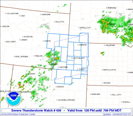
I suspect it probably will be expanded later today into tonight.
The current Tornado Watch area:
0 likes
NEVER, EVER SAY NEVER in the tropics and weather in general, and most importantly, with life itself!!
________________________________________________________________________________________
Fay 2008 Beryl 2012 Debby 2012 Colin 2016 Hermine 2016 Julia 2016 Matthew 2016 Irma 2017 Dorian 2019
________________________________________________________________________________________
Fay 2008 Beryl 2012 Debby 2012 Colin 2016 Hermine 2016 Julia 2016 Matthew 2016 Irma 2017 Dorian 2019
-
northjaxpro
- S2K Supporter
- Posts: 8900
- Joined: Mon Sep 27, 2010 11:21 am
- Location: Jacksonville, FL
Re: Florida Weather
NWS Jax has issued a Flood Advisory for St Johns, Flagler, Bradford and Clay counties through 11:30 AM. Heavy rain is currently moving through those areas.
NWS Jax Twitter..............
A strong shower moving through the Palatka area will produce wind gusts up to 45 mph with possible funnel clouds as it moves quickly NE towards East Palatka, Bostwick, & Penny Farms. #flwx 24 min ago
A heavy shower near Juniper Springs is producing wind gusts in excess of 45 mph & moving quickly to the NE towards Crescent City, Salt Springs, Satsuma, and Georgetown. Torrential rainfall is occurring with this shower, watch for localized flooding. #flwx 56 min ago
0 likes
NEVER, EVER SAY NEVER in the tropics and weather in general, and most importantly, with life itself!!
________________________________________________________________________________________
Fay 2008 Beryl 2012 Debby 2012 Colin 2016 Hermine 2016 Julia 2016 Matthew 2016 Irma 2017 Dorian 2019
________________________________________________________________________________________
Fay 2008 Beryl 2012 Debby 2012 Colin 2016 Hermine 2016 Julia 2016 Matthew 2016 Irma 2017 Dorian 2019
-
SFLcane
- S2K Supporter
- Posts: 10281
- Age: 48
- Joined: Sat Jun 05, 2010 1:44 pm
- Location: Lake Worth Florida
Re: Florida Weather
So far not many reports if any of damage so all bark no bite here? We shall see
0 likes

Re: Florida Weather
I think the threat for more tornadoes along the I-4 corridor is over with, the initial line has cooled off the surface so it will be hard for any surface base storms to form unless the warm surface boundary pushes back north again before the front.
0 likes
-
northjaxpro
- S2K Supporter
- Posts: 8900
- Joined: Mon Sep 27, 2010 11:21 am
- Location: Jacksonville, FL
Re: Florida Weather
............
Last edited by northjaxpro on Thu Dec 20, 2018 11:24 am, edited 1 time in total.
0 likes
NEVER, EVER SAY NEVER in the tropics and weather in general, and most importantly, with life itself!!
________________________________________________________________________________________
Fay 2008 Beryl 2012 Debby 2012 Colin 2016 Hermine 2016 Julia 2016 Matthew 2016 Irma 2017 Dorian 2019
________________________________________________________________________________________
Fay 2008 Beryl 2012 Debby 2012 Colin 2016 Hermine 2016 Julia 2016 Matthew 2016 Irma 2017 Dorian 2019

Re: Florida Weather
Whew?! Been quite a morning here just North of Orlando! Definitely gonna need something to calm my nerves.
It rained.
It rained.
0 likes
Andy D
(For official information, please refer to the NHC and NWS products.)
(For official information, please refer to the NHC and NWS products.)
-
Bocadude85

- Category 5

- Posts: 2991
- Age: 39
- Joined: Mon Apr 18, 2005 2:20 pm
- Location: Honolulu,Hi
Re: Florida Weather
Mostly sunny and muggy here in S.Fla, the atmosphere is primed for some severe weather this evening.
0 likes

Re: Florida Weather
chaser1 wrote:Whew?! Been quite a morning here just North of Orlando! Definitely gonna need something to calm my nerves.
It rained.
Hey chaser 1 don’t jump at me but I’m at work looking out my window in Boca Raton and it’s Partly sunny out we will get the tail of the squall line that’s in the Gulf but nothing from what you guys up north are getting.
0 likes
-
northjaxpro
- S2K Supporter
- Posts: 8900
- Joined: Mon Sep 27, 2010 11:21 am
- Location: Jacksonville, FL
Re: Florida Weather
Just measured the rain gauge here at home and already as of late this morning, I have measured over 1.25 inches, with plenty of more to come.
0 likes
NEVER, EVER SAY NEVER in the tropics and weather in general, and most importantly, with life itself!!
________________________________________________________________________________________
Fay 2008 Beryl 2012 Debby 2012 Colin 2016 Hermine 2016 Julia 2016 Matthew 2016 Irma 2017 Dorian 2019
________________________________________________________________________________________
Fay 2008 Beryl 2012 Debby 2012 Colin 2016 Hermine 2016 Julia 2016 Matthew 2016 Irma 2017 Dorian 2019
-
Bocadude85
- Category 5
- Posts: 2991
- Age: 39
- Joined: Mon Apr 18, 2005 2:20 pm
- Location: Honolulu,Hi
Re: Florida Weather
Latest discussion from SPC hinting that the remainder of S.Fla that is not in the enhanced risk area may be added into the enhanced risk this afternoon.
FL...
A band of strong/severe storms is affecting parts of the central FL
Peninsula this morning, with several transient mesocyclones noted in
the past few hours. Given the strong low level shear in place in
this region, a few tornadoes and locally damaging wind gusts will
remain possible through mid-afternoon. Please refer to Mesoscale
Discussion #1717 for further details.
Meanwhile, the primary squall line remains offshore but will begin
to move inland soon. The air mass ahead of the line is generally
undisturbed and is heating/destabilizing. Forecast soundings across
the southern Peninsula suggest MLCAPE values of 1000-1500 J/kg will
be common. Shear profiles are also quite impressive with 40-50 kt
winds as low as 1000-1500m. This will support a risk of embedded
bows and supercells along the line, capable of damaging wind gusts
and a few tornadoes. Therefore have adjusted the ENH area slightly
southward and may include the remainder of south FL in later
updates.
1 likes
Re: Florida Weather
chaser1 wrote:Whew?! Been quite a morning here just North of Orlando! Definitely gonna need something to calm my nerves.
It rained.
I'm in Forest City just west of Altamonte S, the line that came through during the past hour or two was non eventful, the best chances for severe wx was to the south of us in Polk County, southern Lake and southern Orange county, the surface was too cool & stable in our area with the strong surface jet a few hundred feet above the surface.
0 likes
-
northjaxpro
- S2K Supporter
- Posts: 8900
- Joined: Mon Sep 27, 2010 11:21 am
- Location: Jacksonville, FL
Re: Florida Weather
Also, Tornado Warning in effect for Edgewater and Oak Hill areas of East Central Volusia County..
0 likes
NEVER, EVER SAY NEVER in the tropics and weather in general, and most importantly, with life itself!!
________________________________________________________________________________________
Fay 2008 Beryl 2012 Debby 2012 Colin 2016 Hermine 2016 Julia 2016 Matthew 2016 Irma 2017 Dorian 2019
________________________________________________________________________________________
Fay 2008 Beryl 2012 Debby 2012 Colin 2016 Hermine 2016 Julia 2016 Matthew 2016 Irma 2017 Dorian 2019
Re: Florida Weather
boca wrote:chaser1 wrote:Whew?! Been quite a morning here just North of Orlando! Definitely gonna need something to calm my nerves.
It rained.
Hey chaser 1 don’t jump at me but I’m at work looking out my window in Boca Raton and it’s Partly sunny out we will get the tail of the squall line that’s in the Gulf but nothing from what you guys up north are getting.
LOL, No worries. I do get where you're coming from but you may seriously be exposed to a greater severe risk then up here. Sure, I've had heavy rain but thus far seen no gusts exceeding 25 mph. The atmosphere should be that much more destabilized from the much greater heating there in S. Florida. Plus, I believe the upper wind profile will be that much more favorable 12 or so hours from now. Right now, a few strong calls remain within the advancing warm front that appears to cut across Kissimmee northeast to southwest.
A present ill defined line from about Ceder Key southward toward St. Pete might be some northern extention of a pseudo squall line that might swing back eastward through North and Central Florida
in a few hours from now. I'm not convinced of that though. Seems to me that greater dynamics will be in place for much of S. Florida even if it's passage will be relatively brief
0 likes
Andy D
(For official information, please refer to the NHC and NWS products.)
(For official information, please refer to the NHC and NWS products.)
-
TheStormExpert
Re: Florida Weather
There sure is quite a bit of peeks of sun here in the WPB area this morning. 
0 likes
-
northjaxpro
- S2K Supporter
- Posts: 8900
- Joined: Mon Sep 27, 2010 11:21 am
- Location: Jacksonville, FL
Re: Florida Weather
TheStormExpert wrote:There sure is quite a bit of peeks of sun here in the WPB area this morning.
Yeah, but this is only going to add to the instability of the atmosphere down that way. Tonight could be very interesting down in South Florida with severe weather or potential tornadoes.
0 likes
NEVER, EVER SAY NEVER in the tropics and weather in general, and most importantly, with life itself!!
________________________________________________________________________________________
Fay 2008 Beryl 2012 Debby 2012 Colin 2016 Hermine 2016 Julia 2016 Matthew 2016 Irma 2017 Dorian 2019
________________________________________________________________________________________
Fay 2008 Beryl 2012 Debby 2012 Colin 2016 Hermine 2016 Julia 2016 Matthew 2016 Irma 2017 Dorian 2019
-
northjaxpro
- S2K Supporter
- Posts: 8900
- Joined: Mon Sep 27, 2010 11:21 am
- Location: Jacksonville, FL
Re: Florida Weather
This storm is coming together rather beautifully here at the midday. Water vapor imagery shows the phasing of the southern stream and now the northern stream energy, diving down through Oklahoma currently. This will continue to sharply dive south all the way establishing the base of the upper trough into the Northeast GOM, by early tomorrow morning.

1 likes
NEVER, EVER SAY NEVER in the tropics and weather in general, and most importantly, with life itself!!
________________________________________________________________________________________
Fay 2008 Beryl 2012 Debby 2012 Colin 2016 Hermine 2016 Julia 2016 Matthew 2016 Irma 2017 Dorian 2019
________________________________________________________________________________________
Fay 2008 Beryl 2012 Debby 2012 Colin 2016 Hermine 2016 Julia 2016 Matthew 2016 Irma 2017 Dorian 2019
Re: Florida Weather
All this severe wx over the FL Peninsula without an El Nino being declared by the CPC 
0 likes
-
northjaxpro
- S2K Supporter
- Posts: 8900
- Joined: Mon Sep 27, 2010 11:21 am
- Location: Jacksonville, FL
Re: Florida Weather
Yeah NDG, saying that the signs are all there indicating we are in an El Nino pattern is putting it mildly.. I do not know what the CPC is doing by not officially declaring this as one.
0 likes
NEVER, EVER SAY NEVER in the tropics and weather in general, and most importantly, with life itself!!
________________________________________________________________________________________
Fay 2008 Beryl 2012 Debby 2012 Colin 2016 Hermine 2016 Julia 2016 Matthew 2016 Irma 2017 Dorian 2019
________________________________________________________________________________________
Fay 2008 Beryl 2012 Debby 2012 Colin 2016 Hermine 2016 Julia 2016 Matthew 2016 Irma 2017 Dorian 2019
Return to “USA & Caribbean Weather”
Who is online
Users browsing this forum: snownado, South Texas Storms, Stratton23, wxman22 and 106 guests