Major tornado outbreak next Thursday?
Moderator: S2k Moderators
Forum rules
The posts in this forum are NOT official forecast and should not be used as such. They are just the opinion of the poster and may or may not be backed by sound meteorological data. They are NOT endorsed by any professional institution or STORM2K.
-
conestogo_flood
- Category 5

- Posts: 1268
- Joined: Wed Sep 28, 2005 5:49 pm
-
simplykristi
- S2K Supporter

- Posts: 1220
- Joined: Sat May 10, 2003 1:59 pm
- Location: Near KCMO
- Contact:
- Gorky
- Category 1

- Posts: 334
- Joined: Tue Nov 02, 2004 7:23 am
- Location: Scarborough, North Yorkshire, UK
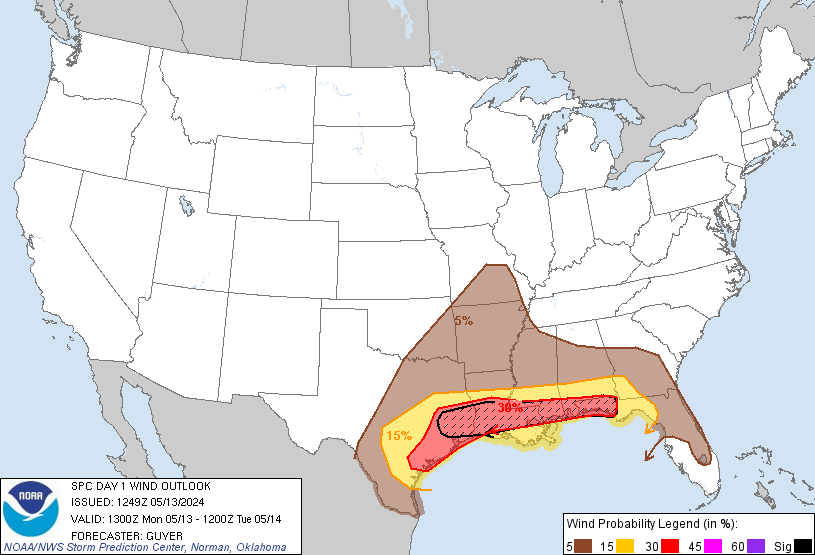
I think the only way they'd upgrade this to high, would be a 30% hatched tornado area... Hail threat alone cannot be given a high threat, and 60% hatched wind threat is required for a day 1 high threat, which seems less likely than upgrading the TOR chances. (current is 15% hatched tor chance and 30% unhatched wind)
0 likes
-
conestogo_flood
- Category 5

- Posts: 1268
- Joined: Wed Sep 28, 2005 5:49 pm
- Extremeweatherguy
- Category 5

- Posts: 11095
- Joined: Mon Oct 10, 2005 8:13 pm
- Location: Florida
- Weatherfreak14
- Category 5

- Posts: 1381
- Joined: Sat Sep 24, 2005 3:40 pm
- Location: Beaufort, SC
- Contact:
-
conestogo_flood
- Category 5

- Posts: 1268
- Joined: Wed Sep 28, 2005 5:49 pm
- Extremeweatherguy
- Category 5

- Posts: 11095
- Joined: Mon Oct 10, 2005 8:13 pm
- Location: Florida
- Gorky
- Category 1

- Posts: 334
- Joined: Tue Nov 02, 2004 7:23 am
- Location: Scarborough, North Yorkshire, UK
The next upgrade will be at 13Z or in 1 hours time 
As for the tornado percentages, this table shows 30%tornado chance as a possibility unless I'm wrong?
http://spc.noaa.gov/misc/SPC_Prob_Conv_ ... 60214.html
As for the tornado percentages, this table shows 30%tornado chance as a possibility unless I'm wrong?
http://spc.noaa.gov/misc/SPC_Prob_Conv_ ... 60214.html
0 likes
-
6SpeedTA95
- Category 5

- Posts: 1206
- Joined: Wed Oct 19, 2005 3:25 pm
- Location: Oklahoma
- Contact:
- cheezyWXguy
- Category 5

- Posts: 6282
- Joined: Mon Feb 13, 2006 12:29 am
- Location: Dallas, TX
- NWIASpotter
- Category 5

- Posts: 1961
- Joined: Sun Jul 18, 2004 12:58 pm
- Location: Terril, Iowa & Ames, Iowa
- Contact:
- wx247
- S2K Supporter

- Posts: 14279
- Age: 42
- Joined: Wed Feb 05, 2003 10:35 pm
- Location: Monett, Missouri
- Contact:
cheezywxman wrote:but why cut the slight risk so much? Yesterday I was in a 30% hatched area and now I'm barely in the 5%. Can someone tell me why the would shrink it so much?
They have refined the threat area. In the day 2 and 3 outlooks, they have a broader area that they need to watch. In the day 1 outlook, that area is refined.
0 likes
- SouthFloridawx
- S2K Supporter

- Posts: 8346
- Age: 47
- Joined: Tue Jul 26, 2005 1:16 am
- Location: Sarasota, FL
- Contact:
- P.K.
- Professional-Met

- Posts: 5149
- Joined: Thu Sep 23, 2004 5:57 pm
- Location: Watford, England
- Contact:
ZCZC SPCPWOSPC ALL
WOUS40 KWNS 061258
KSZ000-MOZ000-NEZ000-062100-
PUBLIC SEVERE WEATHER OUTLOOK
NWS STORM PREDICTION CENTER NORMAN OK
0758 AM CDT THU APR 06 2006
...AN OUTBREAK OF SEVERE THUNDERSTORMS PRODUCING VERY LARGE HAIL AND
TORNADOES IS EXPECTED OVER PARTS OF THE EASTERN PORTIONS OF THE
CENTRAL AND SOUTHERN PLAINS TODAY AND TONIGHT...
THE NWS STORM PREDICTION CENTER IN NORMAN OK IS FORECASTING THE
DEVELOPMENT OF TORNADOES...VERY LARGE HAIL AND DAMAGING WIND GUSTS
OVER PARTS OF THE EASTERN PORTIONS OF THE CENTRAL AND SOUTHERN
PLAINS TODAY AND TONIGHT.
THE AREAS MOST LIKELY TO EXPERIENCE THIS ACTIVITY INCLUDE
EASTERN KANSAS
FAR NORTHWEST MISSOURI
SOUTHEAST NEBRASKA
SURROUNDING THE HIGH RISK AREA...THERE IS A MODERATE RISK OF SEVERE
THUNDERSTORMS FROM EASTERN NEBRASKA AND WESTERN MISSOURI INTO
EASTERN OKLAHOMA AND WESTERN ARKANSAS
A DYNAMIC UPPER LEVEL STORM SYSTEM OVER THE CENTRAL ROCKIES THIS
MORNING IS EXPECTED TO DEVELOP EASTWARD TOWARD KANSAS AND NEBRASKA
THIS AFTERNOON AND TONIGHT. AS A RESULT...A SURFACE LOW PRESSURE
WILL INTENSIFY ACROSS SOUTHERN NEBRASKA THIS AFTERNOON. TO THE
SOUTH OF THE LOW...A DRYLINE WILL STRENGTHEN AND MOVE EASTWARD INTO
THE EASTERN PORTIONS OF THE CENTRAL/SOUTHERN PLAINS.
GULF OF MEXICO MOISTURE HAS BEEN ADVECTING NORTHWARD INTO THE PLAINS
ON STRONG SOUTHERLY LOW-LEVEL WINDS THE PAST COUPLE OF DAYS. THIS
WILL CONTRIBUTE TO AN UNSTABLE ENVIRONMENT SUPPORTIVE FOR
THUNDERSTORMS.
A STRONG WESTERLY FLOW ACCOMPANYING THE STORM SYSTEM WILL DEVELOP
EASTWARD ACROSS THE CENTRAL AND SOUTHERN PLAINS EARLY TODAY...
REACHING THE MID-MISSISSIPPI VALLEY AND MID-SOUTH BY THIS EVENING.
THE STRONG FLOW ATOP THE SOUTHERLY FLOW AT THE SURFACE WILL BE
CONDUCIVE FOR ORGANIZE STORMS INCLUDING SUPERCELLS.
THUNDERSTORM INITIATION WILL LIKELY TAKE PLACE IN TWO MAIN AREAS.
ONE FOCUS FOR THUNDERSTORMS WILL BE ALONG THE DRYLINE FROM CENTRAL
NEBRASKA TO CENTRAL KANSAS BETWEEN 100-400 PM CDT. THESE STORMS
WILL MOVE NORTHEASTWARD INTO EASTERN NEBRASKA...WESTERN IOWA AND
NORTHWEST MISSOURI DURING THE EVENING. VERY LARGE HAIL...DAMAGING
WINDS AND TORNADOES WILL BE LIKELY WITH THESE STORMS. THE
HIGHEST POTENTIAL FOR STRONG TORNADOES SHOULD EXIST ALONG AND
NORTHEAST OF THE SURFACE LOW TRACK...NAMELY ACROSS MUCH OF EASTERN
KANSAS INTO FAR SOUTHEASTERN NEBRASKA AND NORTHWESTERN MISSOURI.
A SECONDARY AREA OF THUNDERSTORMS DEVELOPMENT WILL OCCUR ACROSS
EASTERN OKLAHOMA AND SOUTHEAST KANSAS...PERHAPS AS EARLY AS
100-300PM. THESE STORMS WILL DEVELOP ALONG THE STRONGEST PORTION OF
THE DRYLINE...AND ALONG THE NOSE OF THE STRONG JET STREAM ALOFT.
THESE STORMS WILL TEND TO REMAIN AS DISCRETE SUPERCELL STORMS AS
THEY MOVE INTO SOUTHWEST MISSOURI AND NORTHERN/WESTERN PARTS OF
ARKANSAS DURING THE EVENING. STRONG TORNADOES WILL BE POSSIBLE
ALONG WITH VERY LARGE HAIL AND DAMAGING WIND GUSTS.
THE SEVERE THREAT MAY PERSIST OVERNIGHT INTO THE MID-MISSISSIPPI
VALLEY AND MID-SOUTH. BUT...THE EVOLUTION OF THE LARGE-SCALE
WEATHER SYSTEMS DOES NOT APPEAR LIKELY TO SUPPORT SIGNIFICANT
DESTABILIZATION FOR LOCATIONS FARTHER EAST OVERNIGHT.
THIS IS POTENTIALLY A VERY DANGEROUS SITUATION. THOSE IN THE
THREATENED AREA ARE URGED TO REVIEW SEVERE WEATHER SAFETY RULES AND
TO LISTEN TO RADIO...TELEVISION...AND NOAA WEATHER RADIO FOR
POSSIBLE WATCHES...WARNINGS...AND STATEMENTS LATER TODAY.
..EVANS.. 04/06/2006
0 likes
Return to “USA & Caribbean Weather”
Who is online
Users browsing this forum: SnowyOwl31, South Texas Storms and 128 guests

