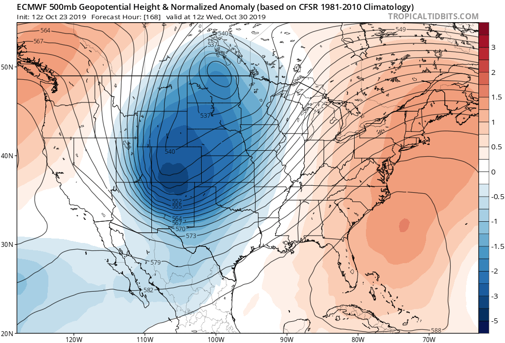
SE Ridge is trying to build back in, but I am hopeful the deep Upper Trough across the Eastern CONUS progged currently for the next week will win out and bring cool Fall weather to at least North Florida by Halloween!

Moderator: S2k Moderators


boca wrote:It’s rare to get cold fronts that produce cold nights and cool days anymore down here.

northjaxpro wrote:Today's 12Z GFS out to 162 hours
SE Ridge is trying to build back in, but I am hopeful the deep Upper Trough across the Eastern CONUS progged currently for the next week will win out and bring cool Fall weather to at least North Florida by Halloween!
https://www.tropicaltidbits.com/analysis/models/gfs/2019102312/gfs_z500aNorm_us_28.png
psyclone wrote:We're getting deep enough into fall that we can get cool fronts and cool downs while still averaging above normal. I'm just hoping for more sane temps...mid 70's for lows with similar dewpoints this late....boo...


psyclone wrote:90 here today. Above normal temps for peninsular florida in the 6-10, 8-14 and 3 to 4 week outlooks. GFS month end cool down is a fail (shocking I tell you)..but we should see some cooler temps right as we turn the calendar..
psyclone wrote:90 here today. Above normal temps for peninsular florida in the 6-10, 8-14 and 3 to 4 week outlooks. GFS month end cool down is a fail (shocking I tell you)..but we should see some cooler temps right as we turn the calendar..
TheStormExpert wrote:psyclone wrote:90 here today. Above normal temps for peninsular florida in the 6-10, 8-14 and 3 to 4 week outlooks. GFS month end cool down is a fail (shocking I tell you)..but we should see some cooler temps right as we turn the calendar..
I hope you’re right! This heat and humidity has LONG overstayed it’s welcome!
Return to “USA & Caribbean Weather”
Users browsing this forum: No registered users and 126 guests
