Re: Florida Weather
Posted: Sun May 24, 2020 7:15 pm
Welcome to Storm2k! Your Year Round Weather Community since 2002!
http://www.storm2k.org/phpbb2/
toad strangler wrote:http://twitter.com/NWSWPC/status/1264665115951009792?s=20
MetroMike wrote:toad strangler wrote:http://twitter.com/NWSWPC/status/1264665115951009792?s=20
I'll believe all the hype about a washout holiday weekend once I see it.
Here in Tampa Bay it been nothing but a few spritzes and does not reflect what the radar has been showing.
Dry air above causing an issue with virga.
toad strangler wrote:MetroMike wrote:toad strangler wrote:http://twitter.com/NWSWPC/status/1264665115951009792?s=20
I'll believe all the hype about a washout holiday weekend once I see it.
Here in Tampa Bay it been nothing but a few spritzes and does not reflect what the radar has been showing.
Dry air above causing an issue with virga.
This is more of an E coast event as far as higher rainfall goes it seems to me.
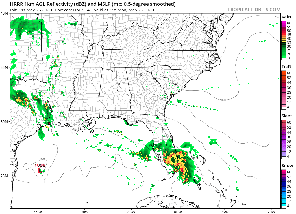
gatorcane wrote:Very windy and squally here in coastal SE Florida. I am out by the beach and it looks like a tropical storm in the saualls.
SFLcane wrote:gatorcane wrote:Very windy and squally here in coastal SE Florida. I am out by the beach and it looks like a tropical storm in the saualls.
Actually a non event here in Broward everything missed the mainland. We should dry out this afternoon.
Severe Weather Statement
National Weather Service Miami FL
853 PM EDT Mon May 25 2020
FLC011-260130-
/O.CON.KMFL.TO.W.0004.000000T0000Z-200526T0130Z/
Broward FL-
853 PM EDT Mon May 25 2020
...A TORNADO WARNING REMAINS IN EFFECT UNTIL 930 PM EDT FOR SOUTHERN
BROWARD COUNTY...
At 853 PM EDT, a severe thunderstorm capable of producing a tornado
was located over Royal Palm Ranches, or near Pembroke Pines, moving
northeast at 15 mph.
HAZARD...TORNADO.
SOURCE...Radar indicated rotation.
IMPACT...Expect damage to mobile homes, roofs, and vehicles. Tree
damage is likely.
Locations impacted include...
Pembroke Pines, Hollywood, Miramar, Davie and Hallandale.