

Florida Weather
Moderator: S2k Moderators
Forum rules

The posts in this forum are NOT official forecast and should not be used as such. They are just the opinion of the poster and may or may not be backed by sound meteorological data. They are NOT endorsed by any professional institution or STORM2K.

Re: Florida Weather Thread - Summer-time weather to continue
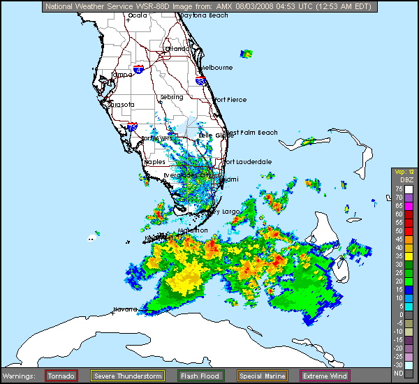
Well, I'm hearing rumbles again so I guess we are gonna have round 4 shortly. 
0 likes
-
Tampa_God

- Category 1

- Posts: 333
- Age: 36
- Joined: Wed May 31, 2006 7:27 pm
- Location: New Port Richey/Trinity, FL
Re: Florida Weather Thread - Summer-time weather to continue
This rain has been getting on my nerves. I haven't had time to mow the yard, all the ponds in the neighborhood are overflowing, and yesterday the water main(sp?) broke and ate somewhat of the sidewalk. If we get anything like yesterday, its gonna be a long day.
0 likes
Re: Florida Weather Thread - Summer-time weather to continue
BULLETIN - EAS ACTIVATION REQUESTED
TORNADO WARNING
NATIONAL WEATHER SERVICE TAMPA BAY AREA - RUSKIN FL
1144 AM EDT FRI AUG 1 2008
THE NATIONAL WEATHER SERVICE IN RUSKIN HAS ISSUED A
* TORNADO WARNING FOR...
WESTERN PINELLAS COUNTY IN FLORIDA.
* UNTIL NOON EDT
* AT 1142 AM EDT...PINELLAS COUNTY EMERGENCY MANAGEMENT REPORTED A
WATERSPOUT 1 MILE WEST OF INDIAN ROCKS BEACH...MOVING EAST TOWARD
SHORE.
* THE TORNADO WILL BE NEAR...
INDIAN ROCKS BEACH BY 1145 AM EDT.
BELLEAIR BY 1150 AM EDT.
A WATERSPOUT IS MOVING TOWARD SHORE. THIS IS A DANGEROUS STORM! MOVE
INTO THE INTERIOR ROOM ON THE LOWEST FLOOR OF A STURDY
BUILDING...AWAY FROM WINDOWS. COVER YOUR HEAD AND BODY WITH PILLOWS
OR BLANKETS.
PLEASE REPORT TORNADOES OR FUNNEL CLOUDS...WINDS OF 58 MPH OR
HIGHER...HAIL THE SIZE OF PENNIES OR LARGER...AND ANY WIND DAMAGE TO
YOUR NATIONAL WEATHER SERVICE IN RUSKIN BY CALLING 813-645-2323.
0 likes
-
JonathanBelles
- Professional-Met

- Posts: 11430
- Age: 35
- Joined: Sat Dec 24, 2005 9:00 pm
- Location: School: Florida State University (Tallahassee, FL) Home: St. Petersburg, Florida
- Contact:
Interesting morning to say the least. I went to the store and as I came out and saw the poorly formed shelf cloud. By the time I got home the police was out and about spawning their sirens (our tornado sirens since we dont have any). By that time everyone was out on their driveways in the near dead calm. You could clearly see the hanging wall cloud that may have been the end of the waterspout or what ever started the tornado warning. The wall cloud was odd in the fact that it moved left and right (looking west...south and north) without any clear direction. the wall cloud eventually lifted up and it began to rain. We only had gusts of maybe 25-30mph with large drops at first, then moderate rain. So much for the lesser rain chance today.
0 likes
-
JonathanBelles
- Professional-Met
- Posts: 11430
- Age: 35
- Joined: Sat Dec 24, 2005 9:00 pm
- Location: School: Florida State University (Tallahassee, FL) Home: St. Petersburg, Florida
- Contact:
-
JonathanBelles
- Professional-Met
- Posts: 11430
- Age: 35
- Joined: Sat Dec 24, 2005 9:00 pm
- Location: School: Florida State University (Tallahassee, FL) Home: St. Petersburg, Florida
- Contact:
I just went out and tried mowing. I did 2/3rds of a yard in the time that it should have taken to do one yard. The grass is about 3" high (- weeds). The bottome third of my front yard has turned into a marsh. I would step in and step into 3" of grass mush and water. The mower would go down just as far. After an hour I gave up and decided Id try again tomorrow.
0 likes
-
JonathanBelles
- Professional-Met
- Posts: 11430
- Age: 35
- Joined: Sat Dec 24, 2005 9:00 pm
- Location: School: Florida State University (Tallahassee, FL) Home: St. Petersburg, Florida
- Contact:
-
JonathanBelles
- Professional-Met
- Posts: 11430
- Age: 35
- Joined: Sat Dec 24, 2005 9:00 pm
- Location: School: Florida State University (Tallahassee, FL) Home: St. Petersburg, Florida
- Contact:
-
JonathanBelles
- Professional-Met
- Posts: 11430
- Age: 35
- Joined: Sat Dec 24, 2005 9:00 pm
- Location: School: Florida State University (Tallahassee, FL) Home: St. Petersburg, Florida
- Contact:
-
JonathanBelles
- Professional-Met
- Posts: 11430
- Age: 35
- Joined: Sat Dec 24, 2005 9:00 pm
- Location: School: Florida State University (Tallahassee, FL) Home: St. Petersburg, Florida
- Contact:
-
JonathanBelles
- Professional-Met
- Posts: 11430
- Age: 35
- Joined: Sat Dec 24, 2005 9:00 pm
- Location: School: Florida State University (Tallahassee, FL) Home: St. Petersburg, Florida
- Contact:
-
Cookiely

- S2K Supporter

- Posts: 3211
- Age: 75
- Joined: Fri Aug 13, 2004 7:31 am
- Location: Tampa, Florida
Re: Florida Weather Thread - Summer-time weather to continue
A friend of mine has standing water in her yard. Its been a very long time since I've seen the ditches with standing water and ponds full in and around Carrollwood.
0 likes
-
Shockwave
- Tropical Storm

- Posts: 167
- Joined: Fri Jul 25, 2008 7:33 am
- Location: Lafayette, TN
- Contact:
Re: Florida Weather Thread - Summer-time weather to continue
What a year makes for you Florida people. Last year, Florida was dealing with drought and forest fires, now this year it's flooding.
0 likes
-
JonathanBelles
- Professional-Met
- Posts: 11430
- Age: 35
- Joined: Sat Dec 24, 2005 9:00 pm
- Location: School: Florida State University (Tallahassee, FL) Home: St. Petersburg, Florida
- Contact:
-
Extremeweatherguy

- Category 5

- Posts: 11095
- Joined: Mon Oct 10, 2005 8:13 pm
- Location: Florida
Re: Florida Weather Thread - Summer-time weather to continue
This is interesting. Could a cool front actually try and reach central Florida this weekend? The NWS thinks it may be possible...
If this boundary (a.k.a. weak cool front) is actually able to make it through, then we will be way ahead of schedule. As the NWS pointed out, central Florida usually does not experience its first front until October.
AREA FORECAST DISCUSSION
NATIONAL WEATHER SERVICE MELBOURNE FL
250 PM EDT WED AUG 6 2008
.DISCUSSION...
TONIGHT/THURSDAY...
DESPITE PLENTIFUL MOISTURE (KXMR/KTBW 12Z SOUNDINGS BOTH MEASURED
~2.0" PW)...AFTN CONVECTION OVER THE CWA HAS BEEN RATHER SPARSE AND
LIMITED TO THE IMMEDIATE VICINITY OF THE SEABREEZE. A WEAK MID LVL
THERMAL PROFILE (H70 TEMPS ~10C...H50 TEMPS ~-7C) AND NVA OCCURRING
AT H50 ARE THE MOST LIKELY CULPRITS FOR THE CONVECTIVE SUPPRESSION.
STEERING FLOW THRU THE H100-H70 LYR WILL REMAIN LIGHT AND VARIABLE
OVERNIGHT AS THE DLM RIDGE AXIS OVER FL DRIFTS INTO THE SRN
PENINSULA IN RESPONSE TO A DEEPENING SHORTWAVE TROF OVER NEW
ENGLAND/ERN CANADA. THIS RAISES DOUBTS AS TO HOW FAR INLAND THE
SEABREEZE WILL BE ABLE TO PENETRATE. THE AIRMASS SIMPLY IS NOT
UNSTABLE ENOUGH TO SUPPORT DIURNAL PRECIP BEYOND THE 18-24Z
TIMEFRAME WITHOUT MESOSCALE BOUNDARY INTERACTIONS.
THE SHORTWAVE TROF WILL CONTINUE TO DEEPEN ON THURSDAY AS THE H25
JET OVER THE NRN PLAINS/UPR MIDWEST PUSHES TOWARD THE NEW ENGLAND
AND MID ATLC COASTS AND IS REINFORCED BY A SECOND JET DIVING OUT OF
NRN CANADA. THE ATLC RIDGE AXIS WILL CONTINUE TO SAG INTO THE SRN
PENINSULA IN RESPONSE TO THIS. HOWEVER...A DEFINITIVE SHIFT
PROBABLY WILL BE DELAYED AS A T-WAVE JUST EAST OF THE BAHAMAS WORKS
ITS WAY WEST AROUND THE BASE OF THE RIDGE.
GIVEN THE LACK ON INLAND PROGRESS OF EITHER THE EAST OR WEST COAST
SEABREEZE...POPS TONIGHT WILL BE TOO LOW TO MENTION. INCREASING
MOISTURE WITH THE APPROACHING T-WAVE ON THURSDAY WILL PUSH POPS BACK
INTO THE SCT CATEGORY. TEMPS ABV CLIMO OVERNIGHT DUE TO HIGH
DEWPOINTS/PW VALUES...AND ON THUR DUE TO RELATIVELY LOW CLOUD COVER
STORM COVERAGE.
FRI...EASTERN CONUS LONGWAVE TROUGH BECOMES RE-ESTABLISHED WITH DEEP
W/SW FLOW AS LOW LEVEL RIDGE AXIS IS SUPPRESSED TO THE FL STRAITS.
OFFSHORE FLOW SHOULD BE STRONG ENOUGH TO PREVENT SEA BREEZE FROM
FORMING. BAND OF DEEPER MOISTURE (PWATS 2"+) FCST TO SHIFT SOUTH
AHEAD OF SFC TROUGH. WILL HOLD ONTO LIKELY (60%) POPS NORTH
SECTIONS...SCT (50%) SOUTH. MAX TEMPS SHOULD REACH THE LOWER TO MID
90S ALL SECTIONS INCLUDING THE COAST.
WEEKEND...GFS CONTINUES TO ADVERTISE A VERY ANOMALOUS PATTERN FOR
MIDSUMMER...A DEEP UPPER TROUGH ALONG THE EASTERN U.S. WITH
SHORTWAVES ROTATING AROUND THE BASE...PUSHING A BOUNDARY THROUGH
CENT FL! HAVE HIGH CONFIDENCE THAT RAIN CHANCES WILL BE ABOVE
NORMAL ONE OR BOTH DAYS. THE SFC TROUGH MAY PROVIDE A FOCUS FOR
HEAVY RAIN AS IT DRIFTS SOUTHWARD ACROSS NORTH AND CENT FL SAT.
SOMEWHAT LESS CONFIDENT THAT THE BOUNDARY WILL BE ABLE TO CLEAR
CENT FL...NORMALLY WE HAVE TO WAIT UNTIL MID OCTOBER. DRYING
INDICATED SUNDAY ACROSS THE NORTH WITH ELEVATED RAIN CHANCES
PERSISTING ACROSS THE SOUTH BUT THIS DEPENDS ON PROGRESS OF
BOUNDARY. SO WILL KEEP SCT POPS SUN AREAWIDE FOR NOW GIVEN LOWER
CONFIDENCE.
MON-WED...WEAK SURFACE RIDGING ASCD WITH THE BERMUDA HIGH WILL
BECOME RE-ESTABLISHED ACROSS THE CENTRAL TO SOUTH PENINSULA. PRECIP
CHCS RETURN TO NEAR CLIMO AS MOISTURE VALUES WILL REMAIN
SUFFICIENT FOR DIURNALLY FORCED SHOWERS/STORMS MAINLY INTERIOR.
If this boundary (a.k.a. weak cool front) is actually able to make it through, then we will be way ahead of schedule. As the NWS pointed out, central Florida usually does not experience its first front until October.
0 likes
Return to “USA & Caribbean Weather”
Who is online
Users browsing this forum: Brent, CaptinCrunch and 62 guests