NWS Miami:
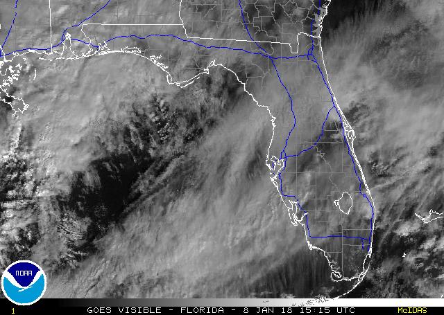
COLD FRONT IS CURRENTLY MOVING THROUGH SOUTHERN PORTIONS OF THE
CWA WITH NW WINDS BECOMING GUSTY BEHIND IT...AND DEWPOINTS
DROPPING MARKEDLY INTO THE 30S ACROSS GLADES COUNTY. JUST A FEW
CLOUDS ACCOMPANYING THE FRONT AND MAINLY HIGH CIRRUS OVER LAND
WITH COLD ADVECTION STRATOCU OVER THE WATER. TO ILLUSTRATE THE
MAGNITUDE OF THIS FRONT...WINDS GUSTED AS HIGH AS 35 KNOTS OVER
LAKE OKEECHOBEE JUST A SHORT WHILE AGO.
http://www.srh.noaa.gov/fwd/productview ... n=1&max=61
Florida Weather
Moderator: S2k Moderators
Forum rules

The posts in this forum are NOT official forecast and should not be used as such. They are just the opinion of the poster and may or may not be backed by sound meteorological data. They are NOT endorsed by any professional institution or STORM2K.
-
HURAKAN

- Professional-Met

- Posts: 46084
- Age: 39
- Joined: Thu May 20, 2004 4:34 pm
- Location: Key West, FL
- Contact:
Sweetwater, FL: http://forecast.weather.gov/MapClick.ph ... 2=-80.3738
Today: Sunny, with a high near 71. Breezy, with a north wind around 17 mph, with gusts as high as 23 mph.
Tonight: Mostly clear, with a low around 48. North wind around 14 mph, with gusts as high as 18 mph.
Wednesday: Sunny, with a high near 75. Wind chill values as low as 43 early. North wind between 9 and 13 mph.


____________________________________________________________________________________
Tamiami, FL: http://forecast.weather.gov/MapClick.ph ... 0.3986&e=0
Today: Sunny, with a high near 71. Breezy, with a north wind between 15 and 17 mph, with gusts as high as 23 mph.
Tonight: Mostly clear, with a low around 46. North wind between 11 and 13 mph.
Wednesday: Sunny, with a high near 75. Wind chill values as low as 41 early. North wind between 9 and 13 mph.
Today: Sunny, with a high near 71. Breezy, with a north wind around 17 mph, with gusts as high as 23 mph.
Tonight: Mostly clear, with a low around 48. North wind around 14 mph, with gusts as high as 18 mph.
Wednesday: Sunny, with a high near 75. Wind chill values as low as 43 early. North wind between 9 and 13 mph.
____________________________________________________________________________________
Tamiami, FL: http://forecast.weather.gov/MapClick.ph ... 0.3986&e=0
Today: Sunny, with a high near 71. Breezy, with a north wind between 15 and 17 mph, with gusts as high as 23 mph.
Tonight: Mostly clear, with a low around 46. North wind between 11 and 13 mph.
Wednesday: Sunny, with a high near 75. Wind chill values as low as 41 early. North wind between 9 and 13 mph.
0 likes
-
tropicana

- Category 5

- Posts: 8056
- Joined: Sat Sep 27, 2003 6:48 pm
- Location: Niagara Falls, Ontario, Canada
- Contact:
Re: Florida Weather Thread: Coldest air of the season on the way
With temperatures at Miami International Airport down to at least 58F and Fort Lauderdale at least 57F.. this is the coldest air to make it this far south since:
April 15-17 2008 when lows at Miami were 58F, 56F and 59F respectively.
-justin-
April 15-17 2008 when lows at Miami were 58F, 56F and 59F respectively.
-justin-
0 likes
-
Extremeweatherguy

- Category 5
- Posts: 11095
- Joined: Mon Oct 10, 2005 8:13 pm
- Location: Florida

-
Extremeweatherguy
- Category 5
- Posts: 11095
- Joined: Mon Oct 10, 2005 8:13 pm
- Location: Florida
Re:
Yeah, I have been thinking the same thing. Usually seasons with these strong early cold snaps tend to feature very interesting winters. 1976, 1984 and 1989 all featured early bouts of unusual cold for Florida, and they were each followed by a memorable December or January event.gatorcane wrote::uarrow:
Note later in the season in 1989 central and north florida saw snow flurries (December 1989).
I wonder if we are going to see something similar come Dec-Jan?
Cold weather in the fall of 1976 - was followed by the memorable 1977 January snow event. Up to 2" fell in parts of interior central Florida, with dustings recorded in Tampa and Orlando. Parts of Miami reported snow flakes.
Cold weather in the fall of 1984 - was followed by the 1985 January freeze event. The low temperature hit 19F in Orlando!
Cold weather in the fall of 1989 - was followed by the December 1989 pre-christmas freeze. Snow and sleet showers were reported as far south as Melbourne and high temperatures failed to get out of the 30s in Central Florida for 1-2 days (with lows below 25F). Miami failed to get above 45F for a high temperature on Christmas Eve, which remains to this day their all-time coldest maximum temperature in history. The low temperature also fell to a stunning 30F in Miami on Christmas morning 1989, which is the coldest temperature they have ever recorded during the month of December.
0 likes
-
gatorcane

- S2K Supporter

- Posts: 23708
- Age: 48
- Joined: Sun Mar 13, 2005 3:54 pm
- Location: Boca Raton, FL
Re: Re:
Extremeweatherguy wrote:Yeah, I have been thinking the same thing. Usually seasons with these strong early cold snaps tend to feature very interesting winters. 1976, 1984 and 1989 all featured early bouts of unusual cold for Florida, and they were each followed by a memorable December or January event.gatorcane wrote::uarrow:
Note later in the season in 1989 central and north florida saw snow flurries (December 1989).
I wonder if we are going to see something similar come Dec-Jan?
Cold weather in the fall of 1976 - was followed by the memorable 1977 January snow event. Up to 2" fell in parts of interior central Florida, with dustings recorded in Tampa and Orlando. Parts of Miami reported snow flakes.
Cold weather in the fall of 1984 - was followed by the 1985 January freeze event. The low temperature hit 19F in Orlando!
Cold weather in the fall of 1989 - was followed by the December 1989 pre-christmas freeze. Snow and sleet showers were reported as far south as Melbourne and high temperatures failed to get out of the 30s in Central Florida for 1-2 days (with lows below 25F). Miami failed to get above 45F for a high temperature on Christmas Eve, which remains to this day their all-time coldest maximum temperature in history. The low temperature also fell to a stunning 30F in Miami on Christmas morning 1989, which is the coldest temperature they have ever recorded during the month of December.
Wow very interesting data points thanks for sharing. I was living in the Tampa area for the big cold snaps of 1985 and 1989 and it was downright cold. Note also the latest Farmer's almanac release suggests the winter is going to be colder than normal for the East Coast of the U.S.
Also, if you look at the frequency of snow flurry events in central Florida you will find that they typically they happen every 15 years or so (196x, 1977, 1989, ?). So it seems Florida is due any year now for a snow flurry event. It will be interesting to see how this winter plays out.
0 likes
-
Extremeweatherguy
- Category 5
- Posts: 11095
- Joined: Mon Oct 10, 2005 8:13 pm
- Location: Florida
AREA FORECAST DISCUSSION
NATIONAL WEATHER SERVICE MELBOURNE FL
936 AM EDT TUE OCT 28 2008
...RECORD COOL HIGH TEMPS THIS AFTERNOON AND RECORD LOWS TONIGHT...
.DISCUSSION...A LONG NORTHWEST/NORTH FETCH OF WINDS FROM THE MIDWEST
AND GREAT LAKES HAS USHERED IN THE COLDEST AIR SINCE APRIL 15.
MINIMUM TEMPS WERE IN THE MID/UPPER 40S...EXCEPT AROUND 50 ALONG THE
FAR SOUTHEAST COAST. GUSTY WINDS ALSO ADDED A CHILL TO THE
AIR...MAKING IT FEEL LIKE THE LOWER 30S IN THE NORTH AND UPPER 30S
IN THE SOUTH DURING THE EARLY MORNING HOURS.
THE RECORD LOW OF 49...LAST SET IN 1957...WAS TIED THIS MORNING AT
MELBOURNE.
HIGH TEMPERATURES TODAY WILL LIKELY BE THE COOLEST ON RECORD IN MANY
LOCATIONS.
A COLD HIGH PRESSURE CENTER SETTLING TO NEAR THE MISSISSIPPI DELTA
TONIGHT WILL CAUSE WINDS TO DECREASE BUT BOUNDARY LAYER FLOW WILL
NOT BECOME CALM. STILL...ALL LOCATIONS HAVE RECORD LOWS FORECAST.
DUE TO THE STILL VERY DRY AIR...SOME LOW LYING...WIND PROTECTED
NORTHWEST SPOTS COULD REACH THE FREEZING MARK...WHICH WOULD BE
EXTREMELY RARE FOR LATE OCTOBER.
A FEW LOCATIONS MAY HAVE THE COLDEST OCTOBER TEMPERATURE ON RECORD
TONIGHT.
TEMPERATURES WILL REMAIN UNUSUALLY COOL THROUGH THURSDAY MORNING
BEFORE RETURNING CLOSE TO NORMAL OVER THE WEEKEND.
0 likes
-
HURAKAN
- Professional-Met
- Posts: 46084
- Age: 39
- Joined: Thu May 20, 2004 4:34 pm
- Location: Key West, FL
- Contact:
Re: Florida Weather Thread: Coldest air of the season on the way
Code: Select all
:   FLORIDA TEMPERATURE AND PRECIPITATION TABLE
:   NATIONAL WEATHER SERVICE MIAMI FL
:   830 AM EDT TUE OCT 28 2008

:
:
:...HIGHEST TEMPERATURE YESTERDAY...LOWEST LAST 12 HOURS...
:...PRECIPITATION LAST 24 HOURS...DATA AS OF 1200 UTC
:
.B MFL 1028 E DH07 /TX/TN/PP
:
:                                  HIGH    LOW     PCPN
:
:
:APALACHICOLA             :AAF      73 /    42 /   0.00
:BROOKSVILLE              :BKV      79 /     M /   0.00
:CRESTVIEW                :CEW      64 /    36 /   0.00
:CROSS CITY               :CTY      79 /    39 /   0.00
:DAYTONA BEACH            :DAB      79 /    46 /   0.00
:DESTIN                   :DTS      66 /    43 /   0.00
:FORT LAUDERDALE INTL     :FLL      83 /    56 /     T
:FORT LAUDERDALE EXEC     :FXE      80 /    54 /   0.00
:FORT MYERS               :FMY      81 /    51 /   0.00
:FORT MYERS / SW REG AP   :RSW      79 /    50 /   0.00
:FORT PIERCE              :FPR      79 /    50 /   0.00
:GAINESVILLE              :GNV      79 /    38 /   0.00
:JACKSONVILLE             :JAX      78 /    40 /   0.00
:KEY WEST                 :EYW      79 /    66 /   0.00
:LEESBURG                 :LEE      79 /    46 /   0.00
:MARATHON                 :MTH      80 /    63 /   0.00
:MARIANNA                 :MAI      67 /    38 /   0.00
:MELBOURNE                :MLB      79 /    49 /   0.00
:MIAMI                    :MIA      81 /    58 /   0.00
:NAPLES                   :APF      79 /    54 /     T
:OPA LOCKA                :OPF      81 /    56 /   0.00
:ORLANDO INTL             :MCO      79 /    47 /   0.00
:ORLANDO EXEC             :ORL      79 /    47 /   0.00
:PANAMA CITY              :PFN      68 /    42 /   0.00
:PEMBROKE PINES           :HWO      81 /    56 /   0.00
:PENSACOLA                :PNS      65 /    39 /   0.00
:POMPANO BEACH            :PMP      80 /    54 /   0.00
:PUNTA GORDA              :PGD      81 /    49 /   0.00
:SANFORD                  :SFB      80 /    48 /   0.00
:SARASOTA / BRADENTON     :SRQ      79 /    51 /   0.00
:ST. PETERSBURG           :SPG      78 /    53 /   0.00
:ST. PETERSBURG/CLEARWATER:PIE      80 /    52 /   0.00
:TALLAHASSEE              :TLH      71 /    39 /   0.00
:TAMPA                    :TPA      80 /    48 /   0.00
:VERO BEACH               :VRB      80 /    49 /   0.00
:WINTER HAVEN             :GIF      80 /    46 /   0.00
:W KENDALL TAMIAMI AP     :TMB      80 /    57 /   0.00
:WEST PALM BEACH          :PBI      80 /    52 /   0.00
0 likes

-
gatorcane
- S2K Supporter
- Posts: 23708
- Age: 48
- Joined: Sun Mar 13, 2005 3:54 pm
- Location: Boca Raton, FL
I just checked the RHs and they are running between 36% and 51% across SE Florida. Very pleasant indeed!
http://www.srh.noaa.gov/mfl/observations.php
http://www.srh.noaa.gov/mfl/observations.php
0 likes
-
x-y-no

- Category 5
- Posts: 8359
- Age: 65
- Joined: Wed Aug 11, 2004 12:14 pm
- Location: Fort Lauderdale, FL
What an absolutely gorgeous day in SFL! More typical of January than October. Temperature in the low 60's, humidity super-low, I'm guessing 40% or less. Crystal-clear blue sky, except off to the south where there's some cirrus indicating a really strong southwesterly jet. Without checking the maps, I'm betting at least 90 knots vertical shear up there.
Days like this are what makes enduring all that heat and humidity worthwhile. I hope this is a harbinger of things to come this winter.
Days like this are what makes enduring all that heat and humidity worthwhile. I hope this is a harbinger of things to come this winter.
0 likes

-
gatorcane
- S2K Supporter
- Posts: 23708
- Age: 48
- Joined: Sun Mar 13, 2005 3:54 pm
- Location: Boca Raton, FL
0 likes
-
HURAKAN
- Professional-Met
- Posts: 46084
- Age: 39
- Joined: Thu May 20, 2004 4:34 pm
- Location: Key West, FL
- Contact:
Re: Florida Weather Thread: Coldest air of the season on the way
Inland South Florida under 50ºF (10/28): Code: Select all
...TEMPERATURE AND PRECIPITATION LAST 24 HOURS...

 COOPERATIVE                          REPORT
 OBSERVATIONS                          TIME     HIGH     LOW     PCPN

BIG CYPRESS               :BCIF1  TUE 08:00 AM    78      48     0.00
CLEWISTON                 :CWEF1  TUE 07:00 AM    81      48     0.00
IMMOKALEE                 :IMKF1  TUE 07:00 AM    85      49     0.00
LABELLE                   :LABF1  TUE 07:00 AM    79      49     0.00
Clewiston breaks the record of 52ºF established in 1990.
Immokalee breaks the record of 56ºF established in 1998.
0 likes
-
Extremeweatherguy
- Category 5
- Posts: 11095
- Joined: Mon Oct 10, 2005 8:13 pm
- Location: Florida
Re: Florida Weather Thread: Coldest air of the season on the way
Tempting to say that this cold front is setting the tone for the winter to come in florida….not sure if there is any long-term correlation between early cold fronts and an overall cold winter. For what it’s worth, the CPC outlook released this month for the upcoming winter shows a forecast of equal chances of above or below normal temps. The link to their discussion on the reasoning is provided.

http://www.cpc.ncep.noaa.gov/products/predictions/90day/fxus05.html
Looking at recent climate history, November 2006 was a chilly month in Miami…averaging 1.4 deg below normal, with a stretch of 10-15 degree below normal weather mid-month. December 2006 and January 2007 were very warm months…averaging 4-5 degrees above normal. In fact, the average temp was higher in December than in November for that year.
Cold fronts happen, even in overall 'mild winters'....what will be interesting to see is if we have a warm-up starting later this week which lasts for an extended period, or if another strong front soon follows. At least through early next week, a warm-up to more seasonal temps is on tap.
0 likes
Return to “USA & Caribbean Weather”
Who is online
Users browsing this forum: Stratton23 and 31 guests