Big Severe Wx Outbreak around 10/18/07 in Plains
Moderator: S2k Moderators
Forum rules

The posts in this forum are NOT official forecast and should not be used as such. They are just the opinion of the poster and may or may not be backed by sound meteorological data. They are NOT endorsed by any professional institution or STORM2K.
-
6SpeedTA95
- Category 5

- Posts: 1206
- Joined: Wed Oct 19, 2005 3:25 pm
- Location: Oklahoma
- Contact:
-
6SpeedTA95
- Category 5
- Posts: 1206
- Joined: Wed Oct 19, 2005 3:25 pm
- Location: Oklahoma
- Contact:
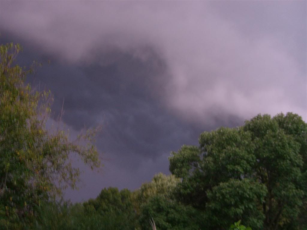
Sorry in advance for any blurriness, this is not my camera, I left mine in OKC so some of the pics did not turn out as I'd like.
This first one was taken this afternoon at work at approximately 1pm ct
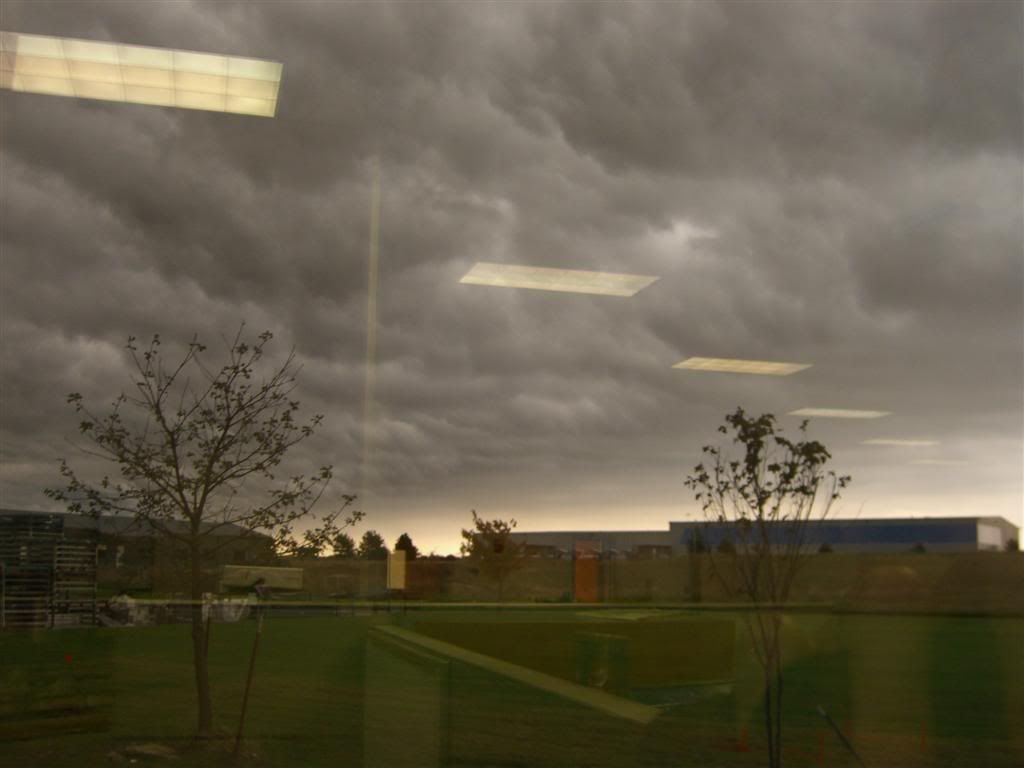
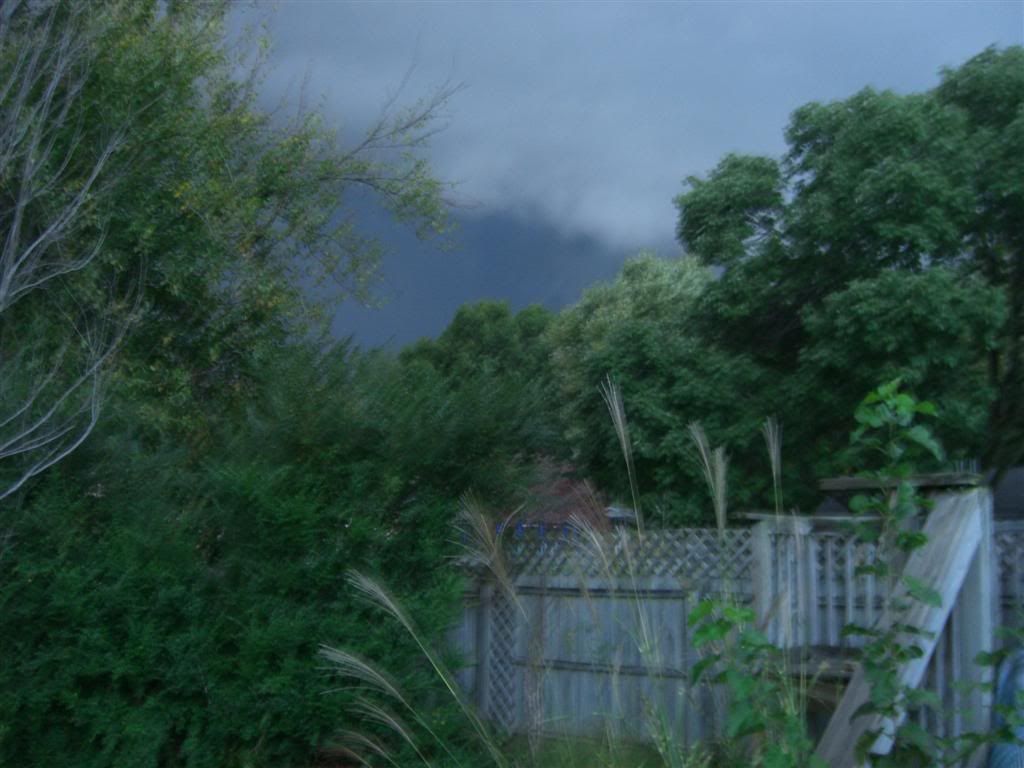
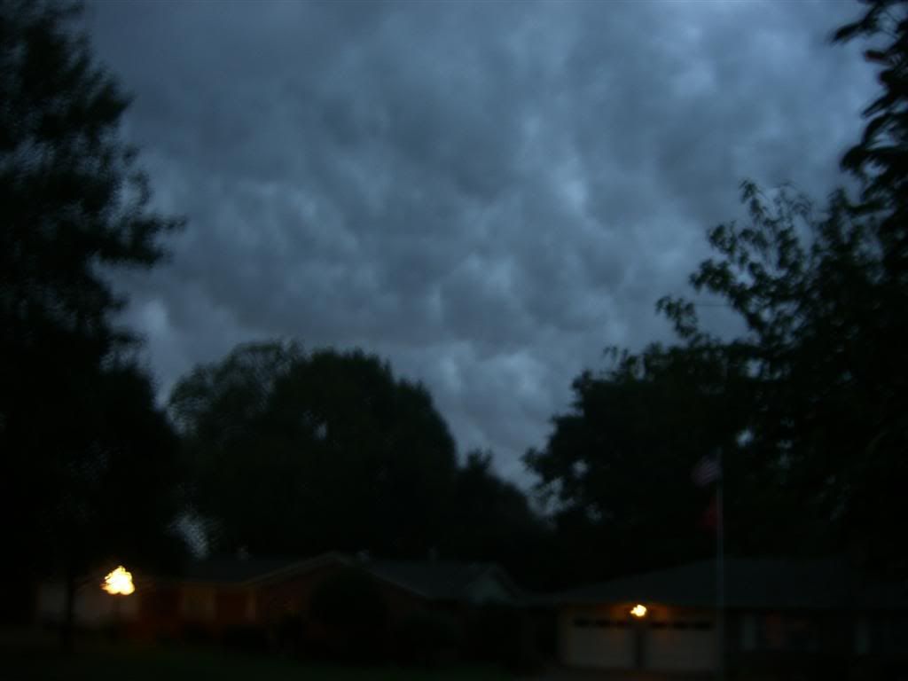
These were taken as storms approached washington county between 6:30 and 6:45cdt...
you can see the striations/rotation in these clouds depending on your monitor, they turned out a bit brighter than I anticipated which makes it harder to see but they were very obvious in person
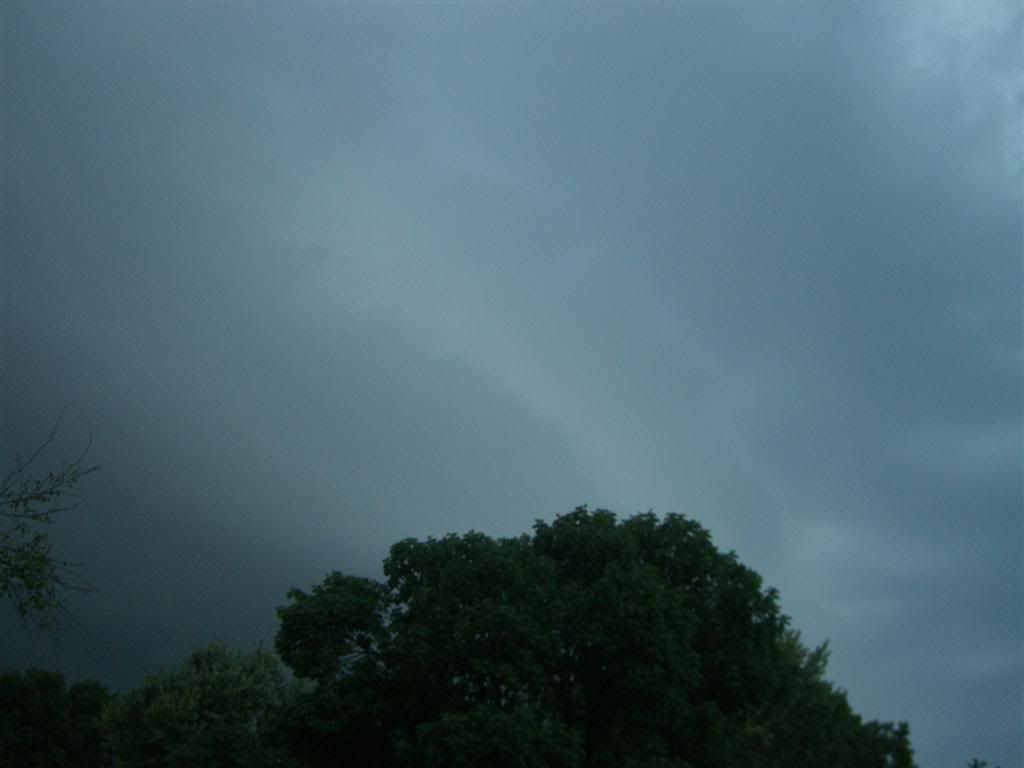
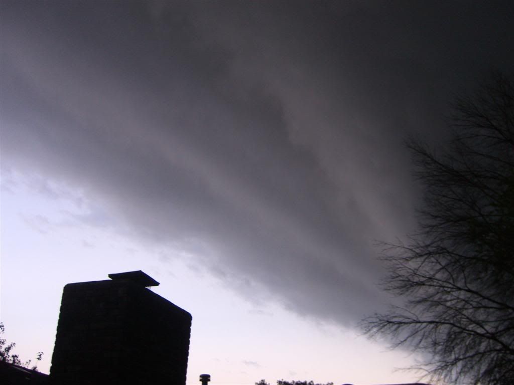
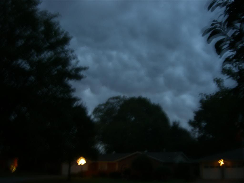
Here's a few as it got closer and moved over head
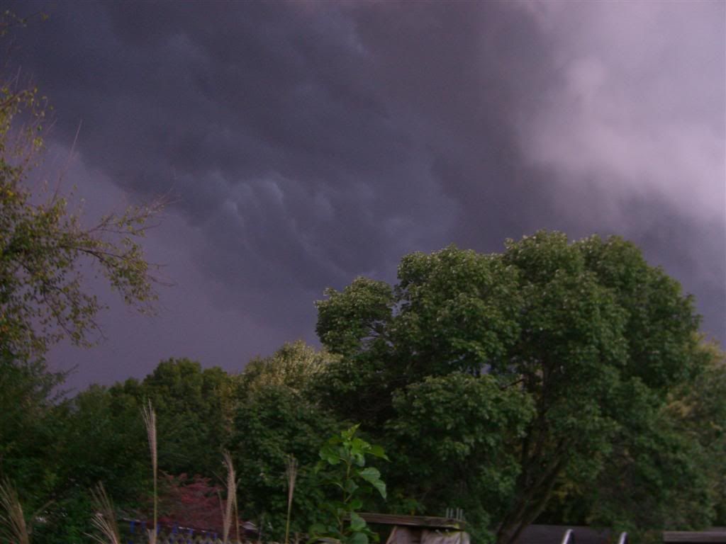
Here's one of the striations from behind (underneath the clouds) much easier to see the striations
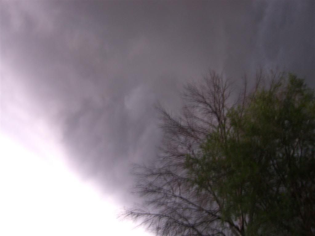
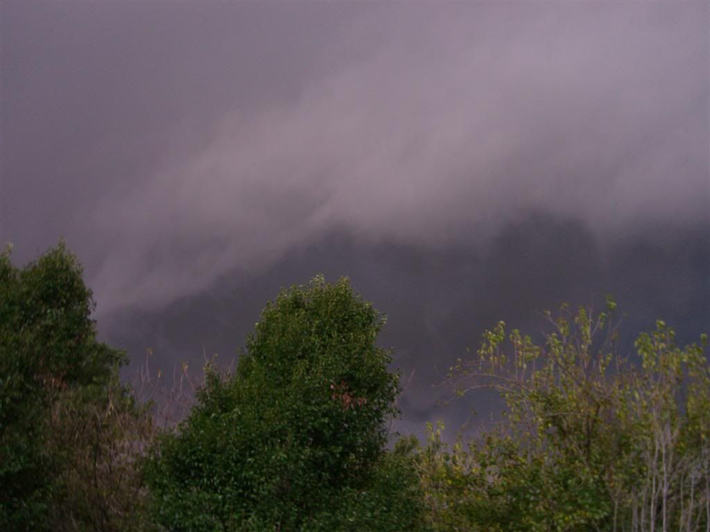
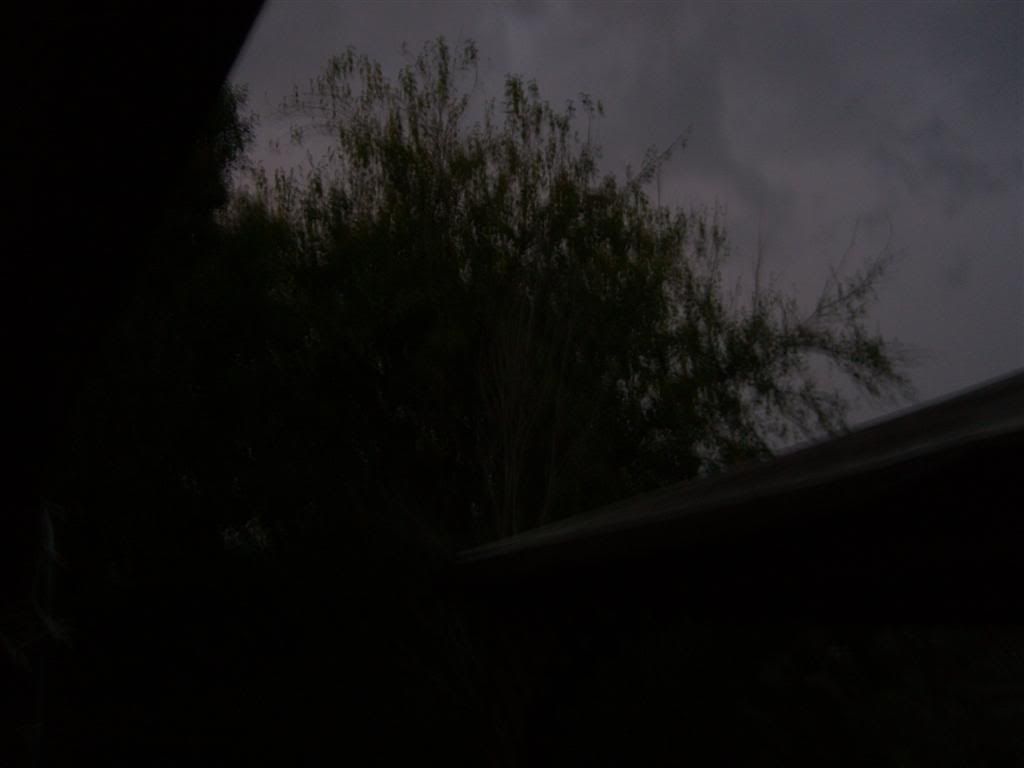
Now here's a couple pics litterally taken within 2 minutes of the last two and it got DARK, I mean DARK!
This first one was taken this afternoon at work at approximately 1pm ct
These were taken as storms approached washington county between 6:30 and 6:45cdt...
you can see the striations/rotation in these clouds depending on your monitor, they turned out a bit brighter than I anticipated which makes it harder to see but they were very obvious in person
Here's a few as it got closer and moved over head
Here's one of the striations from behind (underneath the clouds) much easier to see the striations
Now here's a couple pics litterally taken within 2 minutes of the last two and it got DARK, I mean DARK!
0 likes
-
HarlequinBoy

- Category 5
- Posts: 1400
- Age: 35
- Joined: Wed Nov 29, 2006 1:57 am
- Location: Memphis
Tornado Warning (Southern Miss)
Forrest.. including Hattiesburg
Jones
Forrest.. including Hattiesburg
Jones
Last edited by HarlequinBoy on Wed Oct 17, 2007 8:34 pm, edited 1 time in total.
0 likes
-
HarlequinBoy
- Category 5
- Posts: 1400
- Age: 35
- Joined: Wed Nov 29, 2006 1:57 am
- Location: Memphis
Re:
CrazyC83 wrote:Now reporting 40 people injured in Tulsa...
Wow.. what happened?
And really good pics 6Speed!
0 likes
-
CrazyC83
- Professional-Met

- Posts: 34315
- Joined: Tue Mar 07, 2006 11:57 pm
- Location: Deep South, for the first time!
MESOSCALE DISCUSSION 2101
NWS STORM PREDICTION CENTER NORMAN OK
0810 PM CDT WED OCT 17 2007
AREAS AFFECTED...NERN TX...NRN L A...WRN AR AND NERN OK
CONCERNING...TORNADO WATCH 713...
VALID 180110Z - 180245Z
THE SEVERE WEATHER THREAT FOR TORNADO WATCH 713 CONTINUES.
SEVERE THREAT CONTINUES ACROSS THE ENTIRE WATCH AREA. HOWEVER...SRN
PORTIONS OF THE WATCH MAY BE CLEARED EARLY.
SURFACE ANALYSIS SHOWS DRYLINE ACROSS ERN OK INTO NERN TX...WITH
DEEP MOIST PLUME TO THE E. AMPLE DEEP LAYER SHEAR HAS OVERSPREAD THE
AREA...WITH SIGNIFICANT LOW LEVEL SHEAR AS WELL.
AS UPPER WAVE EJECTS NEWD ACROSS OK INTO MO...WINDS ALOFT WILL
CONTINUE TO VEER SOUTH OF THE JET AXIS WHICH WILL BRING SUBSIDENCE
AND DRYING. LOW LEVEL JET AND ASSOCIATED ADVECTION OF WARM/MOIST AIR
WILL SHIFT EWD INTO THE MS VALLEY. THE MOST PROLONGED SEVERE THREAT
WILL THUS BE JUST AHEAD OF THE UPPER LEVEL VORTICITY MAX FROM ERN OK
INTO SRN MO AND CNTRL/NRN AR...AND ALSO IN MOIST PLUME FARTHER E.
THUS...SWRN PORTIONS OF THE WATCH MAY BE CANCELED EARLY.
..JEWELL.. 10/18/2007
ATTN...WFO...JAN...LZK...SGF...LCH...SHV...TSA...HGX...
31419155 31429517 36569542 36569160
0 likes
-
CrazyC83
- Professional-Met
- Posts: 34315
- Joined: Tue Mar 07, 2006 11:57 pm
- Location: Deep South, for the first time!
Re: Re:
HarlequinBoy wrote:CrazyC83 wrote:Now reporting 40 people injured in Tulsa...
Wow.. what happened?
And really good pics 6Speed!
Tents collapsed at Oktoberfest due to high winds (maybe a tornado?)
0 likes
-
6SpeedTA95
- Category 5
- Posts: 1206
- Joined: Wed Oct 19, 2005 3:25 pm
- Location: Oklahoma
- Contact:
Re: Re:
CrazyC83 wrote:HarlequinBoy wrote:CrazyC83 wrote:Now reporting 40 people injured in Tulsa...
Wow.. what happened?
And really good pics 6Speed!
Tents collapsed at Oktoberfest due to high winds (maybe a tornado?)
Seems to be straightline winds at this point based on what all the local guys are saying.
0 likes
-
6SpeedTA95
- Category 5
- Posts: 1206
- Joined: Wed Oct 19, 2005 3:25 pm
- Location: Oklahoma
- Contact:
-
CrazyC83
- Professional-Met
- Posts: 34315
- Joined: Tue Mar 07, 2006 11:57 pm
- Location: Deep South, for the first time!
MESOSCALE DISCUSSION 2102
NWS STORM PREDICTION CENTER NORMAN OK
0838 PM CDT WED OCT 17 2007
AREAS AFFECTED...PARTS OF ERN OK
CONCERNING...TORNADO WATCH 711...
VALID 180138Z - 180245Z
THE SEVERE WEATHER THREAT FOR TORNADO WATCH 711 CONTINUES.
REGIONAL RADARS SHOWED A LINE OF STRONG TO SEVERE TSTMS EXTENDING
FROM NERN INTO EAST CENTRAL OK. PARAMETERS REMAIN FAVORABLE FOR
DAMAGING WINDS AND ISOLATED TORNADOES AS ACTIVITY TRACKS TO THE
NE...WITH CURRENT TRENDS SUGGESTING THE SEVERE WEATHER THREAT SHOULD
EXIT WW 711 PRIOR TO THE 03Z EXPIRATION. THUS...WW COULD BE
CANCELLED EARLY.
..PETERS.. 10/18/2007
ATTN...WFO...SGF...SHV...TSA...ICT...FWD...OUN...
33699452 33939524 33779648 33789647 34249645 35259597
36169579 37039583 37399576 37399508 36449499 35729553
35239571 35089513 35389443
0 likes
-
Ed Mahmoud
Re: Big Severe Wx Outbreak around 10/18/07 in Plains?
BULLETIN - EAS ACTIVATION REQUESTED
TORNADO WARNING
NATIONAL WEATHER SERVICE JACKSON MS
849 PM CDT WED OCT 17 2007
THE NATIONAL WEATHER SERVICE IN JACKSON HAS ISSUED A
* TORNADO WARNING FOR...
WARREN COUNTY IN WEST CENTRAL MISSISSIPPI...
THIS INCLUDES THE CITIES OF...REDWOOD...VICKSBURG...
* UNTIL 945 PM CDT
* AT 849 PM CDT...NATIONAL WEATHER SERVICE METEOROLOGISTS WERE
TRACKING A SEVERE THUNDERSTORM CAPABLE OF PRODUCING A TORNADO NEAR
LE TOURNEAU...OR ABOUT 9 MILES SOUTH OF VICKSBURG...MOVING
NORTHEAST AT 40 MPH.
* THE TORNADO WILL BE NEAR...
VICKSBURG BY 855 PM CDT...
BOVINA BY 910 PM CDT...
FLOWERS BY 915 PM CDT...
0 likes
-
HarlequinBoy
- Category 5
- Posts: 1400
- Age: 35
- Joined: Wed Nov 29, 2006 1:57 am
- Location: Memphis
-
HarlequinBoy
- Category 5
- Posts: 1400
- Age: 35
- Joined: Wed Nov 29, 2006 1:57 am
- Location: Memphis
THE NATIONAL WEATHER SERVICE IN MEMPHIS HAS ISSUED A
* TORNADO WARNING FOR...
NORTHEASTERN COAHOMA COUNTY IN NORTHWEST MISSISSIPPI...
NORTHWESTERN QUITMAN COUNTY IN NORTHWEST MISSISSIPPI...
SOUTHEASTERN TUNICA COUNTY IN NORTHWEST MISSISSIPPI...
* UNTIL 930 PM CDT
* AT 905 PM CDT...NATIONAL WEATHER SERVICE DOPPLER RADAR INDICATED A
SEVERE THUNDERSTORM PRODUCING A TORNADO NEAR KINGS...OR ABOUT 6
MILES NORTH OF CLARKSDALE...MOVING NORTHEAST AT 50 MPH.
And now I'm under a tornado warning. Go figure.
0 likes
-
Coredesat
Re:
CrazyC83 wrote:Could this be a derecho trying to develop?
Based on the regional radar, I wouldn't be surprised if one were trying to develop. It looks like a bow echo is starting to take shape.
HarlequinBoy wrote:And now I'm under a tornado warning. Go figure.
Be careful over there.
0 likes
-
6SpeedTA95
- Category 5
- Posts: 1206
- Joined: Wed Oct 19, 2005 3:25 pm
- Location: Oklahoma
- Contact:
-
HarlequinBoy
- Category 5
- Posts: 1400
- Age: 35
- Joined: Wed Nov 29, 2006 1:57 am
- Location: Memphis
Return to “USA & Caribbean Weather”
Who is online
Users browsing this forum: No registered users and 113 guests