Florida Weather

U.S. & Caribbean Weather Discussions and Severe Weather Events

Moderator: S2k Moderators

Forum rules

The posts in this forum are NOT official forecast and should not be used as such. They are just the opinion of the poster and may or may not be backed by sound meteorological data. They are NOT endorsed by any professional institution or STORM2K.

Help Support Storm2K
Message
Author
User avatar
dizzyfish
S2K Supporter
S2K Supporter
Posts: 1519
Joined: Fri Sep 16, 2005 7:56 am
Location: New Port Richey, FL

Re: Florida Weather Thread: Cold weekend, active weather later

#3721 Postby dizzyfish » Mon Feb 02, 2009 6:43 am

Just a little snippet from this mornings early discussion...

.LONG TERM (WEDNESDAY NIGHT-SUNDAY)...HIGH PRESSURE ESTABLISHES
OVER THE STATE WHILE COLD AIR ADVECTION CONTINUES THROUGH THE
BEGINNING OF THE LONG TERM AS AN ARCTIC BLAST KEEPS COLD
CONDITIONS THROUGH THE END OF THE WORK WEEK. BY THURSDAY MORNING
WINDS WILL CALM DOWN AND SKIES WILL BECOME CLEAR...SETTING UP THE
STAGE FOR STRONG SFC RADIATIONAL COOLING TO TAKE PLACE.
TEMPERATURES WILL DROP SIGNIFICANTLY AND REGISTER SOME OF THE
LOWEST VALUES OF THE SEASON.
MOST OF THE NATURE COAST WILL
EXPERIENCE HARD FREEZE CONDITIONS...EXCEPT FOR LOCATIONS NEAR THE
COASTLINE. LATEST MOS GUIDANCE FOR BROOKSVILLE BRINGS MORNING LOWS
INTO THE UPPER TEENS...AND LOWER TO MID 20S ELSEWHERE FROM LEVY
SOUTHWARD DOWN TO NORTHERN PASCO COUNTY. FOR MUCH OF HILLSBOROUGH
AND EXTENDING ALL THE WAY DOWN TO HIGHLANDS COUNTY
EXPECT LOWS IN
THE MID TO UPPER 20S...EXCEPT WESTERN AREAS OF THE COASTAL
COUNTIES WHERE TEMPS SHOULD REMAIN ABOVE FREEZING. HIGHS ON
THURSDAY WILL REMAIN COOL WITH AFTERNOON HIGHS HOVERING THE MID TO
UPPER 50S...WITH LOWER 60S DOWN IN CHARLOTTE AND LEE COUNTIES.

:eek: :eek: :eek:
0 likes   

User avatar
HURAKAN
Professional-Met
Professional-Met
Posts: 46086
Age: 38
Joined: Thu May 20, 2004 4:34 pm
Location: Key West, FL
Contact:

#3722 Postby HURAKAN » Mon Feb 02, 2009 7:01 am

Image

Image
0 likes   

User avatar
Evil Jeremy
S2K Supporter
S2K Supporter
Posts: 5463
Age: 32
Joined: Mon Apr 10, 2006 2:10 pm
Location: Los Angeles, CA

Re: Florida Weather Thread: Active weather Monday, cold later

#3723 Postby Evil Jeremy » Mon Feb 02, 2009 8:02 am

Heres hoping that this rain event actually follows the forecast for South Florida.
0 likes   

User avatar
Dave
Retired Staff
Retired Staff
Posts: 13442
Age: 74
Joined: Tue Aug 01, 2006 3:57 pm
Location: Milan Indiana
Contact:

#3724 Postby Dave » Mon Feb 02, 2009 10:05 am

Ok people, I left 10+ inches of snow in Indiana sunday, am now sitting in Miami till tuesday, then up the coast for another day then over to Naples till the end of the week. I know you all need rain so that's ok but please keep the temps at least above 60 degrees! I mean I came out of the 0 - 20 range, so anything above 60 is my kind of weather! :lol:
0 likes   

User avatar
HURAKAN
Professional-Met
Professional-Met
Posts: 46086
Age: 38
Joined: Thu May 20, 2004 4:34 pm
Location: Key West, FL
Contact:

#3725 Postby HURAKAN » Mon Feb 02, 2009 10:31 am

Image

The Sunshine State becoming The Rainy State.
0 likes   

Sanibel
Category 5
Category 5
Posts: 10375
Joined: Mon Aug 30, 2004 11:06 pm
Location: Offshore SW Florida

Re: Florida Weather Thread: Active weather Monday, cold later

#3726 Postby Sanibel » Mon Feb 02, 2009 10:54 am

ai9d: You picked the coldest week of the year, but you'll still have warm sun if you can get out of the wind. Mild today anyway.


Forecasted down to 31* here on Wednesday morning. About as cold as it gets here. We'll be about 36* that morning because of GOM warming.
0 likes   

User avatar
HURAKAN
Professional-Met
Professional-Met
Posts: 46086
Age: 38
Joined: Thu May 20, 2004 4:34 pm
Location: Key West, FL
Contact:

#3727 Postby HURAKAN » Mon Feb 02, 2009 11:13 am

Image
0 likes   

User avatar
Tampa Bay Hurricane
Category 5
Category 5
Posts: 5597
Age: 37
Joined: Fri Jul 22, 2005 7:54 pm
Location: St. Petersburg, FL

#3728 Postby Tampa Bay Hurricane » Mon Feb 02, 2009 11:42 am

Severe weather possible: Damaging Wind/Tornadoes
http://forecast.weather.gov/showsigwx.p ... er+Outlook


LEVY-CITRUS-SUMTER-HERNANDO-PASCO-PINELLAS-HILLSBOROUGH-POLK-
MANATEE-HARDEE-HIGHLANDS-SARASOTA-DE SOTO-CHARLOTTE-LEE-
929 AM EST MON FEB 2 2009

THIS HAZARDOUS WEATHER OUTLOOK IS FOR WEST CENTRAL AND SOUTHWEST
FLORIDA.

.DAY ONE...TODAY AND TONIGHT.

...SLIGHT RISK OF SEVERE WEATHER THIS AFTERNOON...

...THUNDERSTORM IMPACT...
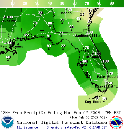
SHOWERS WITH A FEW THUNDERSTORMS WILL BE POSSIBLE TODAY AND
TONIGHT ACROSS ALL OF WEST CENTRAL AND SOUTHWEST FLORIDA AS AN
AREA OF LOW PRESSURE DEVELOPS OVER THE GULF WATERS AND MOVES
ACROSS THE STATE LATER THIS AFTERNOON AND TONIGHT. LOCALLY HEAVY
RAIN...DEADLY LIGHTNING...AND STRONG TO DAMAGING GUSTY WINDS AND A
FEW TORNADOES WILL BE POSSIBLE...WITH THE GREATEST RISK FOR SEVERE
WEATHER ALONG AND SOUTH OF A LINE FROM AVON PARK TO SARASOTA. IF
THUNDER IS HEARD OR LIGHTNING IS OBSERVED MOVE INDOOR IMMEDIATELY.


South Florida Including Miami will see rough weather with damaging winds and tornadoes a distinct possibility:
GLADES-HENDRY-INLAND PALM BEACH-METRO PALM BEACH-COASTAL COLLIER-
INLAND COLLIER-INLAND BROWARD-METRO BROWARD-INLAND MIAMI DADE-
METRO MIAMI DADE-MAINLAND MONROE-COASTAL PALM BEACH-
COASTAL BROWARD-COASTAL MIAMI DADE-FAR SOUTH MIAMI DADE-
1019 AM EST MON FEB 2 2009

...A FEW STRONG STORMS POSSIBLE THIS AFTERNOON...
...GULF STREAM SEAS BUILDING TO 7 FEET TONIGHT...
...MUCH COLDER TEMPERATURES EXPECTED TUESDAY THROUGH THURSDAY...
...HARD FREEZE POSSIBLE GLADES AND HENDRY COUNTIES WEDNESDAY NIGHT...

THIS HAZARDOUS WEATHER OUTLOOK IS FOR SOUTH FLORIDA.

.DAY ONE...TODAY AND TONIGHT

RIP CURRENTS: A SOUTH TO SOUTHEAST WIND OF NEAR 15 MPH ALONG THE
ATLANTIC COAST WILL RESULT IN A SLIGHT RISK OF RIP CURRENTS AT THE
BEACHES.

THUNDERSTORMS: A WARM FRONT WILL BE MOVING THROUGH SOUTH FLORIDA
LATE THIS MORNING INTO EARLY THIS AFTERNOON FOLLOWED BY A COLD
FRONT THIS EVENING. A FEW THUNDERSTORMS COULD DEVELOP ALONG BOTH
THE WARM FRONT AND THE COLD FRONT. ANY STORM THAT DOES DEVELOP WILL
BE CAPABLE OF PRODUCING LIGHTNING STRIKES, GUSTY WINDS, LOCALLY
HEAVY RAINFALL, AND MAYBE EVEN A TORNADO.

TORNADOES: IF ANY STORMS BECOME STRONG, THE ENVIRONMENT SUPPORTS
THE POSSIBILITY OF ONE OR TWO TORNADOES.

WATERSPOUTS: THE ENVIRONMENT OVER SOUTH FLORIDA WATERS TODAY WILL
BE FAVORABLE FOR WATERSPOUTS WITH ANY SHOWERS OR STORMS THAT DO
DEVELOP.

WIND: GUSTY WINDS OF 50 TO 60 MPH WILL BE POSSIBLE IN THE STRONGEST
STORMS THAT DEVELOP...THOUGH GUSTS OF 30 TO 40 MPH WILL BE MORE
COMMON, EVEN IN SHOWERS. SOUTHWEST WINDS OF AROUND 25 MPH WILL
DEVELOP OVER THE ATLANTIC WATERS AND THE OFFSHORE GULF WATERS
TONIGHT.
http://forecast.weather.gov/showsigwx.p ... er+Outlook
0 likes   

User avatar
HURAKAN
Professional-Met
Professional-Met
Posts: 46086
Age: 38
Joined: Thu May 20, 2004 4:34 pm
Location: Key West, FL
Contact:

#3729 Postby HURAKAN » Mon Feb 02, 2009 2:15 pm

Image
0 likes   

User avatar
Evil Jeremy
S2K Supporter
S2K Supporter
Posts: 5463
Age: 32
Joined: Mon Apr 10, 2006 2:10 pm
Location: Los Angeles, CA

#3730 Postby Evil Jeremy » Mon Feb 02, 2009 3:01 pm

The Mesoscale has come out for South Florida: http://www.spc.noaa.gov/products/md/md0063.html
0 likes   

User avatar
HURAKAN
Professional-Met
Professional-Met
Posts: 46086
Age: 38
Joined: Thu May 20, 2004 4:34 pm
Location: Key West, FL
Contact:

#3731 Postby HURAKAN » Mon Feb 02, 2009 3:05 pm

:uarrow:

Image
0 likes   

User avatar
Tampa Bay Hurricane
Category 5
Category 5
Posts: 5597
Age: 37
Joined: Fri Jul 22, 2005 7:54 pm
Location: St. Petersburg, FL

#3732 Postby Tampa Bay Hurricane » Mon Feb 02, 2009 3:29 pm

Heavy rain has been falling here- possibly over an inch...
Also a light breeze- sky is dark...
0 likes   

JonathanBelles
Professional-Met
Professional-Met
Posts: 11430
Age: 35
Joined: Sat Dec 24, 2005 9:00 pm
Location: School: Florida State University (Tallahassee, FL) Home: St. Petersburg, Florida
Contact:

#3733 Postby JonathanBelles » Mon Feb 02, 2009 3:56 pm

Not very interesting here at all.
0 likes   

User avatar
Tampa Bay Hurricane
Category 5
Category 5
Posts: 5597
Age: 37
Joined: Fri Jul 22, 2005 7:54 pm
Location: St. Petersburg, FL

#3734 Postby Tampa Bay Hurricane » Mon Feb 02, 2009 4:47 pm

Mostly a rain event- but after the rain cleared out, the winds
picked up out of the South to around 20 mph.
0 likes   

User avatar
Evil Jeremy
S2K Supporter
S2K Supporter
Posts: 5463
Age: 32
Joined: Mon Apr 10, 2006 2:10 pm
Location: Los Angeles, CA

Re: Florida Weather Thread: Active weather Monday, cold later

#3735 Postby Evil Jeremy » Mon Feb 02, 2009 5:18 pm

The Mesoscale is gone, so either it expired, or it was removed cause a Severe T-Storm watch is going up. We will see.
0 likes   

User avatar
Tampa Bay Hurricane
Category 5
Category 5
Posts: 5597
Age: 37
Joined: Fri Jul 22, 2005 7:54 pm
Location: St. Petersburg, FL

#3736 Postby Tampa Bay Hurricane » Mon Feb 02, 2009 5:37 pm

Severe Weather, Keys/South Florida:

Very nasty cell moving just north of key west:
http://radar.weather.gov/radar.php?rid= ... 11&loop=no
It is likely producing waterspouts

Dark/Light Purple showing up on composite radar
Also a well defined rotation and cyclonic turning
in the area of storms in a squall just West of the Keys-
watch out for waterspouts!
Looking at the squall line, the risk of severe weather in south florida
is increasing in my opinion
3 Special Marine Warnings NW of Key West...
Brief Tornado Signature- Just North of Key West
http://www.wunderground.com/radar/radbl ... 9&smooth=0

Windy here in Tampa Bay...in the last 2 hours winds have increased
to SW at 20-25 mph with occasional gusts to 30-35 mph...
0 likes   

jinftl
Category 5
Category 5
Posts: 4312
Joined: Tue Aug 31, 2004 4:47 pm
Location: fort lauderdale, fl

Re: Florida Weather Thread: Cold weekend, active weather later

#3737 Postby jinftl » Mon Feb 02, 2009 6:31 pm

May not be out of the question.....


excerpt from NWS Tampa Bay Discussion this pm:

DURING FRIDAY THROUGH MONDAY THE SURFACE HIGH WILL SHIFT EAST INTO
THE WESTERN ATLANTIC AS UPPER RIDGING BUILDS IN OVER THE GULF/PENINSULA
IN RESPONSE TO A DIGGING UPPER TROUGH OVER THE SOUTHWESTERN U.S.. DRY
STABLE AIR MASS UNDER THE RIDGING WILL SUPPORT DRY WEATHER THROUGH
THE PERIOD. DEVELOPING RETURN FLOW (EASTERLY) AROUND THE SURFACE HIGH
OVER THE ATLANTIC WILL ALLOW MOISTURE LEVELS AND TEMPERATURES TO MODIFY
THROUGH THE PERIOD WITH TEMPERATURES CLIMBING BACK TO CLIMATIC NORMS
OVER THE WEEKEND...AND THEN RISING TO SLIGHTLY ABOVE BY EARLY NEXT
WEEK
.

Saturday: Mostly sunny, with a high near 74.
Saturday Night: Mostly clear, with a low around 51.
Sunday: Mostly sunny, with a high near 76.
Sunday Night: Mostly clear, with a low around 56.
Monday: Sunny, with a high near 76.


excerpt from NWS Melbourne Discussion and forecast this pm:

FRI-SUN...SFC HIGH PUSHES EAST INTO THE ATLC AND A GRADUAL WARMING
TREND WILL OCCUR WITHIN DEEP ONSHORE (EAST) FLOW. RAIN CHANCES LOOK
TOO LOW TO MENTION AS ATMOS WILL BE SLOW TO MOISTEN. WEEKEND
LOOKS QUITE PLEASANT AT THIS TIME WITH HIGHS RETURNING TO THE LOW
TO MID 70S...AT OR SLIGHTLY ABOVE NORMAL.

Saturday: Mostly sunny, with a high near 71. East wind around 5 mph.
Saturday Night: Partly cloudy, with a low around 54. East wind around 5 mph.
Sunday: Mostly sunny, with a high near 76. East wind around 5 mph.
Sunday Night: Mostly clear, with a low around 56. East wind around 5 mph.
Monday: Sunny, with a high near 76. East wind around 5 mph.


excerpt from NWS Miami Discussion and forecast this pm:

FRIDAY ANY BEYOND...THE DEEP TROUGH PULLS AWAY WITH A RIDGE
BUILDING IN QUICKLY ACROSS THE AREA FROM THE WEST. THIS WILL LEAD
TO WARMING TEMPS...BACK ABOVE NORMAL BY LATE IN THE WEEKEND INTO
NEXT WEEK


Saturday: Mostly sunny and breezy, with a high near 74.
Saturday Night: Partly cloudy, with a low around 63.
Sunday: Mostly sunny, with a high near 77.
Sunday Night: Partly cloudy, with a low around 65.
Monday: Mostly sunny, with a high near 79.


frankthetank wrote:Whole state of Florida is in the 80's 10 days from now... My call :)
0 likes   

User avatar
Tampa Bay Hurricane
Category 5
Category 5
Posts: 5597
Age: 37
Joined: Fri Jul 22, 2005 7:54 pm
Location: St. Petersburg, FL

Re: Florida Weather Thread: Active weather Monday, cold later

#3738 Postby Tampa Bay Hurricane » Mon Feb 02, 2009 8:59 pm

Wind gusts of 50-65 mph reported in the Florida Keys:
http://www.ndbc.noaa.gov/station_page.php?station=VCAF1
55 mph Wind gust

Special Marine Warning
MARINE WEATHER STATEMENT
NATIONAL WEATHER SERVICE KEY WEST FL
826 PM EST MON FEB 2 2009

GMZ031-052-053-072-030200-
/O.CON.KKEY.MA.W.0012.000000T0000Z-090203T0200Z/
825 PM EST MON FEB 2 2009

...A SPECIAL MARINE WARNING REMAINS IN EFFECT UNTIL 900 PM EST...

FOR THE FOLLOWING AREAS...
WATERS FROM OCEAN REEF TO CRAIG KEY FL FROM 20 TO 60 NM...
COASTAL WATERS FROM CRAIG KEY TO THE WEST END OF THE 7 MILE BRIDGE
OUT 20 NM...
COASTAL WATERS FROM OCEAN REEF TO CRAIG KEY FL OUT 20 NM...
FLORIDA BAY...

AT 822 PM EST...NATIONAL WEATHER SERVICE DOPPLER RADAR INDICATED
A THUNDERSTORM...PRODUCING SEVERE WINDS IN EXCESS OF 50 KNOTS OVER
TENNESSEE REEF LIGHT...MOVING EAST AT 20 KNOTS. MARATHON AIRPORT
REPORTED WIND GUSTS TO 52 KNOTS WITH THIS THUNDERSTORM AT 758 PM.

MARINERS CAN EXPECT A STRONG SQUALL IN EXCESS OF 50 KNOTS...ROUGH
SEAS...DANGEROUS LIGHTNING...NEAR ZERO VISIBILITY IN BLINDING RAIN...
AND POSSIBLE WATERSPOUTS. BOATERS SHOULD SEEK HARBOR IMMEDIATELY.
http://forecast.weather.gov/showsigwx.p ... ne+Warning
Marathon Airport: 60 mph Gust
0 likes   

User avatar
HURAKAN
Professional-Met
Professional-Met
Posts: 46086
Age: 38
Joined: Thu May 20, 2004 4:34 pm
Location: Key West, FL
Contact:

#3739 Postby HURAKAN » Tue Feb 03, 2009 10:14 am

Accuweather.

Image

THE SUNSHINE STATE!
0 likes   

frankthetank
Category 2
Category 2
Posts: 527
Joined: Mon Aug 09, 2004 6:16 pm
Location: La Crosse, WI

#3740 Postby frankthetank » Tue Feb 03, 2009 10:15 am

According to the 6z, Miami has a low of 37F with quite a few hours in the 30's...
0 likes   


Return to “USA & Caribbean Weather”

Who is online

Users browsing this forum: No registered users and 19 guests