Florida Weather
Moderator: S2k Moderators
Forum rules

The posts in this forum are NOT official forecast and should not be used as such. They are just the opinion of the poster and may or may not be backed by sound meteorological data. They are NOT endorsed by any professional institution or STORM2K.
-
tropicana

- Category 5

- Posts: 8056
- Joined: Sat Sep 27, 2003 6:48 pm
- Location: Niagara Falls, Ontario, Canada
- Contact:
Re: Florida Weather Thread: Arctic air
Marathon Airport in the Florida Keys did see that wind gust to 60mph at 758pm last night, they also picked up 2.01 inches of much needed rainfall.
-justin-
-justin-
0 likes
-
Tampa Bay Hurricane

- Category 5
- Posts: 5597
- Age: 38
- Joined: Fri Jul 22, 2005 7:54 pm
- Location: St. Petersburg, FL
Re: Florida Weather Thread: Arctic air
Temps in the upper 30s tomorrow night would put this cold snap on par with January 3, 2008 when both Miami and Fort Lauderdale (airports) hit 39F. All hope for a progressively milder weekend is not lost though....temps rebound quite a bit by then.
AREA FORECAST DISCUSSION
NATIONAL WEATHER SERVICE MIAMI FL
921 AM EST TUE FEB 3 2009
DISCUSSION...ONE COLD FRONT WILL EXIT THE AREA THIS MORNING. A
FEW SHOWERS ARE SEEN ON RADAR OFF THE WEST CENTRAL FL COAST WITH
SPRINKLES ACROSS PARTS OF THE AREA...SO ADDED JUST SLIGHT CHC
LIGHT SHOWERS TO THE FCST FOR THIS MORNING. OTHERWISE...SKIES WILL
CLEAR THIS AFTERNOON AS COLD HIGH PRESSURE BUILDS INTO THE AREA
FROM THE NORTHWEST. MUCH DRIER AIR WILL ARRIVE THIS EVENING WITH
DEWPOINTS PLUMMETING INTO THE 30S. THIS WILL SET THE STAGE FOR A
COLD NIGHT WITH 30S INLAND AND 40S AT THE COASTS. THE SAVING GRACE
FOR A FREEZE ACROSS INTERIOR AREAS TONIGHT LOOKS TO BE SLIGHT
MOISTURE ADVECTION OVERNIGHT ESP JUST ABOVE THE SFC AND VEERING
WINDS...ALBEIT LIGHT OVERNIGHT. THIS IS EXPECTED TO KEEP MINS FROM
REACHING THE FREEZING MARK ACROSS N INTERIOR AREAS...THOUGH TRENDS
WILL OF COURSE NEED TO BE WATCHED.
THE LUCK RUNS OUT TOMORROW NIGHT AS A DRY BUT VERY STRONG COLD
FRONT RACES SOUTH OUT OF THE GREAT LAKES AND ACROSS SOUTH FL ON
WEDNESDAY. THIS FRONT LOOKS TO BRING THE COLDEST AIRMASS OF THIS
WINTER SEASON TO THE AREA. 1000-850MB THICKNESSES ON THE LATEST
GFS ARE NOTHING SHORT OF IMPRESSIVE...1293 AT THE LAKE TO 1306 AT
MIAMI. THE LATEST ECMWF SHOWS 1299 AT THE LAKE TO 1311. ENSEMBLE
MEAN VS. OPERATIONAL GFS FROM YESTERDAY (NEWEST NOT IN) WERE
ACTUALLY WITHIN A FEW DEGREES OF EACH OTHER...LENDING TO HIGHER
CONFIDENCE FOR THIS UPCOMING COLD/FREEZE EPISODE. THEREFORE...HAVE
INITIATED HARD FREEZE AND FREEZE WATCHES FOR MUCH OF THE AREA FOR
WED NIGHT/THU MORNING.
A FREEZE IS LIKELY INTERIOR...AND EVEN POSSIBLE ALL THE WAY TO
THE GULF COAST. ON THE EAST COAST...THE TYPICAL COLDER LOCALES
DURING COLD EVENTS SUCH AS THE REDLAND AND WEST KENDALL COULD SEE
A FREEZE. FOR NOW THOUGH...MOST OF THE GOLD COAST SHOULD STAY
ABOVE FREEZING...BUT TEMPS ARE EXPECTED TO FALL INTO THE 30S ALL
THE WAY TO THE ATLANTIC COAST...AND WITH A NW WIND OF 10 TO 15
MPH...LOW WIND CHILLS WILL BE GENERATED...AS LOW AS THE MID TO
UPPER 20S EVEN TO THE BEACHES. WIND CHILL HEADLINES WILL BE
NEEDED AS THIS COLD EPISODE GETS CLOSER.
FOLLOWING ARE THE FORECAST LOW`S FOR THU 2/5 AND THE RECORDS:
FORECASTS (RECORD-YEAR)
MIAMI 38 (35 - 1958)
FT. LAUDERDALE 38 (31 - 1958)
WEST PALM BEACH 34 (33 - 1996)
NAPLES 36 (32 - 1996)
SHOULD NOTE THAT IF TEMPS TREND LOWER NEXT 24 HR...THEN THE FREEZE
WATCH WOULD NEED TO BE EXPANDED TO ENCOMPASS THE EAST COAST
METROPOLITAN AREAS. CONFIDENCE WAS JUST NOT THERE TO INCLUDE
THESE ZONES IN THE WATCH AT THIS TIME.
THE AIRMASS WILL TAKE TIME TO MODIFY...SO ANOTHER FREEZE IS
POSSIBLE ACROSS NW INTERIOR AREAS AGAIN FRIDAY MORNING. TEMPS WILL
MODERATE BY THE UPCOMING WEEKEND WITH TEMPS RETURNING BACK TOWARDS
NORMAL...AND THEN EVEN ABOVE NORMAL FOR MUCH OF NEXT WEEK.
0 likes
-
DESTRUCTION5

- Category 5
- Posts: 4430
- Age: 44
- Joined: Wed Sep 03, 2003 11:25 am
- Location: Stuart, FL
Forecast for Chobee Looks Pretty Chilly...
Wednesday: Sunny, with a high near 61. Wind chill values as low as 31 early. Windy, with a west northwest wind 5 to 10 mph increasing to between 15 and 20 mph. Winds could gust as high as 25 mph.
Wednesday Night: Clear, with a low around 27. Wind chill values as low as 19. Northwest wind around 10 mph.
Thursday: Sunny, with a high near 57. North northwest wind between 5 and 10 mph.
Thursday Night: Mostly clear, with a low around 34. North northwest wind around 5 mph.
http://forecast.weather.gov/MapClick.ph ... it=0&lg=en
 (sorry, I never get to use that emocian)
Wednesday: Sunny, with a high near 61. Wind chill values as low as 31 early. Windy, with a west northwest wind 5 to 10 mph increasing to between 15 and 20 mph. Winds could gust as high as 25 mph.
Wednesday Night: Clear, with a low around 27. Wind chill values as low as 19. Northwest wind around 10 mph.
Thursday: Sunny, with a high near 57. North northwest wind between 5 and 10 mph.
Thursday Night: Mostly clear, with a low around 34. North northwest wind around 5 mph.
http://forecast.weather.gov/MapClick.ph ... it=0&lg=en
(sorry, I never get to use that emocian)
0 likes
Re: Florida Weather Thread: Arctic air
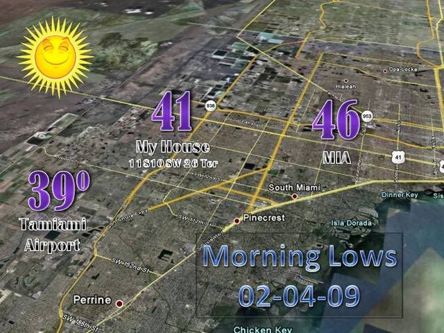
Current temps

Might want to take a dip in the ocean to warm up the next few days!

Might want to take a dip in the ocean to warm up the next few days!
0 likes
Re: Florida Weather Thread: Arctic air
Front brought some relief to the central and northern peninsula....but the 0.1-0.2" rainfall across south florida didn't do too much to alleviate the very dry conditions.....add in the extremely dry airmass moving in and we will see conditions head back in the wrong direction this week...
DROUGHT INFORMATION STATEMENT
NATIONAL WEATHER SERVICE MIAMI FL
330 AM EDT SUN FEB 1 2009
...MODERATE DROUGHT CONDITIONS DEVELOPED OVER EAST COAST METRO
AREAS...
...ABNORMALLY DRY CONDITIONS ELSEWHERE ACROSS SOUTH FLORIDA...
SYNOPSIS...
HIGH PRESSURE HAS BEEN MOSTLY IN CONTROL OF SOUTH FLORIDA FOR THE
FIRST THREE MONTHS OF THE DRY SEASON OF 2008-09. THIS HAS LEAD TO
BELOW NORMAL RAINFALL ACROSS SOUTH FLORIDA.
AS A RESULT...THE NATIONAL DROUGHT MONITOR PERSONNEL HAVE BROUGHT
BACK ABNORMALLY DRY CONDITIONS (D0) ACROSS MOST OF SOUTH
FLORIDA...EXCEPT FOR MODERATE DROUGHT CONDITIONS (D1) ALONG THE EAST
COAST METRO AREAS.
HYDROLOGIC IMPACTS...
THE WELLS ACROSS THE EAST COAST METRO AREAS AND AROUND LAKE
OKEECHOBEE WERE 10 TO 30 PERCENT BELOW THE NORMAL LEVEL...WHILE THE
REST OF THE WELLS WERE AT NEAR NORMAL LEVELS.
THE UNDERGROUND RESERVOIRS OVER ALL OF SOUTH FLORIDA WERE STILL AT
NEAR NORMAL LEVELS. THE LEVEL OF LAKE OKEECHOBEE WAS 13.40 FEET.
THIS IS ABOUT 1.3 FEET BELOW NORMAL FOR THIS TIME OF THE YEAR.
FISHEATING CREEK WAS AROUND 0.9 FEET WHICH WAS 5 PERCENT OF THE
NORMAL LEVEL FOR THIS TIME OF YEAR.
FIRE DANGER IMPACTS...
THE KEETCH-BYRAM DROUGHT INDEX ACROSS SOUTH FLORIDA WAS BETWEEN
600 TO 650...EXCEPT 650 TO 700 AROUND LAKE OKEECHOBEE AND PALM BEACH
COUNTY. THIS STILL INDICATES THAT THE FIRE DANGER IS IN THE SEVERE
RANGE FOR ALL OF SOUTH FLORIDA.
RESPONSE/ACTIONS...
THE SOUTH FLORIDA WATER MANAGEMENT DISTRICT HAS KEPT THE WATER
RESTRICTION AT A PHASE II OVER MOST OF SOUTH FLORIDA. THE ONLY
EXCEPTION IS AROUND THE LAKE OKEECHOBEE AREA WHICH IS IN A PHASE III
WATER RESTRICTION DUE TO THE LOW LEVEL OF LAKE OKEECHOBEE. THIS WILL
LIMIT MOST RESIDENTIAL AND COMMERCIAL WATER USAGE TO TWICE A
WEEK...EXCEPT ONCE A WEEK AROUND THE LAKE OKEECHOBEE AREA.
OUTLOOK...
A COLD FRONT WILL MOVE THROUGH SOUTH FLORIDA LATE MONDAY INTO EARLY
TUESDAY ALLOWING FOR A CHANCE OF SHOWERS AND A SLIGHT CHANCE OF
THUNDERSTORMS ACROSS THE AREA ON MONDAY. HIGH PRESSURE WILL THEN
BUILD INTO SOUTH FLORIDA FOR THE MIDDLE TO END OF THIS WEEK INTO
NEXT WEEKEND KEEPING THE AREA MOSTLY DRY.
THE CLIMATE PREDICTION CENTER`S PRECIPITATION OUTLOOK FOR THE NEXT
14 DAYS IS FOR BELOW NORMAL RAINFALL. THE LONGER TERM OUTLOOK FOR
LATE FEBRUARY THROUGH MARCH IS FOR BELOW NORMAL RAINFALL.
THE NEXT UPDATE WILL BE AROUND THE MIDDLE OF FEBRUARY UNLESS CONDITIONS
CHANGE BEFORE THEN. STAY TUNED TO NOAA WEATHER RADIO AND OTHER LOCAL
MEDIA FOR FURTHER DETAILS OR UPDATES.
$$
BAXTER
0 likes
-
Tampa Bay Hurricane
- Category 5
- Posts: 5597
- Age: 38
- Joined: Fri Jul 22, 2005 7:54 pm
- Location: St. Petersburg, FL
Re: Florida Weather Thread: Arctic air
Record Cold and a Harsh Freeze likely Thursday night...then temperatures
5-10 degrees above normal by the weekend...
Interior south florida and central florida will see low 20s thursday morning-
tampa downtown will see a temperature of 28*F, the coldest since January
24, 2003...and before that, 1996.
Saint Petersburg is forecasted to be around 37*F, but it will likely be
around 30-32*F except in concrete areas and on open gulf water...
0 likes


-
JonathanBelles
- Professional-Met

- Posts: 11430
- Age: 35
- Joined: Sat Dec 24, 2005 9:00 pm
- Location: School: Florida State University (Tallahassee, FL) Home: St. Petersburg, Florida
- Contact:
-
Tampa Bay Hurricane
- Category 5
- Posts: 5597
- Age: 38
- Joined: Fri Jul 22, 2005 7:54 pm
- Location: St. Petersburg, FL
-
JonathanBelles
- Professional-Met
- Posts: 11430
- Age: 35
- Joined: Sat Dec 24, 2005 9:00 pm
- Location: School: Florida State University (Tallahassee, FL) Home: St. Petersburg, Florida
- Contact:
-
frankthetank
- Category 2

- Posts: 527
- Joined: Mon Aug 09, 2004 6:16 pm
- Location: La Crosse, WI
Re: Florida Weather Thread: Arctic air
0Z showing a 38F for Miami.... So should have some crunchy plants inland...
0 likes
-
HURAKAN

- Professional-Met
- Posts: 46084
- Age: 39
- Joined: Thu May 20, 2004 4:34 pm
- Location: Key West, FL
- Contact:
Re: Florida Weather Thread: Arctic air
frankthetank wrote:0Z showing a 38F for Miami.... So should have some crunchy plants inland...

Winds won't be calm, which means that in general the crunch will be limited to the cold places.
0 likes
Re:
fact789 wrote:Why are thy still issuing freeze warnings in places that have been impacted by hard freezes already?
they never stop issuing freeze warnings in Florida. Perhaps this is due to ongoing agricultural interests even if a given area has already experienced a hard freeze? It feels really cold out there tonight. I hope we get through this week ok. We had minimal damage from the last one so hopefully this won't be any worse but it looks dicey.
0 likes
-
JonathanBelles
- Professional-Met
- Posts: 11430
- Age: 35
- Joined: Sat Dec 24, 2005 9:00 pm
- Location: School: Florida State University (Tallahassee, FL) Home: St. Petersburg, Florida
- Contact:
Re: Re:
psyclone wrote:fact789 wrote:Why are thy still issuing freeze warnings in places that have been impacted by hard freezes already?
they never stop issuing freeze warnings in Florida. Perhaps this is due to ongoing agricultural interests even if a given area has already experienced a hard freeze? It feels really cold out there tonight. I hope we get through this week ok. We had minimal damage from the last one so hopefully this won't be any worse but it looks dicey.
I believe Tally stopped issuing regular Freeze Warnings a long time ago.
0 likes
Re: Re:
fact789 wrote:psyclone wrote:fact789 wrote:Why are thy still issuing freeze warnings in places that have been impacted by hard freezes already?
they never stop issuing freeze warnings in Florida. Perhaps this is due to ongoing agricultural interests even if a given area has already experienced a hard freeze? It feels really cold out there tonight. I hope we get through this week ok. We had minimal damage from the last one so hopefully this won't be any worse but it looks dicey.
I believe Tally stopped issuing regular Freeze Warnings a long time ago.
I should have qualified...peninsular Florida. Ruskin won't stop issuing freeze warnings, even for their northern counties which have been frozen solid multiple times already. Jax also never stops. Tlh does continue hard freeze warnings (protect those pipes) and they're about to get a doozy.
0 likes
Return to “USA & Caribbean Weather”
Who is online
Users browsing this forum: No registered users and 18 guests