Florida Weather
Moderator: S2k Moderators
Forum rules

The posts in this forum are NOT official forecast and should not be used as such. They are just the opinion of the poster and may or may not be backed by sound meteorological data. They are NOT endorsed by any professional institution or STORM2K.
-
JonathanBelles
- Professional-Met

- Posts: 11430
- Age: 35
- Joined: Sat Dec 24, 2005 9:00 pm
- Location: School: Florida State University (Tallahassee, FL) Home: St. Petersburg, Florida
- Contact:
-
HURAKAN

- Professional-Met
- Posts: 46084
- Age: 39
- Joined: Thu May 20, 2004 4:34 pm
- Location: Key West, FL
- Contact:
Re: Florida Weather Thread: Cold front passes this weekend

By the way, it rained in my cousin's baseball practice game.
0 likes
-
JonathanBelles
- Professional-Met
- Posts: 11430
- Age: 35
- Joined: Sat Dec 24, 2005 9:00 pm
- Location: School: Florida State University (Tallahassee, FL) Home: St. Petersburg, Florida
- Contact:
-
HURRICANELONNY
- Category 5

- Posts: 1390
- Joined: Wed May 07, 2003 6:48 am
- Location: HOLLYWOOD.FL
Re: Florida Weather Thread: Cold front passes this weekend
I must admit. I never thought the models would come together. March comes in on the cold side. Bottle it up. Soon will be 90 everyday.
http://www.wunderground.com/DisplayDisc ... Lauderdale
http://www.wunderground.com/DisplayDisc ... Lauderdale
0 likes
-
jaxfladude
- Category 5
- Posts: 1249
- Joined: Wed Aug 24, 2005 9:36 pm
- Location: Jacksonville, Fla
Re: Florida Weather Thread: Cold front passes this weekend
Nasty weather around this time Tomorrow(Sat. Feb 28th, 2009) then gets cold for my area.......
0 likes
-
tropicana

- Category 5
- Posts: 8056
- Joined: Sat Sep 27, 2003 6:48 pm
- Location: Niagara Falls, Ontario, Canada
- Contact:
Re: Florida Weather Thread: Cold front passes this weekend
Interesting info:
Key West FL has failed to hit 80F all month (Feb 2009), the last time Key West hit at least 80F was January 30/09.
The warmest temp all month at Key West has been 79F on Feb 12 and Feb 14.
-justin-
Key West FL has failed to hit 80F all month (Feb 2009), the last time Key West hit at least 80F was January 30/09.
The warmest temp all month at Key West has been 79F on Feb 12 and Feb 14.
-justin-
0 likes
Re: Florida Weather Thread: Day 1 SLGT risk for N. FL
URGENT - FIRE WEATHER MESSAGE
NATIONAL WEATHER SERVICE MIAMI FL
251 PM EST SAT FEB 28 2009
GLADES-HENDRY-INLAND PALM BEACH-METRO PALM BEACH-INLAND COLLIER-
INLAND BROWARD-METRO BROWARD-INLAND MIAMI DADE-METRO MIAMI DADE-
THE NATIONAL WEATHER SERVICE IN MIAMI HAS ISSUED A FIRE WEATHER
WATCH...WHICH IS IN EFFECT FROM MONDAY MORNING THROUGH MONDAY
EVENING.
A MUCH DRIER AIRMASS WILL MOVE SOUTH INTO SOUTH FLORIDA EARLY NEXT
WEEK BEHIND A STRONG COLD FRONT. DEWPOINTS WILL DROP THROUGH THE
30S ON MONDAY WITH HIGH TEMPERATURES RANGING IN THE 60S TO LOWER
70S. THIS COULD PRODUCE A POSSIBILITY OF RED FLAG CONDITIONS
ACROSS INTERIOR SOUTH FLORIDA. IT IS POSSIBLE THAT RELATIVE
HUMIDITIES MAY FALL BELOW 35 PERCENT FOR 4 OR MORE CONSECUTIVE
HOURS.
0 likes
-
JonathanBelles
- Professional-Met
- Posts: 11430
- Age: 35
- Joined: Sat Dec 24, 2005 9:00 pm
- Location: School: Florida State University (Tallahassee, FL) Home: St. Petersburg, Florida
- Contact:
Re:
Map of actve wildfires in u.s.....area around Lake O is getting going.....any smoke will catch the nw flow after the front passes tomorrow and move over se fl.
ftp://satepsanone.nesdis.noaa.gov/FIRE/HMS/GRAPHIC/hms20090228.prelim.jpg
ftp://satepsanone.nesdis.noaa.gov/FIRE/HMS/GRAPHIC/hms20090228.prelim.jpg
fact789 wrote:Just in a 25 minute walk to and back from SweetBay, my eyes were burning! I think its from the smoke/allergies right now.
0 likes
-
JonathanBelles
- Professional-Met
- Posts: 11430
- Age: 35
- Joined: Sat Dec 24, 2005 9:00 pm
- Location: School: Florida State University (Tallahassee, FL) Home: St. Petersburg, Florida
- Contact:
Re:
The map in the link below lets you zoom in on the state in quite a bit of detail....red dots indicate current fires...as of post time, looks to be 9 or so fires burning (all apparently small in size) on the peninsula from the I-4 corridor south....exactly in line with the areas showing the highest KBDI values.
http://activefiremaps.fs.fed.us/fireplo ... 9_1500.jpg
Latest KBDI:

http://activefiremaps.fs.fed.us/fireplo ... 9_1500.jpg
Latest KBDI:
fact789 wrote:Can you get that map just of the US or (preferably) Florida?
0 likes
-
JonathanBelles
- Professional-Met
- Posts: 11430
- Age: 35
- Joined: Sat Dec 24, 2005 9:00 pm
- Location: School: Florida State University (Tallahassee, FL) Home: St. Petersburg, Florida
- Contact:
-
Tampa Bay Hurricane

- Category 5
- Posts: 5597
- Age: 38
- Joined: Fri Jul 22, 2005 7:54 pm
- Location: St. Petersburg, FL
Moderate Rain with strong winds:
NW 33, G 38 mph
http://www.wunderground.com/weatherstat ... ?ID=MCCUF1
NW 33, G 38 mph
http://www.wunderground.com/weatherstat ... ?ID=MCCUF1
0 likes
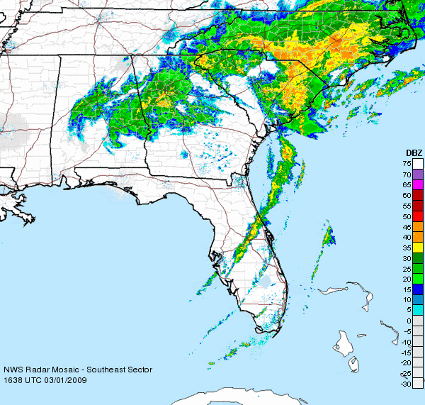
Re: Florida Weather Thread: Day 1 SLGT risk for N. FL
Rain chances continue to diminish for south florida...
FXUS62 KMFL 011440
AFDMFL
AREA FORECAST DISCUSSION
NATIONAL WEATHER SERVICE MIAMI FL
940 AM EST SUN MAR 1 2009
.UPDATE...PLAN TO MAKE SOME SIGNIFICANT CHANGES TO PREVIOUS
FORECAST WITH THE MAIN DIFFERENCE TAKING MENTION OF THUNDER OUT OF
THE FORECAST. FIRST OF ALL, VERY THIN ROPE LIKE FEATURE ON VISIBLE
SATELLITE IMAGERY MARKS THE BOUNDARY OF THE FRONT WITH RADAR
SIGNATURES SHOWING NARROW BAND OF SHRA ALONG THIS BOUNDARY. THERE
ALSO HAS NOT BEEN ANY LIGHTNING DETECTED IN THIS LINE FOR THE PAST
HOUR OR SO. SECONDLY, THE 12Z MFL SOUNDING STILL SHOWS QUITE DRY
AIR ALOFT OVER SOUTH FLORIDA BUT THE MORE STANDOUT FEATURE IS THE
VERY STABLE LAYER FROM JUST ABOVE THE SURFACE TO ABOUT 10K FEET.
THIS WILL GREATLY INHIBIT ANY FORCING FOR TSRA DEVELOPMENT SO HAVE
DECIDED TO SCALE BACK TO ONLY ISOLATED SHRA AND TAKE OUT MENTION
OF THUNDER ALTOGETHER. MAV GUIDANCE FROM 06Z HAD ONLY ISOLATED
POPS AS WELL WITH EVEN 00Z MET GUIDANCE WITH ONLY 10 PERCENT. ALL
OTHER PARAMETERS LOOK IN GOOD SHAPE SO SHOULD HAVE THESE CHANGES
OUT BY THE TOP OF THE HOUR.
&&
0 likes
-
gatorcane

- S2K Supporter

- Posts: 23708
- Age: 48
- Joined: Sun Mar 13, 2005 3:54 pm
- Location: Boca Raton, FL
These cold fronts are rather impressive I must admit. Typically March 1st marks the end of winter for South Florida. But lows across much of the South Florida CWA are going to be in the 40s and even 30s (well inland North and West) for a couple days in a row (also unusual).
I really can't wait until this long-wave pattern of intense troughiness along the Eastern CONUS lets up. Even so, as the sun-angle continues to get higher in the sky and the days get longer, its going to be tough to get the temps to fall into the 40s in South Florida...so even if this long-wave pattern persists, its only so longer until we see lows in the 60s and 70s with highs in the 80s. This has been quite a cold winter for Florida and much, much colder across the rest of the Eastern CONUS.
Of course what I will closely monitor is what happens in about 6 months? Will this intense troughiness let up for a few months and the long-wave pattern shift to Western Atlantic ridging? Although looking out this far is nearly impossible, it wouldn't surprise me if this long-wave pattern is replaced by some ridging across the Eastern CONUS for some big chunks of the summer. Well that is a discussion for Talkin Tropics.
Last edited by gatorcane on Sun Mar 01, 2009 12:22 pm, edited 1 time in total.
0 likes
-
HURRICANELONNY
- Category 5
- Posts: 1390
- Joined: Wed May 07, 2003 6:48 am
- Location: HOLLYWOOD.FL
Re:
March is very much a month of transition as far as 'how cold' it can get in south florida....while fronts are not as frequent even early in the month (like the one we are seeing now), they can still pack a punch. Looking at the record lows for the first week of March, it has definitely gotten 'winter cold' in the past. Record lows in Miami are still in the 30's and low 40's early month. By late March, there is a definite and somewhat dramatic change in how cold it has gotten in the past. Record lows increase to the mid 40's to even low 50's by late in the month in Miami.
In other words, our front today is a bit unusual for so late in the season, but doesn't appear to be in line to reach record low status. In 3 weeks or so, a front of this magnitude would be very unlikely to occur...and if it did, would establish many new record lows. Given the increasing sun angle, length of days, reduction in arctic air to pull from to our north, it is not hard to understand why this change takes place in March.
In other words, our front today is a bit unusual for so late in the season, but doesn't appear to be in line to reach record low status. In 3 weeks or so, a front of this magnitude would be very unlikely to occur...and if it did, would establish many new record lows. Given the increasing sun angle, length of days, reduction in arctic air to pull from to our north, it is not hard to understand why this change takes place in March.
gatorcane wrote:These cold fronts are rather impressive I must admit. Typically March 1st marks the end of winter for South Florida. But lows across much of the South Florida CWA are going to be in the 40s and even 30s (well inland North and West) for a couple days in a row (also unusual).
I really can't wait until this long-wave pattern of intense troughiness along the Eastern CONUS lets up. Even so, as the sun-angle continues to get higher in the sky and the days get longer, its going to be tough to get the temps to fall into the 40s in South Florida...so even if this long-wave pattern persists, its only so longer until we see lows in the 60s and 70s with highs in the 80s. This has been quite a cold winter for Florida and much, much colder across the rest of the Eastern CONUS.
Of course what I will closely monitor is what happens in about 6 months? Will this intense troughiness let up for a few months and the long-wave pattern shift to Western Atlantic ridging? Although looking out this far is nearly impossible, it wouldn't surprise me if this long-wave pattern is replaced by some ridging across the Eastern CONUS for some big chunks of the summer. Well that is a discussion for Talkin Tropics.
0 likes
-
JonathanBelles
- Professional-Met
- Posts: 11430
- Age: 35
- Joined: Sat Dec 24, 2005 9:00 pm
- Location: School: Florida State University (Tallahassee, FL) Home: St. Petersburg, Florida
- Contact:
Return to “USA & Caribbean Weather”
Who is online
Users browsing this forum: No registered users and 18 guests