Fire temporarily closes I-95 in West Palm Beach
By Patty Pensa | South Florida Sun-Sentinel
5:28 PM EDT, March 16, 2009
WEST PALM BEACH - Interstate 95 was shut down at southbound 45th Street in West Palm Beach today so firefighters could battle a brush fire nearby, Lt. Tim Frith of the Florida Highway Patrol said.
The highway was shut down completely for about 20 minutes and partially closed for another 40 minutes from about 2 to 3 p.m., Frith said.
Traffic was backed up to Blue Heron Boulevard in Riviera Beach. A few fender-benders occurred on the clogged interstate, Frith said.
Florida Weather
Moderator: S2k Moderators
Forum rules

The posts in this forum are NOT official forecast and should not be used as such. They are just the opinion of the poster and may or may not be backed by sound meteorological data. They are NOT endorsed by any professional institution or STORM2K.
-
gatorcane

- S2K Supporter

- Posts: 23708
- Age: 48
- Joined: Sun Mar 13, 2005 3:54 pm
- Location: Boca Raton, FL
Re: Florida Weather Thread: Dry weather pattern continues
Well I'll say it again, I'm not really worried about the drought especially in SE Florida. We are getting closer by the day to the rainy season where rains should fall nearly everyday (again expecting a pattern to start the rainy season with afternoon/evening boomers along the SE Coast of Florida, morning showers SW Coast with plenty of troughiness still dominating the Eastern CONUS).
Indeed rainfall chances keep rising over SE Florida. Here is West Palm Beach. 50% chance of rain on the way folks.
Tonight: Partly cloudy, with a low around 62. South wind between 3 and 8 mph.
Tuesday: A 30 percent chance of showers, mainly after 9am. Patchy fog before 9am. Otherwise, mostly cloudy, with a high near 81. Calm wind becoming east between 6 and 9 mph.
Tuesday Night: A 30 percent chance of showers. Mostly cloudy, with a low around 65. East wind around 9 mph.
Wednesday: A 50 percent chance of showers. Mostly cloudy, with a high near 80. East wind between 10 and 15 mph, with gusts as high as 20 mph.
Wednesday Night: A 30 percent chance of showers. Partly cloudy, with a low around 64. East wind between 6 and 11 mph.
Thursday: A 20 percent chance of showers. Partly cloudy, with a high near 81. Northeast wind around 6 mph.
0 likes
-
DESTRUCTION5

- Category 5

- Posts: 4430
- Age: 44
- Joined: Wed Sep 03, 2003 11:25 am
- Location: Stuart, FL
Re: Florida Weather Thread: Dry weather pattern continues
gatorcane wrote:Well I'll say it again, I'm not really worried about the drought especially in SE Florida. We are getting closer by the day to the rainy season where rains should fall nearly everyday (again expecting a pattern to start the rainy season with afternoon/evening boomers along the SE Coast of Florida, morning showers SW Coast with plenty of troughiness still dominating the Eastern CONUS).
Indeed rainfall chances keep rising over SE Florida. Here is West Palm Beach. 50% chance of rain on the way folks.
Tonight: Partly cloudy, with a low around 62. South wind between 3 and 8 mph.
Tuesday: A 30 percent chance of showers, mainly after 9am. Patchy fog before 9am. Otherwise, mostly cloudy, with a high near 81. Calm wind becoming east between 6 and 9 mph.
Tuesday Night: A 30 percent chance of showers. Mostly cloudy, with a low around 65. East wind around 9 mph.
Wednesday: A 50 percent chance of showers. Mostly cloudy, with a high near 80. East wind between 10 and 15 mph, with gusts as high as 20 mph.
Wednesday Night: A 30 percent chance of showers. Partly cloudy, with a low around 64. East wind between 6 and 11 mph.
Thursday: A 20 percent chance of showers. Partly cloudy, with a high near 81. Northeast wind around 6 mph.
When i see a puddle on the ground...Ill believe it....
0 likes

Re: Florida Weather Thread: Dry weather pattern continues
I'm willing to bet that they lower the rain chance from the current 50% for Wed down to 20%. The surrounding offices have a 20% chance on Tuesday for Central Florida and this front is going to fizzle out even further as it heads to S FL on Wed.
0 likes
Here's a real shocker the rain chance went from 50% to 40%. I'm saying by tomorrow it should by 20 or 30% at most.
http://forecast.weather.gov/MapClick.ph ... 9&map.y=84
http://forecast.weather.gov/MapClick.ph ... 9&map.y=84
0 likes
-
Evil Jeremy

- S2K Supporter
- Posts: 5463
- Age: 32
- Joined: Mon Apr 10, 2006 2:10 pm
- Location: Los Angeles, CA
Re: Florida Weather Thread: Cold front brings needed rain
I think the NWS office is being to generous with their forecast again. I doubt we will get more than a few drops of rain, if any at all. Anyways, lots of fog this morning heading north along the Sawgrass Expressway. I am surprised that there is at least a 20% of rain for my area until Monday. Is our rainy season coming early this year?
0 likes
-
DESTRUCTION5
- Category 5
- Posts: 4430
- Age: 44
- Joined: Wed Sep 03, 2003 11:25 am
- Location: Stuart, FL
Were there goes that 50% chance...
Today: A 20 percent chance of showers. Mostly cloudy, with a high near 81. Calm wind becoming northeast between 5 and 10 mph.
Tonight: A 20 percent chance of showers. Mostly cloudy, with a low around 65. North northeast wind around 10 mph.
Wednesday: A 20 percent chance of showers. Mostly cloudy, with a high near 76. East northeast wind around 15 mph, with gusts as high as 20 mph.
Wednesday Night: A 20 percent chance of showers. Mostly cloudy, with a low around 65. East wind between 5 and 10 mph.
Thursday: A 20 percent chance of showers. Partly cloudy, with a high near 77. East wind between 5 and 10 mph.
http://forecast.weather.gov/MapClick.ph ... 2=-80.2432
0 likes
Re: Florida Weather Thread: Cold front brings needed rain
A quarter or a half inch of rain will not end the drought....but it will cut the immediate fire danger some if it materializes and is widespread. Some areas are more than 1 foot behind normal rain in just the past 5 months, so 0.25" is a 'drop in the bucket' in terms of ending the drought.
From the NWS Miami Discussion early today:
THE RAINFALL AMOUNTS DURING THE NEXT COUPLE OF DAYS OVER SOUTH
FLORIDA WILL NOT BE MUCH...AS MID TO UPPER LEVEL SUPPORT FOR DEEP
CONVECTION ALONG THE FRONT WILL BE WELL NORTHEAST OF SOUTH
FLORIDA. SO WE ARE ONLY EXPECTING ABOUT HALF AN INCH OVER THE EAST
COAST METRO AREAS...TO AROUND QUARTER OF AN INCH OVER THE WEST
COAST METRO AREAS. SO AT THIS TIME...THIS WILL NOT BE A DROUGHT
BUSTER FOR SOUTH FLORIDA BUT IT COULD HELP TO REDUCE THE FIRE
DANGER A LITTLE BIT.
While the rainy season is coming in a few months, there is one annual cycle that begins in mid-March and goes through part of May....even in a non-drought year...that is Florida Fire Season. Entering that following the driest winter on record in places (top 3 driest in most in south fla locations...#1 driest of all time in Fort Lauderdale)...coupled with the forecast of continued below normal rainfall through the spring...is what is leading to the heightened concern about water shortages, brushfires, etc.
NWS Miami even mentions the volatiles conditions in the Discussion this morning:
ON THE SIDE NOTE...ALL OF SOUTH FLORIDA IS NOW AT LEAST 700 ON THE
KBDI INDEX WHICH IS IN THE EXTREME FIRE DANGER...EXCEPT FOR
MAINLAND MONROE COUNTY WHICH IS IN THE 650 TO 700 RANGE WHICH IS
IN THE SEVERE FIRE DANGER.
Mother Nature will balance things out in time...and with the hurricane season approaching (along with JB...taken with a grain of salt...alluding to hints of a 2004 season-type set-up), it may take a tropical system to really fill up the lakes and reservoirs and cut the fire danger.
http://www.srh.noaa.gov/fwd/productview ... &version=0
0 likes
-
Tampa Bay Hurricane

- Category 5
- Posts: 5597
- Age: 38
- Joined: Fri Jul 22, 2005 7:54 pm
- Location: St. Petersburg, FL
Re:
NWS Tampa Bay not bullish at all on much rain from that area...
AS FOR RAIN CHANCES CURRENT 88D RETURNS SHOW A LARGE AREA OF MAINLY LIGHT RAIN/
SHOWERS OVER THE ADJACENT GULF WATERS MOVING EAST. HOWEVER WITH LIMITED
MOISTURE AND INSTABILITY OVER THE FORECAST AREA VIA 12Z RAOB DATA AND
THE AFOREMENTIONED SHORT WAVE MOVING AWAY FROM THE REGION OVERALL RAIN
CHANCES AND AMOUNTS SHOULD REMAIN LOW (POPS ~20% AT BEST) WITH JUST
A FEW LIGHT SHOWERS OR SPRINKLES EXPECTED THE REMAINDER OF TODAY.
In fact, after 20% chance of showers today, no more rain mentioned in forecast product.
Tampa Bay Hurricane wrote:large patch of rain moving towards tampa bay!!!!!!!!!!
0 likes
-
HURAKAN

- Professional-Met

- Posts: 46084
- Age: 39
- Joined: Thu May 20, 2004 4:34 pm
- Location: Key West, FL
- Contact:
AREA FORECAST DISCUSSION
NATIONAL WEATHER SERVICE MIAMI FL
220 PM EDT TUE MAR 17 2009
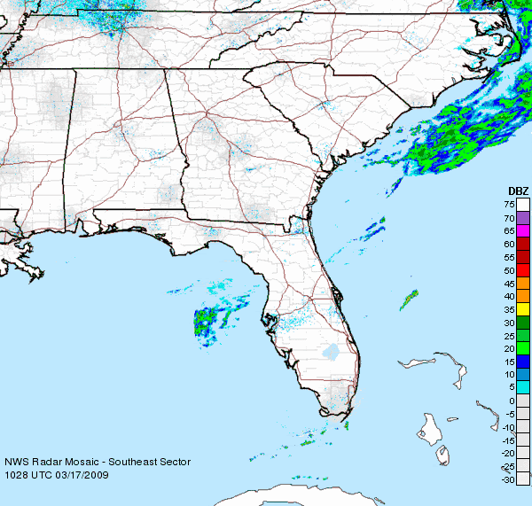
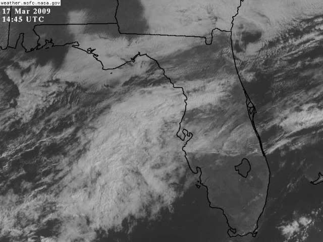
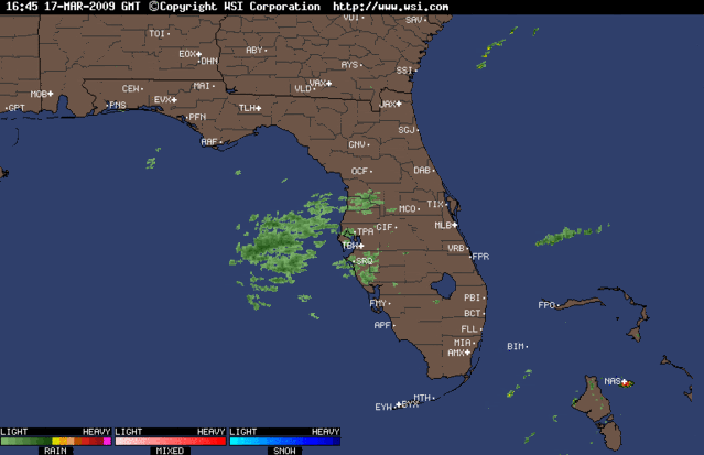
.DISCUSSION...WEAKENING COLD FRONTAL BOUNDARY IS NOW DOWN TO THE LAKE
OKEECHOBEE REGION. RADAR HAS BEEN VIRTUALLY ECHO FREE ALL
DAY...BUT FINALLY SHOWERS HAVE DEVELOPED ALONG THE BOUNDARY OVER
PALM BEACH COUNTY. THIS BOUNDARY WILL CONTINUE TO MOVE SLOWLY
SOUTHWARD DEEPER INTO THE AREA THROUGH THIS EVENING. SEA BREEZES
HAVE DEVELOPED ON BOTH COASTS...AND WITH CONVERGENCE ALONG THE
FRONTAL BOUNDARY...WILL MAINTAIN SCATTERED POPS INTERIOR/GULF
COAST WITH ISOLATED POPS EAST COAST. THE BULK OF THE ACTIVITY WILL
WANE OVERNIGHT AS COOLING TAKES PLACE/CONVERGENCE WEAKENS.
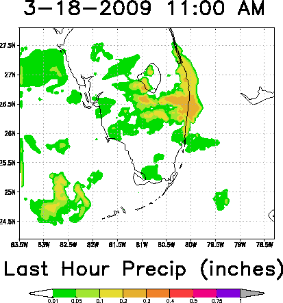
FORECAST FOR WED-THU IS A CHALLENGE. THERE WAS A DOWNWARD TREND IN
POPS UP UNTIL THE 00Z RUN LAST NIGHT...BUT NOW BOTH GFS/NAM MOS HAVE
REALLY INCREASED THE POPS...INTO THE 50-70 PERCENT RANGE...HIGHEST
WED/WED NIGHT. SYNOPTICALLY SPEAKING...IT LOOKS AS THOUGH THIS
BOUNDARY WILL STALL ACROSS SOUTH FL WITH A MID/UPPER TROUGH OVER THE
GULF TO PROGRESS EASTWARD ACROSS THE AREA LATE WED/EARLY THU. THE
ONLY PROBLEM RAINFALL-WISE IS THAT SO FAR THIS BOUNDARY HAS LITTLE
FAN FARE WITH IT...SO AM SPECULATIVE IN JUST HOW MUCH RAIN
COVERAGE THERE WILL BE OVER THE NEXT FEW DAYS. TREND SO FAR
FAVORS IN GOING WITH A DRIER FCST THAN CURRENT MOS INDICATES AND
WILL GO WITH THIS. ALSO...GFS IS DISPLAYING CONVECTIVE FEEDBACK
WITH A BULLSEYE OF QPF RIDING EAST ALONG THE BOUNDARY. THIS
LIKELY IS OVERDONE...BUT CLOUDINESS IN THE EASTERN GULF DOES SHOW A
LITTLE SPIN...SO WE WILL NEED TO WATCH AND SEE IF POPS WILL NEED
TO BE INCREASED IN LATER FORECASTS.
FCST SOUNDINGS SHOW ONLY MARGINAL MOISTURE WITH PWATS 1.2-1.5 INCHES
BUT WITH MORE INSTABILITY BY TOMORROW AFTERNOON INTO THURSDAY. NOT
IMPRESSIVELY UNSTABLE...BUT WITH K-INDICES INCREASING TO AROUND
30...LI`S GOING TO NEAR -3...AND AFTERNOON CAPE REACHING
500-1000...WILL ADD A SLIGHT CHANCE OF TSTORMS TO THE FCST FOR
WED AND THU.
LEFT EXTENDED FCST UNCHANGED. STRONG SURFACE RIDGE WILL BUILD OVER
THE EASTERN U.S. THIS WEEKEND...LEADING TO A STRONGER NE WIND FLOW
WITH INCREASING RIP CURRENTS ATLANTIC BEACHES ALONG WITH ISOLATED
FAST MOVING SHOWERS.
&&
.MARINE...WINDS WILL PREVAIL 15 KT OR LESS WITH SEAS 4 FT OR LESS
THROUGH THU BEFORE INCREASE FRI AND INTO THE WEEKEND AS NE WINDS
INCREASE. ALSO...A 2-4 FT NE SWELL WILL IMPACT THE NORTHERN
ATLANTIC WATERS THU AND INTO THE WEEKEND.
&&
.FIRE WEATHER...NO CONCERNS AS RH`S WILL REMAIN ABOVE CRITICAL
LEVELS.
&&
.PRELIMINARY POINT TEMPS/POPS...
WEST PALM BEACH 67 78 65 78 / 30 40 40 40
FORT LAUDERDALE 67 77 66 78 / 30 40 40 40
MIAMI 67 79 66 78 / 30 40 40 40
NAPLES 62 79 60 80 / 30 40 40 40
NATIONAL WEATHER SERVICE MIAMI FL
220 PM EDT TUE MAR 17 2009
.DISCUSSION...WEAKENING COLD FRONTAL BOUNDARY IS NOW DOWN TO THE LAKE
OKEECHOBEE REGION. RADAR HAS BEEN VIRTUALLY ECHO FREE ALL
DAY...BUT FINALLY SHOWERS HAVE DEVELOPED ALONG THE BOUNDARY OVER
PALM BEACH COUNTY. THIS BOUNDARY WILL CONTINUE TO MOVE SLOWLY
SOUTHWARD DEEPER INTO THE AREA THROUGH THIS EVENING. SEA BREEZES
HAVE DEVELOPED ON BOTH COASTS...AND WITH CONVERGENCE ALONG THE
FRONTAL BOUNDARY...WILL MAINTAIN SCATTERED POPS INTERIOR/GULF
COAST WITH ISOLATED POPS EAST COAST. THE BULK OF THE ACTIVITY WILL
WANE OVERNIGHT AS COOLING TAKES PLACE/CONVERGENCE WEAKENS.
FORECAST FOR WED-THU IS A CHALLENGE. THERE WAS A DOWNWARD TREND IN
POPS UP UNTIL THE 00Z RUN LAST NIGHT...BUT NOW BOTH GFS/NAM MOS HAVE
REALLY INCREASED THE POPS...INTO THE 50-70 PERCENT RANGE...HIGHEST
WED/WED NIGHT. SYNOPTICALLY SPEAKING...IT LOOKS AS THOUGH THIS
BOUNDARY WILL STALL ACROSS SOUTH FL WITH A MID/UPPER TROUGH OVER THE
GULF TO PROGRESS EASTWARD ACROSS THE AREA LATE WED/EARLY THU. THE
ONLY PROBLEM RAINFALL-WISE IS THAT SO FAR THIS BOUNDARY HAS LITTLE
FAN FARE WITH IT...SO AM SPECULATIVE IN JUST HOW MUCH RAIN
COVERAGE THERE WILL BE OVER THE NEXT FEW DAYS. TREND SO FAR
FAVORS IN GOING WITH A DRIER FCST THAN CURRENT MOS INDICATES AND
WILL GO WITH THIS. ALSO...GFS IS DISPLAYING CONVECTIVE FEEDBACK
WITH A BULLSEYE OF QPF RIDING EAST ALONG THE BOUNDARY. THIS
LIKELY IS OVERDONE...BUT CLOUDINESS IN THE EASTERN GULF DOES SHOW A
LITTLE SPIN...SO WE WILL NEED TO WATCH AND SEE IF POPS WILL NEED
TO BE INCREASED IN LATER FORECASTS.
FCST SOUNDINGS SHOW ONLY MARGINAL MOISTURE WITH PWATS 1.2-1.5 INCHES
BUT WITH MORE INSTABILITY BY TOMORROW AFTERNOON INTO THURSDAY. NOT
IMPRESSIVELY UNSTABLE...BUT WITH K-INDICES INCREASING TO AROUND
30...LI`S GOING TO NEAR -3...AND AFTERNOON CAPE REACHING
500-1000...WILL ADD A SLIGHT CHANCE OF TSTORMS TO THE FCST FOR
WED AND THU.
LEFT EXTENDED FCST UNCHANGED. STRONG SURFACE RIDGE WILL BUILD OVER
THE EASTERN U.S. THIS WEEKEND...LEADING TO A STRONGER NE WIND FLOW
WITH INCREASING RIP CURRENTS ATLANTIC BEACHES ALONG WITH ISOLATED
FAST MOVING SHOWERS.
&&
.MARINE...WINDS WILL PREVAIL 15 KT OR LESS WITH SEAS 4 FT OR LESS
THROUGH THU BEFORE INCREASE FRI AND INTO THE WEEKEND AS NE WINDS
INCREASE. ALSO...A 2-4 FT NE SWELL WILL IMPACT THE NORTHERN
ATLANTIC WATERS THU AND INTO THE WEEKEND.
&&
.FIRE WEATHER...NO CONCERNS AS RH`S WILL REMAIN ABOVE CRITICAL
LEVELS.
&&
.PRELIMINARY POINT TEMPS/POPS...
WEST PALM BEACH 67 78 65 78 / 30 40 40 40
FORT LAUDERDALE 67 77 66 78 / 30 40 40 40
MIAMI 67 79 66 78 / 30 40 40 40
NAPLES 62 79 60 80 / 30 40 40 40
0 likes
-
gatorcane
- S2K Supporter
- Posts: 23708
- Age: 48
- Joined: Sun Mar 13, 2005 3:54 pm
- Location: Boca Raton, FL
Re: Florida Weather Thread: Cold front brings needed rain
Heavy rain shower is passing through SE Palm Beach County
0 likes
-
DESTRUCTION5
- Category 5
- Posts: 4430
- Age: 44
- Joined: Wed Sep 03, 2003 11:25 am
- Location: Stuart, FL


Return to “USA & Caribbean Weather”
Who is online
Users browsing this forum: No registered users and 24 guests