I don't know how accurate the car thermometer is- but it
read 95*F at USF Tampa. When I left Saint Petersburg, it read
86*F.
Florida Weather
Moderator: S2k Moderators
Forum rules

The posts in this forum are NOT official forecast and should not be used as such. They are just the opinion of the poster and may or may not be backed by sound meteorological data. They are NOT endorsed by any professional institution or STORM2K.
-
Tampa Bay Hurricane

- Category 5

- Posts: 5597
- Age: 38
- Joined: Fri Jul 22, 2005 7:54 pm
- Location: St. Petersburg, FL
Re: Florida Weather Thread:warming, have/have nots in rain conti
Very dry forecast ahead for the peninsula possibly for the next week..
AREA FORECAST DISCUSSION
NATIONAL WEATHER SERVICE TAMPA BAY RUSKIN FL
102 PM EDT FRI MAY 1 2009
.SHORT TERM (TONIGHT-SUNDAY)MOISTURE WILL REMAIN LIMITED BOTH DAYS
WITH PRECIPITABLE WATER LESS THAN 1.5 INCHES. ENOUGH MOISTURE WILL
BE PRESENT THAT A FEW SPRINKLES MIGHT BE POSSIBLE OVER INTERIOR
SECTIONS AS THE SEA BREEZE MOVES INLAND. TEMPERATURES WILL REMAIN
ABOVE AVERAGE THROUGH THE WEEKEND.
.LONG TERM (SUNDAY NIGHT - FRIDAY)...12Z GFS IS TRENDING DRIER THAN
PREVIOUS GUIDANCE AND MAY WELL BE ON TO SOMETHING. WE ARE LOCKED
INTO A DRY PATTERN WITH SURFACE RIDGING SHOWING NO SIGNS OF BREAKING
DOWN. WE WILL HAVE AFTERNOON SEA BREEZES EACH DAY...WHICH SHOULD
LEAD TO AN INCREASE IN CLOUDS AND PERHAPS A FEW SHOWERS OR STORMS.
FOR THE MOST PART...RAIN CHANCES WILL REMAIN BELOW 20 PERCENT
THROUGH MID WEEK. MODELS WILL LIKELY CONTINUE TO FLIP-FLOP ON WHAT
DAY WE WILL SEE ENOUGH MOISTURE FOR ISOLATED STORMS...SO BEST OPTION
AT THIS POINT IS TO CONTINUE THE 20 POPS FOR THURSDAY AND ADD THE
SAME FOR FRIDAY AFTERNOON AS WELL. IT IS IMPORTANT TO NOTE THAT
WHILE THE FORECAST WILL MENTION ISOLATED THUNDERSTORMS...CHANCES ARE
THAT ONLY A FEW AREAS WILL SEE RAIN...AND EVEN THEN IT IS NOT LIKELY
TO BE ENOUGH TO BE BENEFICIAL.
TEMPERATURES 85 TO 90 EACH DAY AND IN THE 60S INLAND TO AROUND 70
NEAR THE COAST EACH NIGHT.
AREA FORECAST DISCUSSION
NATIONAL WEATHER SERVICE MIAMI FL
210 PM EDT FRI MAY 1 2009
A LITTLE CHANCE OF SHOWERS SOUTHERN AREAS TONIGHT AND
SATURDAY...THEN DRY CONDITIONS SUNDAY INTO EARLY NEXT WEEK.
.DISCUSSION...
HIGH PRESSURE OVER THE SOUTHEAST UNITED STATES WILL REMAIN NEARLY
STATIONARY TONIGHT THROUGH MONDAY. THERE IS ALSO A LOW LEVEL
TROUGH OVER THE CENTRAL BAHAMA ISLANDS INDICATED BY THE VISITABLE
SATELLITE IMAGES THAT WILL MOVE WEST TOWARDS THE SOUTHERN
PORTIONS OF SOUTH FLORIDA THIS EVENING...AND THROUGH SOUTHERN
FLORIDA LATE TONIGHT INTO SATURDAY MORNING. THE GFS MODEL DOES NOT
SHOW THIS LOW LEVEL TROUGH...BUT THE NAM MODEL DOES SEE THIS
TROUGH AND BRING A SLIGHT CHANCE TO CHANCE POPS TO THE SOUTHERN
AREAS OF THE CWA OVERNIGHT INTO SATURDAY MORNING.
ONCE THIS LOW LEVEL TROUGH MOVES WEST OF THE AREA SATURDAY
AFTERNOON...THE MID TO UPPER LEVEL HIGH OVER THE GULF OF MEXICO
WILL BUILD INTO SOUTH FLORIDA FOR THE SECOND HALF OF THE WEEKEND
INTO EARLY NEXT WEEK. SO HAVE KEPT ALL OF SOUTH FLORIDA DRY FOR
THE SECOND HALF OF THE WEEKEND INTO EARLY NEXT WEEK.
AREA FORECAST DISCUSSION
NATIONAL WEATHER SERVICE TAMPA BAY RUSKIN FL
102 PM EDT FRI MAY 1 2009
.SHORT TERM (TONIGHT-SUNDAY)MOISTURE WILL REMAIN LIMITED BOTH DAYS
WITH PRECIPITABLE WATER LESS THAN 1.5 INCHES. ENOUGH MOISTURE WILL
BE PRESENT THAT A FEW SPRINKLES MIGHT BE POSSIBLE OVER INTERIOR
SECTIONS AS THE SEA BREEZE MOVES INLAND. TEMPERATURES WILL REMAIN
ABOVE AVERAGE THROUGH THE WEEKEND.
.LONG TERM (SUNDAY NIGHT - FRIDAY)...12Z GFS IS TRENDING DRIER THAN
PREVIOUS GUIDANCE AND MAY WELL BE ON TO SOMETHING. WE ARE LOCKED
INTO A DRY PATTERN WITH SURFACE RIDGING SHOWING NO SIGNS OF BREAKING
DOWN. WE WILL HAVE AFTERNOON SEA BREEZES EACH DAY...WHICH SHOULD
LEAD TO AN INCREASE IN CLOUDS AND PERHAPS A FEW SHOWERS OR STORMS.
FOR THE MOST PART...RAIN CHANCES WILL REMAIN BELOW 20 PERCENT
THROUGH MID WEEK. MODELS WILL LIKELY CONTINUE TO FLIP-FLOP ON WHAT
DAY WE WILL SEE ENOUGH MOISTURE FOR ISOLATED STORMS...SO BEST OPTION
AT THIS POINT IS TO CONTINUE THE 20 POPS FOR THURSDAY AND ADD THE
SAME FOR FRIDAY AFTERNOON AS WELL. IT IS IMPORTANT TO NOTE THAT
WHILE THE FORECAST WILL MENTION ISOLATED THUNDERSTORMS...CHANCES ARE
THAT ONLY A FEW AREAS WILL SEE RAIN...AND EVEN THEN IT IS NOT LIKELY
TO BE ENOUGH TO BE BENEFICIAL.
TEMPERATURES 85 TO 90 EACH DAY AND IN THE 60S INLAND TO AROUND 70
NEAR THE COAST EACH NIGHT.
AREA FORECAST DISCUSSION
NATIONAL WEATHER SERVICE MIAMI FL
210 PM EDT FRI MAY 1 2009
A LITTLE CHANCE OF SHOWERS SOUTHERN AREAS TONIGHT AND
SATURDAY...THEN DRY CONDITIONS SUNDAY INTO EARLY NEXT WEEK.
.DISCUSSION...
HIGH PRESSURE OVER THE SOUTHEAST UNITED STATES WILL REMAIN NEARLY
STATIONARY TONIGHT THROUGH MONDAY. THERE IS ALSO A LOW LEVEL
TROUGH OVER THE CENTRAL BAHAMA ISLANDS INDICATED BY THE VISITABLE
SATELLITE IMAGES THAT WILL MOVE WEST TOWARDS THE SOUTHERN
PORTIONS OF SOUTH FLORIDA THIS EVENING...AND THROUGH SOUTHERN
FLORIDA LATE TONIGHT INTO SATURDAY MORNING. THE GFS MODEL DOES NOT
SHOW THIS LOW LEVEL TROUGH...BUT THE NAM MODEL DOES SEE THIS
TROUGH AND BRING A SLIGHT CHANCE TO CHANCE POPS TO THE SOUTHERN
AREAS OF THE CWA OVERNIGHT INTO SATURDAY MORNING.
ONCE THIS LOW LEVEL TROUGH MOVES WEST OF THE AREA SATURDAY
AFTERNOON...THE MID TO UPPER LEVEL HIGH OVER THE GULF OF MEXICO
WILL BUILD INTO SOUTH FLORIDA FOR THE SECOND HALF OF THE WEEKEND
INTO EARLY NEXT WEEK. SO HAVE KEPT ALL OF SOUTH FLORIDA DRY FOR
THE SECOND HALF OF THE WEEKEND INTO EARLY NEXT WEEK.
0 likes
-
JonathanBelles
- Professional-Met

- Posts: 11430
- Age: 35
- Joined: Sat Dec 24, 2005 9:00 pm
- Location: School: Florida State University (Tallahassee, FL) Home: St. Petersburg, Florida
- Contact:
-
JonathanBelles
- Professional-Met
- Posts: 11430
- Age: 35
- Joined: Sat Dec 24, 2005 9:00 pm
- Location: School: Florida State University (Tallahassee, FL) Home: St. Petersburg, Florida
- Contact:
Re: Florida Weather Thread:warming, have/have nots in rain conti
Hopefully no one was planning a trip to Fisheating Creek...west of Lake O
From the campgrounds website....Fisheating Creek is exactly as the name describes. The 52 mile long creek is teaming with fish and wildlife.
According to NWS Miami Drought Information Statement released on May 1, 2009:
HYDROLOGIC IMPACTS...
WELLS ACROSS THE INTERIOR AND WEST COAST METRO AREAS OF SOUTH
FLORIDA WERE IN THE LOWEST 10 PERCENT OF NORMAL LEVELS FOR THIS TIME
OF YEAR...WHILE THE EAST COAST METRO AREAS WELLS REMAINED IN THE 10
TO 30 PERCENT OF NORMAL LEVELS FOR THIS TIME OF YEAR.
THE UNDERGROUND RESERVOIRS ALONG THE EAST AND WEST COAST METRO AREAS
WERE RUNNING AT 10 TO 30 PERCENT BELOW NORMAL LEVELS FOR THIS TIME
OF YEAR. THE LEVEL OF LAKE OKEECHOBEE WAS AROUND 11.1 FEET, WHICH IS ABOUT
2.5 FEET BELOW NORMAL FOR THIS TIME OF THE YEAR. FISHEATING CREEK
WAS AROUND -0.15 FEET WHICH IS NOW READING THE POOL LEVEL AS THE
CREEK IS DRY.
OUTLOOK
THE CLIMATE PREDICTION CENTER`S PRECIPITATION OUTLOOK FOR THE NEXT
14 DAYS IS FOR OR AN INCREASED LIKELIHOOD OF BELOW NORMAL RAINFALL.
THIS IS FAIRLY TYPICAL FOR THE LATTER PART OF THE DRY SEASON WHICH
ENCOMPASSES MOST OF THE MONTH OF MAY. THE CLIMATE PREDICTION CENTER`S
LONGER TERM OUTLOOK FOR JUNE AND JULY ALSO SHOWS AN EQUAL CHANCE OF
SEEING ABOVE OR BELOW NORMAL RAINFALL, WITH AN INCREASE PROBABILITY OF
ABOVE NORMAL PRECIPITATION BY AUGUST. IT SHOULD BE EMPHASIZED THAT
MOST OF MAY TYPICALLY FALLS IN THE SOUTH FLORIDA DRY SEASON, AND THUS
THE REGION IS PRONE TO EXTENDED DRY SPELLS. THESE EXTENDED DRY SPELLS,
COMBINED WITH RISING TEMPERATURES, MAY LEAD TO INCREASING FIRE
DANGER OVER THE NEXT SEVERAL WEEKS BEFORE THE RAINY SEASON GETS
UNDERWAY IN LATE MAY OR EARLY JUNE.
http://www.srh.noaa.gov/productview.php?pil=DGTMFL
0 likes
Re: Florida Weather Thread:warming, have/have nots in rain conti
No rain through next weekend....very unusual first 10 days of May if it pans out...normal rainfall for the first 10 days is almost 2" in Miami
AREA FORECAST DISCUSSION
NATIONAL WEATHER SERVICE MIAMI FL
208 PM EDT SUN MAY 3 2009
.DISCUSSION...HIGH PRESSURE RIDGING EXTENDS FROM BERMUDA TO LAKE
OKEECHOBEE THIS AFTERNOON. THIS RIDGE WEAKENS A BIT BY TUESDAY FOR
A LIGHTER WIND FLOW AND STRONGER SEABREEZES. THIS RIDGE MOVES
SOUTH TO THE SOUTHERN SECTIONS OF THE CWA BY THE END OF THE WEEK.
STARTING TUESDAY, THERE WILL BE ENOUGH MOISTURE AND INSTABILITY TO
PRODUCE A SLIGHT CHANCE OF PRECIP. OVER THE NORTHWEST SECTIONS.
THE 12Z GFS40 RUN STILL IS DEPICTING A DEVELOPING LOW ALONG AN
INVERTED TROUGH OR EASTERLY WAVE NORTH OF THE DOMINICAN REPUBLIC
BUT IT TURNS IT NORTH AND THEN EAST AROUND THE STRONGER PART OF
THE HIGH PRESSURE RIDGE. SEVERAL DAYS AGO IT APPEARED THAT WE
WOULD SEE A TROPICAL WAVE THROUGH THIS AREA BUT THINGS CHANGE.
MINIMAL POPS EXPECTED THROUGH THE PERIOD WITH NOT MUCH AT EAST
SECTIONS. LOOKING TOWARD NEXT WEEKEND, A COLD FRONT MOVES OFF THE
SOUTHEAST COAST AND GETS TO SOUTH FLORIDA AND STALLS WITH NOT MUCH
EFFECT ON US.
0 likes
-
gatorcane

- S2K Supporter

- Posts: 23708
- Age: 48
- Joined: Sun Mar 13, 2005 3:54 pm
- Location: Boca Raton, FL
Re: Florida Weather Thread:warming, have/have nots in rain conti
jinftl wrote:No rain through next weekend....very unusual first 10 days of May if it pans out...normal rainfall for the first 10 days is almost 2" in Miami
Not unusual at all for South Florida. In fact the first 2-3 weeks in May are typically the hottest and driest of the year. Rainy season begins usually sometime third week in May, with a mean start date of May 21st.
For all of those interested in the rainy season in South Florida, this is a must read:
http://www.srh.noaa.gov/mfl/?n=summer_season
0 likes
Re: Florida Weather Thread:warming, have/have nots in rain conti
Perhaps below normal is a better description...Miami averages 6" of rain in May...granted there is a upward trend in that as the month progresses, the point I was making that if you take 1/3 of the month with no rain...and the month averages a half a foot...at the simplest calculation, that is almost 0.20"/day. As of 5/3, the 0" of rain in Miami this month is 0.39" below normal....shows that there is an upward trend in the daily rain avg each day of the month in order to get to the average of 5.92".
It would most definitely be unusual if that dryness continued throughtout the month...since 1950, there have only been 11 Mays in which Miami has had less than 2.00" of rain and only 4 with less than 1.00" of rain (most recent being 1992...can we say "Lushine May"!). In the same period, there were 16 Mays with rainfall over 8.00" and 10 with rainfall over 10.00", most recently being 2003 with 11.05". (data from Miami Int'l Airport from Florida Climate Center)
So while the first part of May is the climatologic drier part of the month (but of course dry doesn't mean no rain is the norm either), the key will be if this trend continues or if we suddenly find ourselves thrust into the wet season later in the month. That said, I have lived here long enough to know deficits of several inches can be made up in 1 or 2 wet afternoons.
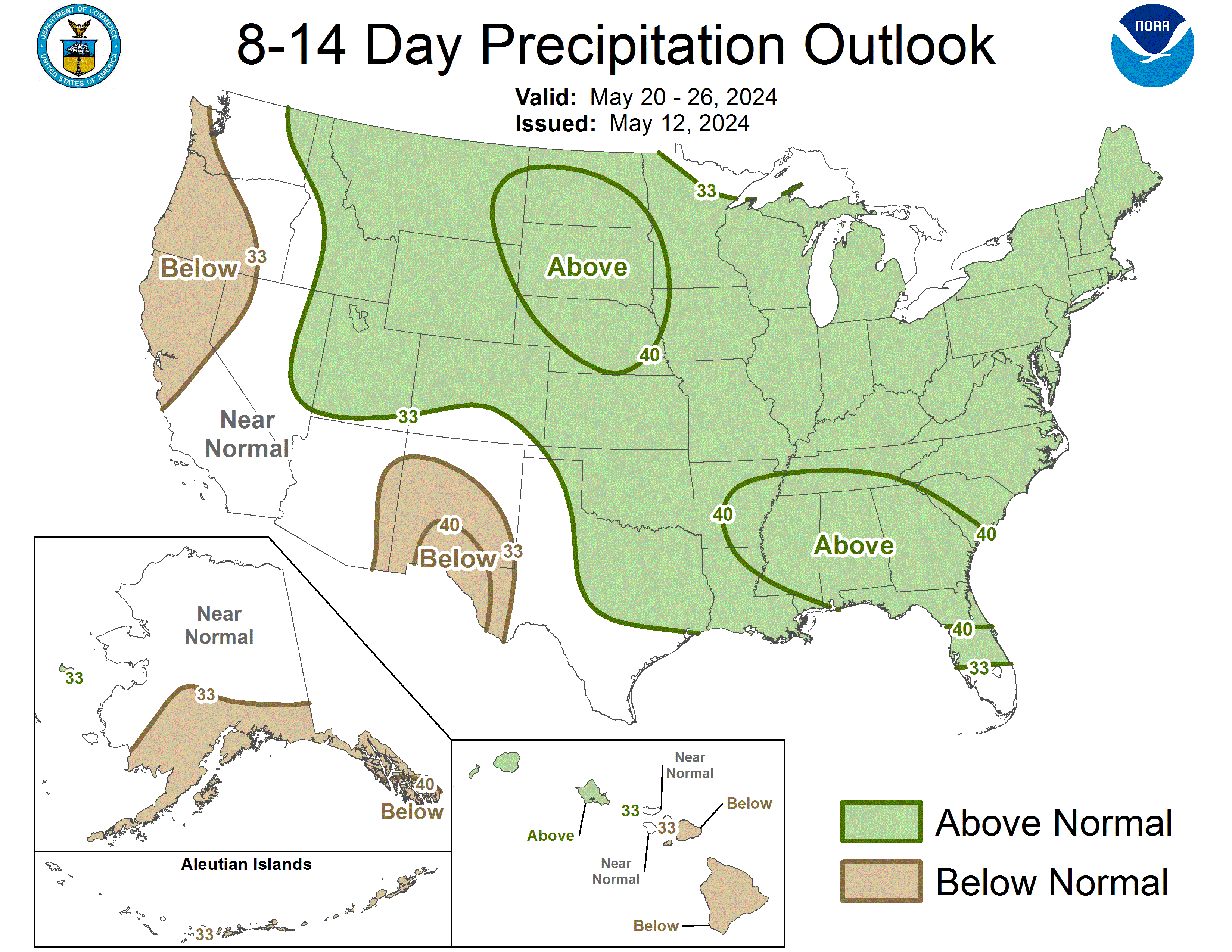
The CPC Precip Outlook for 6-10 Days and 8-14 Days...through May 17th...is for below normal precip statewide.
It would most definitely be unusual if that dryness continued throughtout the month...since 1950, there have only been 11 Mays in which Miami has had less than 2.00" of rain and only 4 with less than 1.00" of rain (most recent being 1992...can we say "Lushine May"!). In the same period, there were 16 Mays with rainfall over 8.00" and 10 with rainfall over 10.00", most recently being 2003 with 11.05". (data from Miami Int'l Airport from Florida Climate Center)
So while the first part of May is the climatologic drier part of the month (but of course dry doesn't mean no rain is the norm either), the key will be if this trend continues or if we suddenly find ourselves thrust into the wet season later in the month. That said, I have lived here long enough to know deficits of several inches can be made up in 1 or 2 wet afternoons.
The CPC Precip Outlook for 6-10 Days and 8-14 Days...through May 17th...is for below normal precip statewide.
gatorcane wrote:jinftl wrote:No rain through next weekend....very unusual first 10 days of May if it pans out...normal rainfall for the first 10 days is almost 2" in Miami
Not unusual at all for South Florida. In fact the first 2-3 weeks in May are typically the hottest and driest of the year. Rainy season begins usually sometime third week in May, with a mean start date of May 21st.
For all of those interested in the rainy season in South Florida, this is a must read:
http://www.srh.noaa.gov/mfl/?n=summer_season
0 likes
Re: Florida Weather Thread:warming, have/have nots in rain conti
I'm so tired of this weather. Yeah, the first half of May has been horribly dry down here for seemingly the past decade. I hate it.
0 likes

Re: Florida Weather Thread:warming, have/have nots in rain conti
I'd like to know when was the last time we had above normal rainfall. The only time we get rain is from a tropical system which seems more of the norm.Growing up I remember getting the afternoon thunderstorms which seem non existant the last couple of years.I hope this pattern breaks soon.
0 likes
-
gatorcane
- S2K Supporter
- Posts: 23708
- Age: 48
- Joined: Sun Mar 13, 2005 3:54 pm
- Location: Boca Raton, FL
Re: Florida Weather Thread:warming, have/have nots in rain conti
Long-range guid
Long-range guidance shows no end in sight to this eastlerly wind pattern, so no afternoon or evening thunderstorms for SE FL east coast areas are going to happen for at least the next 7-10 days. Maybe by the end of this month, we'll see some troughs to breakdown this powerful Bermuda High ridge. BTW looks alot like what we saw in 2004 for May, but I digress.
Now that its May and the sun angle higher with longer hours of sunlight, lakes and reservoirs are drying up fast. We do need the rainy season to start on time this year and not be late. Things are literally looking "torched" in South Florida and the situation is becoming critical fast.
That is one reason why I started a tread on this Bermuda High about 10 days ago -- I knew it was going to be a monster of a high that was going to dominate the Western Atlantic and FL weather for the forseeable future.
boca wrote:I'd like to know when was the last time we had above normal rainfall. The only time we get rain is from a tropical system which seems more of the norm.Growing up I remember getting the afternoon thunderstorms which seem non existant the last couple of years.I hope this pattern breaks soon.
Long-range guidance shows no end in sight to this eastlerly wind pattern, so no afternoon or evening thunderstorms for SE FL east coast areas are going to happen for at least the next 7-10 days. Maybe by the end of this month, we'll see some troughs to breakdown this powerful Bermuda High ridge. BTW looks alot like what we saw in 2004 for May, but I digress.
Now that its May and the sun angle higher with longer hours of sunlight, lakes and reservoirs are drying up fast. We do need the rainy season to start on time this year and not be late. Things are literally looking "torched" in South Florida and the situation is becoming critical fast.
That is one reason why I started a tread on this Bermuda High about 10 days ago -- I knew it was going to be a monster of a high that was going to dominate the Western Atlantic and FL weather for the forseeable future.
0 likes
-
DESTRUCTION5

- Category 5
- Posts: 4430
- Age: 44
- Joined: Wed Sep 03, 2003 11:25 am
- Location: Stuart, FL
-
gatorcane
- S2K Supporter
- Posts: 23708
- Age: 48
- Joined: Sun Mar 13, 2005 3:54 pm
- Location: Boca Raton, FL
Re:
DESTRUCTION5 wrote:Who has the latest Fl indexes? im thinking the ECFL is close to the 700's again...
http://www.srh.noaa.gov/mfl/?n=drought_info
0 likes

-
gatorcane
- S2K Supporter
- Posts: 23708
- Age: 48
- Joined: Sun Mar 13, 2005 3:54 pm
- Location: Boca Raton, FL
Re:
HURAKAN wrote:It's dry as a desert. So far, the high today has been 88.1ºF. Humidity at the moment, 55%
Yeah its so dry and hot around my area that it smells like burnt grass when the wind blows.
the lakes are drying up pretty quickly.
0 likes
Re: Florida Weather Thread: Dry weather continues
Outlook through mid-month not encouraging...

0 likes
-
JonathanBelles
- Professional-Met
- Posts: 11430
- Age: 35
- Joined: Sat Dec 24, 2005 9:00 pm
- Location: School: Florida State University (Tallahassee, FL) Home: St. Petersburg, Florida
- Contact:
Re:
CPC Outlook isn't lacking in warmth...above normal temps forecast across much of u.s. Above normal temps and below normal rain in florida means hot sunny May days ahead...
http://www.cpc.ncep.noaa.gov/products/p ... day.01.gif
http://www.cpc.ncep.noaa.gov/products/p ... day.02.gif
NWS Tampa Bay mentions temps really rising by this time next week....sounds like 90s will be widespread
LONG TERM (WEDNESDAY NIGHT-MONDAY)...HIGH PRESSURE WILL BE OVER OR
JUST SOUTH OF THE REGION THROUGH THE PERIOD. FLOW ALOFT WILL BE
SOMEWHAT LIGHT ON THE SOUTH SIDE OF A TROUGH OVER THE MIDWEST.
RIDGING WILL TRY TO BUILD IN FOR THE WEEKEND AND MONDAY...SO EXPECT
TEMPERATURES WELL ABOVE NORMAL BY MONDAY. A SERIES OF FRONTS WILL
MOVE NORTH OF THE REGION THROUGH THE PERIOD...BUT GENERALLY STAY TOO
FAR NORTH TO IMPACT OUR REGION. WILL KEEP SLIGHT CHANCE OR SILENT
POPS EACH DAY AS IN PREVIOUS FORECAST THINKING.
fact789 wrote:Hopefully that hot bubble out west doesnt come east.
Last edited by jinftl on Mon May 04, 2009 3:11 pm, edited 1 time in total.
0 likes
-
gatorcane
- S2K Supporter
- Posts: 23708
- Age: 48
- Joined: Sun Mar 13, 2005 3:54 pm
- Location: Boca Raton, FL
The ECMWF 12Z just out a couple of hours ago -- shows the Bermuda High ridge holding strong all the way through 240 hours folks....
That ridge extends through FL into the Eastern GOM, just like it has for the past couple of weeks now.
Besides isolated showers here and there that develop off the Gulf stream, most of the South FL CWA will be high and dry for at least 10 days it looks like.
ECMWF 240 hours:
http://www.ecmwf.int/products/forecasts ... 9050412!!/
On a side note, this long-wave pattern with such a staunch Bermuda ridge would steer tropical systems far to the west and would prevent recurvature (at least those systems developing west of about 55W).
We are lucky to have this pattern now when no threats exist. This long-wave pattern should inevitably break-down...and be replaced with more troughiness along the Eastern CONUS.
0 likes
Return to “USA & Caribbean Weather”
Who is online
Users browsing this forum: No registered users and 22 guests