What a week!
Moderator: S2k Moderators


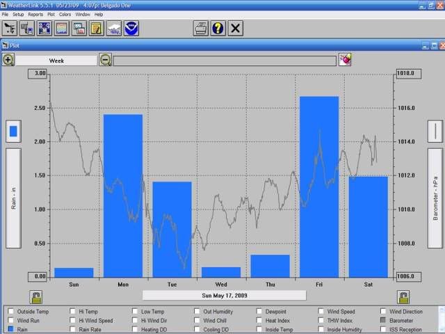
HURAKAN wrote:Since May 17, 9.46 inches of rain. Thanks 90L!


Code: Select all
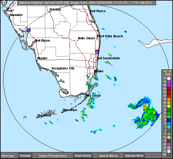
1945 175 SUNRISE BROWARD FL 2617 8028 SUNRISE POLICE OFFICER REPORTED GOLF BALL SIZE HAIL BETWEEN UNIVERSITY DRIVE AND WEST OAKLAND BLVD (MFL)jinftl wrote:MIA (Miami Intl Airport) has seen 4.94" and FLL (Fort Laud-Hwd Int'l) has seen 4.06" since May 17....gotta love the variation from street to street with patterns like this....esp this time of year.
Believe it or not, the official reporting stations have not reached the average May rainfall (for entire month) yet.....it could happen in 20 minutes though with this pattern! Not impossible that it could still end up being a Lushine May (technically using airport totals)....
Month to Date:
Miami Int'l = 5.04" (average total May rainfall = 5.96")
Ftl-Hwd Int'l = 4.48" (average total May rainfall = 6.33")HURAKAN wrote:Since May 17, 9.46 inches of rain. Thanks 90L!

Sanibel wrote:I'm curious if a big hurricane will come to Florida anyway Lushine or not.
Like Ike except it doesn't dive south.
Warm and humid in the morning now. Sleeping without a blanket.
jinftl wrote:Well for south florida, the 'real' hurricane season is from August 15-October 15....about 90% of our hurricanes happen during that window (interesting that wilma was past that window). We need to keep our eyes to the southwest as much, if not more, than to the east....strikes from wilma-type tracks are actually more common.
That leads to no clear cut answer if we are at risk...ridges and troughs can be our friend or enemy....we want troughs to turn storms to our east out to sea....but a trough approaching with a storm off the yucatan could push it right over us....timing is everything (and location). One thing that can be guaranteed....the water is/will be warm enough to support any tropical system to our coast.Sanibel wrote:I'm curious if a big hurricane will come to Florida anyway Lushine or not.
Like Ike except it doesn't dive south.
Warm and humid in the morning now. Sleeping without a blanket.

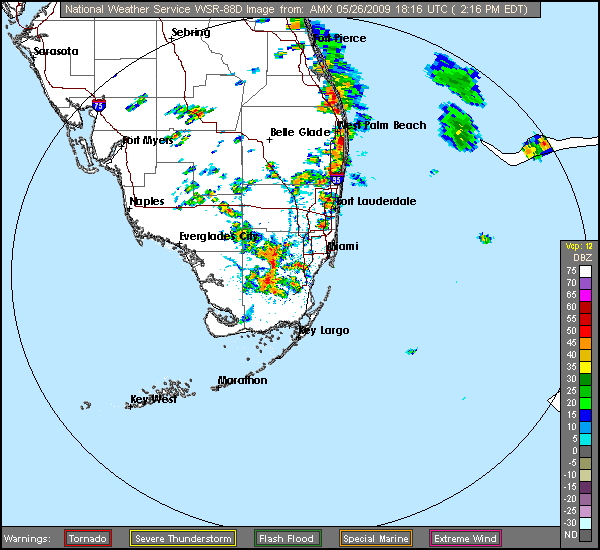
dolebot_Broward_NW wrote:Looks like tstorms starting just north of boca/delrayish. I see a boundary of some sort heading into western (sub)urban broward on NWS radar atm.
Return to “USA & Caribbean Weather”
Users browsing this forum: wxman22 and 63 guests