Severe Thunderstorm Watch
SEVERE THUNDERSTORM WATCH OUTLINE UPDATE FOR WS 396
NWS STORM PREDICTION CENTER NORMAN OK
355 PM EDT FRI JUN 15 2012
SEVERE THUNDERSTORM WATCH 396 IS IN EFFECT UNTIL 900 PM EDT
FOR THE FOLLOWING LOCATIONS
FLC011-015-021-027-043-049-051-055-071-081-086-087-099-115-
160100-
/O.NEW.KWNS.SV.A.0396.120615T1955Z-120616T0100Z/
FL
. FLORIDA COUNTIES INCLUDED ARE
BROWARD CHARLOTTE COLLIER
DESOTO GLADES HARDEE
HENDRY HIGHLANDS LEE
MANATEE MIAMI-DADE MONROE
PALM BEACH SARASOTA
$$
Florida Weather
Moderator: S2k Moderators
Forum rules

The posts in this forum are NOT official forecast and should not be used as such. They are just the opinion of the poster and may or may not be backed by sound meteorological data. They are NOT endorsed by any professional institution or STORM2K.
-
Bocadude85

- Category 5

- Posts: 2991
- Age: 39
- Joined: Mon Apr 18, 2005 2:20 pm
- Location: Honolulu,Hi
Re: Florida Weather
0 likes
-
Bocadude85
- Category 5
- Posts: 2991
- Age: 39
- Joined: Mon Apr 18, 2005 2:20 pm
- Location: Honolulu,Hi
Re: Florida Weather
BULLETIN - EAS ACTIVATION REQUESTED
SEVERE THUNDERSTORM WARNING
NATIONAL WEATHER SERVICE MIAMI FL
519 PM EDT FRI JUN 15 2012
THE NATIONAL WEATHER SERVICE IN MIAMI HAS ISSUED A
* SEVERE THUNDERSTORM WARNING FOR...
SOUTHWESTERN GLADES COUNTY IN SOUTH FLORIDA.
EXTREME NORTHWESTERN HENDRY COUNTY IN SOUTH FLORIDA.
* UNTIL 545 PM EDT
* AT 514 PM EDT...NATIONAL WEATHER SERVICE METEOROLOGISTS DETECTED A
SEVERE THUNDERSTORM CAPABLE OF PRODUCING LARGE HAIL...AND DAMAGING
WINDS IN EXCESS OF 60 MPH. THIS STORM WAS LOCATED 11 MILES NORTH OF
MUSE...AND MOVING SOUTHEAST AT 10 MPH.
* THE STORM WILL AFFECT...
RURAL WESTERN GLADES COUNTY
AND SURROUNDING COMMUNITIES.
PRECAUTIONARY/PREPAREDNESS ACTIONS...
SEVERE THUNDERSTORMS PRODUCE DAMAGING WINDS IN EXCESS OF 58 MPH AND
OR LARGE HAIL. FREQUENT TO EXCESSIVE LIGHTNING AND HEAVY RAINFALL IS
ALSO POSSIBLE. IF THE STORM APPROACHES YOUR LOCATION, SEEK SHELTER IN
AN ENCLOSED BUILDING ON THE LOWEST FLOOR AND STAY AWAY FROM WINDOWS.
A SEVERE THUNDERSTORM WATCH REMAINS IN EFFECT UNTIL 900 PM EDT FRIDAY
EVENING FOR SOUTHERN FLORIDA.
&&
LAT...LON 2690 8124 2673 8155 2679 8157 2703 8157
2704 8156 2704 8141
TIME...MOT...LOC 2118Z 328DEG 10KT 2698 8152
$$
BULLETIN - EAS ACTIVATION REQUESTED
SEVERE THUNDERSTORM WARNING
NATIONAL WEATHER SERVICE MIAMI FL
518 PM EDT FRI JUN 15 2012
THE NATIONAL WEATHER SERVICE IN MIAMI HAS ISSUED A
* SEVERE THUNDERSTORM WARNING FOR...
SOUTHWESTERN MIAMI-DADE COUNTY IN SOUTH FLORIDA.
SOUTHEASTERN MAINLAND MONROE COUNTY IN SOUTH FLORIDA.
* UNTIL 545 PM EDT
* AT 514 PM EDT...NATIONAL WEATHER SERVICE METEOROLOGISTS DETECTED A
SEVERE THUNDERSTORM CAPABLE OF PRODUCING PENNY SIZE HAIL. THIS
STORM WAS LOCATED 5 MILES SOUTHEAST OF MAHOGANY HAMMOCK...AND
MOVING SOUTHEAST AT 10 MPH.
* THE STORM WILL AFFECT...
RURAL SOUTHWESTERN MIAMI-DADE COUNTY
AND SURROUNDING COMMUNITIES.
PRECAUTIONARY/PREPAREDNESS ACTIONS...
SEVERE THUNDERSTORMS CAN PRODUCE VERY STRONG WINDS IN EXCESS OF 58
MPH...LARGE HAIL...DEADLY LIGHTNING...AND VERY HEAVY RAINFALL. STAY
INSIDE AWAY FROM WINDOWS UNTIL THE STORM HAS PASSED.
A SEVERE THUNDERSTORM WATCH REMAINS IN EFFECT UNTIL 900 PM EDT FRIDAY
EVENING FOR SOUTHERN FLORIDA.
&&
LAT...LON 2533 8091 2542 8074 2520 8053 2520 8055
2522 8058 2520 8058 2519 8058 2519 8061
2519 8062 2518 8063 2516 8076
TIME...MOT...LOC 2118Z 312DEG 8KT 2529 8077
$$
KOB
SEVERE THUNDERSTORM WARNING
NATIONAL WEATHER SERVICE MIAMI FL
519 PM EDT FRI JUN 15 2012
THE NATIONAL WEATHER SERVICE IN MIAMI HAS ISSUED A
* SEVERE THUNDERSTORM WARNING FOR...
SOUTHWESTERN GLADES COUNTY IN SOUTH FLORIDA.
EXTREME NORTHWESTERN HENDRY COUNTY IN SOUTH FLORIDA.
* UNTIL 545 PM EDT
* AT 514 PM EDT...NATIONAL WEATHER SERVICE METEOROLOGISTS DETECTED A
SEVERE THUNDERSTORM CAPABLE OF PRODUCING LARGE HAIL...AND DAMAGING
WINDS IN EXCESS OF 60 MPH. THIS STORM WAS LOCATED 11 MILES NORTH OF
MUSE...AND MOVING SOUTHEAST AT 10 MPH.
* THE STORM WILL AFFECT...
RURAL WESTERN GLADES COUNTY
AND SURROUNDING COMMUNITIES.
PRECAUTIONARY/PREPAREDNESS ACTIONS...
SEVERE THUNDERSTORMS PRODUCE DAMAGING WINDS IN EXCESS OF 58 MPH AND
OR LARGE HAIL. FREQUENT TO EXCESSIVE LIGHTNING AND HEAVY RAINFALL IS
ALSO POSSIBLE. IF THE STORM APPROACHES YOUR LOCATION, SEEK SHELTER IN
AN ENCLOSED BUILDING ON THE LOWEST FLOOR AND STAY AWAY FROM WINDOWS.
A SEVERE THUNDERSTORM WATCH REMAINS IN EFFECT UNTIL 900 PM EDT FRIDAY
EVENING FOR SOUTHERN FLORIDA.
&&
LAT...LON 2690 8124 2673 8155 2679 8157 2703 8157
2704 8156 2704 8141
TIME...MOT...LOC 2118Z 328DEG 10KT 2698 8152
$$
BULLETIN - EAS ACTIVATION REQUESTED
SEVERE THUNDERSTORM WARNING
NATIONAL WEATHER SERVICE MIAMI FL
518 PM EDT FRI JUN 15 2012
THE NATIONAL WEATHER SERVICE IN MIAMI HAS ISSUED A
* SEVERE THUNDERSTORM WARNING FOR...
SOUTHWESTERN MIAMI-DADE COUNTY IN SOUTH FLORIDA.
SOUTHEASTERN MAINLAND MONROE COUNTY IN SOUTH FLORIDA.
* UNTIL 545 PM EDT
* AT 514 PM EDT...NATIONAL WEATHER SERVICE METEOROLOGISTS DETECTED A
SEVERE THUNDERSTORM CAPABLE OF PRODUCING PENNY SIZE HAIL. THIS
STORM WAS LOCATED 5 MILES SOUTHEAST OF MAHOGANY HAMMOCK...AND
MOVING SOUTHEAST AT 10 MPH.
* THE STORM WILL AFFECT...
RURAL SOUTHWESTERN MIAMI-DADE COUNTY
AND SURROUNDING COMMUNITIES.
PRECAUTIONARY/PREPAREDNESS ACTIONS...
SEVERE THUNDERSTORMS CAN PRODUCE VERY STRONG WINDS IN EXCESS OF 58
MPH...LARGE HAIL...DEADLY LIGHTNING...AND VERY HEAVY RAINFALL. STAY
INSIDE AWAY FROM WINDOWS UNTIL THE STORM HAS PASSED.
A SEVERE THUNDERSTORM WATCH REMAINS IN EFFECT UNTIL 900 PM EDT FRIDAY
EVENING FOR SOUTHERN FLORIDA.
&&
LAT...LON 2533 8091 2542 8074 2520 8053 2520 8055
2522 8058 2520 8058 2519 8058 2519 8061
2519 8062 2518 8063 2516 8076
TIME...MOT...LOC 2118Z 312DEG 8KT 2529 8077
$$
KOB
0 likes

Unusual cold front came through. This morning was absolutely pleasant! Temp was 71F dewpoint was 68F breeze out of the NE at 5-10mph. Clear and breezy. For June this is a bonus. Unfortunately, only 1.4" of rain from yesterday's storms which largely missed us. Now it is days of hot dry weather. Perhaps I will get the next round. 
0 likes
-
Hurricane Alexis

- Category 2

- Posts: 683
- Age: 29
- Joined: Thu Jun 14, 2012 7:59 pm
- Location: Miami,Florida
We're in for some good rain here this week in south florida. I'll say 2-5 inches and probably higher locally.
0 likes
Personal Forecast Disclaimer:
The posts in this forum are NOT official forecast and should not be used as such. They are just the opinion of the poster and may or may not be backed by sound meteorological data. They are NOT endorsed by any professional institution or storm2k.org. For official information, please refer to the NHC and NWS products.
The posts in this forum are NOT official forecast and should not be used as such. They are just the opinion of the poster and may or may not be backed by sound meteorological data. They are NOT endorsed by any professional institution or storm2k.org. For official information, please refer to the NHC and NWS products.
-
cycloneye

- Admin

- Posts: 149158
- Age: 69
- Joined: Thu Oct 10, 2002 10:54 am
- Location: San Juan, Puerto Rico
Re: Florida Weather
Here is the latest update by the Miami NWS on how much rain is expected in the next few days.
HYDROLOGIC OUTLOOK
NATIONAL WEATHER SERVICE MIAMI FL
800 PM EDT MON JUN 18 2012
...HEAVY RAINFALL POTENTIAL TUESDAY NIGHT THROUGH EARLY THIS WEEKEND...
A TROUGH OF LOW PRESSURE OVER THE WESTERN CARIBBEAN SEA WILL MOVE
NORTH INTO SOUTH FLORIDA TUESDAY NIGHT INTO WEDNESDAY BRINGING
DEEP TROPICAL MOISTURE NORTHWARD. THE TROUGH WILL CONTINUE TO MOVE
SLOWLY NORTH INTO CENTRAL FLORIDA THROUGH EARLY NEXT WEEKEND
KEEPING SOUTH FLORIDA UNDER THE DEEP TROPICAL MOISTURE.
TOTAL RAINFALL ACCUMULATIONS FROM TUESDAY NIGHT THROUGH EARLY NEXT
WEEKEND ARE FORECAST TO RANGE FROM 2 TO 4 INCHES NORTH OF
ALLIGATOR ALLEY TO 3 TO 5 INCHES SOUTH OF ALLIGATOR ALLEY. AS
TYPICALLY OBSERVED DURING THESE EVENTS...LOCALLY HIGHER AMOUNTS
COULD OCCUR. INTERESTS ARE ENCOURAGED TO MONITOR LATER FORECASTS
FOR UPDATES THROUGH THIS PERIOD. AS MODELS CONTINUE TO SHOW THIS
TREND...AND CONFIDENCE CONTINUES TO INCREASE...A FLOOD WATCH
COULD BECOME NECESSARY FOR PORTIONS OF SOUTH FLORIDA.
$$
BAXTER
0 likes
Visit the Caribbean-Central America Weather Thread where you can find at first post web cams,radars
and observations from Caribbean basin members Click Here
and observations from Caribbean basin members Click Here
-
northjaxpro

- S2K Supporter

- Posts: 8900
- Joined: Mon Sep 27, 2010 11:21 am
- Location: Jacksonville, FL
Yeah, the Tampa and Miami NWS offices are totally buying the GFS runs from today with the prospects of the NW Caribbean tropical disturbance heading toward the peninsula late this week.
I think we will have a pretty good idea by Wednesday if indeed the GFS runs are on the money.
I think we will have a pretty good idea by Wednesday if indeed the GFS runs are on the money.
0 likes
NEVER, EVER SAY NEVER in the tropics and weather in general, and most importantly, with life itself!!
________________________________________________________________________________________
Fay 2008 Beryl 2012 Debby 2012 Colin 2016 Hermine 2016 Julia 2016 Matthew 2016 Irma 2017 Dorian 2019
________________________________________________________________________________________
Fay 2008 Beryl 2012 Debby 2012 Colin 2016 Hermine 2016 Julia 2016 Matthew 2016 Irma 2017 Dorian 2019

-
northjaxpro
- S2K Supporter
- Posts: 8900
- Joined: Mon Sep 27, 2010 11:21 am
- Location: Jacksonville, FL
NDG, you see moderate SW shear in the GOM late this week affecting our tropical entity? I haven't checked the shear forecasts yet with the models, but it is a definite possible scenario, which could spread abundant moisture toward central and south FL.
0 likes
NEVER, EVER SAY NEVER in the tropics and weather in general, and most importantly, with life itself!!
________________________________________________________________________________________
Fay 2008 Beryl 2012 Debby 2012 Colin 2016 Hermine 2016 Julia 2016 Matthew 2016 Irma 2017 Dorian 2019
________________________________________________________________________________________
Fay 2008 Beryl 2012 Debby 2012 Colin 2016 Hermine 2016 Julia 2016 Matthew 2016 Irma 2017 Dorian 2019
Re:
northjaxpro wrote:NDG, you see moderate SW shear in the GOM late this week affecting our tropical entity? I haven't checked the shear forecasts yet with the models, but it is a definite possible scenario, which could spread abundant moisture toward central and south FL.
Yes, the euro during its last couple of runs or so has really back up from the upper level ridge it wanted to build right over the middle of the GOM. It now picks up on the ULL that is in place right now showing not to move too fast westward keeping SW & westerly shear over the central & northern GOM over, which makes sense if such a strong ridge develps over the central plains, there could be TUTT like trough developing along the NW GOM between that ridge and the UL ridge developing over the Caribbean.
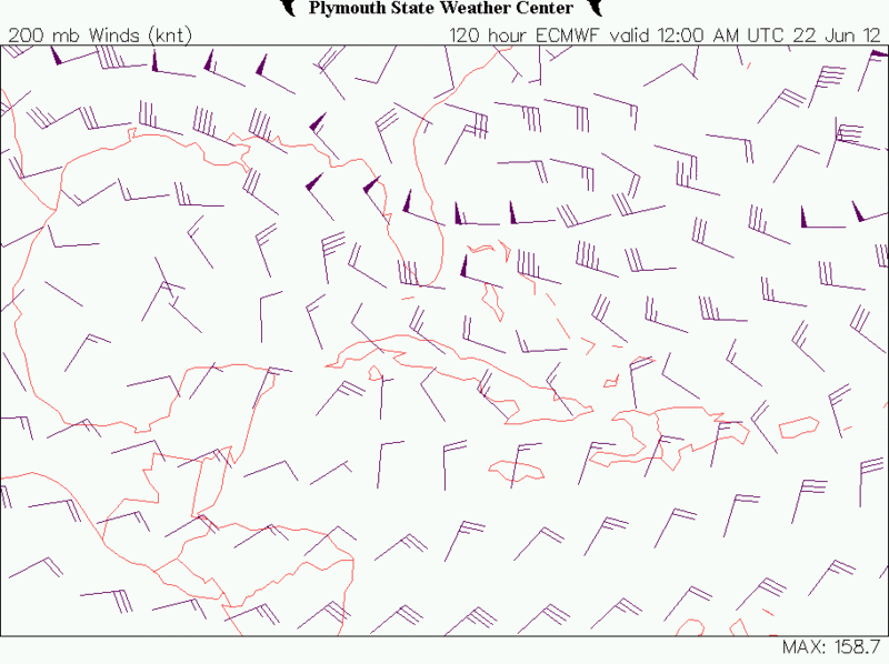
Today's ECMWF's run for Friday morning:

ECMWF's old run for about the same time:
0 likes
-
northjaxpro
- S2K Supporter
- Posts: 8900
- Joined: Mon Sep 27, 2010 11:21 am
- Location: Jacksonville, FL
Yes, NDG, I see what you are talking about. Thanks. Should that occur, it would be a sheared, lopsided tropical entity which would have the very moist eastern side of the system surge mositure right into the peninsula. We'll see how it pans out.
0 likes
NEVER, EVER SAY NEVER in the tropics and weather in general, and most importantly, with life itself!!
________________________________________________________________________________________
Fay 2008 Beryl 2012 Debby 2012 Colin 2016 Hermine 2016 Julia 2016 Matthew 2016 Irma 2017 Dorian 2019
________________________________________________________________________________________
Fay 2008 Beryl 2012 Debby 2012 Colin 2016 Hermine 2016 Julia 2016 Matthew 2016 Irma 2017 Dorian 2019
This surge of moisture heading up to FL looks like a blast of rainfall, some heavy that is expected. It has been odd. The past few days have been unusually cool. I've hit 68F twice in the AM (unheard of for June in Tampa Bay) and daytime dewpoints were in the middle 60'sF. Oddly windy for June, more reminiscent of April. Now once again lots of moisture is flowing north. Do I see a pattern....dry dry then wet wet? 
0 likes
-
northjaxpro
- S2K Supporter
- Posts: 8900
- Joined: Mon Sep 27, 2010 11:21 am
- Location: Jacksonville, FL
Yeah, I have had morning lows well down in the 60s. As a matter of fact, it dropped to 60 degrees on Monday morning at my location. NWS Jax office set a record low of 59 that same morning. The dry High Pressure ride that built dow from the East coast has been responsible for good radionational cooling conditions at night for the area. I must say that it has certainly been a pleasant break considering we are in late June.
Meanwhile, all eyes on the developing Low Pressure system in the South-Central Gulf of Mexico. Everyone all up and down the peninsula will have to really watch this carefully for the next several days.
Meanwhile, all eyes on the developing Low Pressure system in the South-Central Gulf of Mexico. Everyone all up and down the peninsula will have to really watch this carefully for the next several days.
0 likes
NEVER, EVER SAY NEVER in the tropics and weather in general, and most importantly, with life itself!!
________________________________________________________________________________________
Fay 2008 Beryl 2012 Debby 2012 Colin 2016 Hermine 2016 Julia 2016 Matthew 2016 Irma 2017 Dorian 2019
________________________________________________________________________________________
Fay 2008 Beryl 2012 Debby 2012 Colin 2016 Hermine 2016 Julia 2016 Matthew 2016 Irma 2017 Dorian 2019
Sea breeze convergence with the storms/showers created torrential downpours here with T&L for about 40 mins. In excess of an inch easily. Power flashed on and off a few times. We got the heaviest in the area. My yard and garden are happy!  ) Guess that sunshine we had for an hour or so at 3pm did its job!
0 likes

-
northjaxpro
- S2K Supporter
- Posts: 8900
- Joined: Mon Sep 27, 2010 11:21 am
- Location: Jacksonville, FL
Re:
gsytch wrote:It is blowing pretty good, rain nonstop since Sat afternoon. Squalls frequent. Total precip since Thur is over 5" and counting, and for June I am over 13". A nice, dry sunny period is needed now. It is near noon out yet it resembles twilight. Oh Debby go away already. We get it!
Yeah, gsytch, it apparently is becoming more likely that the entire peninsula will get impacted by Debby with a myriad of problems. This is going to be a huge event in the making if the GFS verifies, which it appears to be doing currently. Many areas of the state are going to see coastal and inland flooding and also quick spawned small-scaled tornadoes as Debby approaches. Another problem is the very slow movement of Debby which is really going to add to the woes. The only good thing is that drought-stricken areas of west central peninsula will get a huge dent into the drought after this event for certain.
Look at the wall of rain and bands on the eastern side of Debby currently affecting the western Coast and interior peninsula:

0 likes
NEVER, EVER SAY NEVER in the tropics and weather in general, and most importantly, with life itself!!
________________________________________________________________________________________
Fay 2008 Beryl 2012 Debby 2012 Colin 2016 Hermine 2016 Julia 2016 Matthew 2016 Irma 2017 Dorian 2019
________________________________________________________________________________________
Fay 2008 Beryl 2012 Debby 2012 Colin 2016 Hermine 2016 Julia 2016 Matthew 2016 Irma 2017 Dorian 2019
It appears on the latest radar loop that Debby is sliding south. The circulation is clearly throwing bands to my area (New Port Richey) andf the local pressure is 29.58". The tornado that came overhead Sun did a lot of damage in my neighborhood. Trees in houses, etc but now flooding is forcing people out of their houses, and not ju st on the coast!
0 likes
-
northjaxpro
- S2K Supporter
- Posts: 8900
- Joined: Mon Sep 27, 2010 11:21 am
- Location: Jacksonville, FL
Yeah, Brian Norcross just alluded to this a few minutes ago on TWC.  Looking at the long range radar above it does give an appearance like the center is drifting S-SE along the coast, but I will wait to see what NHC states about that if they do at all in the 11:00 advisory.
0 likes
NEVER, EVER SAY NEVER in the tropics and weather in general, and most importantly, with life itself!!
________________________________________________________________________________________
Fay 2008 Beryl 2012 Debby 2012 Colin 2016 Hermine 2016 Julia 2016 Matthew 2016 Irma 2017 Dorian 2019
________________________________________________________________________________________
Fay 2008 Beryl 2012 Debby 2012 Colin 2016 Hermine 2016 Julia 2016 Matthew 2016 Irma 2017 Dorian 2019
-
Hurricaneman
- Category 5
- Posts: 7404
- Age: 45
- Joined: Tue Aug 31, 2004 3:24 pm
- Location: central florida
Re: Florida Weather
I wasn't expecting this to move south, Debby is one of the oddest storms I've seen in years
0 likes
Return to “USA & Caribbean Weather”
Who is online
Users browsing this forum: blackice and 137 guests