Florida Weather
Moderator: S2k Moderators
Forum rules

The posts in this forum are NOT official forecast and should not be used as such. They are just the opinion of the poster and may or may not be backed by sound meteorological data. They are NOT endorsed by any professional institution or STORM2K.
-
northjaxpro

- S2K Supporter

- Posts: 8900
- Joined: Mon Sep 27, 2010 11:21 am
- Location: Jacksonville, FL
Hey psyclone. Well, I think we are going to be in for a wet, stormy and colder winter in Florida this year due to this strong El Nino. It could be potentially some really interesting weather for us .
0 likes
NEVER, EVER SAY NEVER in the tropics and weather in general, and most importantly, with life itself!!
________________________________________________________________________________________
Fay 2008 Beryl 2012 Debby 2012 Colin 2016 Hermine 2016 Julia 2016 Matthew 2016 Irma 2017 Dorian 2019
________________________________________________________________________________________
Fay 2008 Beryl 2012 Debby 2012 Colin 2016 Hermine 2016 Julia 2016 Matthew 2016 Irma 2017 Dorian 2019
-
northjaxpro
- S2K Supporter
- Posts: 8900
- Joined: Mon Sep 27, 2010 11:21 am
- Location: Jacksonville, FL
NWS WFOs from Ruskin and Melbourne have issued Flood Watches from now through Monday evening. Good move, especially considering all the rain earlier this summer in this region and with all of this moisture coming in, we may be looking a potential major flooding concerns next week. NWS WFOs in Tallahassee and Jacksonville may have to to do the same as we get into early next week.
0 likes
NEVER, EVER SAY NEVER in the tropics and weather in general, and most importantly, with life itself!!
________________________________________________________________________________________
Fay 2008 Beryl 2012 Debby 2012 Colin 2016 Hermine 2016 Julia 2016 Matthew 2016 Irma 2017 Dorian 2019
________________________________________________________________________________________
Fay 2008 Beryl 2012 Debby 2012 Colin 2016 Hermine 2016 Julia 2016 Matthew 2016 Irma 2017 Dorian 2019

You know there's a lot of tropical moisture being pump in already when is past sunset and showers are not dying out especially after it has already rained, the atmosphere is loaded.
There could be some damaging flooding in some areas by the time her remnants are out of our area.
0 likes
Re:
psyclone wrote:well we can already see a subtle change...the sun angle is getting lower and as we head into sept the edge will slowly come off of summer. the worst is certainly over.. central fl climo shows a distinct drying in sept even before the first cold front which is usually around oct 10. I'm looking forward to mountain biking at Alafia river state park. my last outing there was in early May. in the meantime I'll continue to enjoy the beaches and pool. Summer in FL is like Winter in MN...you just have to embrace it and find ways to make it work. I'd rather be hot than frozen.
I think September will continue to be wet, at least in the first half, due to the strong El Nino, maybe a little drying in October before rains start cranking up again in Nov through next Spring.
Regarding temps, not necessarily because there's a strong El Nino temps will be colder, if the NAO goes positive it will be a warm and very wet winter like 97/98 winter.
0 likes
-
northjaxpro
- S2K Supporter
- Posts: 8900
- Joined: Mon Sep 27, 2010 11:21 am
- Location: Jacksonville, FL
I just recorded nearly 2.5 inches in heavy downpours which just moved through the past 30 minutes. The humidity and tropical feel to the airmass is so heavy out there NDG you can cut. It with a knife. It is going to be a long long week NDG with this rainfall threat. Just think Erica's remnants have not even entered into the souttate just yet.
0 likes
NEVER, EVER SAY NEVER in the tropics and weather in general, and most importantly, with life itself!!
________________________________________________________________________________________
Fay 2008 Beryl 2012 Debby 2012 Colin 2016 Hermine 2016 Julia 2016 Matthew 2016 Irma 2017 Dorian 2019
________________________________________________________________________________________
Fay 2008 Beryl 2012 Debby 2012 Colin 2016 Hermine 2016 Julia 2016 Matthew 2016 Irma 2017 Dorian 2019

-
northjaxpro
- S2K Supporter
- Posts: 8900
- Joined: Mon Sep 27, 2010 11:21 am
- Location: Jacksonville, FL
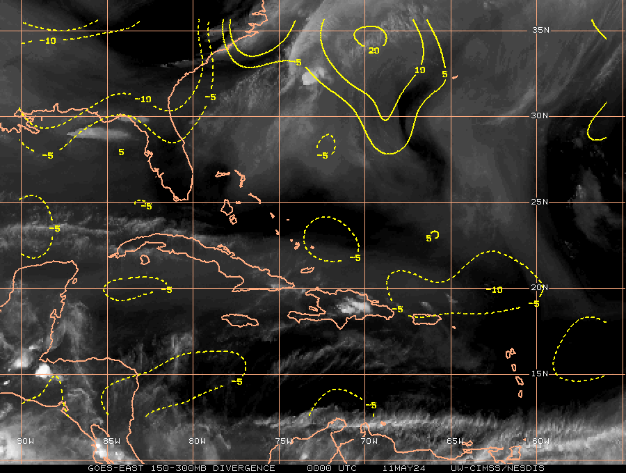
Yeah, I mentioned about that in the Erika thread earlier. The Water Vapor imagery really shows how the moisture from the Eastern Pacific is being pumped into Florida by that ULL in the North Central GOM.
0 likes
NEVER, EVER SAY NEVER in the tropics and weather in general, and most importantly, with life itself!!
________________________________________________________________________________________
Fay 2008 Beryl 2012 Debby 2012 Colin 2016 Hermine 2016 Julia 2016 Matthew 2016 Irma 2017 Dorian 2019
________________________________________________________________________________________
Fay 2008 Beryl 2012 Debby 2012 Colin 2016 Hermine 2016 Julia 2016 Matthew 2016 Irma 2017 Dorian 2019
-
gatorcane

- S2K Supporter
- Posts: 23708
- Age: 48
- Joined: Sun Mar 13, 2005 3:54 pm
- Location: Boca Raton, FL
we have gotten some rain showers that have moved onshore with deep easterly flow building as the pressure gradient is tightening with Erika's remnants passing to the south. A little bit to my south, Pompano Beach Airpark saw a wind gust of 37mph in a squall at 2:53pm this afternoon. Finally we have some good winds here (and some moisture) as it has felt stagnant for so long this summer!
0 likes
-
StormingB81

- S2K Supporter
- Posts: 5676
- Age: 44
- Joined: Thu Aug 27, 2009 1:45 am
- Location: Rockledge, Florida
-
northjaxpro
- S2K Supporter
- Posts: 8900
- Joined: Mon Sep 27, 2010 11:21 am
- Location: Jacksonville, FL
Yeah, gatorcane you will get some wind gusts to tropical storm force in a few of those rain cells as they pivot across the coast. If my memory serves.me correctly, was there a report of a wind gust in a storm cell of 62 mph. yesterday in the Ft. Lauderdale area?
0 likes
NEVER, EVER SAY NEVER in the tropics and weather in general, and most importantly, with life itself!!
________________________________________________________________________________________
Fay 2008 Beryl 2012 Debby 2012 Colin 2016 Hermine 2016 Julia 2016 Matthew 2016 Irma 2017 Dorian 2019
________________________________________________________________________________________
Fay 2008 Beryl 2012 Debby 2012 Colin 2016 Hermine 2016 Julia 2016 Matthew 2016 Irma 2017 Dorian 2019

-
northjaxpro
- S2K Supporter
- Posts: 8900
- Joined: Mon Sep 27, 2010 11:21 am
- Location: Jacksonville, FL
0 likes
NEVER, EVER SAY NEVER in the tropics and weather in general, and most importantly, with life itself!!
________________________________________________________________________________________
Fay 2008 Beryl 2012 Debby 2012 Colin 2016 Hermine 2016 Julia 2016 Matthew 2016 Irma 2017 Dorian 2019
________________________________________________________________________________________
Fay 2008 Beryl 2012 Debby 2012 Colin 2016 Hermine 2016 Julia 2016 Matthew 2016 Irma 2017 Dorian 2019
-
gatorcane
- S2K Supporter
- Posts: 23708
- Age: 48
- Joined: Sun Mar 13, 2005 3:54 pm
- Location: Boca Raton, FL
Hey northjaxpro, I didnt hear about that 62mph gust, that is quite a gust!
NDG, that is some serious rain up your way. Warnings certainly may be necessary as this may just be the beginning, I wonder where the next blowup of deep convection will be?
You get the feeling it is coming somewhere as Erika's remnant energy interacts with the shear to the northwest not to mention all the lower pressure around the peninsula and to the south.
0 likes
-
StormingB81
- S2K Supporter
- Posts: 5676
- Age: 44
- Joined: Thu Aug 27, 2009 1:45 am
- Location: Rockledge, Florida


-
northjaxpro
- S2K Supporter
- Posts: 8900
- Joined: Mon Sep 27, 2010 11:21 am
- Location: Jacksonville, FL
All of that rain is slowly lifting north. It will get up here in Jax area overnight or during thw wee hours on early Sunday.
0 likes
NEVER, EVER SAY NEVER in the tropics and weather in general, and most importantly, with life itself!!
________________________________________________________________________________________
Fay 2008 Beryl 2012 Debby 2012 Colin 2016 Hermine 2016 Julia 2016 Matthew 2016 Irma 2017 Dorian 2019
________________________________________________________________________________________
Fay 2008 Beryl 2012 Debby 2012 Colin 2016 Hermine 2016 Julia 2016 Matthew 2016 Irma 2017 Dorian 2019
-
gatorcane
- S2K Supporter
- Posts: 23708
- Age: 48
- Joined: Sun Mar 13, 2005 3:54 pm
- Location: Boca Raton, FL
Re:
StormingB81 wrote:All these photos where taking outside Disney to the SW
Ankle deep water here:
http://i784.photobucket.com/albums/yy127/StormingB81/11910856_10153748625494674_1180656054_n.jpg
All these I had a passenger take...
http://i784.photobucket.com/albums/yy127/StormingB81/11931756_10153748628219674_1321177735_n.jpg
http://i784.photobucket.com/albums/yy127/StormingB81/11933607_10153748634249674_548169054_n.jpg
Wow looks nasty there, thanks for sending the pics.
Looking at the latest radar over Central Florida, I see some intense rains moving through now with deep reds showing up around the Orlando area, but it appears a break is coming.
0 likes
-
StormingB81
- S2K Supporter
- Posts: 5676
- Age: 44
- Joined: Thu Aug 27, 2009 1:45 am
- Location: Rockledge, Florida
Return to “USA & Caribbean Weather”
Who is online
Users browsing this forum: Stratton23 and 135 guests