Page 1 of 1
Check out Houston radar!
Posted: Mon Feb 11, 2008 10:05 pm
by MGC
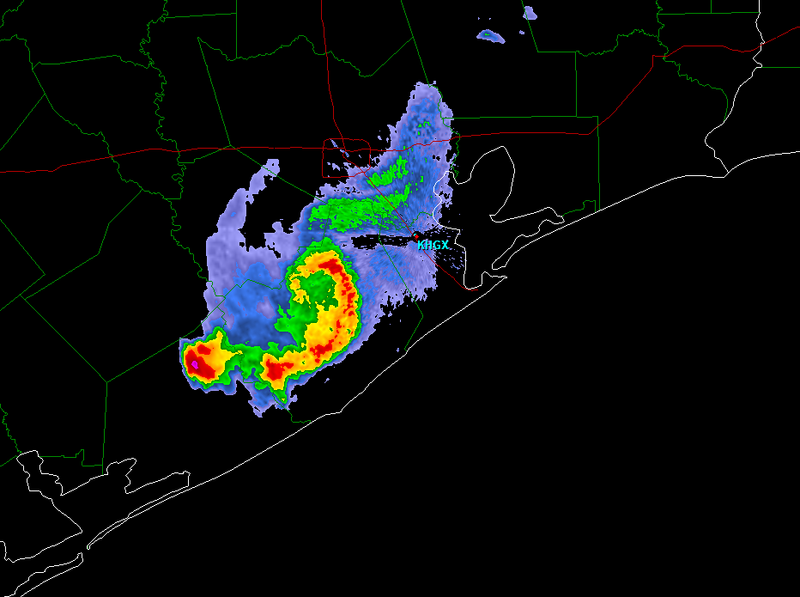
Quite an interesting feature this evening. Almost looks like a tiny hurricane.......MGC
Re: Check out Houston radar!
Posted: Tue Feb 12, 2008 12:11 am
by wbug1
Severe TS formed rapidly, and just as rapidly dissipating?
Posted: Tue Feb 12, 2008 12:19 pm
by Squarethecircle
I didn't see it! Does anyone have some sort of graphic?
Posted: Tue Feb 12, 2008 5:53 pm
by Aquawind
That funky little twist caught my eye as well. No graphics here Squarethecircle..
Posted: Tue Feb 12, 2008 5:57 pm
by RL3AO
I saved an image of it last night.
Posted: Tue Feb 12, 2008 6:13 pm
by Squarethecircle

Hehe. Any word if there was an actual swirl of low pressure?
Re:
Posted: Wed Feb 13, 2008 12:33 am
by wall_cloud
Squarethecircle wrote::uarrow: Hehe. Any word if there was an actual swirl of low pressure?
obviously. Hard to tell from one image, but I would assume that the image is that of cyclonic end of a bookend vortex. Were there strong winds reported south/southwest of Houston with this storm?
Re: Check out Houston radar!
Posted: Wed Feb 13, 2008 12:53 am
by Ptarmigan
I also managed to get the radar image from last night.

Re: Check out Houston radar!
Posted: Wed Feb 13, 2008 4:44 pm
by weatherrabbit_tx
mini 'cane or TS.....lets hope its not a pre cursor.........

Posted: Wed Feb 13, 2008 5:18 pm
by Squarethecircle
I'd like to know what the heck happened there. That's definitely not you're average low pressure system, especially not with all that heavy cyclonic-ly-arranged rain.
Is there any official notice of the storm, or do we have to keep with speculation?
Posted: Wed Feb 13, 2008 5:32 pm
by RL3AO