S. Plains Severe April 17th to 19th?
Posted: Mon Apr 13, 2009 11:38 am
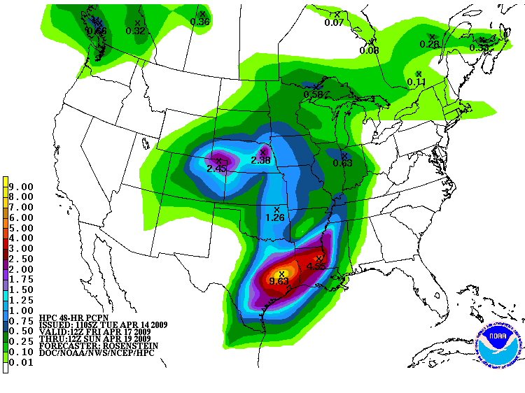
SPC 4-8 days has parts of the Central Plains in the action Days 4 and 5
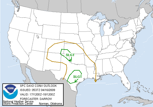
OK, this hotlink has only about 23 hours to live...

Storms ahead of the dryline way back in the Permian Basin approaching I-35 corridor
NAM solution of storms on what appears to be a returning frontal feature seems more correct to me

Instability per NAM a bit limited, but 50 knots plus of deep shear...

Euro low level wind speeds/surface features, despite a healthy 500 mb feature, don't look too impressive until Sunday, when the system is in the mid-South.
I have a quick look, strong 850 mb flow, and 500 mb flow divergent and cutting ahead of an upper low or trough, as a probable indicator of severe potential.
And the Euro does not seem on board for a big time event, or at least suggests wind dynamics will be limited. At least not 'til Sunday in the mid-South.
OK, this hotlink has only about 23 hours to live...
Storms ahead of the dryline way back in the Permian Basin approaching I-35 corridor
NAM solution of storms on what appears to be a returning frontal feature seems more correct to me
Instability per NAM a bit limited, but 50 knots plus of deep shear...
Euro low level wind speeds/surface features, despite a healthy 500 mb feature, don't look too impressive until Sunday, when the system is in the mid-South.
I have a quick look, strong 850 mb flow, and 500 mb flow divergent and cutting ahead of an upper low or trough, as a probable indicator of severe potential.
And the Euro does not seem on board for a big time event, or at least suggests wind dynamics will be limited. At least not 'til Sunday in the mid-South.