I have been studying the microscale meteorology in my holler for the last couple of years, in an effort to gather data about our ridge and valley splits for the local NWS office, and maybe help to figure out how exactly East Kentucky's version of the split happens. This was mostly in the form of using my quadcopter and a Kestrel 4000 to do a "sounding", where some nights I recorded a 15F+ difference between the valley floor and just 500-600ft aloft (local ridge tops are between 400-530ft above the valley floor). Just recently I have started gathering temperature data along the valley floor, both the main river valley, and our holler (the holler is a creek valley that empties out into the river valley). I held my Kestrel 4000 out of the car window (not driving) while it logged data every 2 seconds, and used an app on my iPhone to log GPS points. I then merged the data and used QGIS to plot the points on a modified topographic map of the area. Some of the results have been pretty interesting, thus far, but I only have a limited sample size to pull from. I was expecting that the coolest temperatures would be in the river valley (cold air is denser than warm air), and as I traveled up the holler, the air temperature would slowly warm up the further back we went...as there is about an 80ft gain in elevation from the mouth of the holler to the house. Wrong.
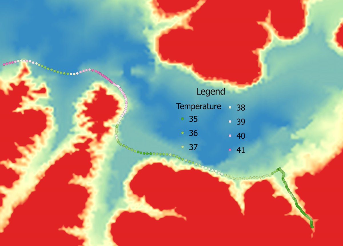
Here is a wide view, with the holler down in the bottom right...the data covers approximately 4 miles of roadway:
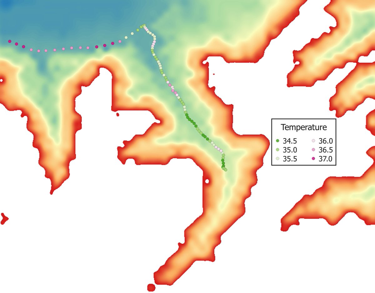
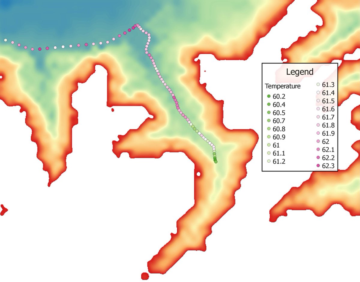
And this is the holler, with approximately a mile of roadway covered here:
On a couple of occasions (remember, limited sample size), I have noted that when we passed by the 3 drainages in the holler, the temperature is colder there than between them. In some cases, it can be 5F+ cooler in front of the drainage than just 200ft away! I always knew it could be cooler, you can feel it when walking or driving down the road...but I never thought much of it, let alone that it could be so much of a difference.
In this case, as we drove by 1 drainage (it is the middle one when looking at the topo map), the temperature dropped from 70F to 66F, then increased back to 69F before dropping to 61F by the back drainage...I have not been able to replicate this again, but we also haven't really had a night like that again in the last week, either.
Here is the topo map for the above GE shot:
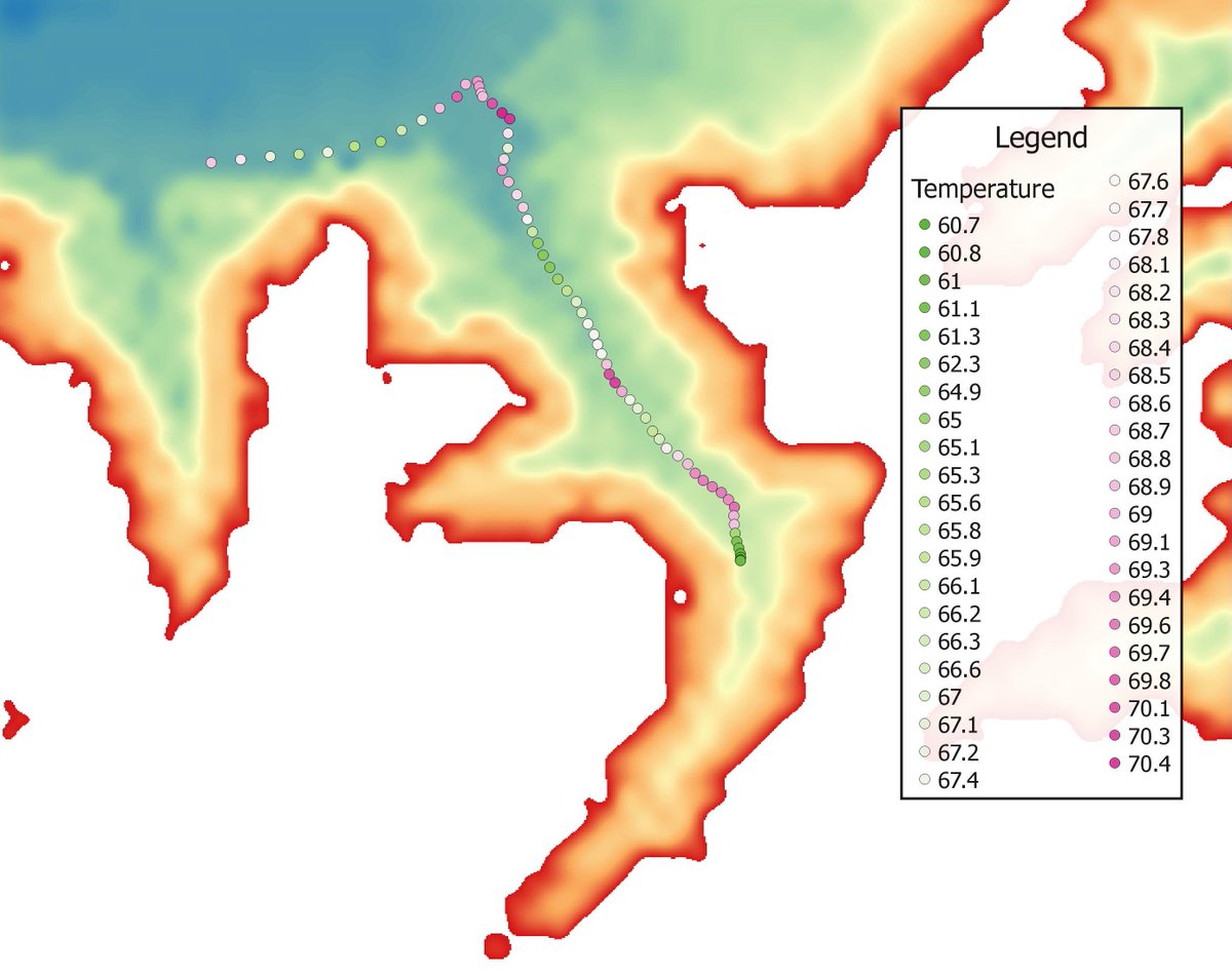
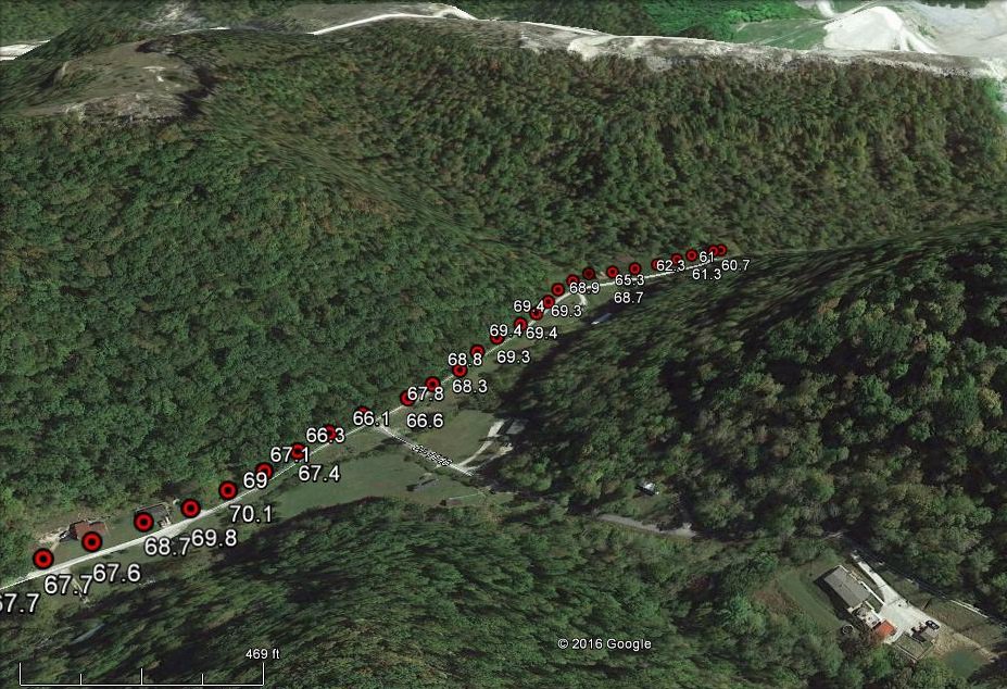
I did have a night where everything was pretty flat lined (it had been cloudy and rainy), but the holler still had slightly cooler air draining into it from the drainages...with the air becoming cooler in each drainage the deeper into the holler you went.
I leave you with this snippet from a 2009 article in the Mountain News Journal, a newsletter that NWS Jackson, KY used to publish every quarter, written by the then Science and Operations Officer Gary Votaw:
After the Weather Forecast Office at Jackson/Julian Carroll Airport was established to begin 1981 the forecast staff began to realize that the difference between temperatures on the ridges and in the valleys of eastern Kentucky became quite intense at times, more so than had been understood until then. As we know from basic chemistry cool air sinks relative to adjacent warmer air. That also applies to air cooling on hillsides which tends to slide to lower elevations though a breeze can sweep it away before doing so. Eastern Kentucky is more complicated than most mountain locations in this regard since the valleys and hollows are narrow enough that mountain ridges efficiently shelter low lying areas so that wind cannot easily mix warmer ridge top air into the valleys. But the slopes are very steep so not much cool air is able to develop on the slopes. The point is that this process requires more study to be able to forecast it better.
Source:
http://www.crh.noaa.gov/images/jkl/news ... 9_Fall.pdf