Page 27 of 30

Re: Texas Fall 2020

Posted: Mon Nov 23, 2020 5:42 pm
by cheezyWXguy
bubba hotep wrote:Too bad this pattern isn't rocking in January. Constant stream of systems being forced under the block but there really isn't any cold air them to pull down.

https://www.tropicaltidbits.com/analysis/models/ecmwf/2020112312/ecmwf_z500aNorm_namer_11.png

It’s been about 4 weeks since the last good setup, hopefully the pattern continues to reload every 4-6 weeks and we actually have a decent source region next time

Re: Texas Fall 2020

Posted: Mon Nov 23, 2020 11:11 pm
by cheezyWXguy
0z 3k NAM is quiet for DFW, maybe a little too quiet at 00z Wed. Nothing but streamer showers depicted, but surface cape near 1000, elevated is higher than that, very weak cap, and 0-1km srh over 350m2/s2. Low center is not too far NW, in west-central Oklahoma. This strikes me as a low coverage event capable of a surprise or two. To those who know more than me (and there are plenty on this board), do you think there is something here, or do you think this is a non-event?

Re: Texas Fall 2020

Posted: Mon Nov 23, 2020 11:47 pm
by Brent
cheezyWXguy wrote:0z 3k NAM is quiet for DFW, maybe a little too quiet at 00z Wed. Nothing but streamer showers depicted, but surface cape near 1000, elevated is higher than that, very weak cap, and 0-1km srh over 350m2/s2. Low center is not too far NW, in west-central Oklahoma. This strikes me as a low coverage event capable of a surprise or two. To those who know more than me (and there are plenty on this board), do you think there is something here, or do you think this is a non-event?


its been so boring lately I'll believe it when I see it as far as widespread anything that's for sure

the news just showed it blowing up east of us which sounds totally like the usual everything is east

Re: Texas Fall 2020

Posted: Mon Nov 23, 2020 11:51 pm
by cheezyWXguy
Brent wrote:
cheezyWXguy wrote:0z 3k NAM is quiet for DFW, maybe a little too quiet at 00z Wed. Nothing but streamer showers depicted, but surface cape near 1000, elevated is higher than that, very weak cap, and 0-1km srh over 350m2/s2. Low center is not too far NW, in west-central Oklahoma. This strikes me as a low coverage event capable of a surprise or two. To those who know more than me (and there are plenty on this board), do you think there is something here, or do you think this is a non-event?


its been so boring lately I'll believe it when I see it as far as widespread anything that's for sure

the news just showed it blowing up east of us which sounds totally like the usual everything is east

So true. I won’t hold my breath for a second, just wondering if there’s an outside chance of anything given the depicted environment

Re: Texas Fall 2020

Posted: Tue Nov 24, 2020 2:19 am
by Brent
HRRR doesnt have anything either

Again rain chances look promising by the weekend but I mean they were promising Sunday and today at one point

also the end of the Euro pushed the snow back into Oklahoma no surprise there

Re: Texas Fall 2020

Posted: Tue Nov 24, 2020 7:57 am
by cheezyWXguy
11z HRRR breaks out storms just southeast of dfw at 04-05z

Re: Texas Fall 2020

Posted: Tue Nov 24, 2020 9:58 am
by cheezyWXguy
13z HRRR has shifted west with initiation and has a storm over Dallas county at 5z in a pretty volatile environment. Knowing the HRRR I wouldn’t put much stock into it, but need to watch for future runs

Re: Texas Fall 2020

Posted: Tue Nov 24, 2020 2:29 pm
by TeamPlayersBlue
12z Euro looks interesting. The weather may be east of us in Texas, but i cant tell entirely by looking at the 500mb chart. Shows a huge rex block day 9 with ULL centered over NTX

Re: Texas Fall 2020

Posted: Tue Nov 24, 2020 4:47 pm
by bubba hotep
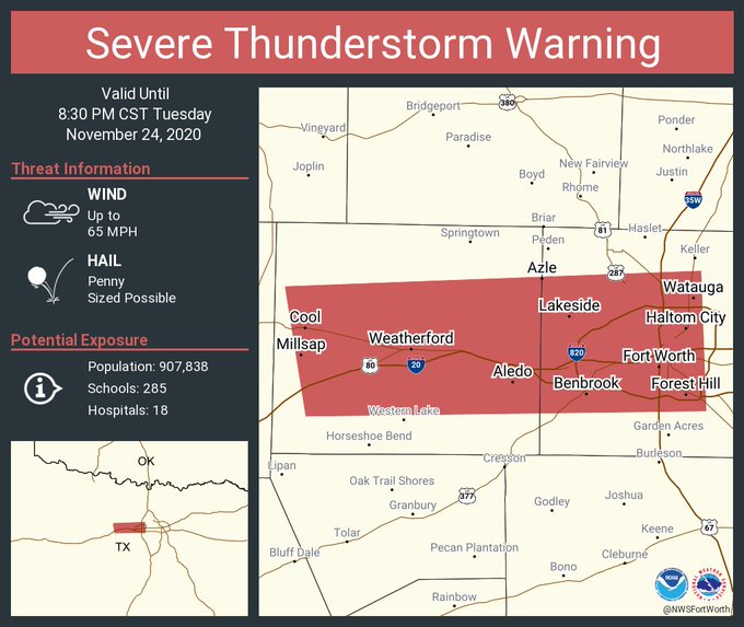
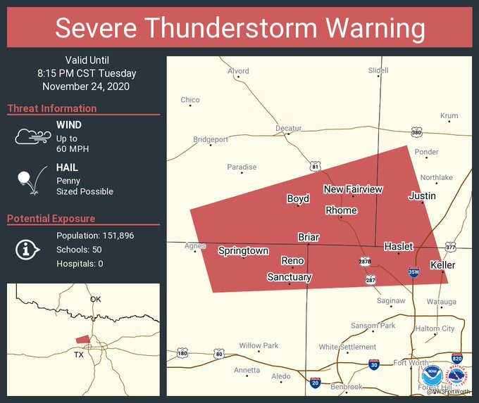
Dryline convection across Western NTX appears to be more robust than what any of the models were showing.

Re: Texas Fall 2020

Posted: Tue Nov 24, 2020 5:28 pm
by cheezyWXguy
bubba hotep wrote:Dryline convection across Western NTX appears to be more robust than what any of the models were showing.

Nam and hrrr have come around to showing storms in dfw, but are still underdoing current radar trends

Re: Texas Fall 2020

Posted: Tue Nov 24, 2020 5:58 pm
by bubba hotep
cheezyWXguy wrote:
bubba hotep wrote:Dryline convection across Western NTX appears to be more robust than what any of the models were showing.

Nam and hrrr have come around to showing storms in dfw, but are still underdoing current radar trends


Quick look at SPC mesoanalysis shows a robust parameter space across DFW. If a cell or can get established then this might end up being a sneaky little event for portions of DFW.

Re: Texas Fall 2020

Posted: Tue Nov 24, 2020 7:15 pm
by bubba hotep
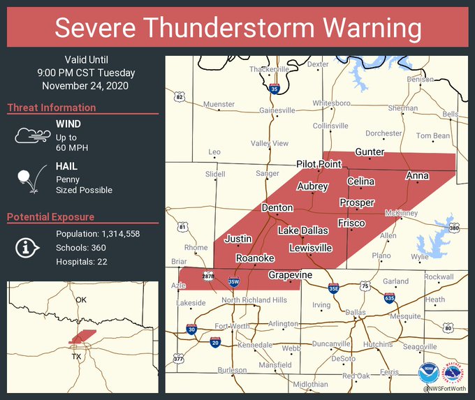
Image

Image

Mesoscale Discussion 1808
NWS Storm Prediction Center Norman OK
0517 PM CST Tue Nov 24 2020

Areas affected...Portions of southern Kansas...central
Oklahoma...north-central Texas

Concerning...Severe Thunderstorm Watch 513...

Valid 242317Z - 250115Z

The severe weather threat for Severe Thunderstorm Watch 513
continues.

SUMMARY...The severe threat is expected to continue across Severe
Thunderstorm Watch 0513. Additional isolated severe thunderstorms
may develop just north/east of the watch in southern Kansas into
eastern Oklahoma as well as into northern Texas. Large hail,
damaging gusts, and perhaps a tornado cannot be ruled out with the
stronger storms. An additional WW may be needed downstream.

DISCUSSION...Quasi-discrete convection has grown upscale into a more
continuous linear segment along a cold front, aligned roughly from
AVK to CLK. More isolated cellular development, with an uptick in
lightning flash rates and echo tops exceeding 30kft, has also been
noted along a dryline across southwestern OK into northwest TX.
Ahead of both storm regimes, a narrow and weak but highly sheared
warm sector remains in place. Based on latest Mesoanalysis,
temperatures just over 60F (with upper 50s F dewpoints) beneath near
7 C/km mid-level lapse rates are supporting a narrow corridor of
around 1000 J/kg MLCAPE. Modest veering of 35-50 kt 925-850 mb
southerly flow overspreading this warm sector is promoting 200-300
m2/s2 effective SRH, with even stronger flow aloft contributing to
50+ kts of effective bulk shear. As such, any storms embedded in the
line or established in the warm sector will have the potential to
produce damaging gusts and large hail. Given the magnitude of
low-level shear present, the most intense QLCS circulations or
sustained supercell structures may produce a tornado.

Much of southern KS to northern TX east of the I-35 corridor have
remained under overcast skies and cooler conditions. However, strong
sfc/low-level warm-air advection may promote some additional
destabilization ahead of the ongoing line/discrete cellular
development, and a downstream WW issuance is possible.

..Squitieri/Hart.. 11/24/2020

...Please see http://www.spc.noaa.gov for graphic product...

ATTN...WFO...SGF...TSA...ICT...FWD...OUN...

Re: Texas Fall 2020

Posted: Tue Nov 24, 2020 7:55 pm
by cheezyWXguy
Storms are pretty numerous, but not too strong. Probably having trouble getting rooted to the surface, given the cap. Plus they’re close to the front which minimizes their ability to capitalize on the SRH without being undercut. Things could change, but I prefer they don’t. A decent quick rain with some lightning sounds pretty good right about now.

Re: Texas Fall 2020

Posted: Tue Nov 24, 2020 8:54 pm
by HockeyTx82
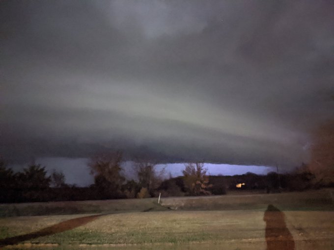
Quite the cloud formation just west of Ponder. Looked like we were about to get socked then it went NE. Cool breeze and rain.

Re: Texas Fall 2020

Posted: Tue Nov 24, 2020 8:56 pm
by bubba hotep
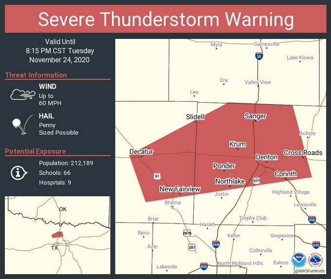
Popping off now.

Image

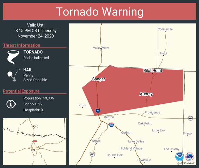
Image

Image

Re: Texas Fall 2020

Posted: Tue Nov 24, 2020 9:01 pm
by HockeyTx82
Tornado warning

Re: Texas Fall 2020

Posted: Tue Nov 24, 2020 9:02 pm
by bubba hotep
Image

Re: Texas Fall 2020

Posted: Tue Nov 24, 2020 9:03 pm
by bubba hotep
Kudos to FWD, they never really backed off of storms for DFW even when all the models earlier today showed everything missing DFW to the east.

Re: Texas Fall 2020

Posted: Tue Nov 24, 2020 9:11 pm
by bubba hotep
Image

Re: Texas Fall 2020

Posted: Tue Nov 24, 2020 9:15 pm
by bubba hotep
Posted by someone in Wise County

Image