 this is horrible
Hopefully that front next week is legit
Moderator: S2k Moderators

 this is horrible
Brent wrote:There's already a heat advisory til at least Thursday here
Hopefully that front next week is legit
Brent wrote:There's already a heat advisory til at least Thursday here
Hopefully that front next week is legit


Iceresistance wrote:This is going to be a long week . . .
Up to 103 now, but still bad.

ElectricStorm wrote:As someone who has an outdoor job, this week is absolutely brutal. The last two summers weren't that bad but this year is really bringing the heat...

Ntxw wrote:Brent wrote:There's already a heat advisory til at least Thursday here
Hopefully that front next week is legit
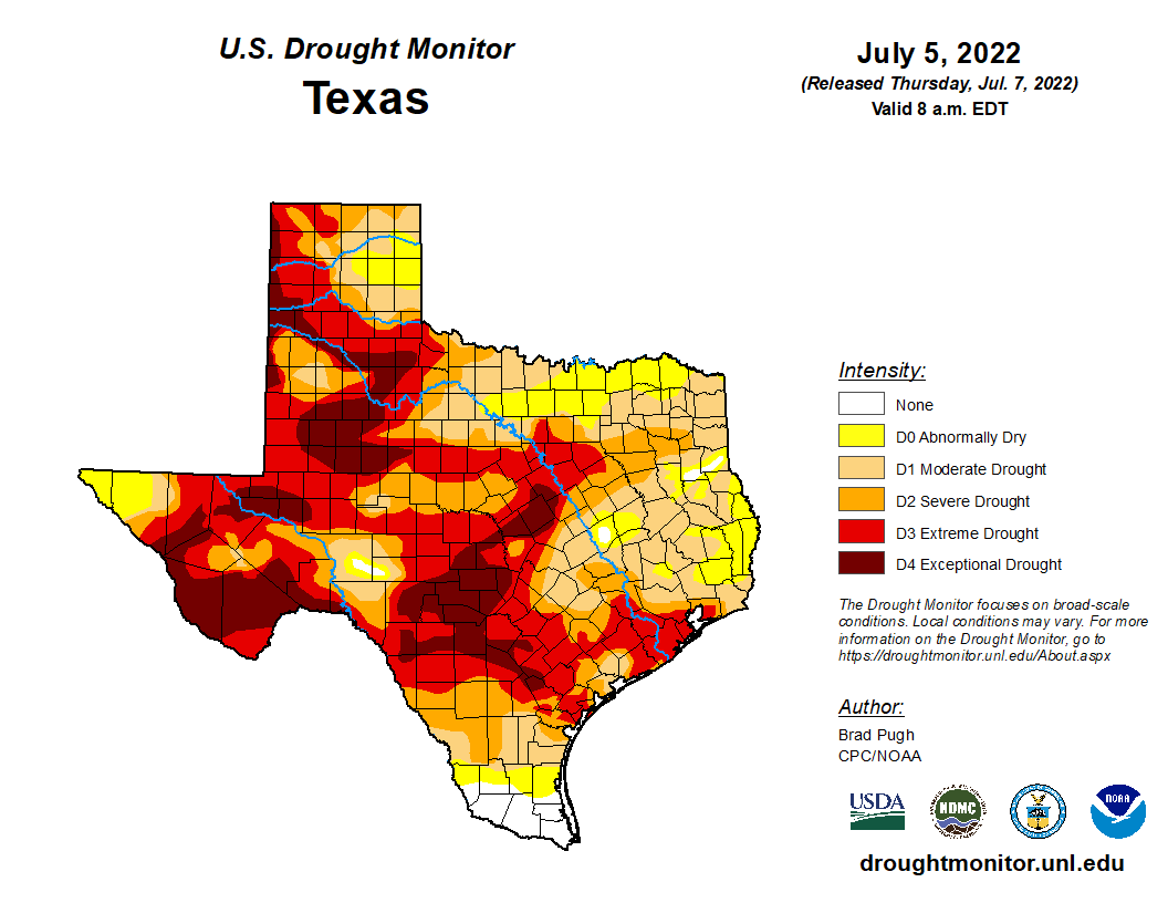
Depends on what your expectations of cool down is. If down to 95-100F from 100-105F and 0% rainfall to 10-30% then yes for Tulsa. The forecast discussions note it due to the ridge shifting, but there isn't blocking up north causing a breakdown. It's just shifts of the ridge, so it's not lasting.
There is a little good news the PDO for June rose after being elevated most of the year. Would like to see a string of several more months in that direction.
https://i.imgur.com/xhsKTX2.png
underthwx wrote:Iceresistance wrote:This is going to be a long week . . .
Up to 103 now, but still bad.
Let a smile be your umbrella Ice, sooner or later the rain will fall...
I just don't know what else to say about this week at this point


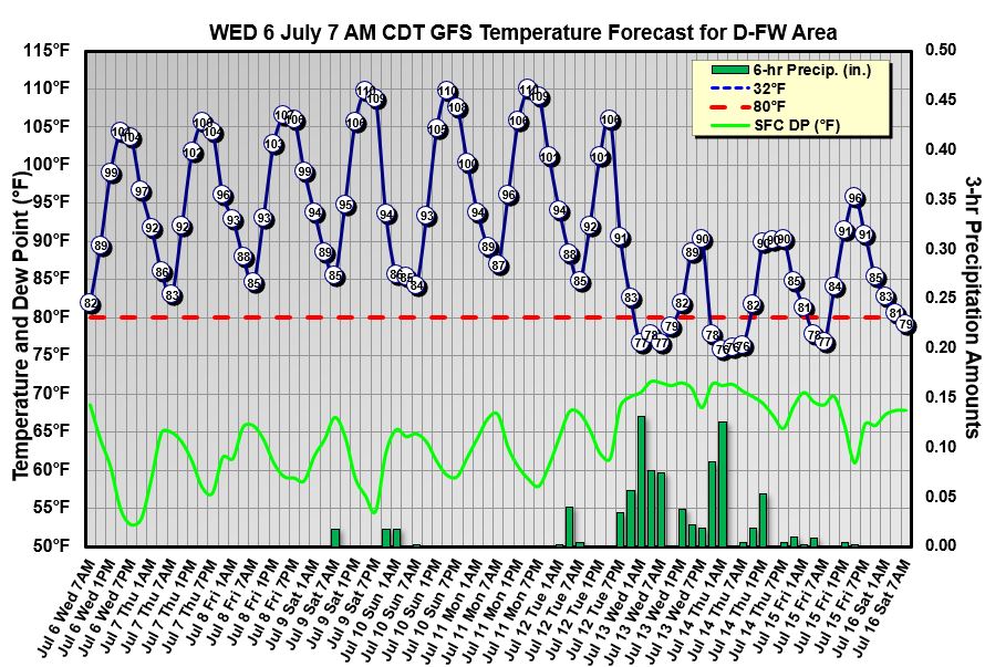
wxman57 wrote:Looks like it might just be warm enough for a bike ride in Dallas-Ft. Worth this weekend and early next week. After Monday, the GFS has rain moving in and highs only near 90. Brrr! Hope you get the rain.
http://wxman57.com/images/DFW.JPG
Ntxw wrote:MJO is trying to make it out into the Pacific (hasn't happened yet) per guidance. Definitely watch the SOI in the coming weeks, if it can sustain negatives then we know the MJO/rising motion out in the Pacific may shake the pattern with success. It would be towards the end of the month and August to bear fruit if it's real. Trade surges out there fighting it though, hopeful.
Cpv17 wrote:Ntxw wrote:MJO is trying to make it out into the Pacific (hasn't happened yet) per guidance. Definitely watch the SOI in the coming weeks, if it can sustain negatives then we know the MJO/rising motion out in the Pacific may shake the pattern with success. It would be towards the end of the month and August to bear fruit if it's real. Trade surges out there fighting it though, hopeful.
The forecast is looking a bit better for my neck of the woods beginning the middle part of next week.


Return to “USA & Caribbean Weather”
Users browsing this forum: Cpv17 and 102 guests

