Raining in north Fort Worth.
Yay!
Texas Fall 2022
Moderator: S2k Moderators
Forum rules

The posts in this forum are NOT official forecast and should not be used as such. They are just the opinion of the poster and may or may not be backed by sound meteorological data. They are NOT endorsed by any professional institution or STORM2K.
-
rwfromkansas
- Category 5

- Posts: 2165
- Joined: Sat Aug 27, 2005 12:47 am
- Location: North Fort Worth
Re: Texas Fall 2022
4 likes
-
Iceresistance

- Category 5
- Posts: 8911
- Age: 20
- Joined: Sat Oct 10, 2020 9:45 am
- Location: Tecumseh, OK/Norman, OK
Re: Texas Fall 2022
I know it's the first time it has shown up, but the 12z GFS has a Rain/Snow mix over most of Oklahoma (Including me!) next Friday (+240 hours).
EDIT: The WPC has highlighted a risk of Heavy Rain for all of Southern Texas early next week. The Happy Hour GFS shows heavy rain for the general area at the same general time.
EDIT: The WPC has highlighted a risk of Heavy Rain for all of Southern Texas early next week. The Happy Hour GFS shows heavy rain for the general area at the same general time.
2 likes
Bill 2015 & Beta 2020
Winter 2020-2021
All observations are in Tecumseh, OK unless otherwise noted.
Winter posts are focused mainly for Oklahoma & Texas.
Take any of my forecasts with a grain of salt, refer to the NWS, SPC, and NHC for official information
Never say Never with weather! Because ANYTHING is possible!
Winter 2020-2021
All observations are in Tecumseh, OK unless otherwise noted.
Winter posts are focused mainly for Oklahoma & Texas.
Take any of my forecasts with a grain of salt, refer to the NWS, SPC, and NHC for official information
Never say Never with weather! Because ANYTHING is possible!
-
rwfromkansas
- Category 5
- Posts: 2165
- Joined: Sat Aug 27, 2005 12:47 am
- Location: North Fort Worth

-
Iceresistance
- Category 5
- Posts: 8911
- Age: 20
- Joined: Sat Oct 10, 2020 9:45 am
- Location: Tecumseh, OK/Norman, OK
Re: Texas Fall 2022
rwfromkansas wrote:https://i.imgur.com/G2JWw5A.jpg
Wow. The hail in Fort Stockton drifted in FEET. Some was left today.
That may help with the drought situation down there, this is odd for a Hailstorm to drift like this! Looks like after a blizzard came through that area!
0 likes
Bill 2015 & Beta 2020
Winter 2020-2021
All observations are in Tecumseh, OK unless otherwise noted.
Winter posts are focused mainly for Oklahoma & Texas.
Take any of my forecasts with a grain of salt, refer to the NWS, SPC, and NHC for official information
Never say Never with weather! Because ANYTHING is possible!
Winter 2020-2021
All observations are in Tecumseh, OK unless otherwise noted.
Winter posts are focused mainly for Oklahoma & Texas.
Take any of my forecasts with a grain of salt, refer to the NWS, SPC, and NHC for official information
Never say Never with weather! Because ANYTHING is possible!

Re: Texas Fall 2022
I think I received two sprinkles today. Thunder was detected within 20 miles of my house. Not much rain with it all. Still enjoying the nice temperatures.
0 likes
Re: Texas Fall 2022
rwfromkansas wrote:https://i.imgur.com/G2JWw5A.jpg
Wow. The hail in Fort Stockton drifted in FEET. Some was left today.
That’s almost as incredible as Yordans walk-off home run today!
1 likes
-
Iceresistance
- Category 5
- Posts: 8911
- Age: 20
- Joined: Sat Oct 10, 2020 9:45 am
- Location: Tecumseh, OK/Norman, OK
Re: Texas Fall 2022
Heavy Rainfall event is now likely for Central and Southern Texas on the next 5-7 Days.
1 likes
Bill 2015 & Beta 2020
Winter 2020-2021
All observations are in Tecumseh, OK unless otherwise noted.
Winter posts are focused mainly for Oklahoma & Texas.
Take any of my forecasts with a grain of salt, refer to the NWS, SPC, and NHC for official information
Never say Never with weather! Because ANYTHING is possible!
Winter 2020-2021
All observations are in Tecumseh, OK unless otherwise noted.
Winter posts are focused mainly for Oklahoma & Texas.
Take any of my forecasts with a grain of salt, refer to the NWS, SPC, and NHC for official information
Never say Never with weather! Because ANYTHING is possible!
Re: Texas Fall 2022
My 2 sprinkles yesterday might turn into 3 or 4 today. Better chance on Sunday, with maybe half an inch or so possible. Heaviest rain looks to stay west/south of here.
0 likes
-
Iceresistance
- Category 5
- Posts: 8911
- Age: 20
- Joined: Sat Oct 10, 2020 9:45 am
- Location: Tecumseh, OK/Norman, OK
Re: Texas Fall 2022
Look at this! This is 7 days out from the WPC, also a risk for Heavy Rainfall from the WPC for the same general area as well.

https://s4.gifyu.com/images/WPC-Wow.gif
https://s4.gifyu.com/images/WPC-Wow.gif
1 likes
Bill 2015 & Beta 2020
Winter 2020-2021
All observations are in Tecumseh, OK unless otherwise noted.
Winter posts are focused mainly for Oklahoma & Texas.
Take any of my forecasts with a grain of salt, refer to the NWS, SPC, and NHC for official information
Never say Never with weather! Because ANYTHING is possible!
Winter 2020-2021
All observations are in Tecumseh, OK unless otherwise noted.
Winter posts are focused mainly for Oklahoma & Texas.
Take any of my forecasts with a grain of salt, refer to the NWS, SPC, and NHC for official information
Never say Never with weather! Because ANYTHING is possible!
Re: Texas Fall 2022
DFW's record of 97F looks safe with the forecast 92F. Still pretty warm (and dry). Dry streak so far continues, I'm hopeful for the wpc qpf forecast but cautious in case it trends down as it gets closer. It's supposed to rain a lot in October.
1 likes
The above post and any post by Ntxw is NOT an official forecast and should not be used as such. It is just the opinion of the poster and may or may not be backed by sound meteorological data. It is NOT endorsed by any professional institution including Storm2k. For official information, please refer to NWS products.
Help support Storm2K!
-
weatherdude1108
- Category 5
- Posts: 4172
- Joined: Tue Dec 13, 2011 1:04 pm
- Location: Northwest Austin/Cedar Park, TX
Re: Texas Fall 2022
EWX has some nice wording! The CPC just has average to below average rain, but cooler than average in the 6 to 10 day time frame. Not worth including here.
I pray this forecast doesn't dry up on us again. Should be mostly wet this time of year, not mostly dry and watering. Too many duds. Thanks La Nina!

000
FXUS64 KEWX 121834
AFDEWX
Area Forecast Discussion
National Weather Service Austin/San Antonio TX
134 PM CDT Wed Oct 12 2022
...New SHORT TERM, LONG TERM...
.SHORT TERM...
(Tonight through Thursday night)
Issued at 114 PM CDT Wed Oct 12 2022
A cold front bringing drier air into the region highlights the short
term period.
The aforementioned cold front is currently oriented SW to NE from
just south of Midland through just south of Wichita Falls. The front
will continue to progress southeast and move through south central
TX later this afternoon and evening. CAMs still indicate a few
isolated showers or storms may develop ahead of this front across
the I-35 corridor and into the Coastal Plains, so we have maintained
a slight chance PoP mention in the forecast for this evening. Just a
quick downpour and some gusty and erratic winds are expected with
any activity. Otherwise, it will be a mostly clear night with drier
air filtering into the region. Lows are expected to drop into the
mid to upper 50s across northwestern portions of the Hill Country to
the 60s elsewhere.
Tomorrow will still be a warm day with plentiful sunshine and highs
climbing into the upper 80s to mid 90s, though it will feel more
comfortable with dewpoints mainly in the 40s and 50s. Consequently,
minimum relative humidity will fall into the upper teens and 20s,
which combined with a northeasterly breeze behind the front (10-15
mph sustained with gusts to 20 mph) will resulted in elevated to
near critical fire weather conditions.
Temperatures Friday morning should be a few degrees cooler than
Thursday morning, with relatively greater cloud cover likely keeping
temperatures from falling more than they otherwise would.
&&
.LONG TERM...
(Friday through Wednesday)
Issued at 134 PM CDT Wed Oct 12 2022
An active pattern is expected to return in the long term period, but
we will continue with our warm and dry regime through at least the
first half of the weekend before things get interesting Sunday-
Tuesday. Northwest flow aloft is expected to continue through Friday
and into portions of Saturday before signs of our first shot at
widespread rain since late August arrive late Sunday into Monday.
Expect southeasterly surface flow to return in earnest on Friday
afternoon and continue up until the passage of our much anticipated
cold front set to arrive late Sunday into early Monday.
A 500mb cut off low will remain situated off the coast of Southern
California on Saturday, but begin to migrate eastward Saturday
afternoon and evening. Once it starts moving east, this low will
become absorbed by a longwave trough diving south over the Great
Lakes. A strong 200mb jet streak will slide into SW Texas late Sunday
and then become favorably positioned over South-Central Texas Monday
afternoon-Tuesday morning, with much of the region within the right
entrance region of a 70-90 kt WSW oriented jet streak.
Meanwhile, the troughing over the Great Lakes will send a strong
Fall cold front southward into north Texas by Sunday morning. The
front should continue its trek southward and move through South-
Central Texas by late Sunday evening/early Monday morning. With good
strong southeasterly surface flow and decent isentropic upglide over
the frontal boundary, widespread showers with a few embedded
thunderstorms appear increasingly likely Sunday night-Tuesday
afternoon. Locally heavy rainfall will be possible on Monday, but
it`s a bit too early to hone in on specifics yet. Just know that
confidence is increasing in a soaking rain event, especially given a
favorable synoptic setup. Moving further on, expect a rapid drying
trend Tuesday evening and into the middle of next week with much
cooler temperatures settling into our neck of the woods. Expect highs
to be some 20 degrees cooler by this time next week with mornings in
the 40s and 50s likely as well.
I pray this forecast doesn't dry up on us again. Should be mostly wet this time of year, not mostly dry and watering. Too many duds. Thanks La Nina!
000
FXUS64 KEWX 121834
AFDEWX
Area Forecast Discussion
National Weather Service Austin/San Antonio TX
134 PM CDT Wed Oct 12 2022
...New SHORT TERM, LONG TERM...
.SHORT TERM...
(Tonight through Thursday night)
Issued at 114 PM CDT Wed Oct 12 2022
A cold front bringing drier air into the region highlights the short
term period.
The aforementioned cold front is currently oriented SW to NE from
just south of Midland through just south of Wichita Falls. The front
will continue to progress southeast and move through south central
TX later this afternoon and evening. CAMs still indicate a few
isolated showers or storms may develop ahead of this front across
the I-35 corridor and into the Coastal Plains, so we have maintained
a slight chance PoP mention in the forecast for this evening. Just a
quick downpour and some gusty and erratic winds are expected with
any activity. Otherwise, it will be a mostly clear night with drier
air filtering into the region. Lows are expected to drop into the
mid to upper 50s across northwestern portions of the Hill Country to
the 60s elsewhere.
Tomorrow will still be a warm day with plentiful sunshine and highs
climbing into the upper 80s to mid 90s, though it will feel more
comfortable with dewpoints mainly in the 40s and 50s. Consequently,
minimum relative humidity will fall into the upper teens and 20s,
which combined with a northeasterly breeze behind the front (10-15
mph sustained with gusts to 20 mph) will resulted in elevated to
near critical fire weather conditions.
Temperatures Friday morning should be a few degrees cooler than
Thursday morning, with relatively greater cloud cover likely keeping
temperatures from falling more than they otherwise would.
&&
.LONG TERM...
(Friday through Wednesday)
Issued at 134 PM CDT Wed Oct 12 2022
An active pattern is expected to return in the long term period, but
we will continue with our warm and dry regime through at least the
first half of the weekend before things get interesting Sunday-
Tuesday. Northwest flow aloft is expected to continue through Friday
and into portions of Saturday before signs of our first shot at
widespread rain since late August arrive late Sunday into Monday.
Expect southeasterly surface flow to return in earnest on Friday
afternoon and continue up until the passage of our much anticipated
cold front set to arrive late Sunday into early Monday.
A 500mb cut off low will remain situated off the coast of Southern
California on Saturday, but begin to migrate eastward Saturday
afternoon and evening. Once it starts moving east, this low will
become absorbed by a longwave trough diving south over the Great
Lakes. A strong 200mb jet streak will slide into SW Texas late Sunday
and then become favorably positioned over South-Central Texas Monday
afternoon-Tuesday morning, with much of the region within the right
entrance region of a 70-90 kt WSW oriented jet streak.
Meanwhile, the troughing over the Great Lakes will send a strong
Fall cold front southward into north Texas by Sunday morning. The
front should continue its trek southward and move through South-
Central Texas by late Sunday evening/early Monday morning. With good
strong southeasterly surface flow and decent isentropic upglide over
the frontal boundary, widespread showers with a few embedded
thunderstorms appear increasingly likely Sunday night-Tuesday
afternoon. Locally heavy rainfall will be possible on Monday, but
it`s a bit too early to hone in on specifics yet. Just know that
confidence is increasing in a soaking rain event, especially given a
favorable synoptic setup. Moving further on, expect a rapid drying
trend Tuesday evening and into the middle of next week with much
cooler temperatures settling into our neck of the woods. Expect highs
to be some 20 degrees cooler by this time next week with mornings in
the 40s and 50s likely as well.
1 likes
The preceding post is NOT an official forecast, and should not be used as such. It is only the opinion of the poster and may or may not be backed by sound meteorological data. It is NOT endorsed by any professional institution including storm2k.org. For Official Information please refer to the NHC and NWS products.
-
Texas Snowman

- Storm2k Moderator

- Posts: 6011
- Joined: Fri Jan 25, 2008 11:29 am
- Location: Denison, Texas
Re: Texas Fall 2022
Before today, the previous record late 100 degree day in Waco was Oct. 4, 1983. And just a little bit more than a couple of months later that year, one of the coldest air masses of the 20th Century plunged south through Texas…
——-
@NWSFortWorth — Waco hit a record breaking 100 degrees today at approximately 3:15 PM CDT. This breaks the previous October 12th record of 98 from 2015. This is also the latest 100 degree day of all time, breaking the previous latest 100 degree day from October 4th in 1983. #dfwwx #ctxwx #txwx
——-
@NWSFortWorth — Waco hit a record breaking 100 degrees today at approximately 3:15 PM CDT. This breaks the previous October 12th record of 98 from 2015. This is also the latest 100 degree day of all time, breaking the previous latest 100 degree day from October 4th in 1983. #dfwwx #ctxwx #txwx
0 likes
The above post and any post by Texas Snowman is NOT an official forecast and should not be used as such. It is just the opinion of the poster and may or may not be backed by sound meteorological data. It is NOT endorsed by any professional institution including storm2k.org. For official information, please refer to NWS products.
-
Iceresistance
- Category 5
- Posts: 8911
- Age: 20
- Joined: Sat Oct 10, 2020 9:45 am
- Location: Tecumseh, OK/Norman, OK
Re: Texas Fall 2022
Texas Snowman wrote:Before today, the previous record late 100 degree day in Waco was Oct. 4, 1983. And just a little bit more than a couple of months later that year, one of the coldest air masses of the 20th Century plunged south through Texas…
——-
@NWSFortWorth — Waco hit a record breaking 100 degrees today at approximately 3:15 PM CDT. This breaks the previous October 12th record of 98 from 2015. This is also the latest 100 degree day of all time, breaking the previous latest 100 degree day from October 4th in 1983. #dfwwx #ctxwx #txwx
And then, this winter, we could have an extreme cold wave that could make February 2021 look like nothing. It's my opinion, but it seems to always occur right after the extreme heat.
The posts in this forum are NOT official forecasts and should not be used as such. They are just the opinion of the poster and may or may not be backed by sound meteorological data. They are NOT endorsed by any professional institution or STORM2K. For official information, please refer to products from the NHC and NWS.
0 likes
Bill 2015 & Beta 2020
Winter 2020-2021
All observations are in Tecumseh, OK unless otherwise noted.
Winter posts are focused mainly for Oklahoma & Texas.
Take any of my forecasts with a grain of salt, refer to the NWS, SPC, and NHC for official information
Never say Never with weather! Because ANYTHING is possible!
Winter 2020-2021
All observations are in Tecumseh, OK unless otherwise noted.
Winter posts are focused mainly for Oklahoma & Texas.
Take any of my forecasts with a grain of salt, refer to the NWS, SPC, and NHC for official information
Never say Never with weather! Because ANYTHING is possible!
Re: Texas Fall 2022
Hi-Res models did a pretty good job depicting precip in East Texas. Storm basically formed as the front reached Longview - but all the rain missed town to the south. The airport picked up 0.30". 92F yesterday.
0 likes
-
Iceresistance
- Category 5
- Posts: 8911
- Age: 20
- Joined: Sat Oct 10, 2020 9:45 am
- Location: Tecumseh, OK/Norman, OK
Re: Texas Fall 2022
Fell to 44.5°F this morning.
0 likes
Bill 2015 & Beta 2020
Winter 2020-2021
All observations are in Tecumseh, OK unless otherwise noted.
Winter posts are focused mainly for Oklahoma & Texas.
Take any of my forecasts with a grain of salt, refer to the NWS, SPC, and NHC for official information
Never say Never with weather! Because ANYTHING is possible!
Winter 2020-2021
All observations are in Tecumseh, OK unless otherwise noted.
Winter posts are focused mainly for Oklahoma & Texas.
Take any of my forecasts with a grain of salt, refer to the NWS, SPC, and NHC for official information
Never say Never with weather! Because ANYTHING is possible!
-
cheezyWXguy

- Category 5
- Posts: 5528
- Joined: Mon Feb 13, 2006 12:29 am
- Location: Dallas, TX
Re: Texas Fall 2022
6z gfs has some interesting prospects in the 10+ day range. Long ways out but worth watching.
1 likes
-
HockeyTx82
- S2K Supporter

- Posts: 1985
- Joined: Tue Oct 27, 2009 11:17 am
- Location: Ponder, TX
Re: Texas Fall 2022
cheezyWXguy wrote:6z gfs has some interesting prospects in the 10+ day range. Long ways out but worth watching.
In what way?
0 likes
Don't hold me accountable for anything I post on this forum. Leave the real forecasting up to the professionals.
Location: Ponder, TX (all observation posts are this location unless otherwise noted)
Location: Ponder, TX (all observation posts are this location unless otherwise noted)

Re: Texas Fall 2022
cheezyWXguy wrote:6z gfs has some interesting prospects in the 10+ day range. Long ways out but worth watching.
Storm parade! That would really set us up nicely for what will probably be a pretty dry winter. Hope it verifies!
2 likes
-
Iceresistance
- Category 5
- Posts: 8911
- Age: 20
- Joined: Sat Oct 10, 2020 9:45 am
- Location: Tecumseh, OK/Norman, OK
Re: Texas Fall 2022
HockeyTx82 wrote:cheezyWXguy wrote:6z gfs has some interesting prospects in the 10+ day range. Long ways out but worth watching.
In what way?
Lots of rainfall for all of Texas and most of Oklahoma
1 likes
Bill 2015 & Beta 2020
Winter 2020-2021
All observations are in Tecumseh, OK unless otherwise noted.
Winter posts are focused mainly for Oklahoma & Texas.
Take any of my forecasts with a grain of salt, refer to the NWS, SPC, and NHC for official information
Never say Never with weather! Because ANYTHING is possible!
Winter 2020-2021
All observations are in Tecumseh, OK unless otherwise noted.
Winter posts are focused mainly for Oklahoma & Texas.
Take any of my forecasts with a grain of salt, refer to the NWS, SPC, and NHC for official information
Never say Never with weather! Because ANYTHING is possible!
-
Edwards Limestone

- S2K Supporter
- Posts: 338
- Age: 34
- Joined: Tue Dec 28, 2021 11:05 am
- Location: Smithson Valley, TX
Re: Texas Fall 2022
How's SOI look? I want to believe those WPC totals for my area, but I've been burned too many times this year. Probably wise to cut those totals in half.
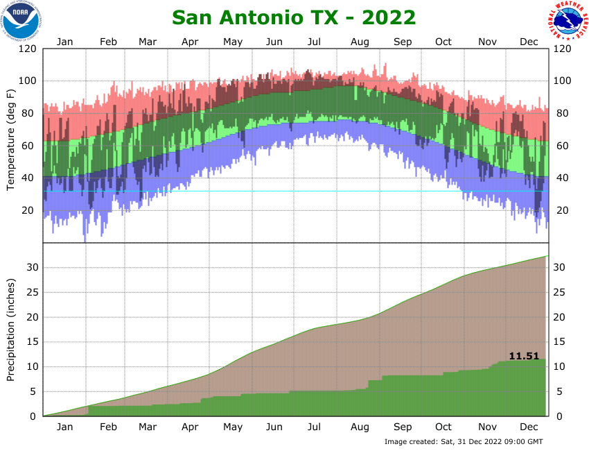
We desperately need some form of precip soon. SAT is running nearly 20 inches below average...
We desperately need some form of precip soon. SAT is running nearly 20 inches below average...
0 likes
The above post is NOT an official forecast and should not be used as such. It is just the opinion of the poster and may or may not be backed by sound meteorological data. It is NOT endorsed by any professional institution including Storm2k. For official information, please refer to NWS products.
Return to “USA & Caribbean Weather”
Who is online
Users browsing this forum: ElectricStorm and 153 guests