Page 1 of 22
Texas Spring 2026
Posted: Sat Feb 07, 2026 8:00 pm
by Texas Snowman
The winter solstice was weeks ago, football is down to the Super Bowl tomorrow, and meteorological spring is now only a few weeks away on the calendar.
Plus, the last patch of sleet from our crazy winter storm finally melted from my yard a couple of days ago and from my neighbor’s yard yesterday.
So, I guess that means we’ll soon be migrating to the “Texas Spring 2026” discussion thread for the next season on the calendar.
With any luck, we’ll delay talk of spring and instead talk about a snowfall or two before Easter.
Spring cancel? Hey, we can dream, right?!?


Re: Texas Spring 2026
Posted: Sun Feb 08, 2026 5:07 am
by cycloneye
Texas Snowman wrote:The winter solstice was weeks ago, football is down to the Super Bowl tomorrow, and meteorological spring is now only a few weeks away on the calendar.
Plus, the last patch of sleet from our crazy winter storm finally melted from my yard a couple of days ago and from my neighbor’s yard yesterday.
So, I guess that means we’ll soon be migrating to the “Texas Spring 2026” discussion thread for the next season on the calendar.
With any luck, we’ll delay talk of spring and instead talk about a snowfall or two before Easter.
Spring cancel? Hey, we can dream, right?!?
Another important thing is one month from today is daylight saving time.
Re: Texas Spring 2026
Posted: Fri Feb 20, 2026 8:53 pm
by bubba hotep
18z GFS gets March off to a fast start. This is supported by the latest Euro Weeklies.

Re: Texas Spring 2026
Posted: Tue Feb 24, 2026 10:57 am
by wxman22
I’m excited for this years storm season due to the transition to El Niño. I expect that we will see a lot of MCS’s this season. As disturbances move in along the subtropical jet.
Re: Texas Spring 2026
Posted: Tue Feb 24, 2026 3:47 pm
by Iceresistance
That's a really good look, been dry for too long
 https://s13.gifyu.com/images/bvCvI.png
Re: Texas Spring 2026
Posted: Wed Feb 25, 2026 5:03 pm
by bubba hotep
Re: Texas Spring 2026
Posted: Wed Feb 25, 2026 5:39 pm
by Brent
At least it looks to start wet
I see no reason to stay in the winter thread at this point haha gonna be the warmest winter on record here for sure with the next 3 days
It's in the mid 90s along the Mexican border

Re: Texas Spring 2026
Posted: Wed Feb 25, 2026 6:06 pm
by wxman22
Yep, might as well move to the Spring thread now.
Re: Texas Spring 2026
Posted: Thu Feb 26, 2026 1:50 pm
by Iceresistance
The "Moderate Risk" of flooding is just higher confidence
 https://s13.gifyu.com/images/bva0J.png
Re: Texas Spring 2026
Posted: Thu Feb 26, 2026 6:38 pm
by wxman22
Sounds like SPC is about to put some risk areas up, once they have a better consensus.It also looks like the dryline is about to become active also per models.
Day 4-8 Convective Outlook
NWS Storm Prediction Center Norman OK
0356 AM CST Thu Feb 26 2026
Valid 011200Z - 061200Z
...DISCUSSION...
Early in the forecast period a transition across the western US will
take place as the low-amplitude ridge over the Great Basin/Southwest
shifts eastward, giving way to an amplifying trough over the West.
Several speed maxima are forecast to traverse the flow while it
remains primarily northwesterly over the central US early in the
period. At the surface, uncertainty remains regarding the southern
extent of the arctic front pushing into the Plains on Day 3.
Uncertainties in the position of this front will cause low
confidence in the projected quality of the low-level moisture
recovery across the southern Plains through Tuesday. As the
upper-air pattern across the central US transitions from
northwesterly to southwesterly, and return flow commenses, the
shallow nature of the modified arctic airmass may initially limit
the northward penetration of the richest theta-e air.
As the period progresses into Wednesday and Thursday, ensemble
guidance remains in general agreement regarding the transition to an
amplified western trough and central-to-eastern ridge. However, the
timing and phasing of individual shortwaves moving into the Plains
remains a source of forecast uncertainty.
The first meaningful shortwave is forecast to eject into the Plains
early Wednesday, inducing surface cyclogenesis that should support a
northward advancement of the warm sector. Any severe risk with this
trough on Wednesday (Day 7) will be predicated on the evolution of
the moisture return on prior days.
On Thursday, a second, more potent trough is forecast to approach
the Plains. Current ensemble guidance shows quite a bit more
variance with the timing, amplitude, and evolution of this second
trough. Some guidance brings this wave out as single, potent trough,
with other guidance suggesting a series of more subtle shortwave
troughs ejecting into the Plains from Thursday into Saturday. These
discrepancies will have an impact on the location, timing, and
magnitude of any potential severe weather threat.
Despite these timing differences, the synoptic setup (increasing
low-level moisture, strengthening southwest flow aloft, repeated
cyclogenesis) is favorable for organized severe weather over the
Plains and lower Mississippi Valley. While the severe weather threat
should increase by Wednesday and Thursday (Days 7 and 8), the
specific orientation of frontal boundaries and the northward extent
of the moisture return will be highly dependent on the evolution of
the upper-lows. Given that models tend to struggle with handling the
details of pattern changes, will hold off on trying to highlight any
specific corridor for severe probabilities for Wednesday and
Thursday at this time.
..Marsh.. 02/26/2026
Re: Texas Spring 2026
Posted: Thu Feb 26, 2026 8:04 pm
by Brent
I hope this goes better than the flood Valentine's Day weekend

didn't even have a quarter inch here
Re: Texas Spring 2026
Posted: Fri Feb 27, 2026 1:08 am
by Stratton23
00z Euro is extremely wet across most of the state, definitely looks a lot better than the GFS
Re: Texas Spring 2026
Posted: Fri Feb 27, 2026 7:14 am
by wxman22
Day 6 severe weather risk added for portions of North Texas and Southern Oklahoma.
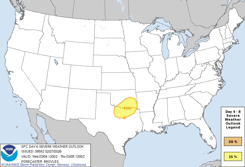
Day 4-8 Convective Outlook
NWS Storm Prediction Center Norman OK
0359 AM CST Fri Feb 27 2026
Valid 021200Z - 071200Z
...DISCUSSION...
...Monday/Day 4 to Tuesday/Day 5...
At mid-levels, a trough is forecast to move across California on
Monday as zonal flow remains in place over the central and eastern
U.S. On Tuesday, the trough is forecast to move eastward across the
Desert Southwest, as flow becomes southwesterly in the south-central
states. A moist airmass will likely be in place on Monday and
Tuesday from eastern parts of the southern Plains into the lower to
mid Mississippi Valley. Thunderstorm development will be possible
each afternoon and evening across parts of the moist airmass. In
areas that destabilize the most, a marginal severe threat may
develop.
...Wednesday/Day 6 to Friday/Day 8...
On Wednesday, the trough is forecast to move into the southern and
central High Plains, as an associated mid-level jet ejects
northeastward across the southern High Plains. At the surface, a
cold front is forecast to move into the southern Plains, as a moist
airmass spreads northward from north Texas into southern and eastern
Oklahoma. As surface temperatures warm during the day, thunderstorms
appear most likely to form along the cold front, and further south
across parts of the warm sector. Moderate deep-layer shear is
evident on model forecasts which should support a severe threat
during the afternoon and evening, with a potential for large hail
and severe wind gusts. While confidence is high enough to add a
severe threat area across the southern Plains, variance does exist
concerning the timing of the shortwave trough. If the trough moves
across the southern Plains faster, then the area could need to be
adjusted.
On Thursday, the mid-level trough is forecast to eject northeastward
into the Great Lakes region, as a large upper-level trough digs into
the Desert Southwest. Southwesterly mid-level flow will likely be in
place over parts of the Great Plains, with a moist and unstable
airmass remaining over much of Texas and Oklahoma. As surface
temperatures warm, isolated strong to severe storms will be possible
in areas that destabilize the most. At this time, there is
uncertainty regarding the magnitude of the threat because some
solutions move a shortwave ridge northeastward across the
south-central U.S.
On Friday, model forecasts suggest that a large-scale upper-level
trough will move through the western U.S. Ahead of this feature,
thunderstorms will continue to be possible over parts of the
southern and central Plains, where a moist and unstable airmass is
forecast to be in place. However, a significant amount of variance
exists among the model solutions, suggesting that uncertainty is
substantial concerning the magnitude and spacing of any severe
threat.
..Broyles.. 02/27/2026
Re: Texas Spring 2026
Posted: Fri Feb 27, 2026 1:31 pm
by wxman22
12z Euro

Re: Texas Spring 2026
Posted: Fri Feb 27, 2026 10:30 pm
by Brent
Another record high for this so called winter
Please let the Euro verify. It was way too over hyped with the snowstorm here. The GFS was much closer to reality
Re: Texas Spring 2026
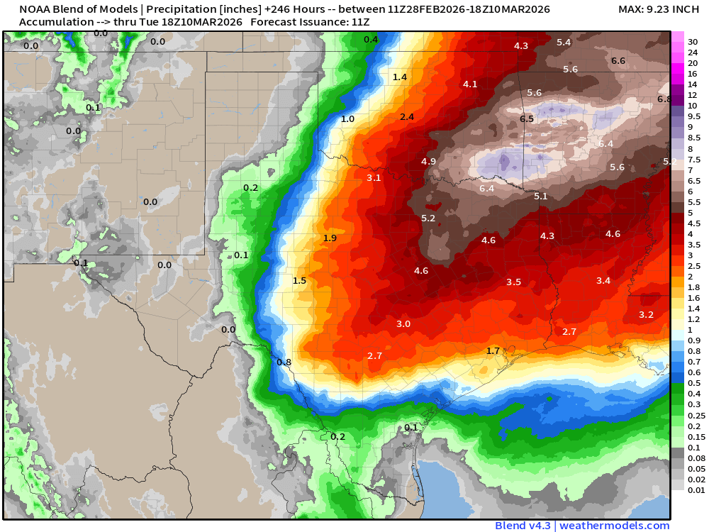
Posted: Sat Feb 28, 2026 7:57 am
by wxman22
A very strong signal on the conservative NBM for heavy rainfall.
Re: Texas Spring 2026
Posted: Sat Feb 28, 2026 8:47 am
by opticsguy
I was going to plant a couple tomato plants today in East Texas, but I just checked the 0z GFS. Highs below freezing on the 14th. Ouch. Euro showing cold air also.
Re: Texas Spring 2026
Posted: Sat Feb 28, 2026 2:47 pm
by Iceresistance
I suppose that Meteorological spring is going to be off to a very fast start, good grief!

 https://s13.gifyu.com/images/bv5O8.png
Re: Texas Spring 2026
Posted: Sat Feb 28, 2026 4:17 pm
by Stratton23
Im not getting my hopes up, ive seen that outlook from the CPC so many times only to be absolutely burned
Re: Texas Spring 2026
Posted: Sat Feb 28, 2026 6:34 pm
by TomballEd
Stratton23 wrote:Im not getting my hopes up, ive seen that outlook from the CPC so many times only to be absolutely burned
The GFS ensembles had been much, much drier along and S of the I-10 corridor but the 0Z GEFS trended towards Euro QPF amounts and the 12Z continues the trend of the Euro. The one thing towards 'I'll believe it when I see it' is that most of the rain down here is a week or more away.
GFS doesn't support the SWODY Day 5 for North Central Texas the way the Euro does based on reflectivity. Noting Euro has enough instability for strong storms Wednesday up there but the mid-level winds are unimpressive for early March.