Page 1 of 1
First springtime warmth and severe wx event this weekend????
Posted: Sat Feb 28, 2004 7:42 am
by Guest
Things look to be heating up this weekend from the plains into the Midwest and OH/TN Valley's as alot of these areas except the northern most will see thier first taste of springtime wx with temps ranging from the 50s to the 60s bringing with those warmer temps a chance for severe wx into these areas as well as a strong low pressure ejects out of the rockies and heads thru the central plains up into the Great Lakes.
The Severe wx should start later today in western TX (Main threats' Large Hail and damaging winds)and then move out into the central/southern Plains tomorrow (Large Hail, Damaging winds, Isolated Tornadoes)and then moving ene up into the OH/TN Valley's come Monday (Large Hail, Isolated Tornadoes).
More on this later!
Posted: Sat Feb 28, 2004 7:45 am
by Guest
Bring 'em on!


Posted: Sat Feb 28, 2004 8:02 am
by wx247
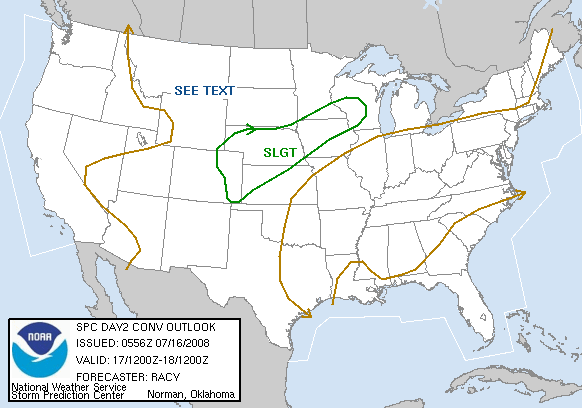
Here is tomorrow's outlook!

Posted: Sat Feb 28, 2004 8:03 am
by Guest
wx247 wrote:Here is tomorrow's outlook!

I am in a GEN TSTM outlook FOR NOW... but the SLGT is not too far away!

Posted: Sat Feb 28, 2004 8:17 am
by Suzi Q
Looks like the majority of the action is to be north of me (north of I-10) so I won't do the twister dance on this one.
BUT, IT'S GETTING CLOSER!!!!!!

Posted: Sat Feb 28, 2004 8:49 am
by wx247
NEWeatherguy wrote:wx247 wrote:Here is tomorrow's outlook!

I am in a GEN TSTM outlook FOR NOW... but the SLGT is not too far away!

You might have some good old fashioned thunderstorms tomorrow Brian.
Posted: Sat Feb 28, 2004 8:50 am
by Guest
wx247 wrote:NEWeatherguy wrote:wx247 wrote:Here is tomorrow's outlook!

I am in a GEN TSTM outlook FOR NOW... but the SLGT is not too far away!

You might have some good old fashioned thunderstorms tomorrow Brian.
It would be amazing if, in later outlooks, that slight is pushed just a bit further north!

However, I will take what I can get!

Posted: Sat Feb 28, 2004 8:52 am
by wx247
watch the wind fields...
lightning looks like a good bet as well.

Posted: Sat Feb 28, 2004 8:57 am
by Guest
wx247 wrote:watch the wind fields...
For severe weather, the wind shear is about the only thing going for any severe storms Sunday, besides the upper-level system itself. Instability is not going to be the greatest.
Posted: Sun Feb 29, 2004 4:26 pm
by therock1811
I'm more concerned about the threat on Monday in the OV...attm, I look for the biggest threat to be across IN/IL/MO, some threat here as well...
