Page 1 of 1

My Area: Should we let our guard down?

Posted: Sat May 29, 2004 8:24 pm
by Guest
Here in the Omaha area, should we let our guard down as it pertains to supercellular-tyoe of storms?

Posted: Sat May 29, 2004 8:29 pm
by Aquawind
No it's not over yet..

Look at the poppage SW!


http://www.crh.noaa.gov/radar/loop/DS.p ... ktlx.shtml

Colliding outflow boundries near Phillipsburg..


Dryline still way west..

http://www.rap.ucar.edu/weather/surface ... t&nplots=1

:Chit:

Posted: Sat May 29, 2004 8:36 pm
by ssom04
what about here in south central Minnesota around mankato, tornadoes are probably not likely anymore tonight.... right? looks like everything will form in to a big MC and move over south central minnesota and southern wisconsin tonight.

Posted: Sat May 29, 2004 8:50 pm
by Guest
http://kamala.cod.edu/spc/0405300145.acus11.html

I guess that answered my question also. :lol: :eek:

Plus the fact that my weather radio has sound three times in the past 10 minutes! :eek:

Posted: Sat May 29, 2004 8:54 pm
by USAwx1
Latest RUC indicates STRONG southerly 50-60 KT LLJ will develop over the Missouri valley later this evening and overnight, strong warm advection/isentropic lift associated with it will keep convection going, as it organizes into a rather potent forward propagating MCS even w/ loss of diurnal heating. Were already STARTING to see some signs of that happening as we speak WRT convective orientation.

Airmass is still VERY unstable with lowest 100mb mean layer CAPE in excess of 2500 J/kg reaching as far N as SERN SD/ extreme SW IA and good boundary layer moisture with SFC dewpoints > 64F.

Image

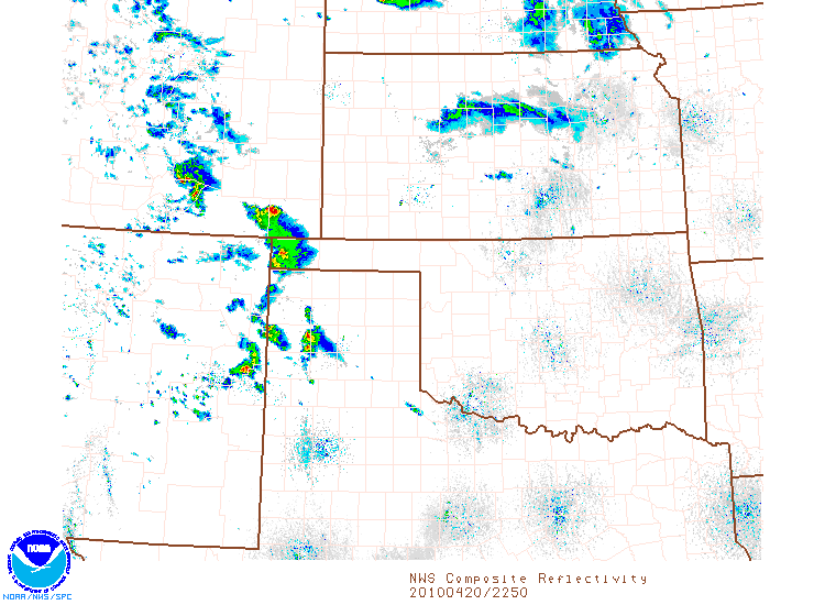
Convection further south in more strongly capped environment over SRN KS, OK and TX may translate into a second however, possibly SOMEWHAT weaker MCS.