Page 1 of 1

Flooding Rains begin for Tristate area.

Posted: Mon Jul 12, 2004 1:57 pm
by whiteoutwx1796
Bands of Heavy,heavy rains now entering NYC as i speak.
Flood watches out.

FLOOD WATCH
CTZ005-009-NJZ002>006-011-NYZ067>077-130300-

BULLETIN - IMMEDIATE BROADCAST REQUESTED
FLOOD WATCH
NATIONAL WEATHER SERVICE UPTON NY
219 PM EDT MON JUL 12 2004

...A FLOOD WATCH IN EFFECT FROM THIS EVENING TO TUESDAY AFTERNOON FOR
THE FOLLOWING COUNTIES...

IN NEW YORK...
ORANGE...PUTNAM...NORTHERN WESTCHESTER...ROCKLAND...SOUTHERN
WESTCHESTER...BRONX...NEW YORK (MANHATTAN)...KINGS (BROOKLYN)...
RICHMOND (STATEN IS.)...NASSAU AND QUEENS.

IN NEW JERSEY...
HUDSON...BERGEN...EASTERN PASSAIC...ESSEX...UNION AND WESTERN
PASSAIC.

IN CONNECTICUT...
NORTHERN FAIRFIELD AND SOUTHERN FAIRFIELD.

SOUTHEAST WINDS AHEAD OF A WARM FRONT APPROACHING FROM THE DELMARVA
REGION WILL CONTINUE TO TRANSPORT CONSIDERABLE ATLANTIC MOISTURE INTO
THE AREA TONIGHT. THIS IN COMBINATION WITH AN APPROACHING UPPER LEVEL
DISTURBANCE WILL LEAD TO WIDESPREAD SHOWERS AND A FEW THUNDERSTORMS
TONIGHT INTO TUESDAY MORNING. SOME OF THESE SHOWERS
AND THUNDERSTORMS WILL PRODUCE TORRENTIAL RAINFALL...AND RAINFALL
AMOUNTS THROUGH TUESDAY MORNING MAY AVERAGE 1 1/2 TO 2 1/2
INCHES...WITH LOCAL AMOUNTS IN EXCESS OF FOUR INCHES. THIS AMOUNT OF
RAIN COULD CAUSE FLOODING OF SMALL STREAMS AND POOR DRAINAGE
AREAS...WITH SIGNIFICANT PONDING OF WATER ON ROADWAYS. MAIN STEM
RIVERS WILL LIKELY EXPERIENCE SIGNIFICANT RISES...BUT SHOULD REMAIN
WITHIN THEIR BANKS.

A FLOOD WATCH MEANS THAT FLOODING OF STREAMS...CREEKS AND POOR
DRAINAGE AREAS IS POSSIBLE WITHIN THE WATCH AREA. PEOPLE IN THE
WATCH AREA SHOULD KEEP AN EYE ON THE WEATHER AND BE PREPARED FOR
IMMEDIATE ACTION SHOULD HEAVY RAINS AND FLOODING OCCUR OR A FLOOD
WARNING BE ISSUED.

&&

TUNE TO NOAA WEATHER RADIO...OR YOUR LOCAL RADIO OR TELEVISION
STATIONS...FOR FURTHER DETAILS OR UPDATES. ADDITIONAL WEATHER
INFORMATION CAN BE FOUND ON THE INTERNET AT WEATHER.GOV. THEN CLICK
ON THE LOCAL AREA.

$$

GOODMAN

Posted: Mon Jul 12, 2004 3:05 pm
by USAwx1
PW's are over 2" across Parts of the delmarva and SE MD and NE VA to the south of the warm front w/ boundary layer Td's as high as 76F as per latest SPC mesoanalysis.

Also noted good directional shear w/ winds backing around from SE to S between the SFC and 5K FT (850mb), and the around to the SW around 500H. This could lead to a tornadic threat this afternoon from thunderstorms which form INVOF the front and can tap the directional shear.

Infact I think we had a tornado warning not too long ago for New Castle County DE.

LCL heights are VERY low (near 600m AGL) which would help also.

MUCAPE across parts of VA South of the front are as high as 4500 J/kg which would support rather vigorous updrafts, however weak shear suggests pulse-type severe storms There.

MUCAPE backs off to less than 500 j/kg Near and NE of the front under the precip sheild which is limiting SFC heating, however up here lowest 3 KM SRH is more impressive and winds are backing around to the west w/ height so the potential for rotation is BETTER w/ storms which CAN go severe as we have seen in New Castle County this afternoon.

Image

Image

Image

Posted: Mon Jul 12, 2004 3:56 pm
by Stephanie
We've been getting a nice moderate rain here in Atlantic City since about 3:00 pm. We had some thunder - actually a "BOOM" about 45 minutes ago!

Posted: Mon Jul 12, 2004 4:22 pm
by USAwx1
Steph, the precip in your area is primarily weak and low-topped convection. So the main concern WRT that is heavy rain. Might also hear a rumble or two of thunder and flash of lightning.

The cell north of KDOV (dover DE) had both an TVS and MESO (rotation) detected. Both are moving VERY slowly w/ VILs about 50.

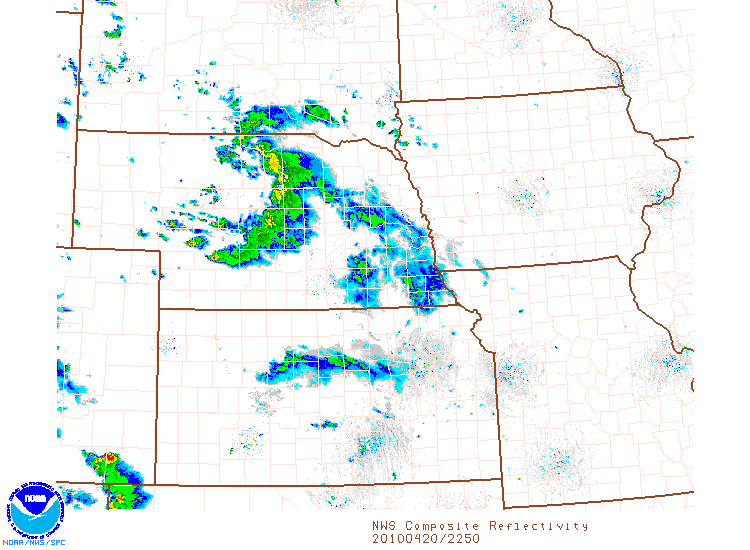
Still not as rough as those in the plains which have VILs of almost 90 Kg/m^2

Posted: Mon Jul 12, 2004 4:25 pm
by USAwx1
Image

Posted: Mon Jul 12, 2004 8:14 pm
by Stephanie
Those storms in DE floated into the Delaware Bay and fortunately stayed there. There were estimates of 5 inches of rain coming from them. :eek: There were other storms that hit the northern parts of Camden and Burlington county, just across from Philadelphia that had almost the same amount of rain. Interstate 295 and the New Jersey Turnpike are flooded in places. My significant other, Marty, got stuck on the turnpike.

Posted: Mon Jul 12, 2004 8:24 pm
by whiteoutwx1796
Right now im seeing strong gusty winds with very heavy rains out of Bayside, NY.

Posted: Mon Jul 12, 2004 8:30 pm
by Rainband
Stay safe, all of you :wink: