Alabama Severe Weather
Posted: Fri Apr 01, 2005 2:42 pm
Thermodynamics are becoming increasingly conducive of severe weather. Currently 75/60 at my location with SSE winds of 21mph. Low level moist advection is ongoing as SFC low pressure has developed across NE MS. N-S oriented squall line is developing in MS along in the right entrance region of a 500 hPa jet streak. As increasing instability fields move across the region and continue to destabalize the area, some supercell formation is definately not out of the question across Central AL.

The 850-500 shear values speak for themselves in saying that we are definately going to enter a tornado producing environment.
That not good enough for ya? Well have a look at 0-1 km SRH fields...
An area of 400+m2/s2 SRH is located directly over my head and it looks as if things will fire as we head into the peak heating hour (3-4pm CDT)
-CG strikes are really increasing across ERN MS with the intensifying squall line. Some embedded supercellular formation can not be ruled out as well as some storms have sustained mesocyclones with definate mid level rotation.
A Severe Thunderstorm Watch is in effect for the region until 6 PM CDT.

Expect this to be upgraded to TOR soon especially across eastern sections if storms can fire.
The 850-500 shear values speak for themselves in saying that we are definately going to enter a tornado producing environment.
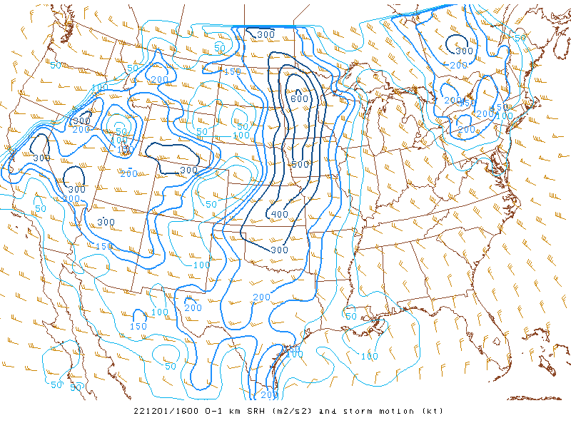
That not good enough for ya? Well have a look at 0-1 km SRH fields...
An area of 400+m2/s2 SRH is located directly over my head and it looks as if things will fire as we head into the peak heating hour (3-4pm CDT)
-CG strikes are really increasing across ERN MS with the intensifying squall line. Some embedded supercellular formation can not be ruled out as well as some storms have sustained mesocyclones with definate mid level rotation.
A Severe Thunderstorm Watch is in effect for the region until 6 PM CDT.
Expect this to be upgraded to TOR soon especially across eastern sections if storms can fire.