Page 1 of 2
*sigh* High Risk of Severe Weather
Posted: Sat Jun 04, 2005 8:13 am
by snoopj
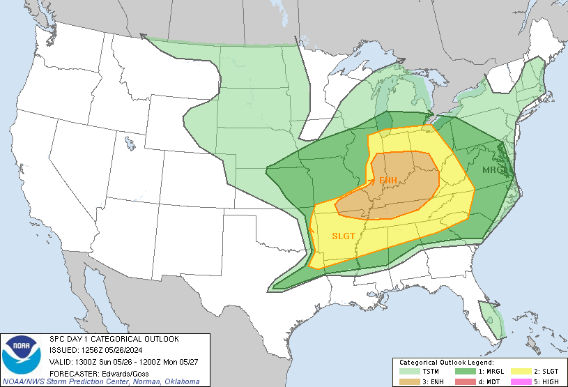
Looks like the SPC has my area (Kansas City) targetted for a high risk of severe weather today. The map has an eerie shape to the map back in the 05/04/03 storms in which KC had 4 seperate tornadoes track through the metro area. Looks like I'm keeping the weather radio handy this afternoon/evening.
--snoopj
Posted: Sat Jun 04, 2005 8:35 am
by vbhoutex
That looks like a definite good idea Snoopj!!!
Posted: Sat Jun 04, 2005 9:28 am
by wx247
snoop... you are right! That map looks very similar to May 4, 2003. I hope that it isn't a repeat performance.

Posted: Sat Jun 04, 2005 9:35 am
by simplykristi
I am definitely keeping a close eye on the weather today. We had 4 inches of rain here overnight. Since yesterday morning, we've had a total of 5.75 inches of rain.
Kristi
Posted: Sat Jun 04, 2005 9:45 am
by snoopj
Not quite the same image, but some similarities. This was the 1300z Day 1 SPC Outlook for 05/04/03. Hmmmmm....

--snoopj
Posted: Sat Jun 04, 2005 10:00 am
by PurdueWx80
There are major differences between that weather system and this one. First of all, the warm front had a good 40 degree temperature differential across it, with mid 40's in Iowa, and mid 80's back in KS. There will be nothing like that today - in fact, not even close. Also, surface winds backed to the SE and were very strong near and ahead of the warm front. Today, the warm front will be further east across portions of MN and WI, with a weak "tropical" warm front extending east-southeast from the developing surface low in NE separating maritime air from the Gulf and slightly drier air to the north - this 2ndary boundary will have low-to-mid 70's dewpoints to it's south with upper 60's to near 70 north. Winds at the surface and low levels do not look to back to the southeast, and in fact, may even be southwesterly (except ahead of the NE low) - which will make the low-level profile more unidirectional, and less-favorable for strong, long-lived tornadoes, except just east of and adjacent to the surface low. However, factors in favor of tornadoes include the extreme instability that will develop along and south of that secondary boundary where temps are in the 80's/90's and dewpoints reach into the 70's. This sort of high-instability, low-shear atmos. can still produce tornadoes, although not like the event in early May of 2003. Instead, very large hail seems more likey (golfball to softball sized) with the initial supercells that develop across eastern KS and southeast NE. The best tornado threat would probably be in NE and IA just ahead of the develping surface low. Things should rapidly congeal into a large MCS by this evening, and the amount of instability/moisture available suggests some extreme rainfall could occur in MO and IA as the MCS tracks through and backbuilding occurs at the trailing edge of the storms. The instability and developing low-level jet tonight will also act to support the eastward development of this bow echo into the mid/upper-MS Valley overnight.
Further north and east, across portions of WI, far SE MN, eastern IA and northern IL - the warm front in this region has become somewhat blurred by the weakening overnight convection, but as skies clear across central IA late this morning and afternoon, it will become more well defined. In these regions, winds will strongly back to the E and SE and will increase as cyclogenesis occurs across the Plains. This atmosphere is much more conducive to tornadic development, given the turning of winds with height, from 10-20 kt SE at the surface, to S at 850 mb (with a 30-40 kt llj) and WSW at 500 mb (35-50 kt). 12Z RUC and NAM guidance suggest storm-relative helicities on the order of 300-400 m2/s2 with CAPES ranging from 1500-3000 J/kg along the warm frontal boundary. Lake breezes will act to enhance convergence along the front by afternoon, and it appears that a decent threat of tornadic supercells exists this afternoon and evening, particularly in far SE MN, eastern IA, NW IL and southern WI. 12Z guidance shows convective development along and south/west of the warm front by 18-21z this afternoon, and this appears reasonable as of now. I would expect the moderate risk to be extended eastward sometime this afternoon once the convective initiation appears more likely. Also, the MCS that develops in the Plains will probably carry a risk of damaging winds into these regions late tonight, further supporting a moderate risk of storms in the mid-MS valley.
This looks to be a very ative day in the Midwest - it's about time, eh? Ya gotta have severe weather when it's this moist/humid and warm this time of year! Be careful out there, and stay tuned to NOAA weather radio and your local media outlets.
Posted: Sat Jun 04, 2005 10:48 am
by AirmaN
Being the bull's eye makes me feel special.
Posted: Sat Jun 04, 2005 11:13 am
by PurdueWx80
New outlook:

They did bring the mod risk east to the MS River but didn't quite extend it into WI, although they seem to be considering it based on the amount of clearing and instability that develops:
...UPPER MS VALLEY...
AS LEAD S/WV TROUGH LIFTS NEWD ACROSS THIS AREA DURING
AFTERNOON...MID LEVEL FLOW VEERS TO SWLY WHICH WILL ENHANCE SHEAR
PROFILES. WITH S/SELY BOUNDARY LAYER FLOW TO E OF MN SURFACE LOW
ONLY QUESTION AS TO POTENTIAL FOR SUPERCELLS AND TORNADO THREAT WILL
BE SUFFICIENT AVAILABLE INSTABILITY. CURRENT CLOUD COVER SHOULD
THIN DURING AFTERNOON ALLOWING DEVELOPMENT OF SURFACE BASED
THUNDERSTORMS FROM SURFACE LOW EWD INTO WI. A FEW SUPERCELLS ARE
LIKELY ASSOCIATED WITH AT LEAST AN ISOLATED TORNADO THREAT.
CONSIDERED EXTENDING MDT RISK INTO WI...HOWEVER TOO MUCH UNCERTAINTY
AS TO HOW MUCH INSTABILITY WILL BE AVAILABLE TO DO SO ATTM.
Posted: Sat Jun 04, 2005 11:34 am
by Anonymous
Wow--looks like the SPC went and issued the HWO for the midwest states instead of the Local NWSs doing so as they issued a special statement
I dont think that would happen if it were florida as the local NWS also issues everything here but maybe the Midwest is close to the SPC so the SPC can handle it all.
Code: Select all
The SPC is forecasting an enhanced risk of severe thunderstorms today and tonight across portions of the United States. Please read the latest public statement about this event.PUBLIC SEVERE WEATHER OUTLOOK
NWS STORM PREDICTION CENTER NORMAN OK
1100 AM CDT SAT JUN 04 2005
VALID 041600Z - 050000Z
...OUTBREAK OF SEVERE THUNDERSTORMS EXPECTED OVER PARTS OF THE
CENTRAL PLAINS AND MISSOURI VALLEY TODAY AND TONIGHT.
THE NWS STORM PREDICTION CENTER IN NORMAN OK IS FORECASTING THE
DEVELOPMENT OF A FEW STRONG TORNADOES AND VERY LARGE DAMAGING HAIL
OVER PARTS OF THE CENTRAL PLAINS AND MISSOURI VALLEY LATER TODAY AND
TONIGHT.
THE AREAS MOST LIKELY TO EXPERIENCE THIS ACTIVITY INCLUDE
SOUTHWEST IOWA
EASTERN KANSAS
WESTERN MISSOURI
SOUTHEAST NEBRASKA
SURROUNDING THE HIGH RISK AREA...THERE IS A MODERATE RISK OF SEVERE
THUNDERSTORMS FROM SOUTHERN MINNESOTA INTO SOUTHERN OKLAHOMA.
A VERY WARM/MOIST AND EXTREMELY UNSTABLE AIRMASS IS DEVELOPING
ACROSS PARTS OF EASTERN NEBRASKA AND EASTERN KANSAS AT MID
DAY...AHEAD OF AN APPROACHING UPPER LEVEL DISTURBANCE OVER THE
CENTRAL HIGH PLAINS. STRENGTHENING WIND FIELDS ALOFT AND THE HIGH
DEGREE OF INSTABILITY ARE EXPECTED TO LEAD TO EXPLOSIVE THUNDERSTORM
DEVELOPMENT BY LATE AFTERNOON IN THESE REGIONS. STORMS ARE LIKELY TO
BE SUPERCELLS...CAPABLE OF VERY LARGE DAMAGING HAIL AND A FEW STRONG
TORNADOES. ACTIVITY WILL SPREAD EASTWARD INTO WESTERN IOWA AND
WESTERN MISSOURI DURING THE EVENING.
ADDITIONAL...MORE ISOLATED...SEVERE THUNDERSTORMS ARE EXPECTED FROM
SOUTHERN MINNESOTA ALL THE WAY SOUTHWARD INTO PARTS OF OKLAHOMA AND
TEXAS. DAMAGING HAIL AND SEVERE WIND GUSTS WILL LIKELY BE THE MAIN
THREATS WITH THESE STORMS...ALTHOUGH A FEW TORNADOES ARE ALSO
POSSIBLE.
THIS IS POTENTIALLY A VERY DANGEROUS SITUATION. THOSE IN THE
THREATENED AREA ARE URGED TO REVIEW SEVERE WEATHER SAFETY RULES AND
TO LISTEN TO RADIO...TELEVISION...AND NOAA WEATHER RADIO FOR
POSSIBLE WATCHES...WARNINGS...AND STATEMENTS LATER TODAY.
..GUYER/HALES.. 06/04/2005
Posted: Sat Jun 04, 2005 11:44 am
by snoopj
AirmaN wrote:Being the bull's eye makes me feel special.
Aye. Gives me a great feeling being in the "almost middle" of that High area.
--snoopj
Posted: Sat Jun 04, 2005 11:49 am
by PurdueWx80
First watch of the day issued just ahead of the decaying MCS in IL - thunderstorms should continue to increase in coverage and intensity across IL and WI where dewpoints have reached the low-to-mid 60's and temps are approaching 80 late this morning.
http://www.spc.noaa.gov/products/watch/ww0389.html
Posted: Sat Jun 04, 2005 1:17 pm
by AirmaN
snoopj wrote:AirmaN wrote:Being the bull's eye makes me feel special.
Aye. Gives me a great feeling being in the "almost middle" of that High area.
--snoopj
Stay safe down there
Posted: Sat Jun 04, 2005 2:09 pm
by simplykristi
Tornado Watch has just been issued for the KC metro area until 11:00 PM. It is a PDS watch.
Kristi
Posted: Sat Jun 04, 2005 2:23 pm
by AirmaN
Should we expect the Tornado watch to move north?
Posted: Sat Jun 04, 2005 2:26 pm
by ALhurricane
Jekyhe32210,
The Public Severe Weather Outlook is seperate from the local HWOs. The SPC issues a Public Severe Weather Outlook for all moderate and high risk days. The local offices still issue an HWO for their area.
Posted: Sat Jun 04, 2005 2:31 pm
by chris07dabomb
I think they will issue a ww for north texas anytime now!!! There are some big cumulus clouds forming near abilene.
Posted: Sat Jun 04, 2005 3:41 pm
by Gorky
A PDS tornado watch is now in effect for Central Oklahoma and Southern Central Kansas. They stopped short of Putting A WW up for Texas so far. Also a large part of Wisconsin is now under a Tornado watch. It's going to be a very active day by the looks of it...
Posted: Sat Jun 04, 2005 3:46 pm
by chris07dabomb
yep i know, there are now storms firing up just northeast of Lawton,OK and northeast of Abilene,TX. They should issue some type of ww for NTX soon.
Posted: Sat Jun 04, 2005 3:59 pm
by chris07dabomb
I was wright they just issued a TW for NTX!!!!!
Posted: Sat Jun 04, 2005 4:20 pm
by snoopj
Let the fun to begin.
PDS watches and now some warnings a county or two north of Topeka.
--snoopj