Friday outbreak

U.S. & Caribbean Weather Discussions and Severe Weather Events

Moderator: S2k Moderators

Forum rules

The posts in this forum are NOT official forecast and should not be used as such. They are just the opinion of the poster and may or may not be backed by sound meteorological data. They are NOT endorsed by any professional institution or STORM2K.

Help Support Storm2K
Message
Author
User avatar
Pebbles
S2K Supporter
S2K Supporter
Posts: 1994
Joined: Tue Jul 08, 2003 1:42 pm
Location: New Lenox, IL (SW of Chicago)

Friday outbreak

#1 Postby Pebbles » Thu Apr 06, 2006 9:45 am

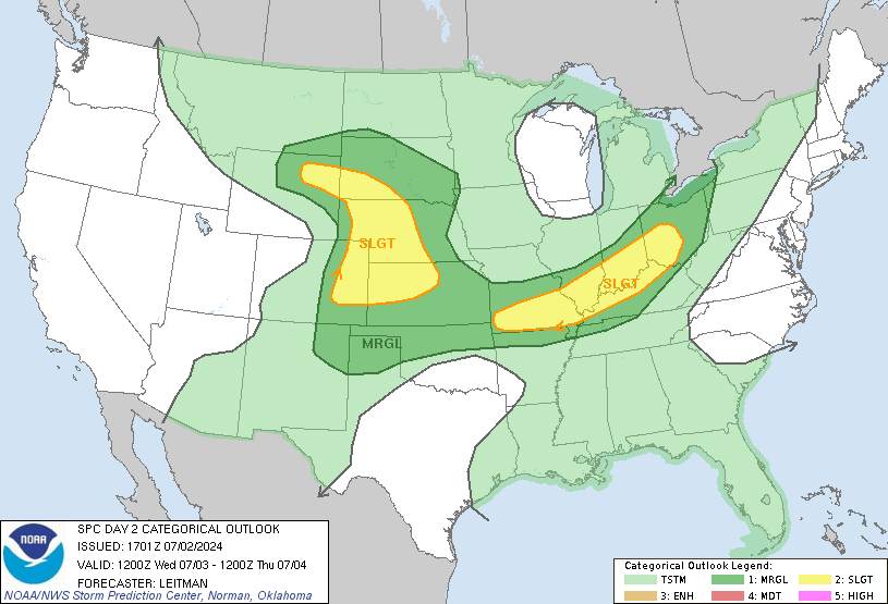
Moderate or severe? Looks like they are expecting future models might shift some of the mod area up to high risk.

I'm flying out to Atlanta very early Friday morning and hanging there till early Sunday. Looks like my parade is getting rained on :( I usually love weather.. but not this weekend!

What do you all think of the situation for atlanta and outta curiosity to share news with a friend ... Chatanooga (spelled wrong?) TN.

Pebbles
0 likes   

CrazyC83
Professional-Met
Professional-Met
Posts: 34002
Joined: Tue Mar 07, 2006 11:57 pm
Location: Deep South, for the first time!

#2 Postby CrazyC83 » Thu Apr 06, 2006 10:47 am

Get ready for big-time severe weather. I think the tornado outbreak will continue into Friday.
0 likes   

Brent
S2K Supporter
S2K Supporter
Posts: 38091
Age: 36
Joined: Sun May 16, 2004 10:30 pm
Location: Tulsa Oklahoma
Contact:

#3 Postby Brent » Thu Apr 06, 2006 11:15 am

Looks very bad. Make sure you have a plan in case there's a tornado warning.
0 likes   
#neversummer

sccdct01
Tropical Wave
Tropical Wave
Posts: 1
Joined: Sun Jul 17, 2005 9:50 am

#4 Postby sccdct01 » Thu Apr 06, 2006 11:24 am

what about for south carolina for saturday...any opinions?
0 likes   

conestogo_flood
Category 5
Category 5
Posts: 1268
Joined: Wed Sep 28, 2005 5:49 pm

#5 Postby conestogo_flood » Thu Apr 06, 2006 12:21 pm

HIGH RISK HAS BEEN ISSUED FOR TOMORROW! 60%!!
0 likes   

Brent
S2K Supporter
S2K Supporter
Posts: 38091
Age: 36
Joined: Sun May 16, 2004 10:30 pm
Location: Tulsa Oklahoma
Contact:

#6 Postby Brent » Thu Apr 06, 2006 12:45 pm

:crazyeyes:

Image

DAY 2 CONVECTIVE OUTLOOK CORR 1
NWS STORM PREDICTION CENTER NORMAN OK
1235 PM CDT THU APR 06 2006

VALID 071200Z - 081200Z

...THERE IS A HIGH RISK OF SVR TSTMS ACROSS NE MS...NRN AL...SCNTRL
TN AND FAR NW GA...

...THERE IS A MDT RISK OF SVR TSTMS ACROSS PARTS OF
MS...AL...TN...GA...LA...ERN AR...WRN NC AND FAR WRN SC...

...THERE IS A SLGT RISK OF SVR TSTMS ACROSS PARTS OF THE LOWER MS
VALLEY...OH VALLEY...SRN AND CNTRL APPALACHIANS AND IMMEDIATE GULF
COAST...

CORRECTED FOR WORDING LAST PARAGRAPH

A POTENT UPPER-LEVEL TROUGH OVER THE PLAINS STATES WILL SHIFT SEWD
INTO THE OZARKS FRIDAY AHEAD OF A MOIST AND VERY UNSTABLE WARM
SECTOR ACROSS THE TN VALLEY. THE SHEAR ENVIRONMENT WILL BE VERY
FAVORABLE FOR TORNADOES AND A SIGNIFICANT TORNADO OUTBREAK IS
EXPECTED FRIDAY AFTERNOON AND EVENING ACROSS NRN AL...NE MS...SCNTRL
TN AND FAR NW GA.

...TN VALLEY...
SEVERAL MESOSCALE CONVECTIVE SYSTEMS ONGOING AT THE BEGINNING OF THE
PERIOD IN THE MID-MS VALLEY WILL DRIFT QUICKLY NEWD AS A 90-100 KT
MID-LEVEL JET EJECTS NEWD OUT OF THE CNTRL PLAINS TROUGH. THIS WILL
INCREASE MOISTURE ADVECTION STRENGTHENING A 40-50 KT LOW-LEVEL JET
TRANSPORTING MID TO UPPER 60S F SFC DEWPOINTS NNEWD ACROSS THE TN
VALLEY. THE MODELS ARE IN GOOD AGREEMENT SHUNTING MORNING CONVECTION
AWAY FROM THE HIGH RISK AREA DURING THE MORNING LEAVING THE AIRMASS
UNDISTURBED MIDDAY FRIDAY ACROSS MS...AL...TN AND NRN GA. AS STORMS
INITIATE FRIDAY AFTERNOON...SUPERCELLS WILL BE LIKELY DUE TO THE
STRONG VERTICAL SHEAR ASSOCIATED WITH THE MID-LEVEL JET. NAMKF
FORECAST SOUNDINGS FOR TUPELO MS...FLORENCE ALABAMA AND HUNTSVILLE
ALABAMA FRIDAY AFTERNOON SEEM REASONABLE WITH MODERATE TO STRONG
INSTABILITY (MLCAPE VALUES 2500-3000 J/KG)...0-6 KM SHEAR VALUES
AT/ABV 60 KT AND IMPRESSIVE LOW-LEVEL SHEAR PROFILES (0-3 KM SRH
AT/ABV 350 M2/S2). IN THIS ENVIRONMENT...STORMS SHOULD REMAIN
DISCRETE FOR THE LATE AFTERNOON AND EARLY EVENING HOURS. IN
ADDITION...LCL HEIGHTS ARE FORECAST TO REMAIN LOW WHICH COMBINED
WITH THE INSTABILITY AND STRONG LOW-LEVEL SHEAR WILL BE VERY
FAVORABLE FOR TORNADOES. LONG-TRACK STRONG OR EVEN VIOLENT TORNADOES
WILL BE POSSIBLE ESPECIALLY WITH SUPERCELLS THAT TRACK ALONG ANY
PRE-EXISTING BOUNDARIES OR CONVERGENCE ZONES. THE
INSTABILITY...SHEAR AND STEEP MID-LEVEL LAPSE RATES NEAR 8.0 C/KM
SHOWN ON THE FORECAST SOUNDINGS WILL ALSO BE FAVORABLE FOR LARGE
HAIL AND WIND DAMAGE WITH THE SUPERCELLS. VERY LARGE HAIL WILL ALSO
BE POSSIBLE WITH THE STRONGER SUPERCELLS.

STORM COVERAGE WILL LIKELY EXPAND DURING THE EVENING AS THE
UPPER-TROUGH APPROACHES FROM THE NORTHWEST. ALTHOUGH CONVECTION MAY
GRADUALLY ORGANIZE INTO A LINEAR ORIENTATION BY LATE EVENING...THE
WIND SHEAR ENVIRONMENT SHOULD REMAIN SUPPORTIVE OF DISCRETE
SUPERCELLS AS THE LOW-LEVEL JET INCREASES AND EXPANDS NWD ACROSS THE
HIGH RISK AREA. THE WIND DAMAGE POTENTIAL WILL LIKELY BE ENHANCED
WITH SUPERCELLS AND/OR BOW ECHOES THAT DEVELOP DURING THE LATE
EVENING. THE SEVERE THREAT ACROSS THE TN VALLEY SHOULD BEGIN TO DROP
OFF AFTER MIDNIGHT AS INSTABILITY DECREASES AND A COLD FRONT
ADVANCES EWD ACROSS THE REGION.

...OH VALLEY...
VERY STRONG LARGE-SCALE ASCENT WILL SPREAD EWD ACROSS THE OH VALLEY
FRIDAY MORNING AS A LARGE AREA OF CONVECTION SPREADS NEWD ACROSS THE
REGION. THIS WILL LIKELY DELAY DESTABILIZATION ACROSS MUCH OF THE OH
VALLEY AND UNCERTAINTY REMAINS CONCERNING THE DEVELOPMENT OF
INSTABILITY IN THE AFTERNOON HOURS. THE NAM AND GFS INITIATE
POST-FRONTAL CONVECTION EARLY IN THE AFTERNOON NORTH OF A FRONTAL
BOUNDARY EXTENDING WSWD TO ENEWD ACROSS THE OH VALLEY. FORECAST
SOUNDINGS FOR THIS AREA FRIDAY AFTERNOON SHOW SUFFICIENT
INSTABILITY/SHEAR PROFILES AND STEEP LAPSE RATES THAT SHOULD BE
FAVORABLE FOR SUPERCELLS WITH LARGE HAIL. FURTHER SOUTH ACROSS
KY...SFC DEWPOINTS IN THE UPPER 50S TO NEAR 60 F SHOULD ALLOW
MODERATE INSTABILITY TO DEVELOP. ALTHOUGH CONVECTIVE INITIATION MAY
HOLD OFF UNTIL LATER IN THE AFTERNOON...SFC-BASED STORMS APPEAR
LIKELY TO DEVELOP ALONG AND SOUTH OF THE BOUNDARY DURING THE LATE
AFTERNOON AND EVENING HOURS. STEEP LOW-LEVEL LAPSE RATES...GREATER
MOISTURE AND STRONG LOW-LEVEL SHEAR WILL FAVOR LARGE HAIL...WIND
DAMAGE AND A FEW TORNADOES WITH SUPERCELLS THAT TRACK ENEWD ACROSS
THE REGION. THE SEVERE THREAT SHOULD CONTINUE INTO THE EVENING HOURS
WITH THE THREAT GRADUALLY BECOMING MARGINAL TOWARD MIDNIGHT AS
INSTABILITY DECREASES.

..BROYLES.. 04/06/2006
0 likes   
#neversummer

User avatar
SouthFloridawx
S2K Supporter
S2K Supporter
Posts: 8346
Age: 46
Joined: Tue Jul 26, 2005 1:16 am
Location: Sarasota, FL
Contact:

#7 Postby SouthFloridawx » Thu Apr 06, 2006 12:56 pm

geez brent right up your alley!!! :eek:
0 likes   

CrazyC83
Professional-Met
Professional-Met
Posts: 34002
Joined: Tue Mar 07, 2006 11:57 pm
Location: Deep South, for the first time!

#8 Postby CrazyC83 » Thu Apr 06, 2006 12:57 pm

I don't think I have EVER seen a Day 2 High Risk before!!! Super Outbreak II???
0 likes   

Matt-hurricanewatcher

#9 Postby Matt-hurricanewatcher » Thu Apr 06, 2006 12:58 pm

I'm thinking so. I gived my option of it in the thursday outbreak thread.
0 likes   

Brent
S2K Supporter
S2K Supporter
Posts: 38091
Age: 36
Joined: Sun May 16, 2004 10:30 pm
Location: Tulsa Oklahoma
Contact:

#10 Postby Brent » Thu Apr 06, 2006 1:04 pm

I'm wondering if tomorrow might be worse than today...

FWIW: I am just outside the High Risk by about 30 miles. I'm very concerned though... there hasn't been a tornado stronger than F2 in this state since November 2002, and the last big Spring Outbreak was in April 1998.
0 likes   
#neversummer

User avatar
therock1811
Category 5
Category 5
Posts: 5163
Age: 39
Joined: Thu May 15, 2003 2:15 pm
Location: Kentucky
Contact:

#11 Postby therock1811 » Thu Apr 06, 2006 1:18 pm

If I were you all, I'd be getting things ready and tied down TODAY! This will be a catastrophic event I believe, and there are going to be some serious twisters!
0 likes   

CrazyC83
Professional-Met
Professional-Met
Posts: 34002
Joined: Tue Mar 07, 2006 11:57 pm
Location: Deep South, for the first time!

#12 Postby CrazyC83 » Thu Apr 06, 2006 1:47 pm

That is how I see it too. Think of it as the night before Hurricane Katrina came ashore.
0 likes   

User avatar
GeneratorPower
S2K Supporter
S2K Supporter
Posts: 1648
Age: 45
Joined: Sun Dec 18, 2005 11:48 pm
Location: Huntsville, AL

#13 Postby GeneratorPower » Thu Apr 06, 2006 1:51 pm

Uh oh. We're smack in the middle of the high risk area. And we DID get everything tied down today. We will be putting cars in the garage to protect them from gorilla hail. Good grief this is a big one.
0 likes   

User avatar
GeneratorPower
S2K Supporter
S2K Supporter
Posts: 1648
Age: 45
Joined: Sun Dec 18, 2005 11:48 pm
Location: Huntsville, AL

#14 Postby GeneratorPower » Thu Apr 06, 2006 2:00 pm

CrazyC83 wrote:I don't think I have EVER seen a Day 2 High Risk before!!! Super Outbreak II???


Me neither. This is unbelievable. As mentioned in another thread, people at the weather service can get "slapped around" for this type of thing. They must be pretty darn sure.
0 likes   

CrazyC83
Professional-Met
Professional-Met
Posts: 34002
Joined: Tue Mar 07, 2006 11:57 pm
Location: Deep South, for the first time!

#15 Postby CrazyC83 » Thu Apr 06, 2006 2:07 pm

It takes a lot of confidence to issue a High Risk just for Day 1...although IMO the Day 2 High Risk is warranted, this is THAT bad...

I'm thinking this will be the "Katrina" of tornado events...
0 likes   

User avatar
Pebbles
S2K Supporter
S2K Supporter
Posts: 1994
Joined: Tue Jul 08, 2003 1:42 pm
Location: New Lenox, IL (SW of Chicago)

#16 Postby Pebbles » Thu Apr 06, 2006 2:12 pm

I dunno about predicting a "katrina" of tornado event 2 days out ... but it's gonna be quite the outbreak if all falls in as predicted. Just wish it was a different weekend. I won't even have my puter with me to armchair chase! Might be getting a much closer look then I wanted though :P
0 likes   

User avatar
tidesong
Tropical Storm
Tropical Storm
Posts: 231
Joined: Tue May 10, 2005 4:02 pm
Location: Baltimore, MD

#17 Postby tidesong » Thu Apr 06, 2006 2:25 pm

Wow, a high risk issued for a Day 2? That's pretty rare, isn't it?

:eek:
0 likes   

User avatar
Nalora
Tropical Storm
Tropical Storm
Posts: 119
Joined: Mon May 12, 2003 4:49 am
Location: Oklahoma City, Oklahoma
Contact:

#18 Postby Nalora » Thu Apr 06, 2006 2:28 pm

Our local folks here are saying today will be a major outbreak, but only Eastern Oklahoma and Arkansas affected in my neck of the woods. Looking at the Oklahoma Mesonet take a look at that dry line passing!

http://okmesonet.ocs.ou.edu/public/current.html

(check the dew point map)

Clouds are forming above me as the dry line passes overhead.

Nal
0 likes   

User avatar
GeneratorPower
S2K Supporter
S2K Supporter
Posts: 1648
Age: 45
Joined: Sun Dec 18, 2005 11:48 pm
Location: Huntsville, AL

#19 Postby GeneratorPower » Thu Apr 06, 2006 2:30 pm

Wow those are some big dewpoint changes.
0 likes   

User avatar
Nalora
Tropical Storm
Tropical Storm
Posts: 119
Joined: Mon May 12, 2003 4:49 am
Location: Oklahoma City, Oklahoma
Contact:

#20 Postby Nalora » Thu Apr 06, 2006 3:21 pm

Live coverage of local meteorologists, radars, dopplers and chasers at:

http://www.kfor.com/

(you can watch it from your puter) They are blowing up in the eastern part of the state.

Nal
0 likes   


Return to “USA & Caribbean Weather”

Who is online

Users browsing this forum: No registered users and 20 guests