Page 1 of 1
my first tornadoES 4/24/06
Posted: Tue Apr 25, 2006 2:37 am
by SamSagnella
I will have a full chase report up sometime tomorrow, but I witnessed my first two tornadoes today in central Oklahoma, one of which was a classic anticyclonic.
EDIT: see below.
Posted: Tue Apr 25, 2006 5:40 am
by Cookiely
Great pics. Thanks for sharing.
Posted: Tue Apr 25, 2006 6:27 am
by vbhoutex
Nicely done Sam!!! Looking forward to the rest of the report.
Posted: Tue Apr 25, 2006 7:00 am
by Weatherfreak14
Me too. Cant wait until I get out into OK and start my chasing.
Posted: Tue Apr 25, 2006 3:54 pm
by conestogo_flood
Congratulations!
Posted: Tue Apr 25, 2006 7:51 pm
by JonathanBelles
nice pics
Posted: Tue Apr 25, 2006 9:41 pm
by SamSagnella
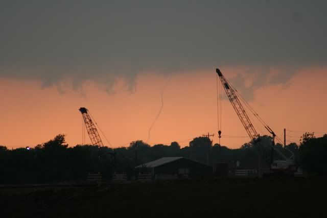
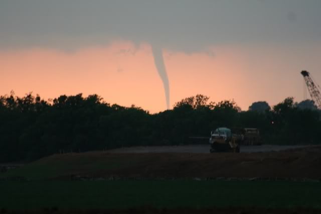
** Wall cloud about 5 min prior to first tornado touchdown

** Tornado #1 touching down.
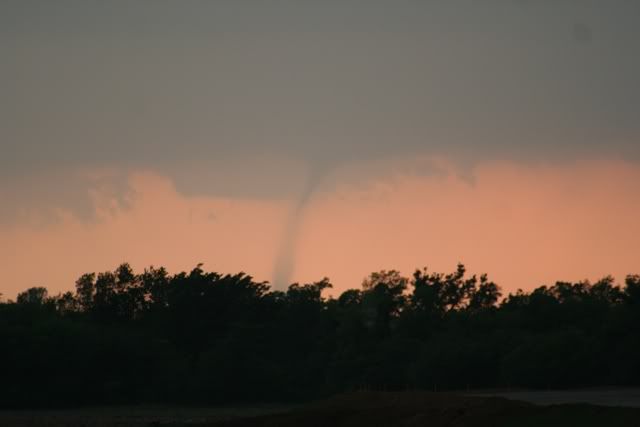
zoomed in:
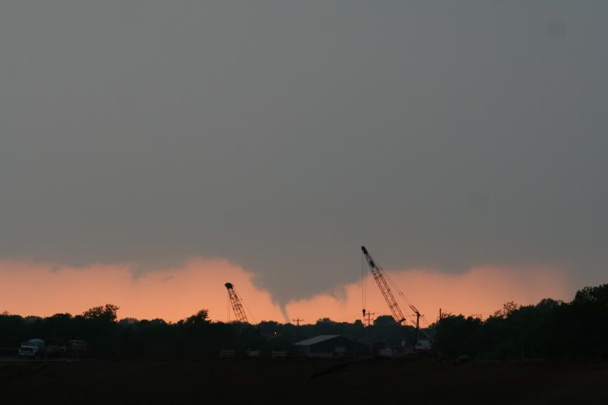
**Tornado #1 1m30s after touchdown:
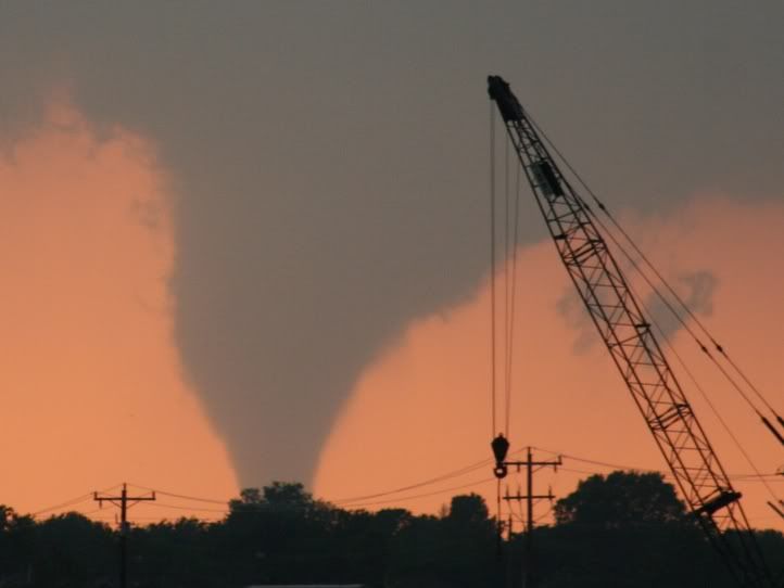
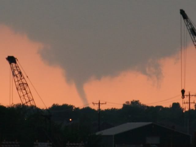
**Tornado #1 3m30s after touchdown:

**Tornado #1 5min after touchdown:
More coming soon.
Posted: Tue Apr 25, 2006 10:36 pm
by wxmann_91
Great photos Sam!! That's gotta be one in the "classic chase" column for those who bagged.
Posted: Tue Apr 25, 2006 10:49 pm
by x-y-no
Nice job!
Congrats on the successful chase - may there be many more.

Posted: Tue Apr 25, 2006 11:02 pm
by SamSagnella
Posted: Wed Apr 26, 2006 6:48 pm
by isobar
Way to go, Sam! Awesome pics!
Question ... Was the anti-cyclonic tornado in the same cell
as a cyclonic one? That would be interesting. I thought
most anti-cyclonics occurred in the northern cell of a
bow/derecho. Learn something new everyday!
Posted: Wed Apr 26, 2006 7:10 pm
by wxmann_91
isobar wrote:Way to go, Sam! Awesome pics!
Question ... Was the anti-cyclonic tornado in the same cell
as a cyclonic one? That would be interesting. I thought
most anti-cyclonics occurred in the northern cell of a
bow/derecho. Learn something new everyday!
There have been numerous cases of anticyclonic tornadoes stemming from supercells, such as the 5/29/04 Jamestown, KS, and Calumet, OK tornadoes. It appears, from SRV data, that the old cyclonic meso occluded, and a new anticyclonic meso formed just to the south (the storm cycled).
Posted: Wed Apr 26, 2006 7:49 pm
by isobar
Thx wxmann. Makes sense, though I suspect generally the anticyclonic would be weaker.
The one in Sam's shot has a landspout type appearance.
Posted: Wed Apr 26, 2006 8:10 pm
by brunota2003
Nice photos...I was at Pizza Hut yesterday and caught them talking about an anti-cyclonic tornado...that wouldn't happen to be yours would it?

Posted: Wed Apr 26, 2006 9:10 pm
by HurricaneHunter914
Looks like you're on your way to become a master tornado chaser. Keep up the good work!